
“… The edge of a city is a philosophical region, where city and natural landscape overlap, existing without choice or expectation.”
Pamphlet Architecture 13: Edge of a City,
by Steven Holl, NY: Princeton Architectural Press, c1991
As I mentioned in a previous posting, The Urban Genome: Approach, there are 17 elements makeup the different urban typologies.
They include:
- The Rural Zone
- The Approach
- Edges
- City Gates or Points of Entrance
- Circulation (Streets, Boulevards, Alleys, etc.)
- Galleries
- The Block
- Courtyards
- Fields
- City Spaces
- Open Spaces (Parks, Zoos)
- Object Buildings
- Terracing
- Siting (Geography)
- Monuments
- Water Conditions
- Ensemble
In this posting I’ll be discussing the urban typology, edges.
-
Edges

The city always has defined edges. Historically some form of a defensive wall almost always defined the city edge, but in today’s urban setting the term edge occurs in many forms. Some are clearly defined, such as those that occur along water edges, or a change in building density and size. Some edges are blurred though, such as those that may occur from one side of a street to another, and only distinguishable by a change in possible street fabric or building style.
There are four types of edge conditions.
1. The clear-defined edge
2. the blurred edge
3. the enclosed edge
4. the branching edge
5. A fifth condition exists when you have combinations of the above
1. The clear-defined edge
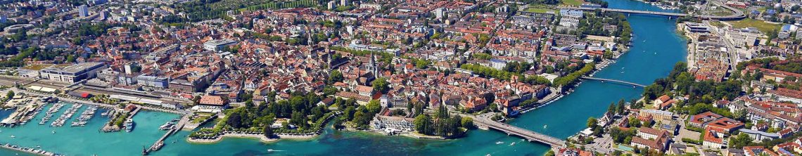
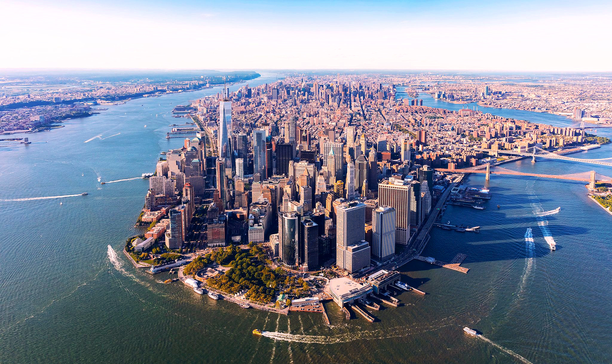
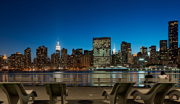
Typically, the clear-defined edge occurs when there is a change in massing, height, and/or geography. Manhattan is an example of all three. It is dense, has a wall created by the height of its skyscrapers, and being an island has a clearly defined edge which is viewed from various sides of its water masses.
2. The blurred edge
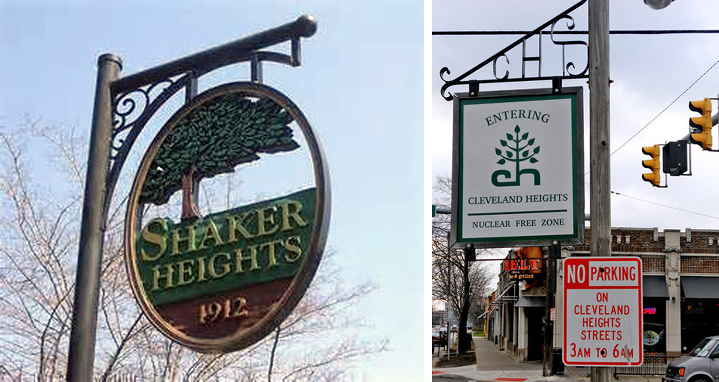
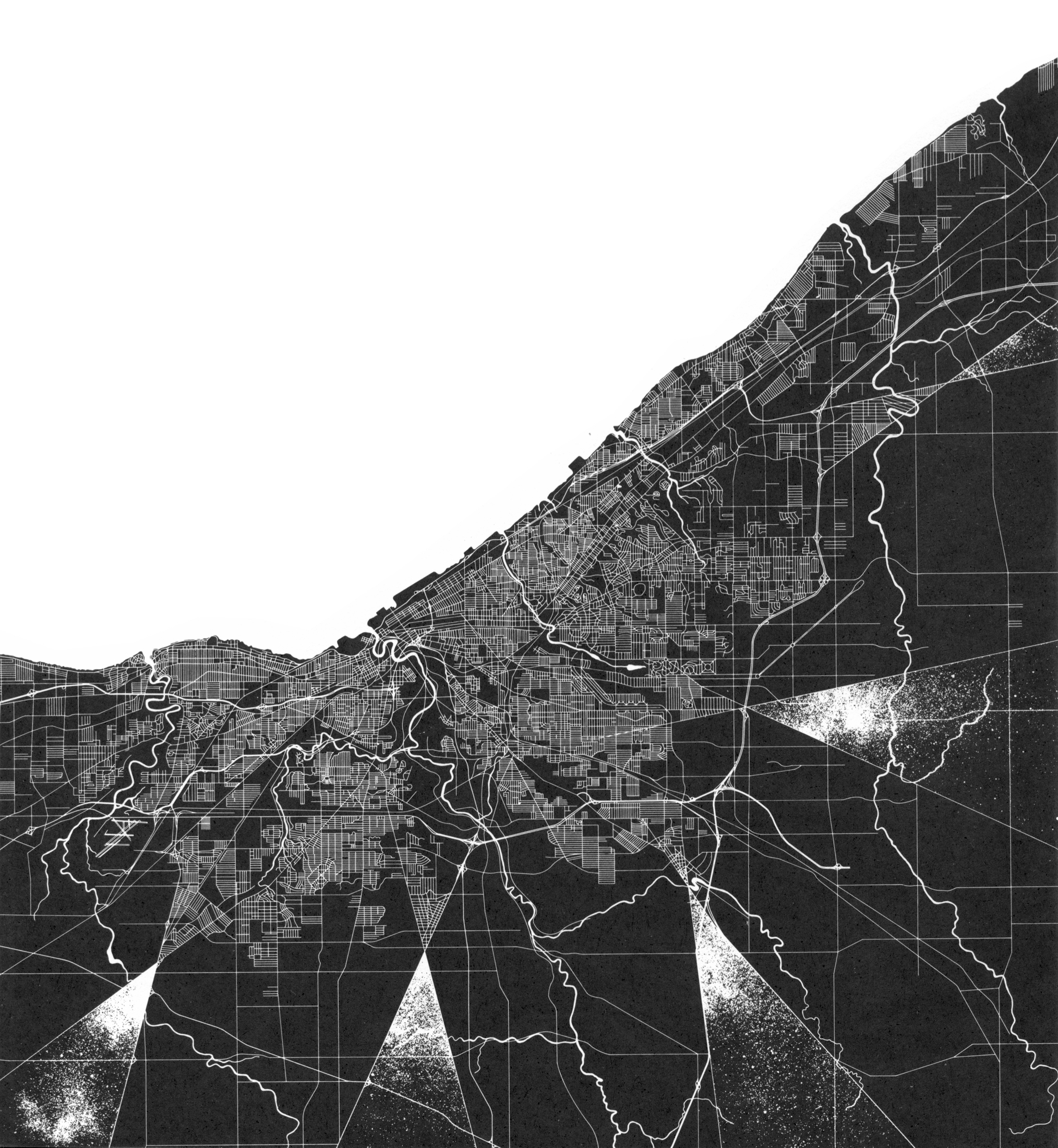
The blurred edge is typically hard to discern as an urban edge. The boundaries are sometimes geographic but are more commonly economical or governmental. A good example is the historic garden city of Shaker Heights, Ohio.
In the image below you see the boundaries of three small cities, Cleveland Heights, University Heights, and Shaker Heights.

The only demarcation that you have entered any of the three cities mentioned above are signs indicating so.
3. The enclosed edge
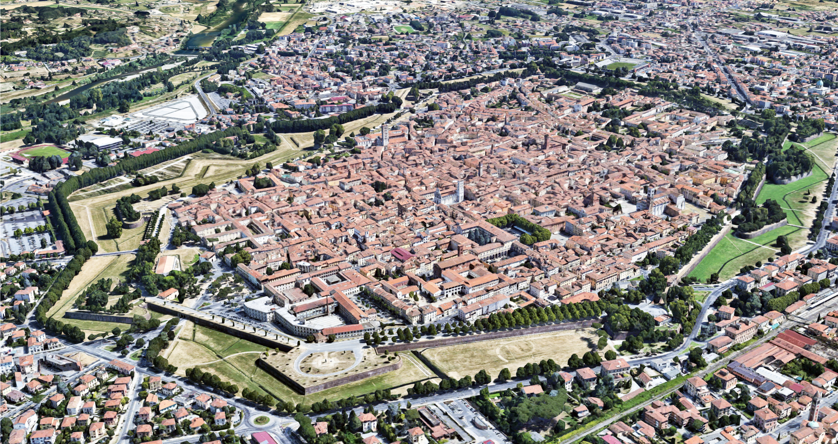
The enclosed edge is typically a wall left over from times past, and today are generally a tourist attraction. Lucca, Italy is a perfect example of a fortified city. The walls built in the Renaissance era still stand today. The area around the walls is generally cleared to fire upon invading troops. Today this area surrounding Lucca is a park.


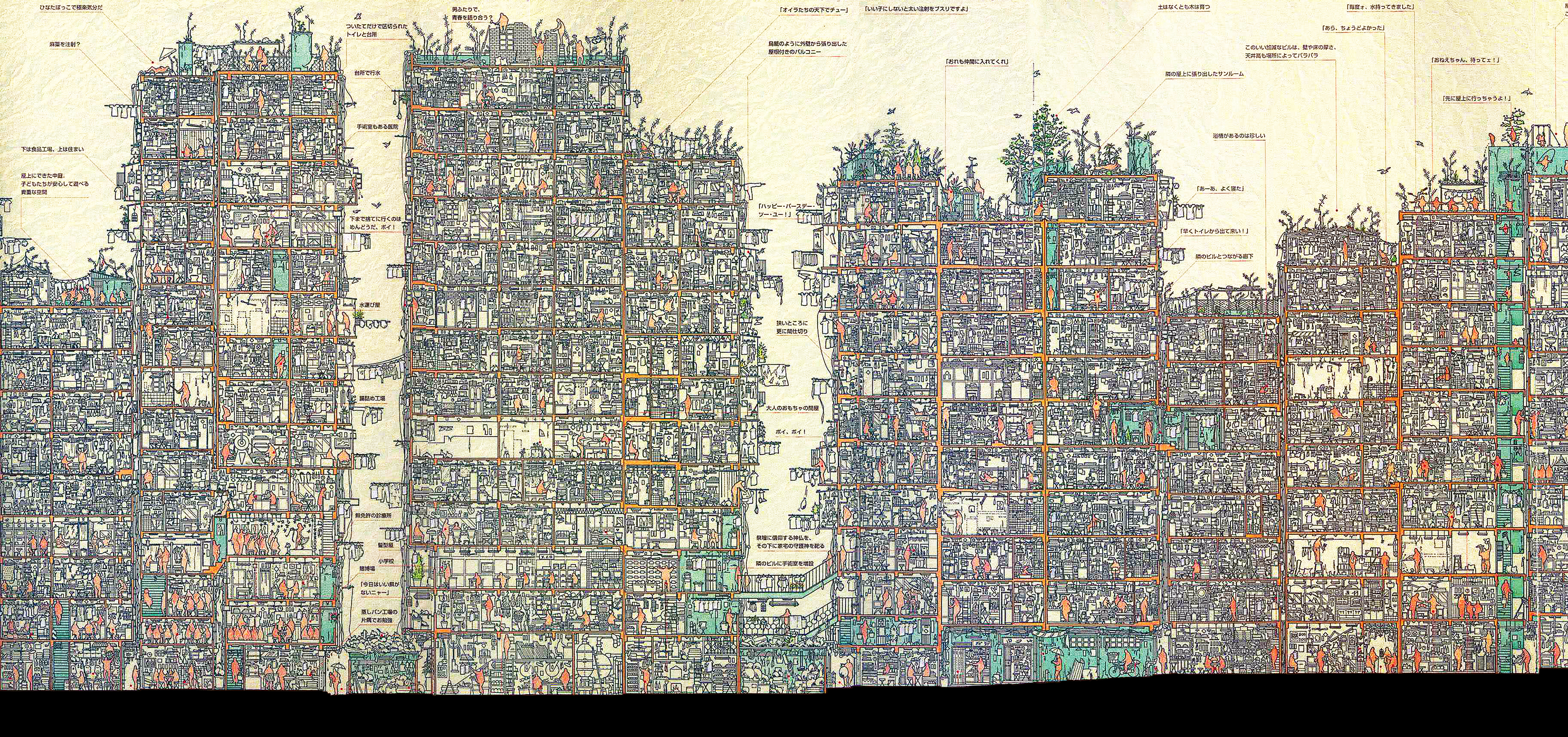
There are examples though of enclosed edge urban settings that are defined by a very dense wall of building fabric.
One example is Kowloon Walled City, once located in Hong Kong, and now demolished.

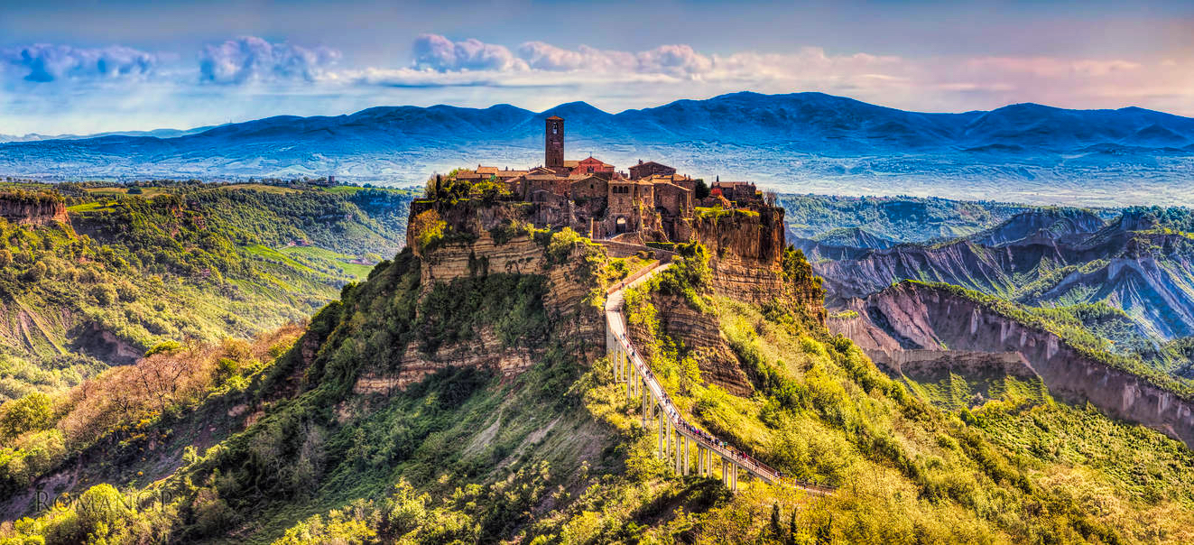
Another example is the Italian Hill town of Civita di Bagnoregio. Originally founded by Etruscans more than 2,500 years ago, the Etruscans had a propensity for building on hill tops or ridges for security reasons.
4. The branching edge
The branched edge commonly occurs when the city follows the geography, i.e. a town nestled in a series of small, connected valleys, or the property lines do not follow a gridded pattern. Below is an aerial view of Siena, Italy.


5. The fifth condition, a combinations of the above.
The fifth condition is not as clear cut as the first four, and is harder to define at times. In Steven Holl’s Pamphlet Architecture 13: Edge of a City he discusses Cleveland’s inland edge.
“Five X’s spaced along the inland edge of Cleveland (the northern edge is formed by Lake Erie) define precise crossover points from new urban areas to a clarified rural region.”
Today’s cities tend to have somewhat fuzzy edges. The idea of transitioning from a clarified rural region to urban areas is harder to define due to the vast size of our cities. In the U.S. we have a phenomena known as the Northeast Megalopolis. A megalopolis is typically defined as a chain of approximate adjacent metropolitan areas, which may be somewhat separated or may merge into a continuous urban region.

The Northeast Megalopolis runs primarily northeast to southwest from the northern suburbs of Boston, Massachusetts, to the southern suburbs of Washington, D.C., in Northern Virginia. It includes the major cities of Boston, New York City, Philadelphia, Baltimore, and Washington, D.C., along with their metropolitan areas and suburbs, as well as many smaller urban centers such as Richmond and Norfolk, Virginia to the south and Portland, Maine to the north. As of 2010, the region contained over 50 million people.
The image below shows the levels of night time light pollution from the 1950’s and projected to the year 2025.

This image visibly defines how the urban edge is fading over time. So what will we call this next stage of combined urban settings, Ultralopolis or maybe Hyperlopolis?
Addendum:
I’m adding another city, which I’ve never been too but hope to visit some day, Shibam, Yemen. Similar to Kowloon Walled City, the city of Shibam resembles a mega sized city block.

