

When the term “Canal City” is mentioned the first city that comes to mind is Venice, Italy. Canal cities exist though all over the world. In this post I’ll be illustrating various cities that contain transportation waterways. To demonstrate these circulation pathways I’ve produced a series of maps that only show the water systems within the urban settings, and in some cases the surrounding countryside.
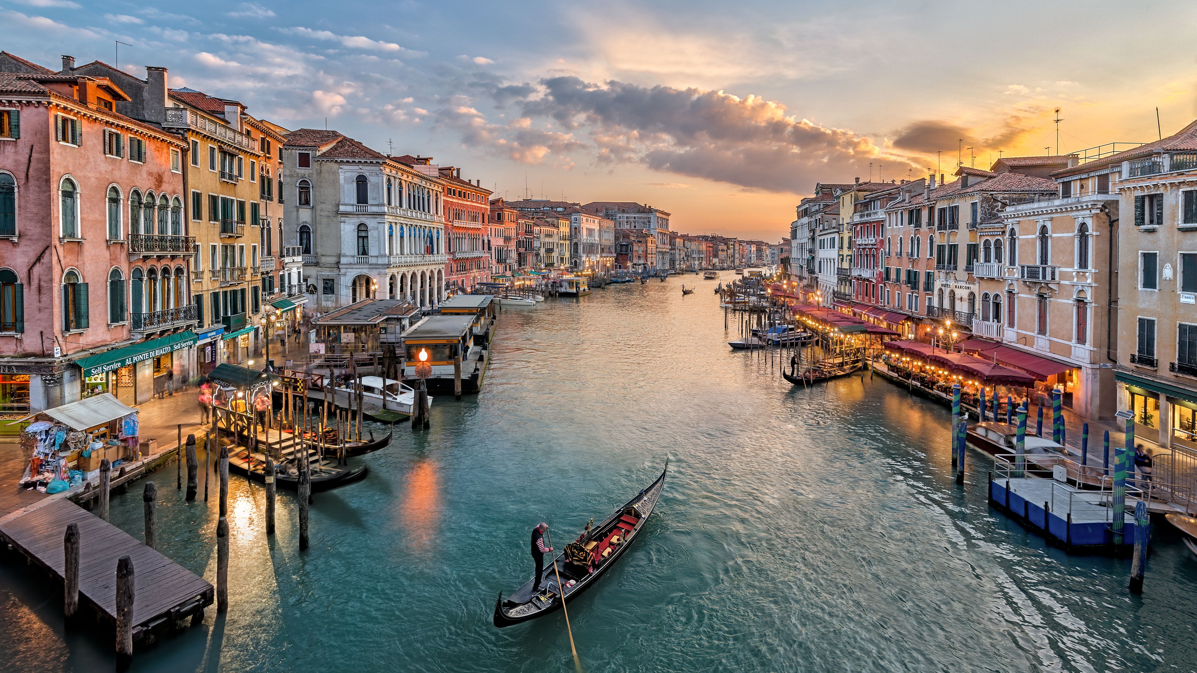
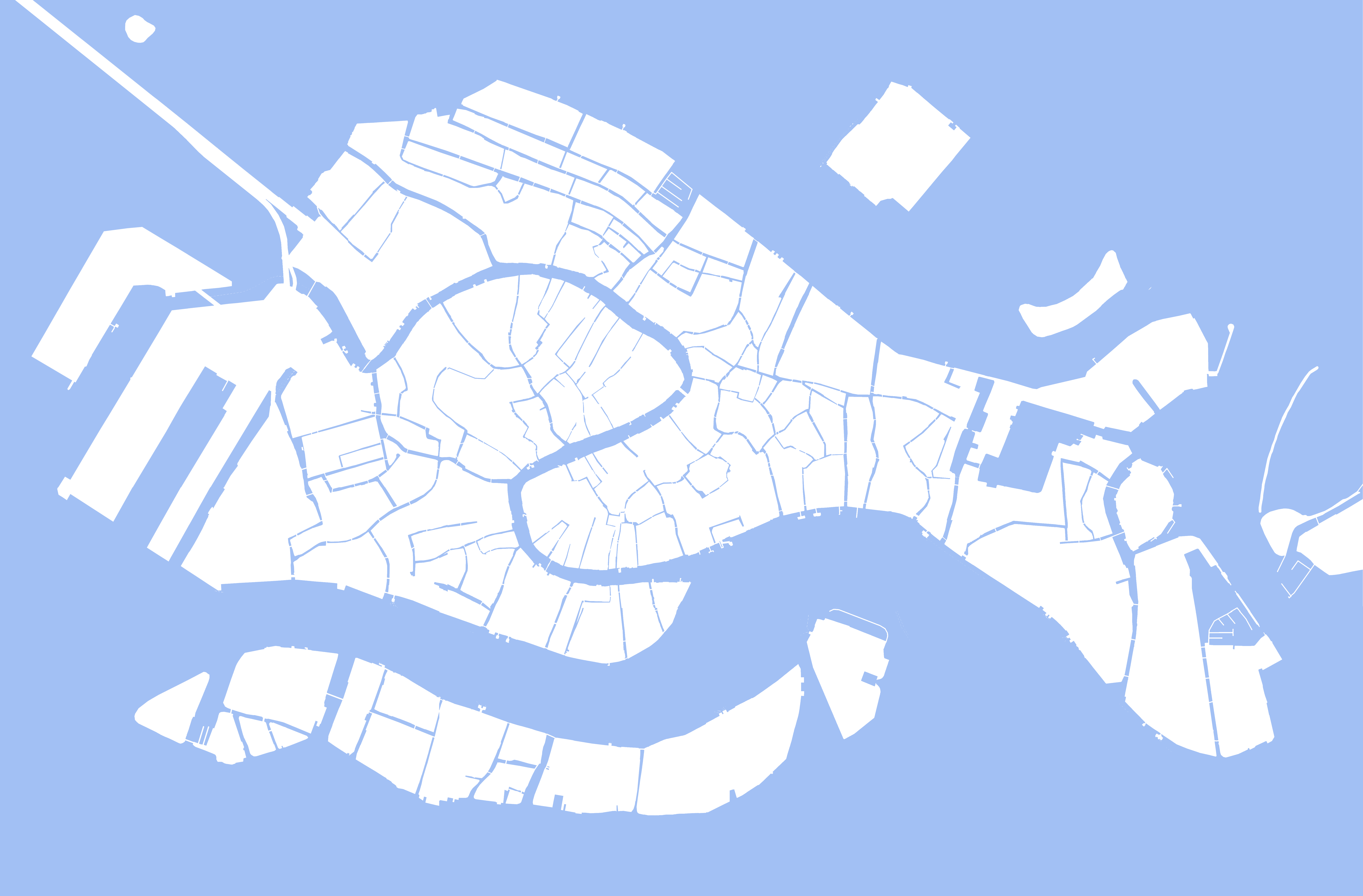
I’ll begin with Venice. The best-known canal city.
Venice is a city in northeastern Italy and the capital of the Veneto region. It is built on a group of 118 small islands.

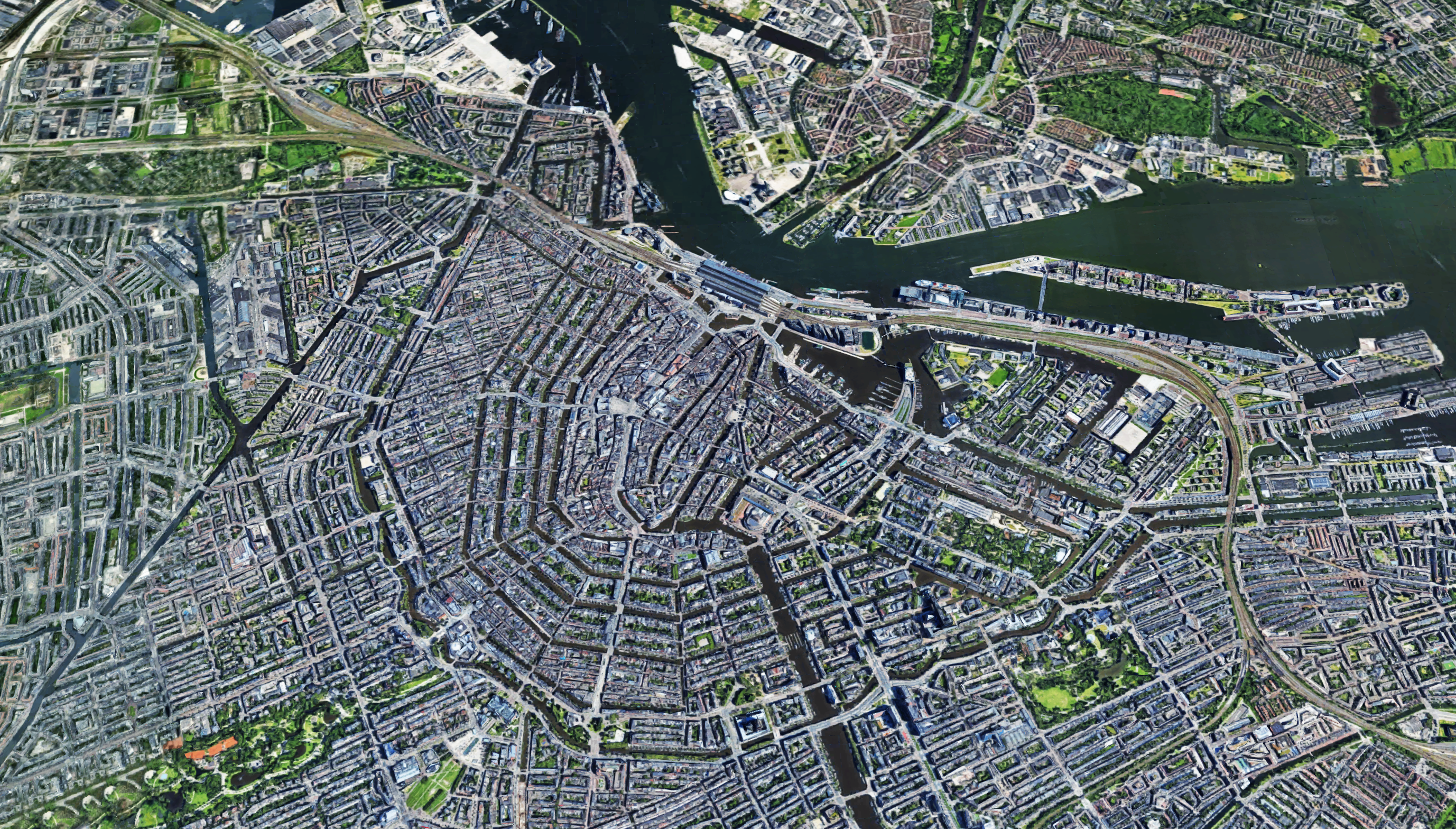
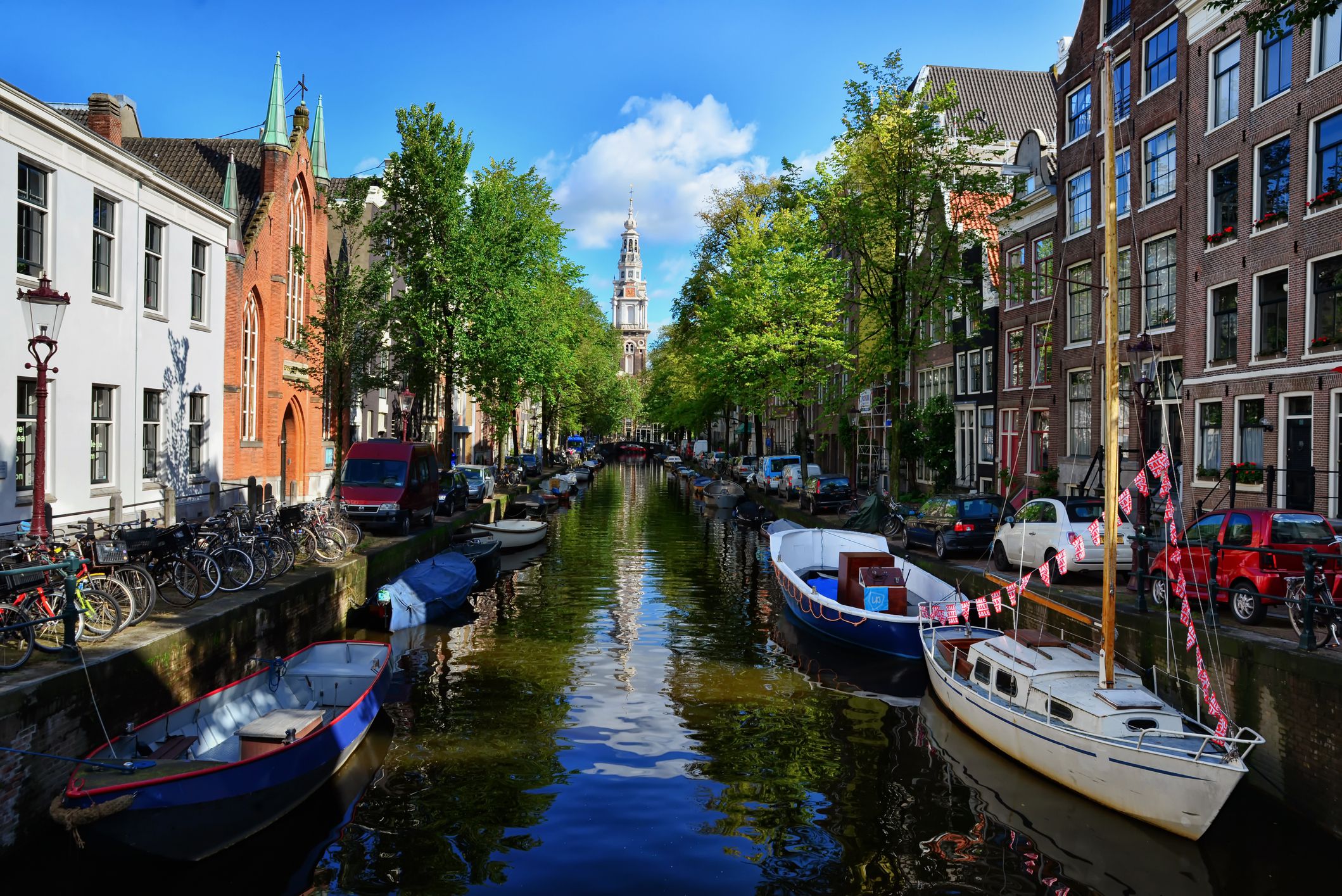
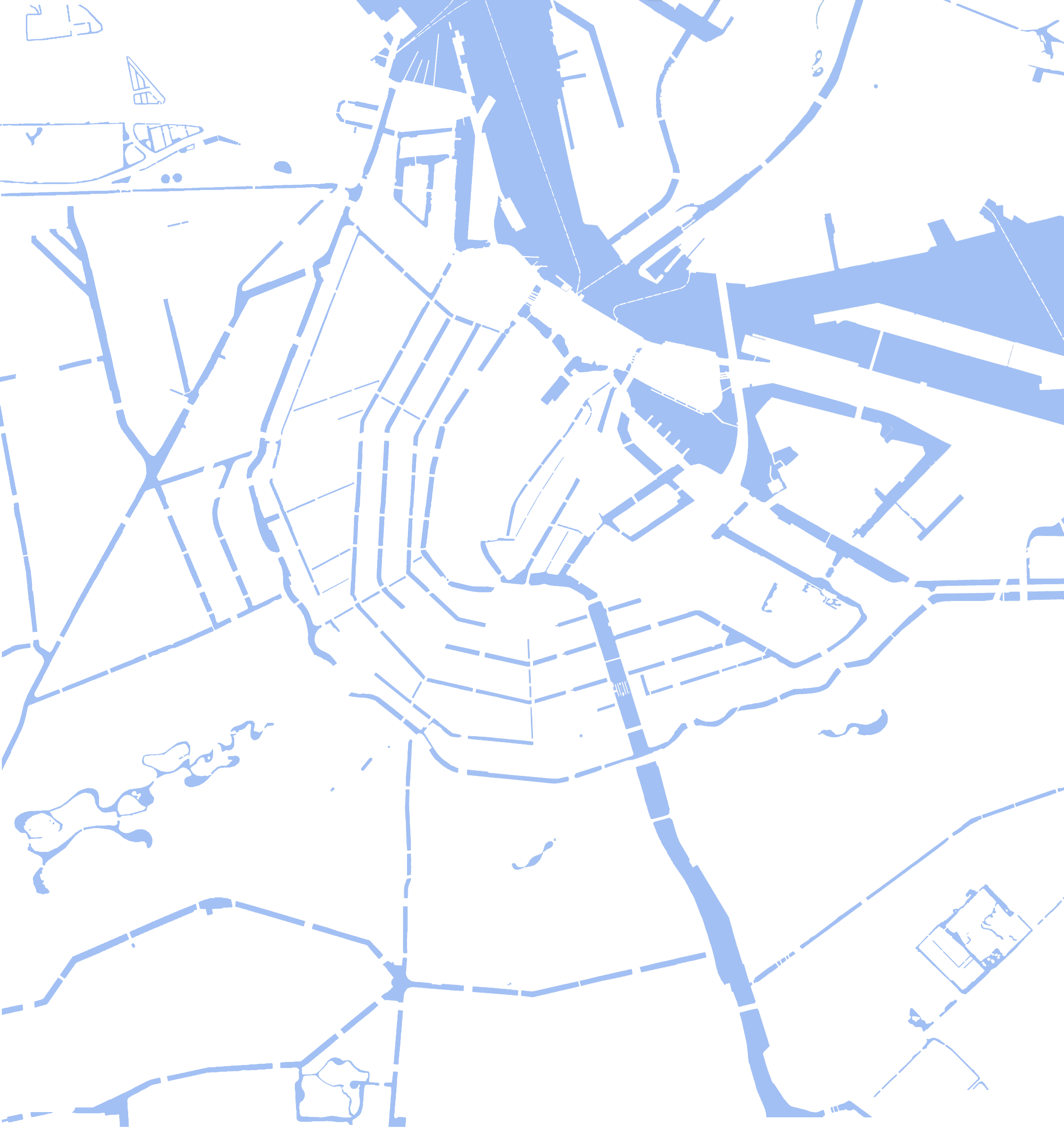
Amsterdam is informally referred to as the “Venice of the North”, due to its large number of canals. Combined, the Amsterdam canals are over 60 miles long (that’s 100 kilometers), and Amsterdam has more than 160 canals.
Although much diminished from its past prominence, water-based transport still plays an important role in Bangkok and the immediate upstream and downstream provinces.


Bruges became important due to the tidal inlet that was crucial to local commerce. This inlet was then known as the “Golden Inlet”. Bruges received its city charter on 27 July 1128, and new walls and canals were built.


The city has over 400 miles (640 km) of canals. Most of the canals are navigable and some have access to the Gulf of Mexico. Cape Coral’s canal system is so extensive that local ecology and tides have been affected.


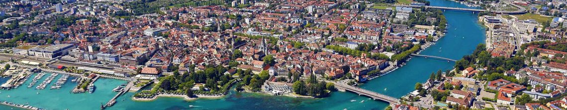
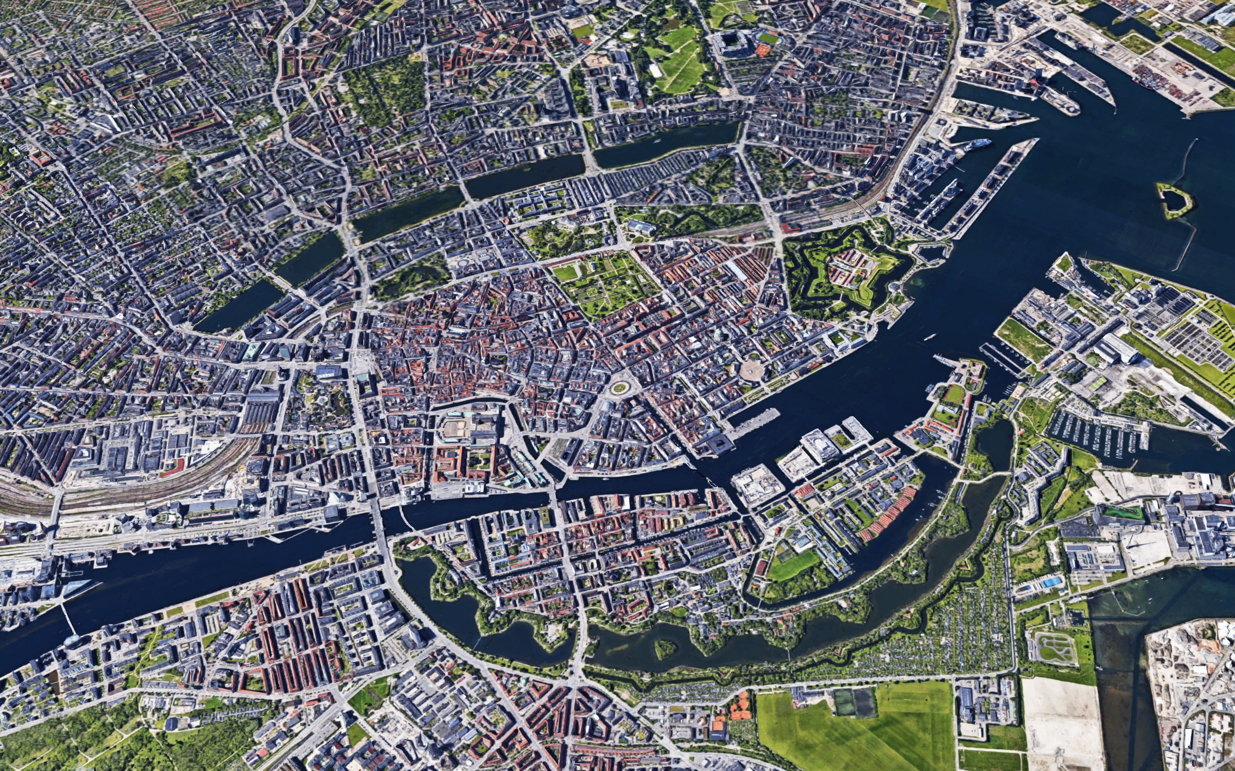
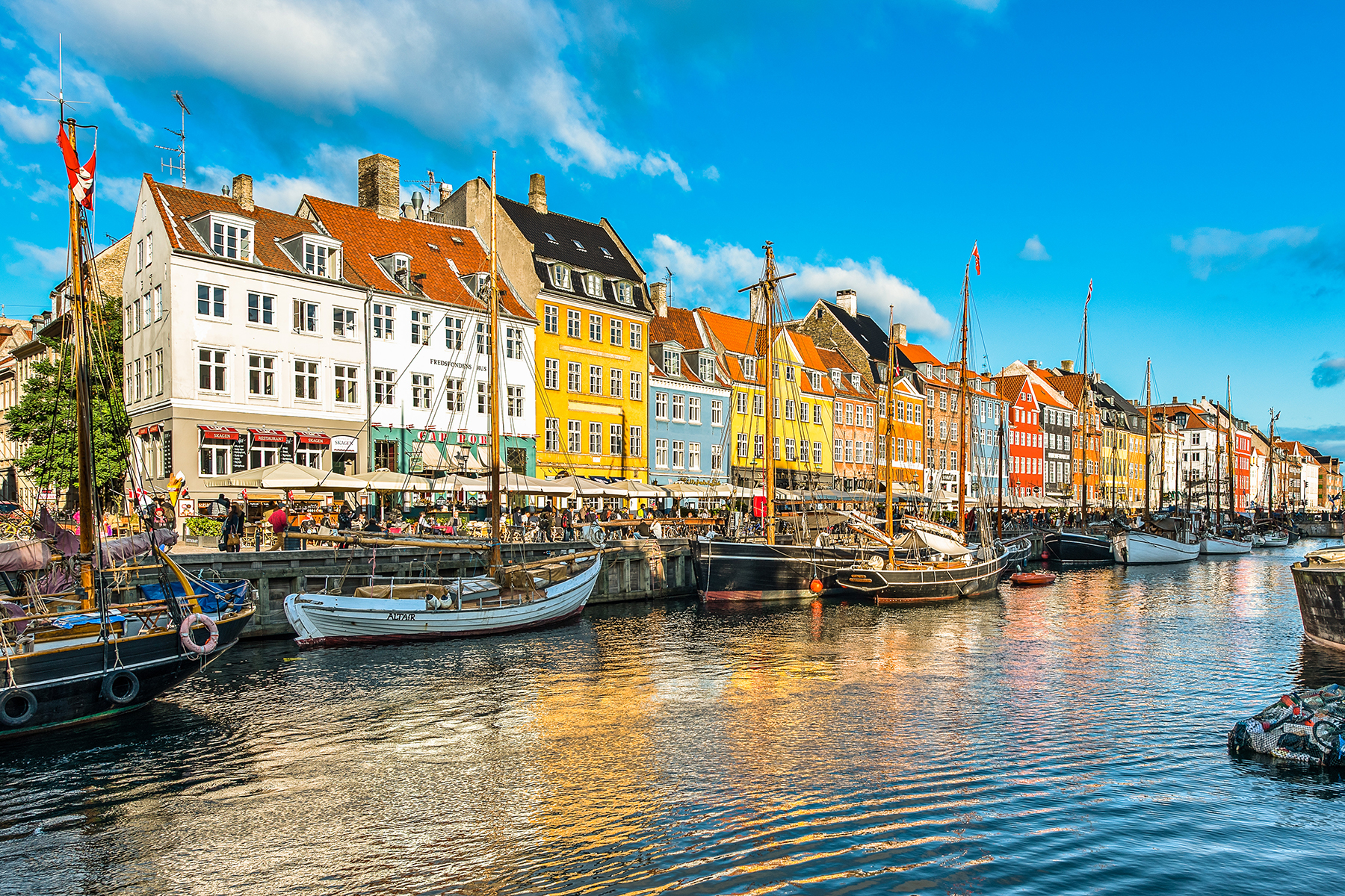
A majority of the canals are located in Christianshavn and on the east side of Copenhagen, on the Isle of Amager.

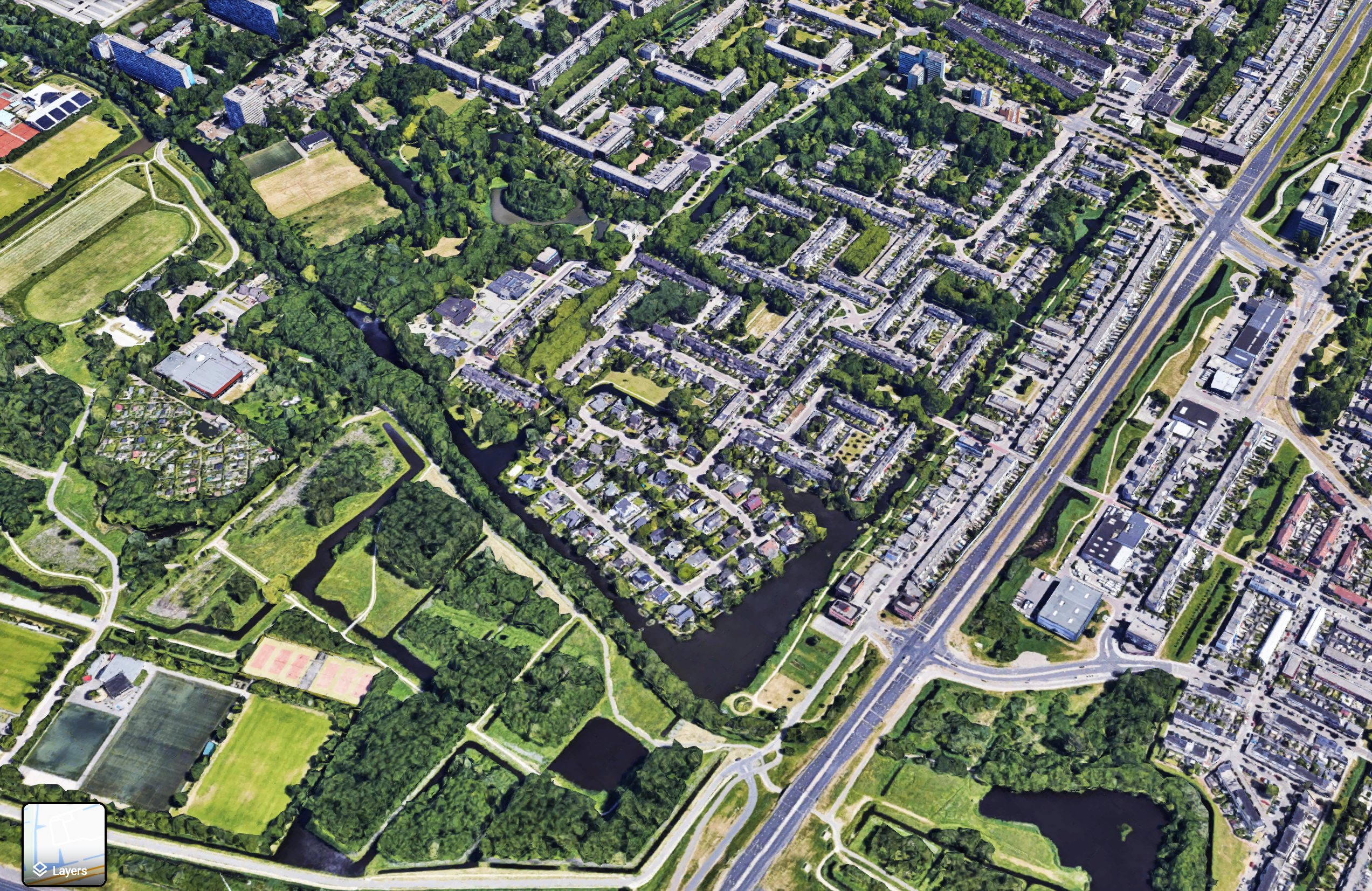
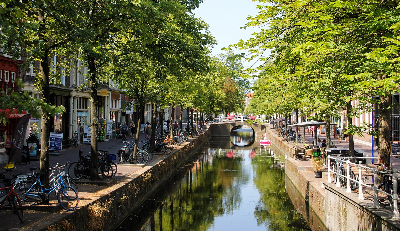
The city of Delft came into being beside a canal, the ‘Delf’, which comes from the word delven, meaning to delve or dig, and this led to the name Delft. At the elevated place where this ‘Delf’ crossed the creek wall of the silted upriver Gantel, a Count established his manor, probably around 1075. Partly because of this, Delft became an important market town, the evidence for which can be seen in the size of its central market square.

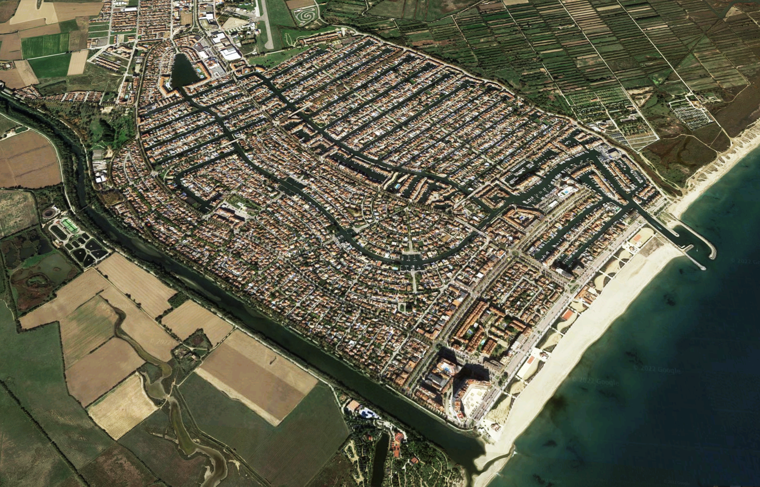
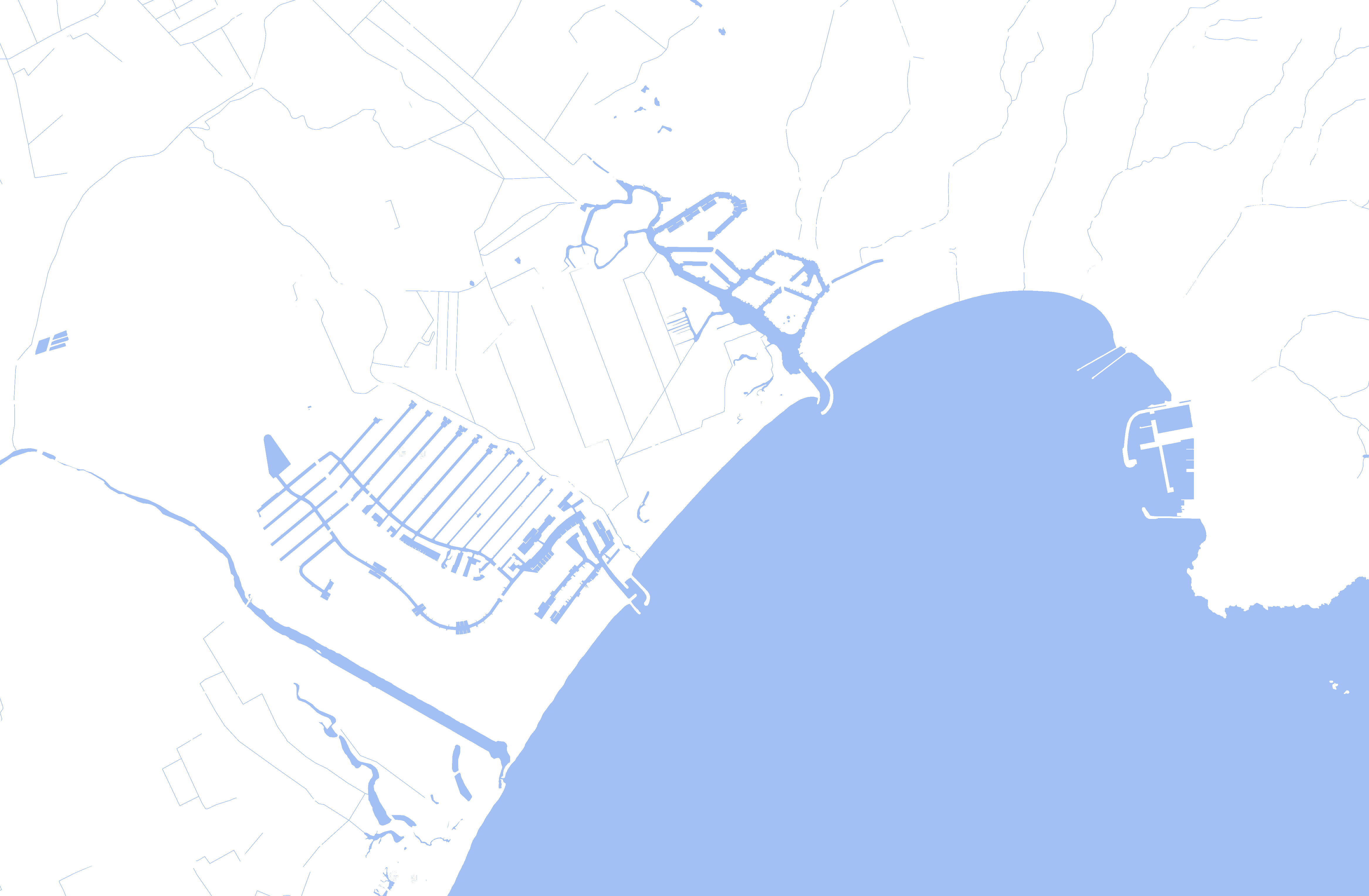
Originally built on a swamp, Empuriabrava was transformed into a tourist community, initially planned in 1964 and completed in 1975. The town has more than 40 km of canals and a seasonal, summer population of around 80,000.

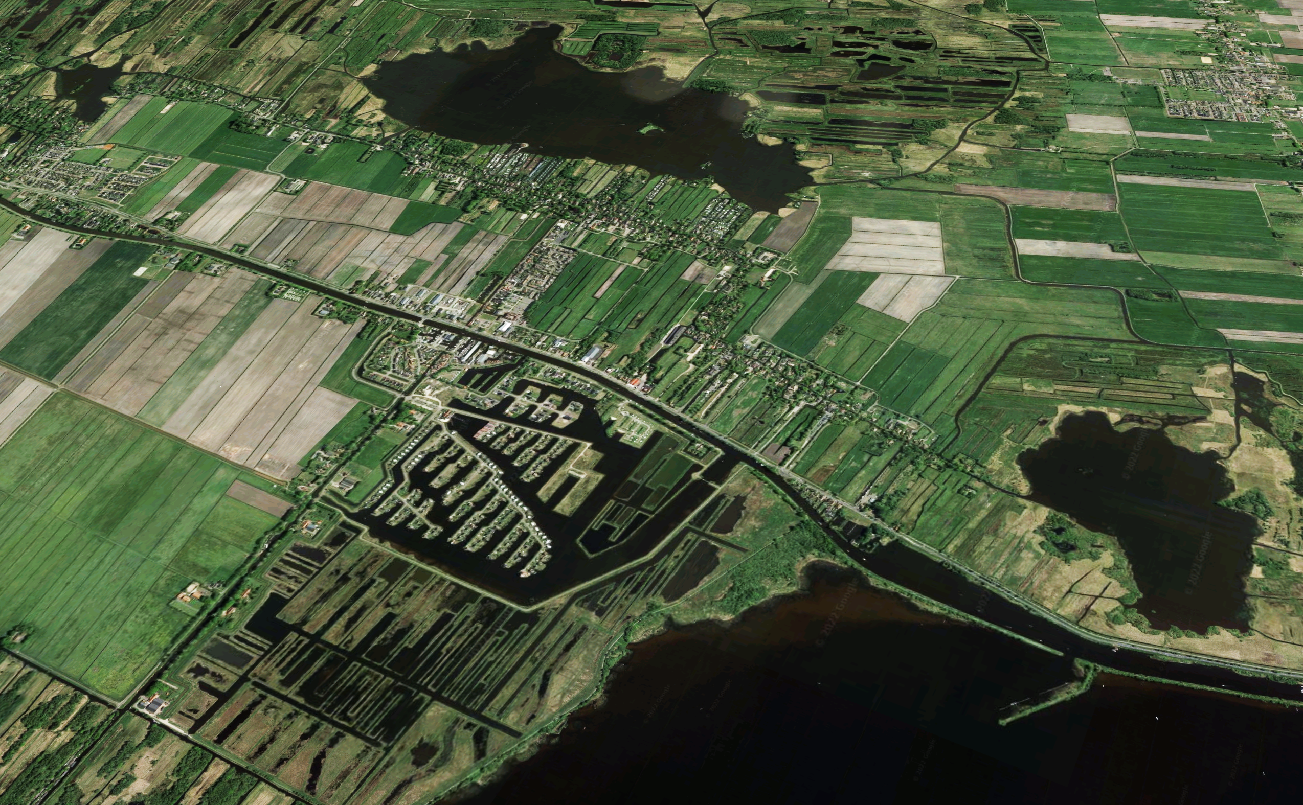
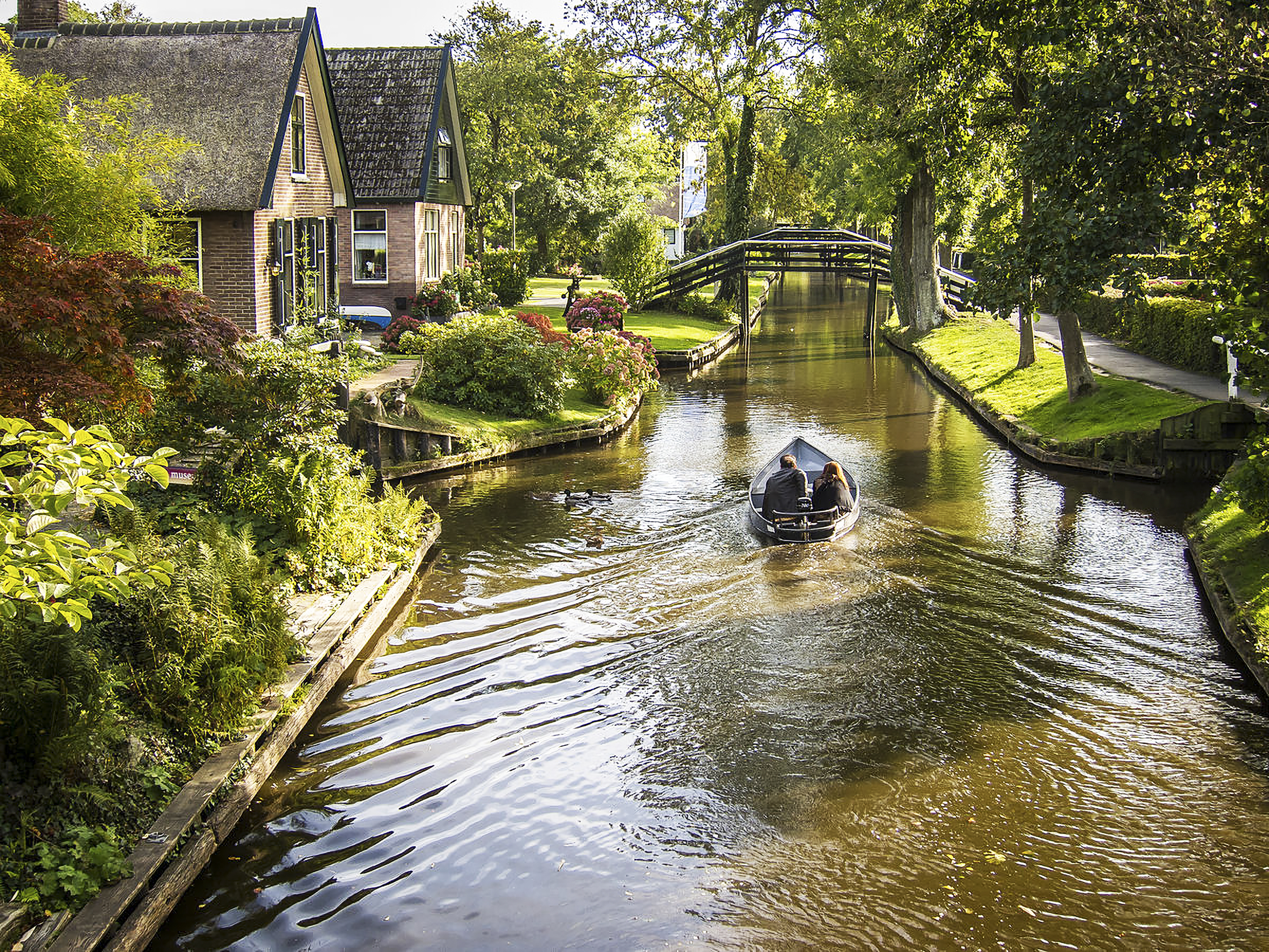
Giethoorn is a town in the province of Overijssel, Netherlands with a population of 2,795 in 2020, and is a popular Dutch tourist destination both within Netherlands and abroad, Giethoorn is often referred to as “Dutch Venice” or the “Venice of the Netherlands”.
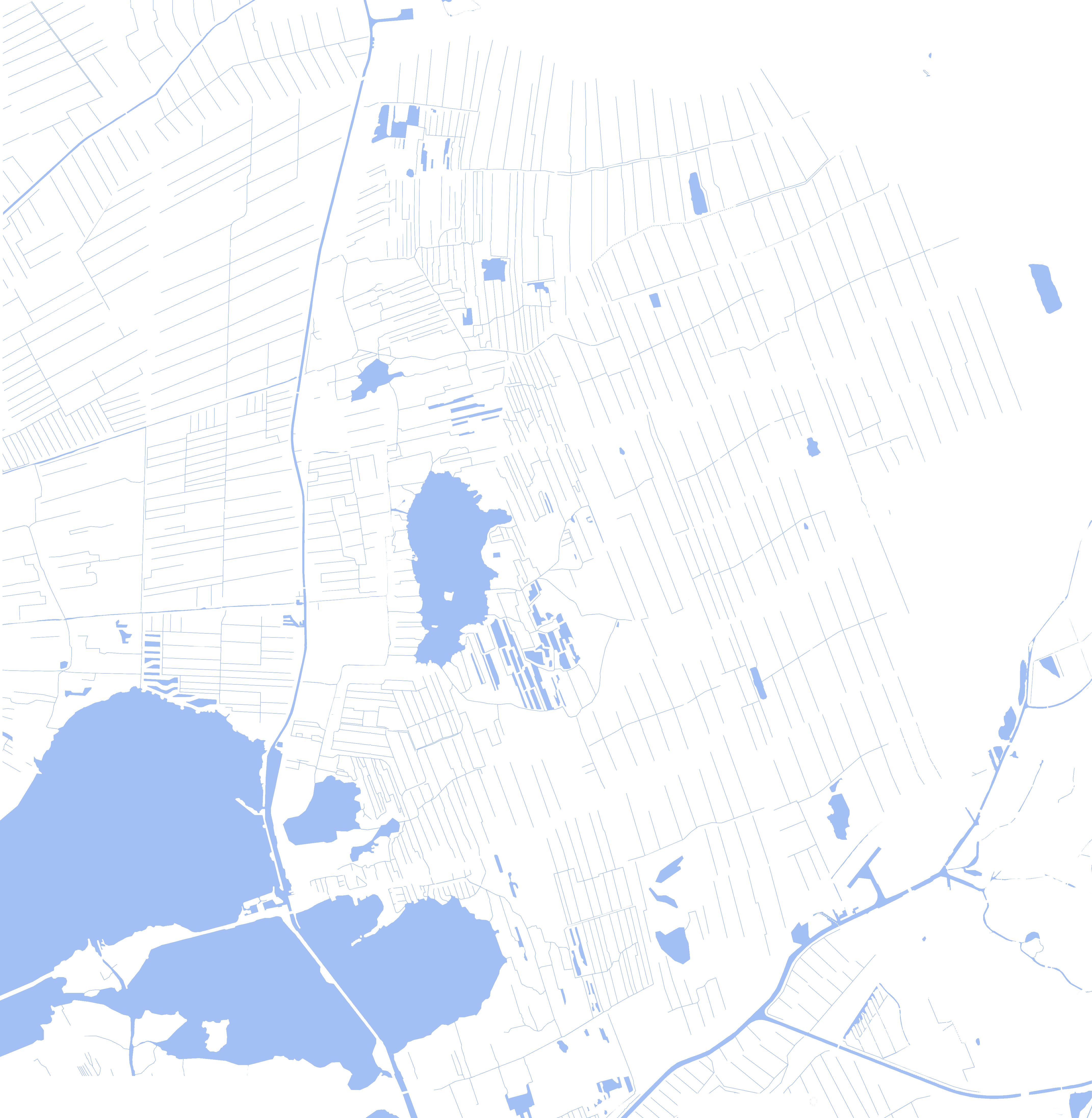
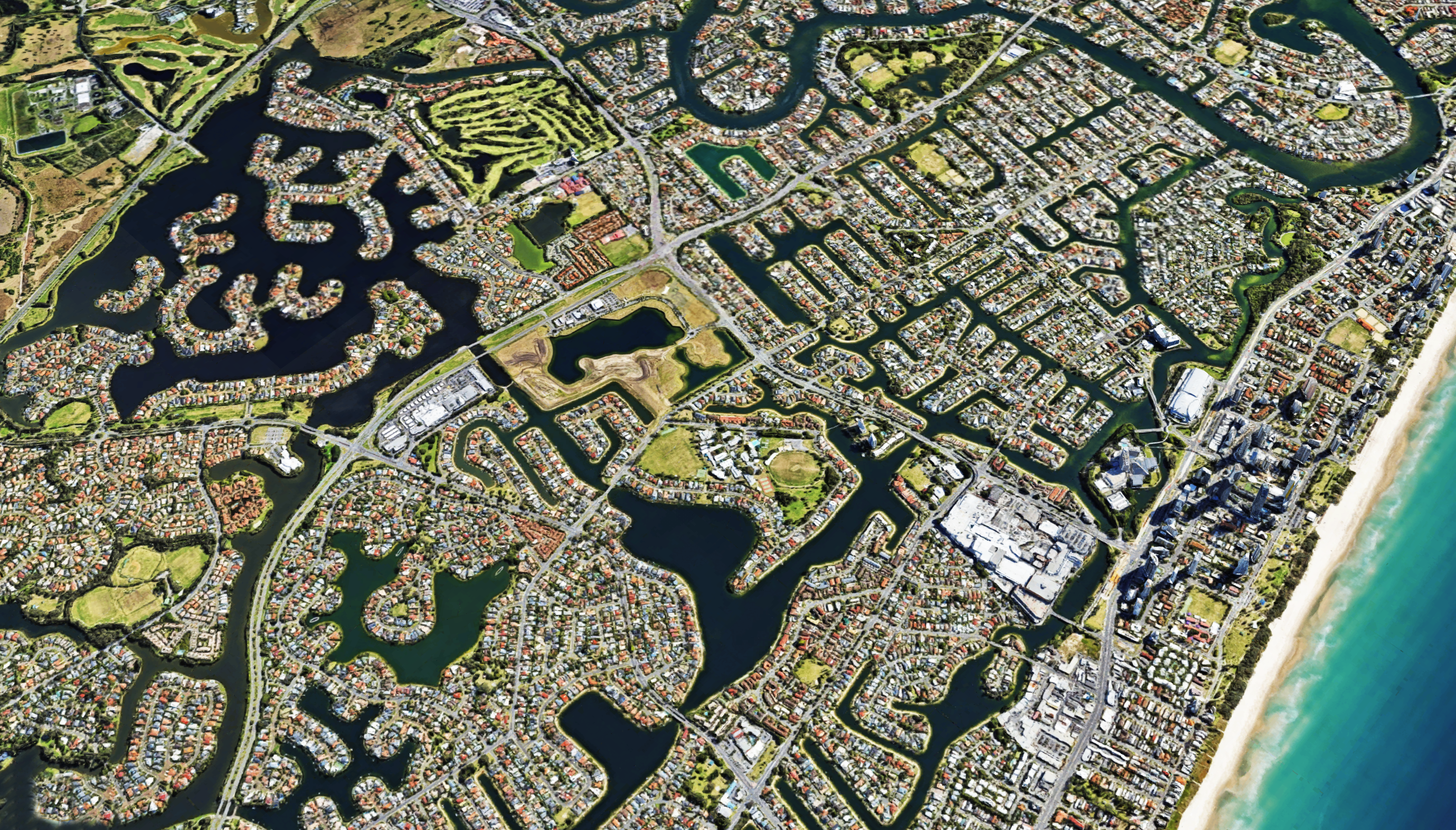
The Gold Coast has the largest constructed canal network in the southern hemisphere, with 135 constructed lakes and more than 248 miles (400 kilometers) of canals.


Hamburg’s many streams, rivers and canals are crossed by some 2,500 bridges, more than London, Amsterdam and Venice put together.


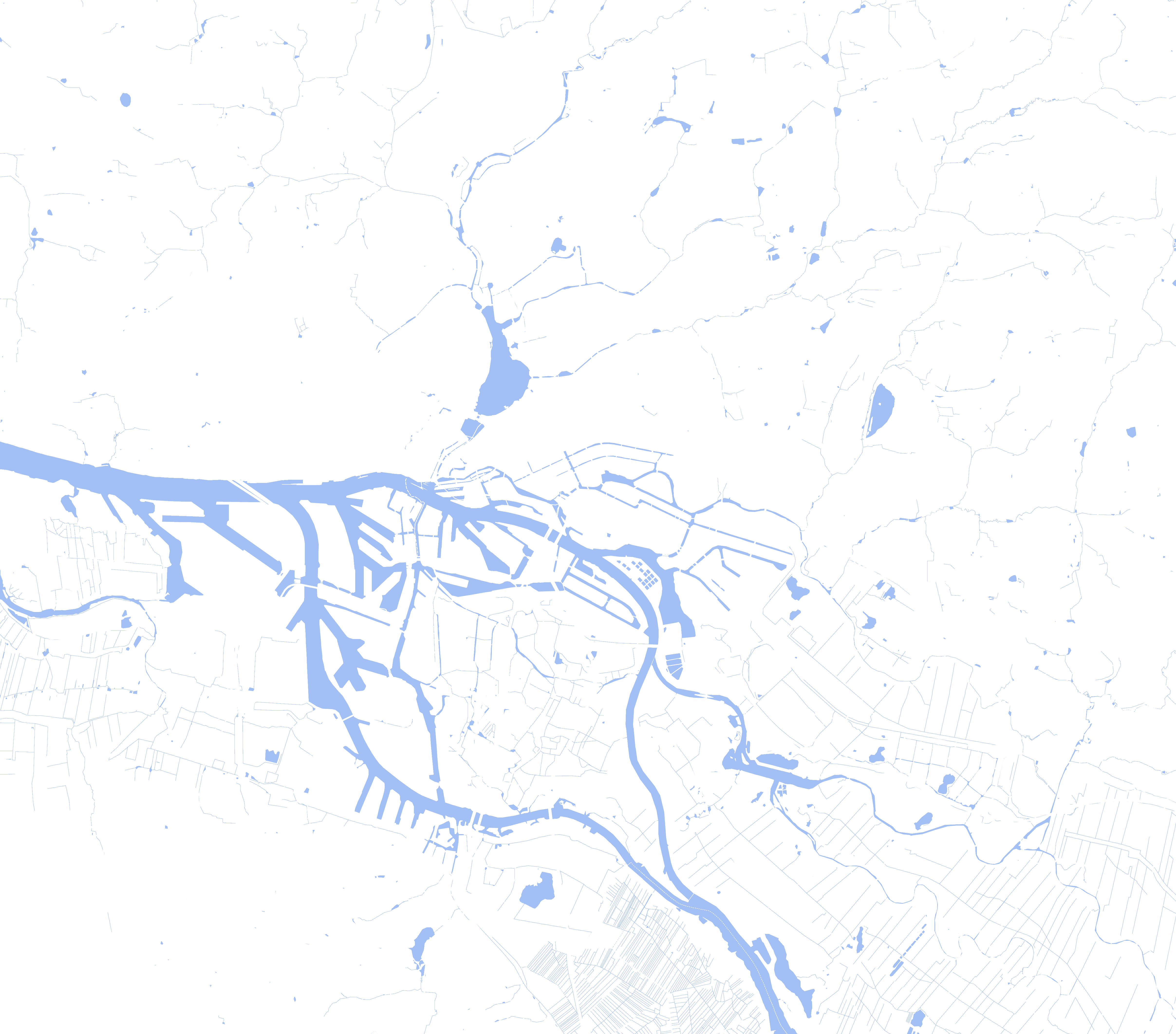
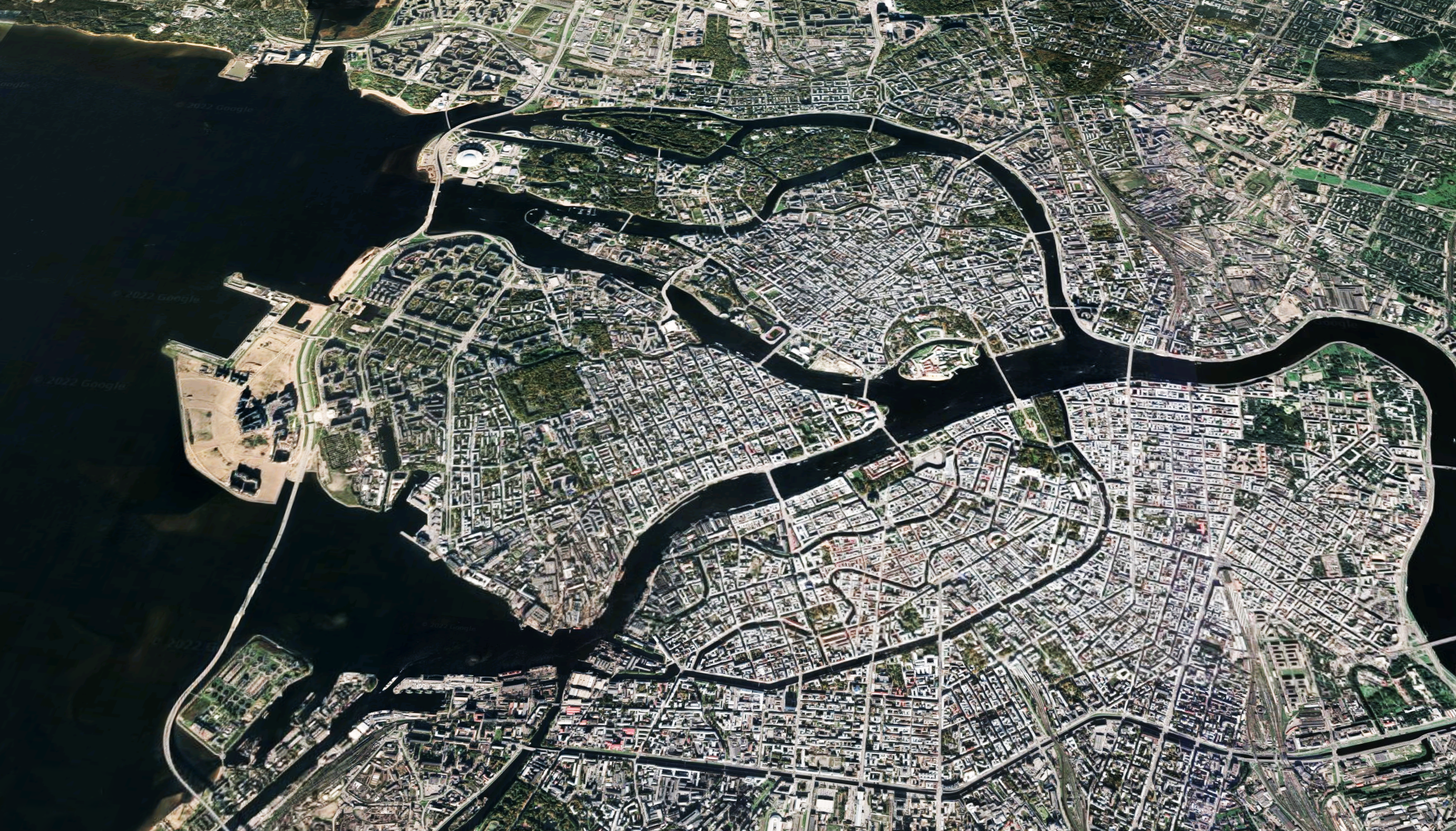
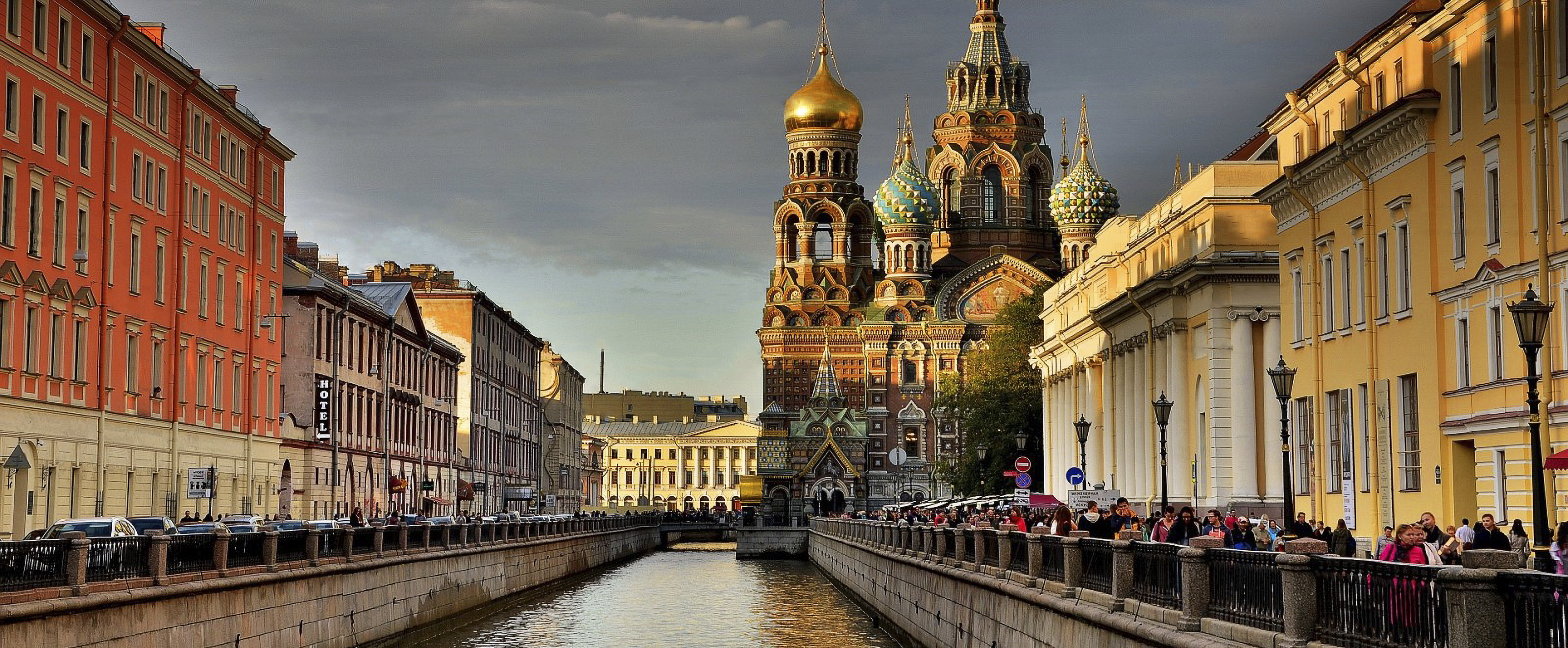
During its first few years, the city of St. Petersburg developed around Trinity Square on the right bank of the Neva, near the Peter and Paul Fortress. However, St. Petersburg soon started to be built according to a plan. By 1716 the Swiss Italian Domenico Trezzini had elaborated a project whereby the city center would be on Vasilyevsky Island and shaped by a rectangular grid of canals.
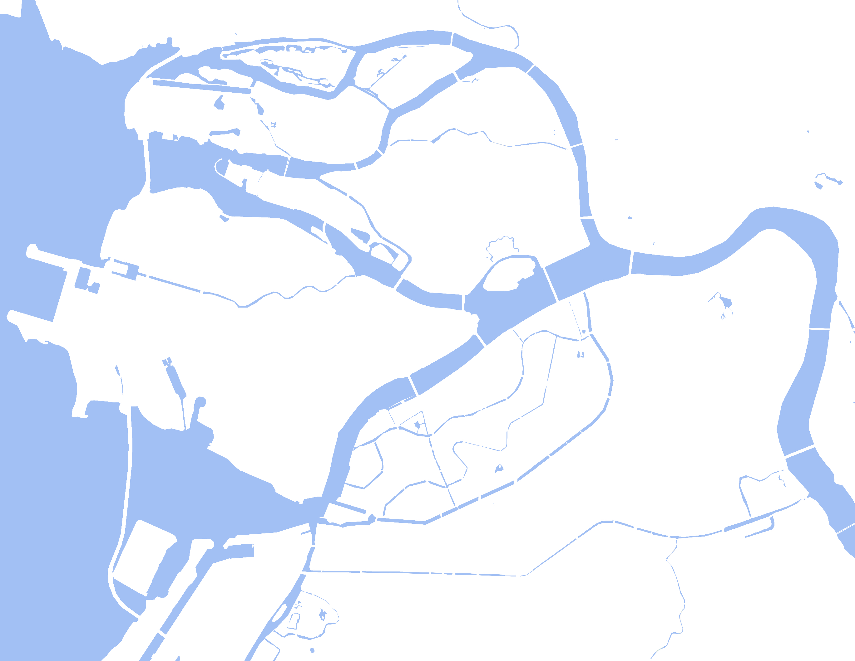
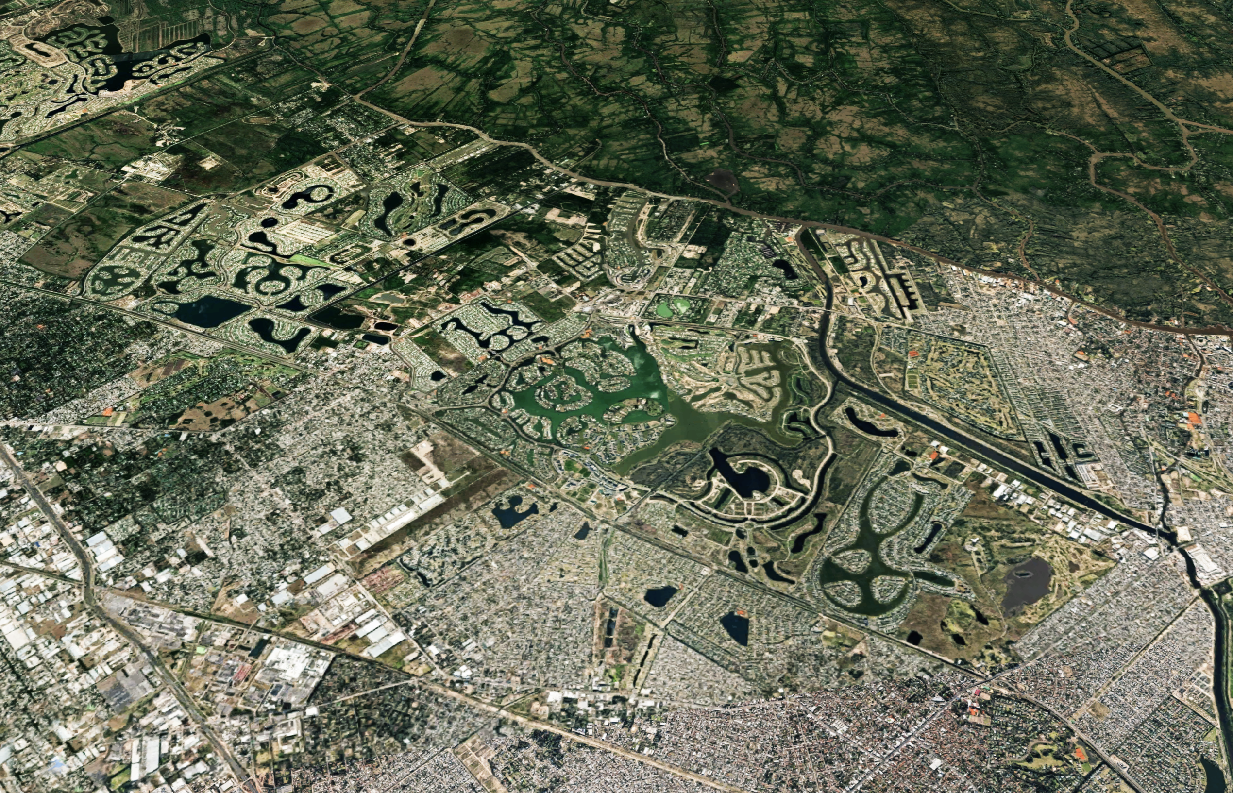
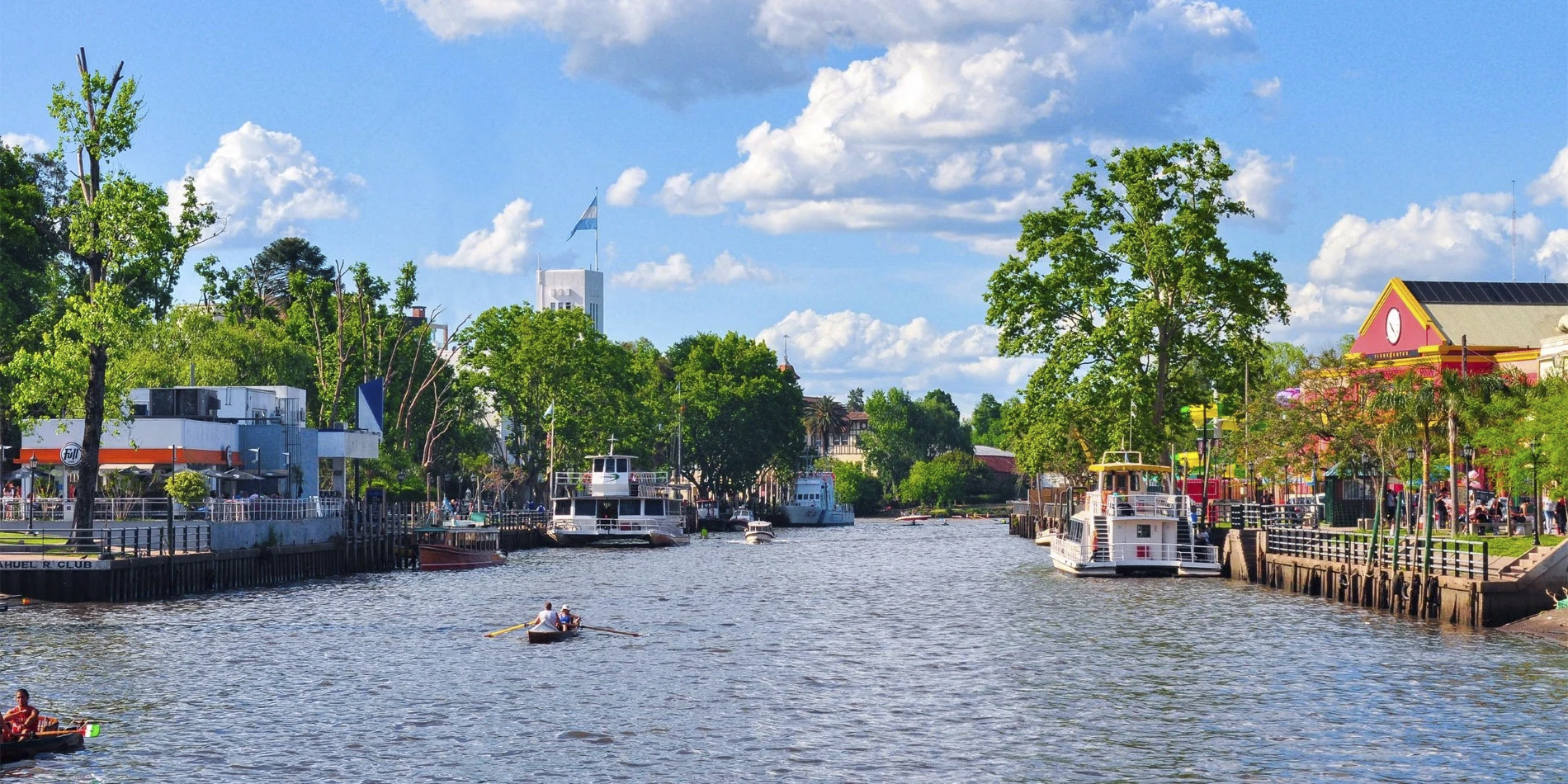
The town of Tigre is situated on the banks of the Paraná River, a river that is broken down by the presence of thousands of little islands, bisected and isolated by reed and plant-lined inlets and waterways.
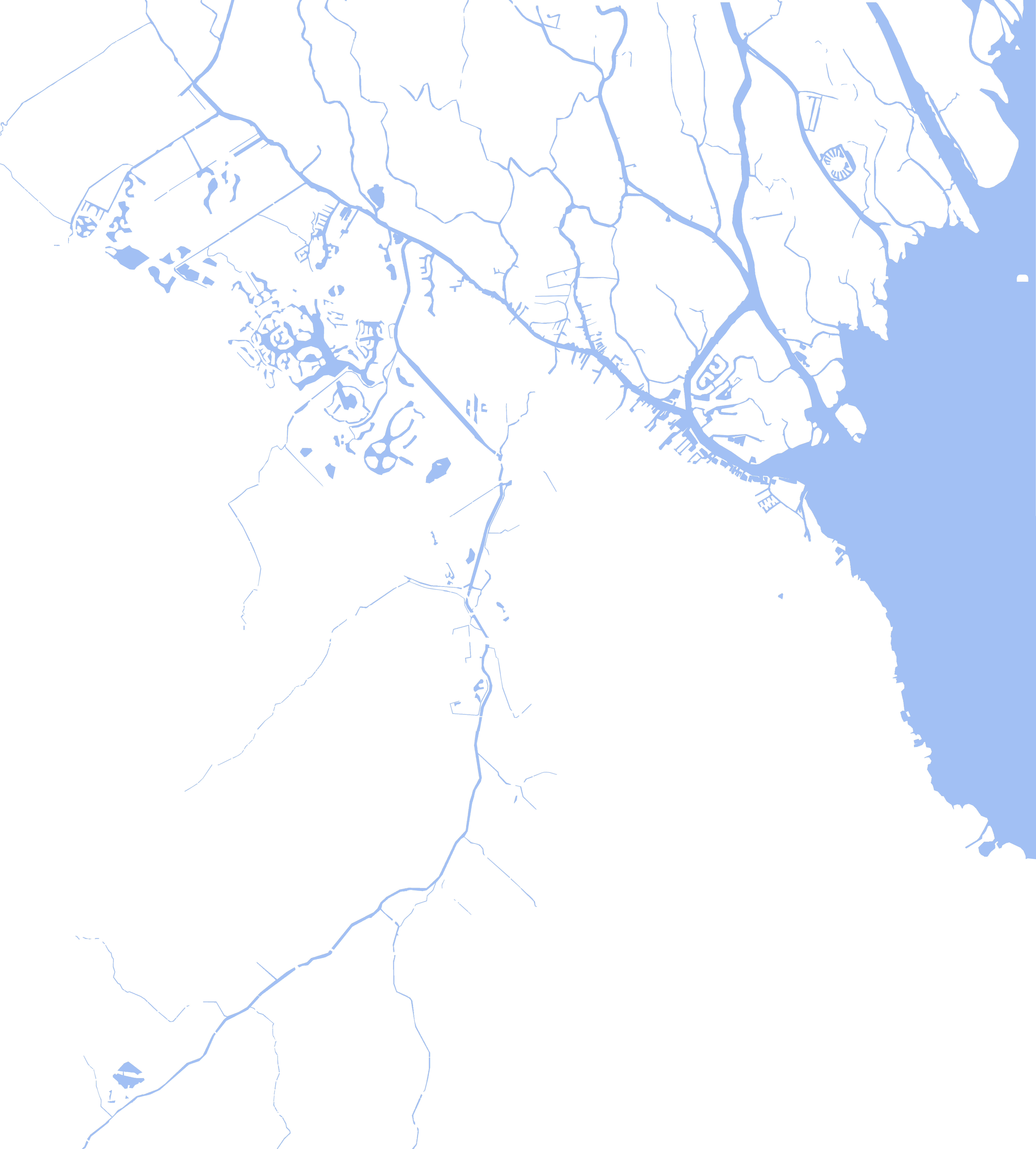
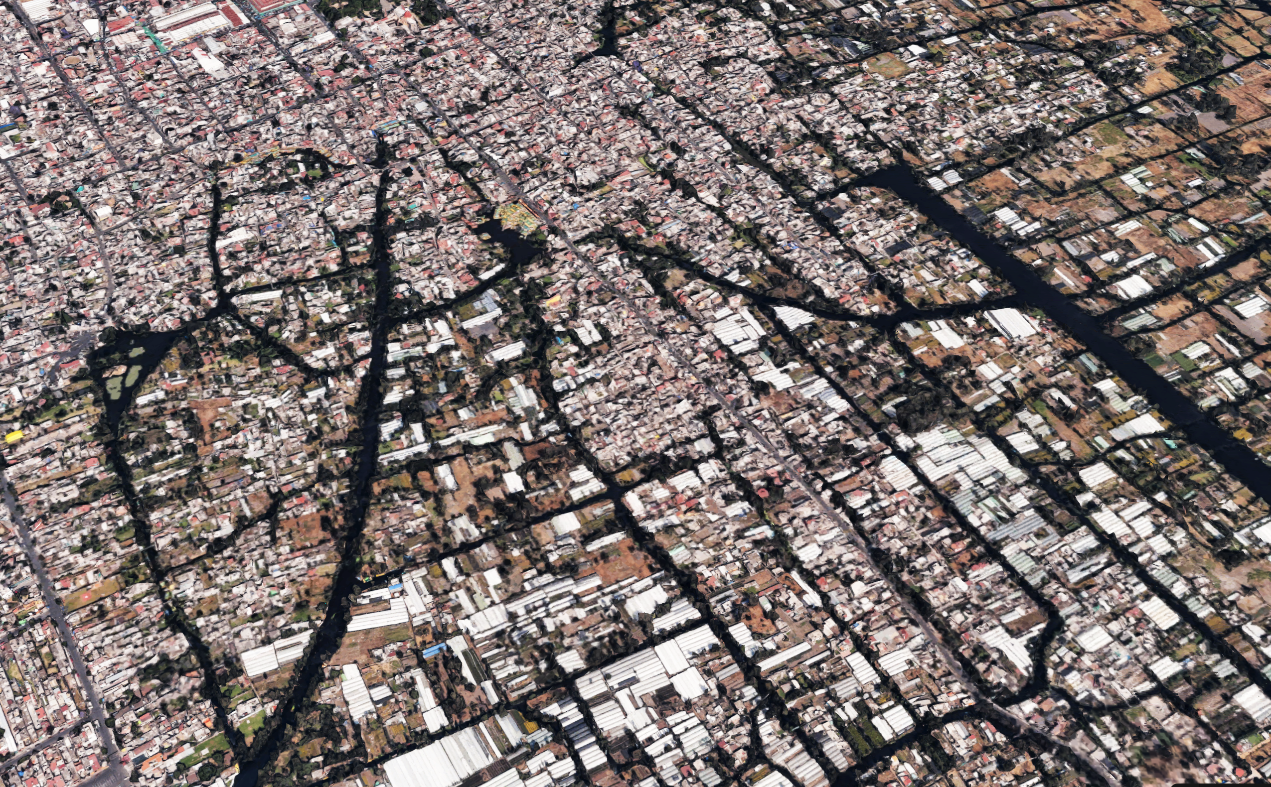
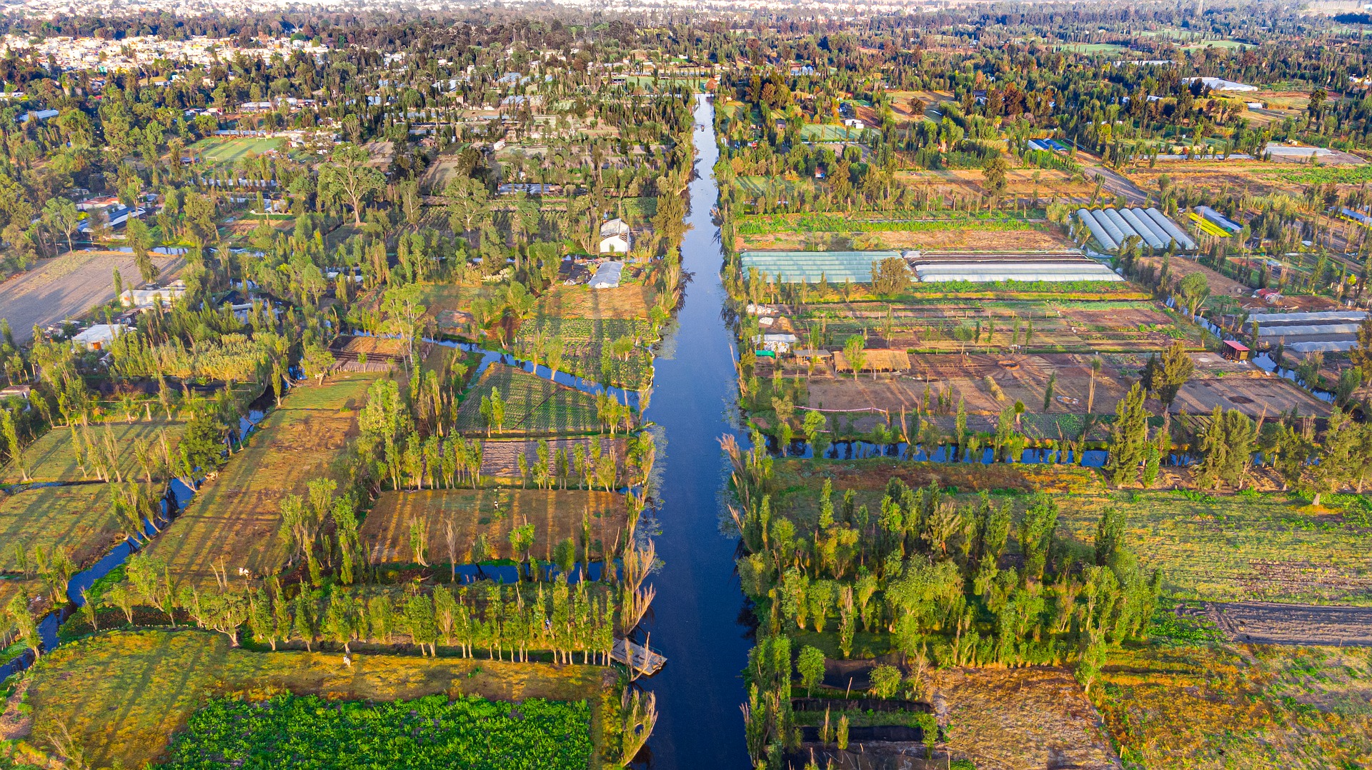
Xochimilco is best known for its canals, which are left from what was an extensive lake and canal system that connected most of the settlements of the Valley of Mexico. These canals, along with artificial islands called chinampas, attract tourists and other city residents to ride on colorful gondola-like boats called trajineras around the 170 km (110 mi) of canals. This canal and chinampa system, as a vestige of the area’s precolonial past, has made Xochimilco a World Heritage Site.

Above images of 14 canal cities are shown. This is just a small sample of urban settings that contain multiple waterways. Please let me know of any other city you feel should be shown and I’ll add it to the list above.

Dear Professor, thank you very much for sharing such valuable insights on canal cities. I would like to add that several Chinese examples, such as Hangzhou, Jiaxing, and Suzhou along the Grand Canal, could also be included, although their historic urban structures have been significantly transformed by modern development and the original morphology is often preserved only within the historic districts. This is also why I am particularly interested in the relationship between historic canal districts and the larger city: in China many such districts have become isolated islands within a modernised urban fabric, and I am exploring whether alternative forms of protection or integration might be possible. I would be grateful for your advice on two questions: since in many European and global cases the boundaries of historic canal districts are not explicitly defined, do you think it is reasonable to delineate them through urban fabric characteristics such as building density, plot size, spatial randomness, and proximity to the canal? And as I am building a global comparative dataset (including Amsterdam, Bruges, Copenhagen, Milan, Leiden, Ghent, Hamburg, Delft, Utrecht, Aveiro, Toulouse, Paris, Lowell, and several Asian cases), are there additional historic canal districts you would recommend including? Thank you very much for your work and for taking the time to read my question.
LikeLike