

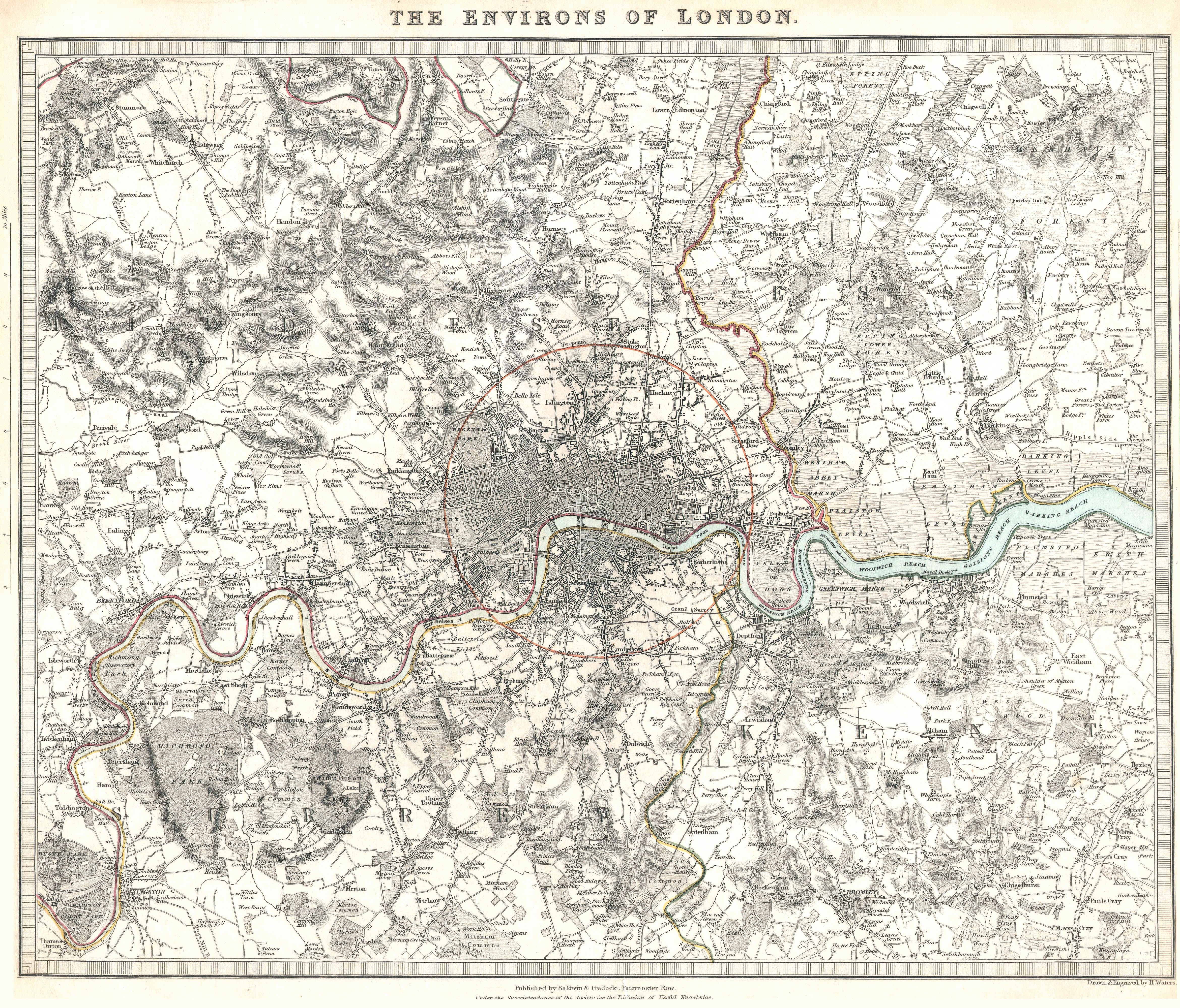
In 1981 I presented my graduate thesis titled “Manhattan a Measure.” To write this thesis I searched for various historic city maps. Eventually I would use similar historic city plans in my book “The Genealogy of Cities.” On this website I previously wrote about my use of urban plans found in the Baedeker Travel Guides. Another major source for maps is found towards the end of a two volume Atlas that was published in 1844 by the Society for the Diffusion of Useful Knowledge.
The Society for the Diffusion of Useful Knowledge (SDUK) was founded in London in 1826, mainly at the instigation of the Whig MP Henry Brougham, with the object of publishing information to people who were unable to obtain formal teaching or who preferred self-education. It was a largely Whig organization, and published inexpensive texts intended to adapt scientific and similarly high-minded material for the rapidly expanding reading public over twenty years until it was disbanded in 1846.
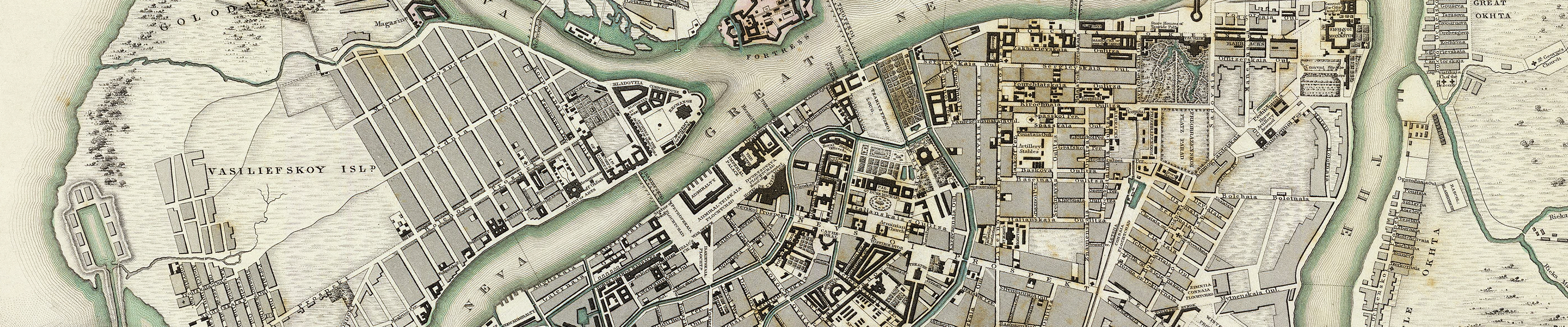
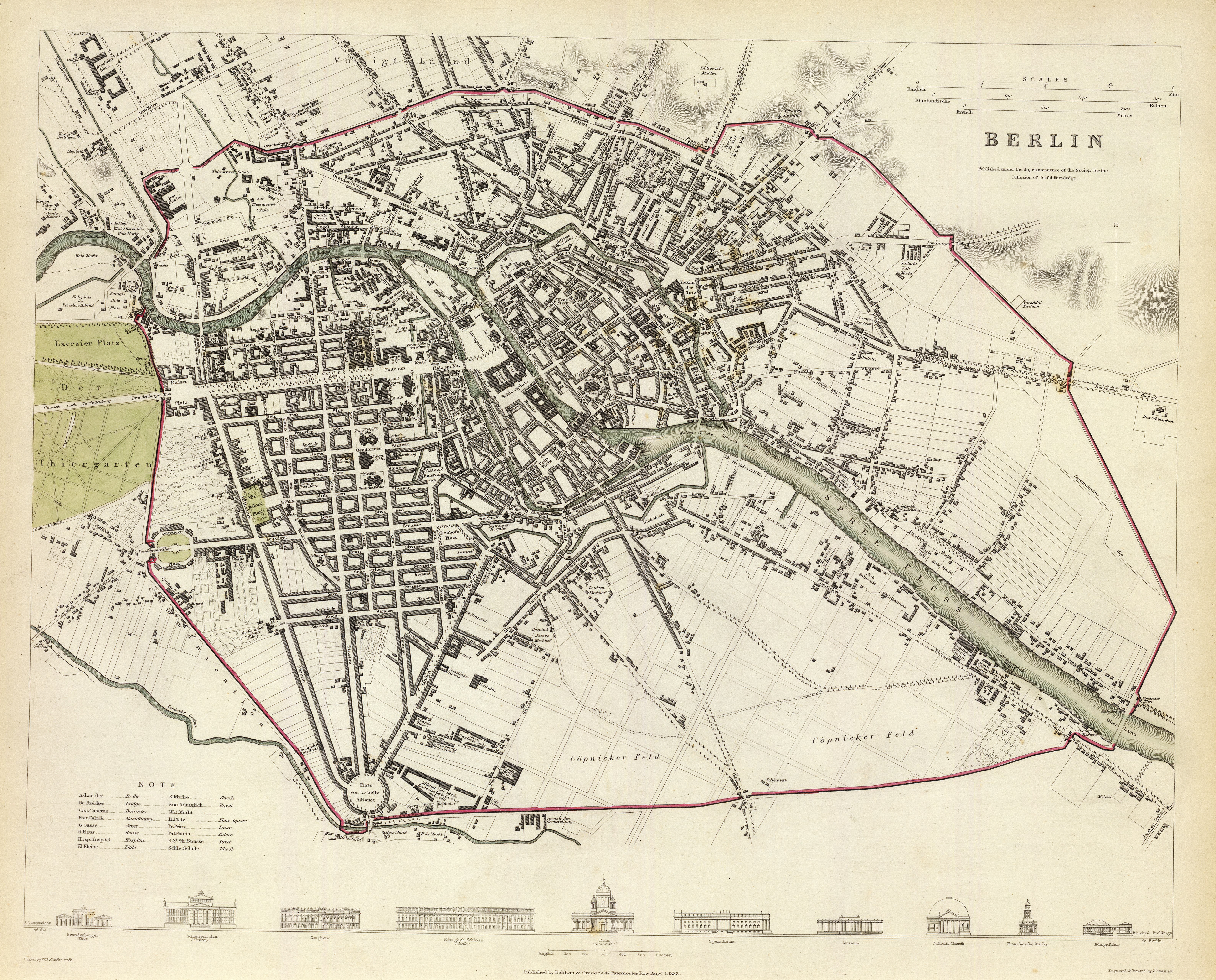
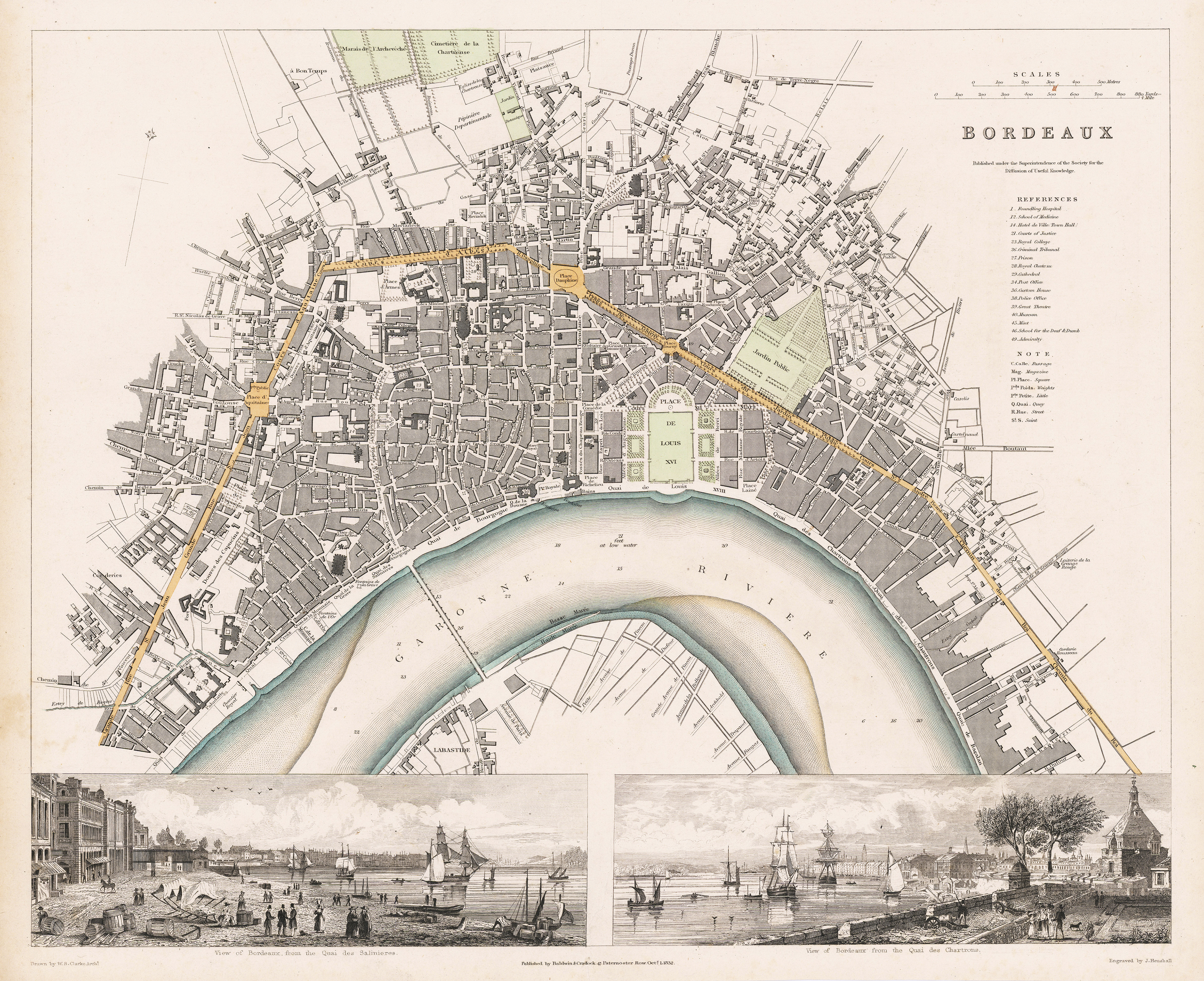
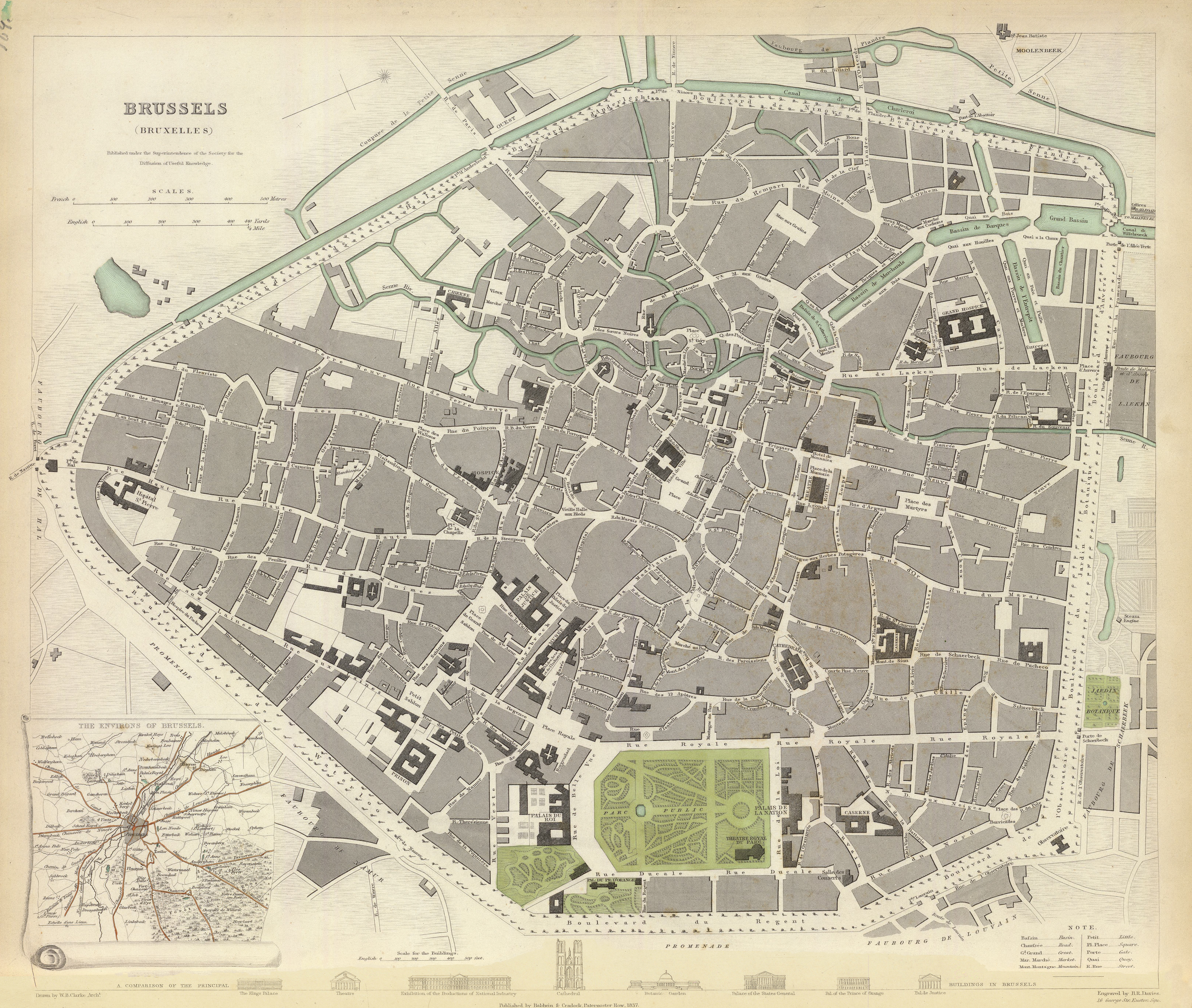
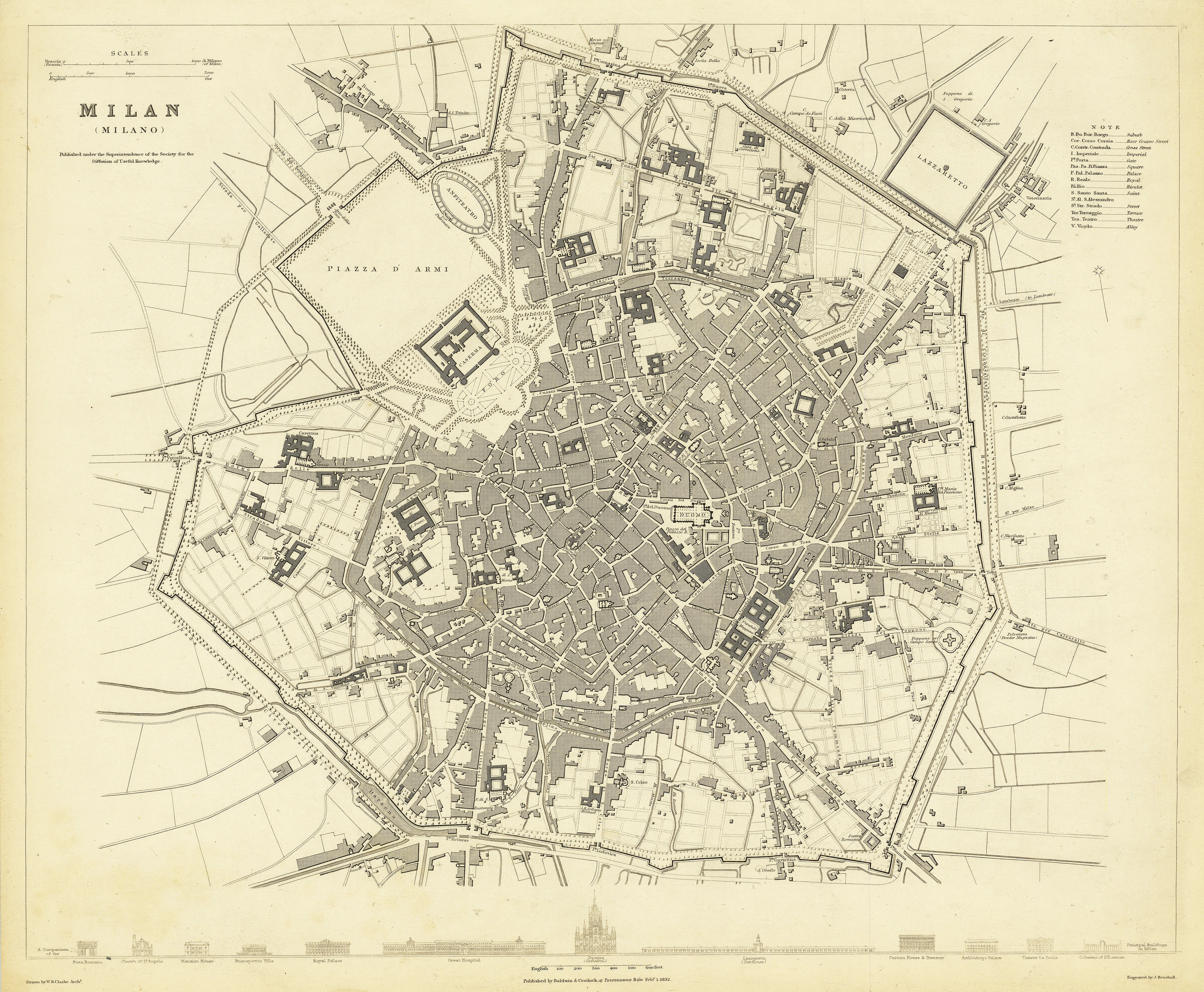
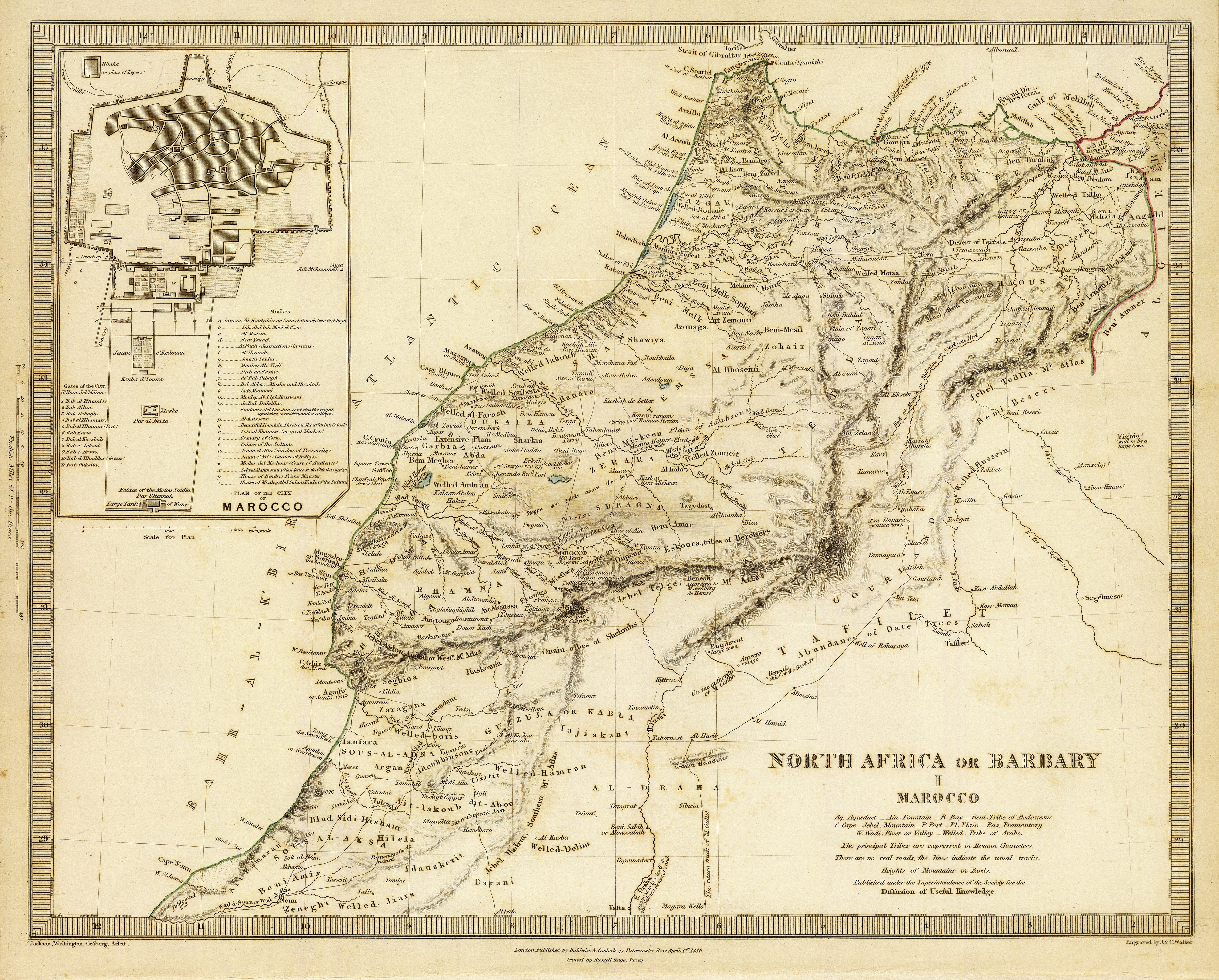
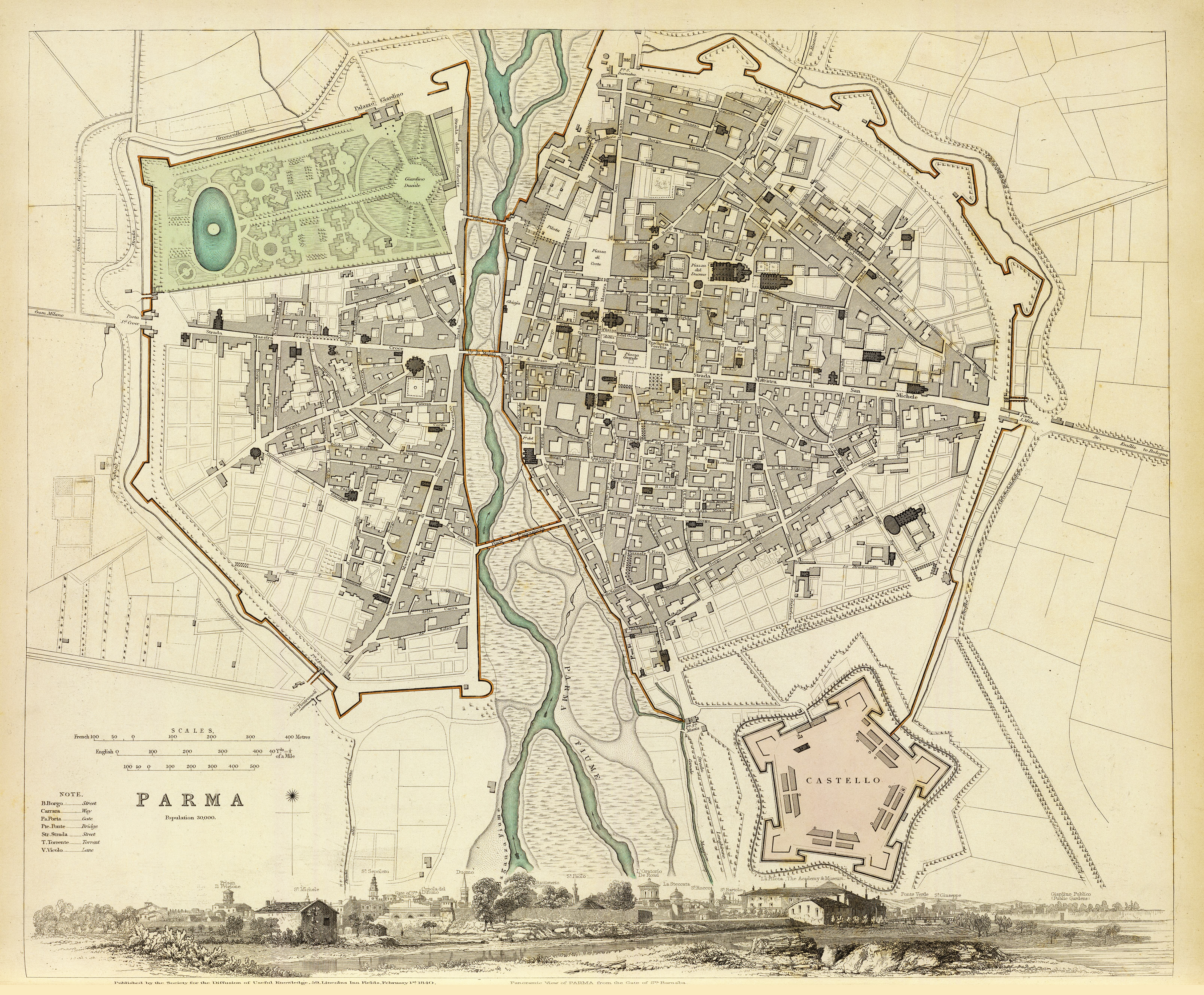
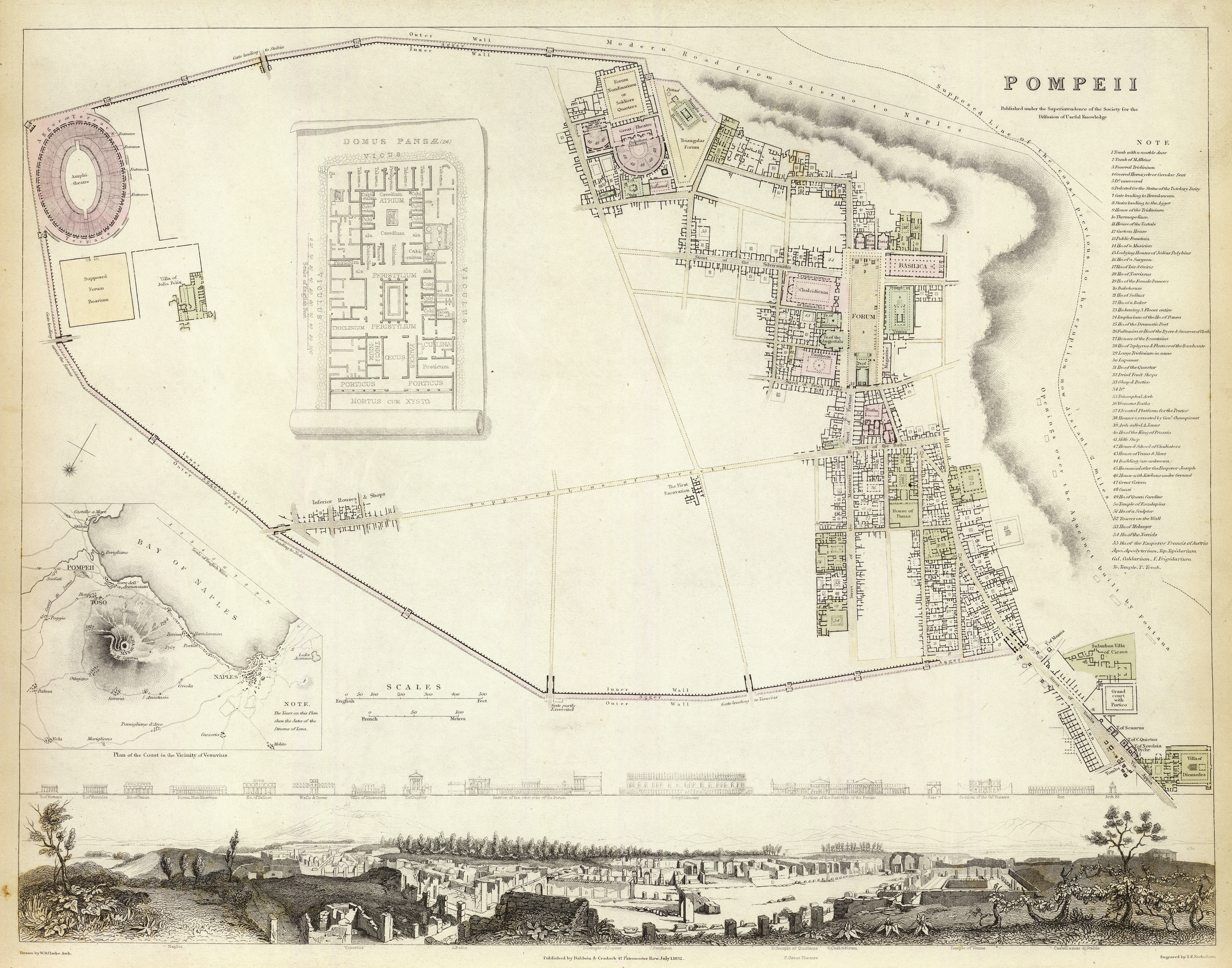
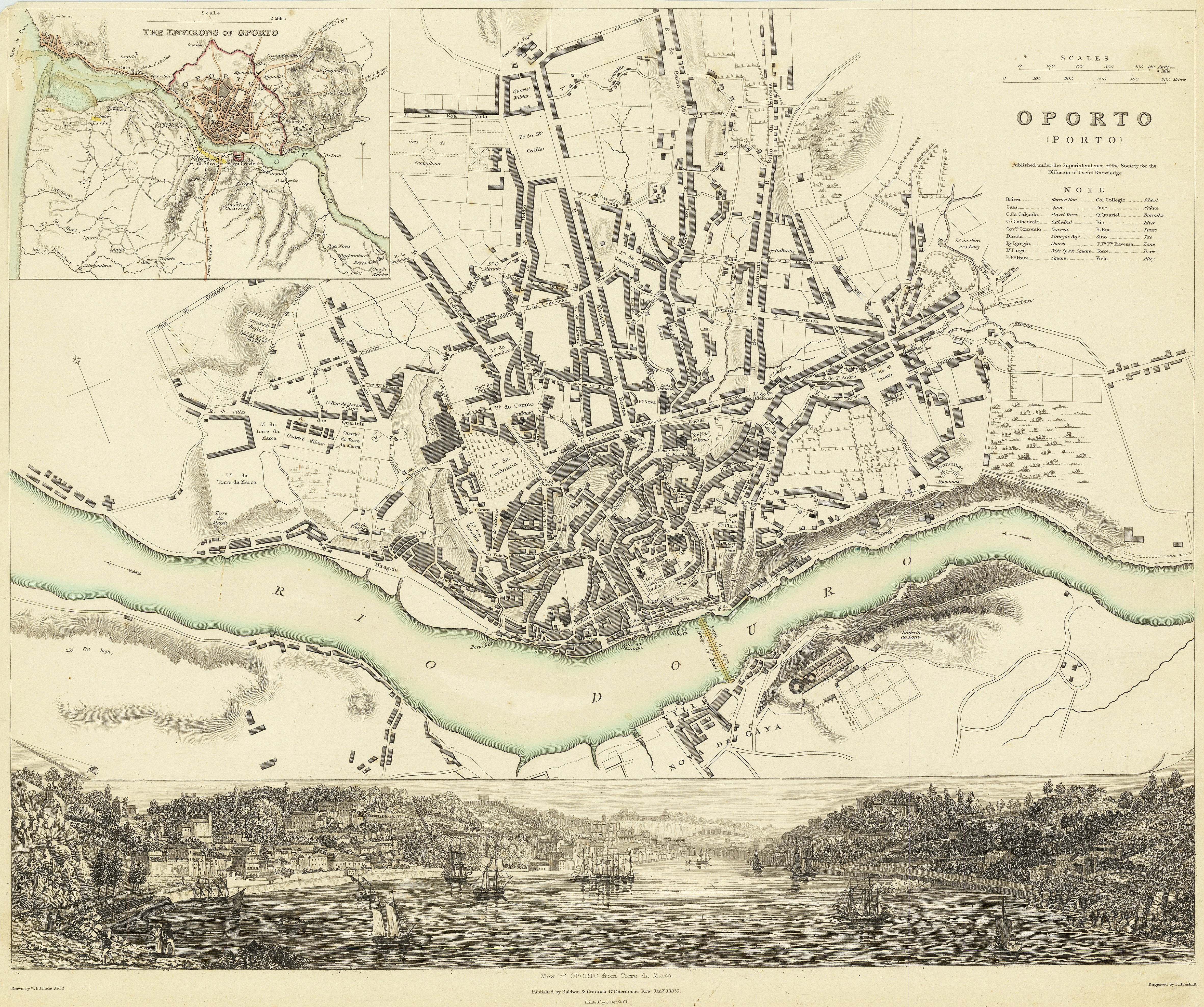
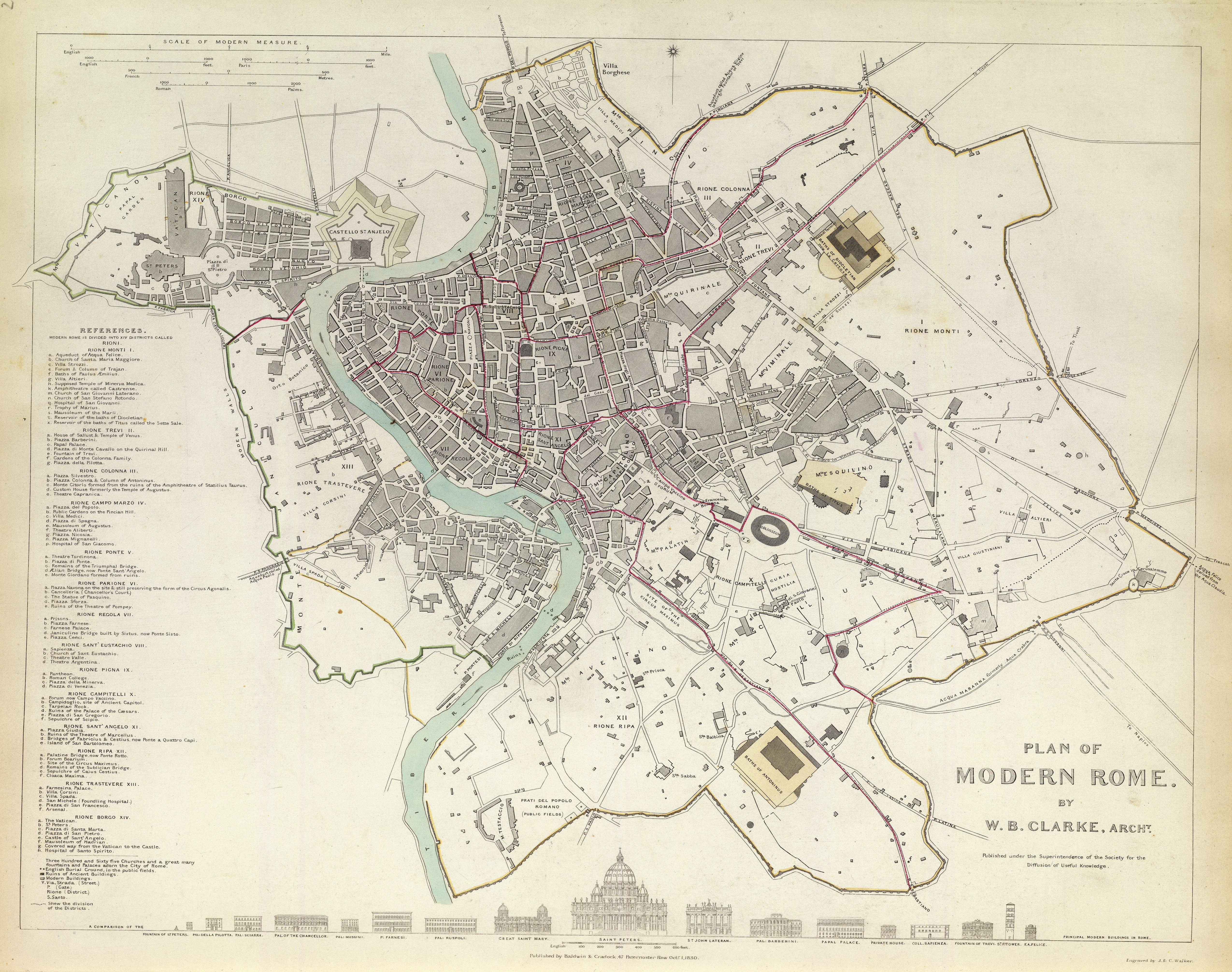
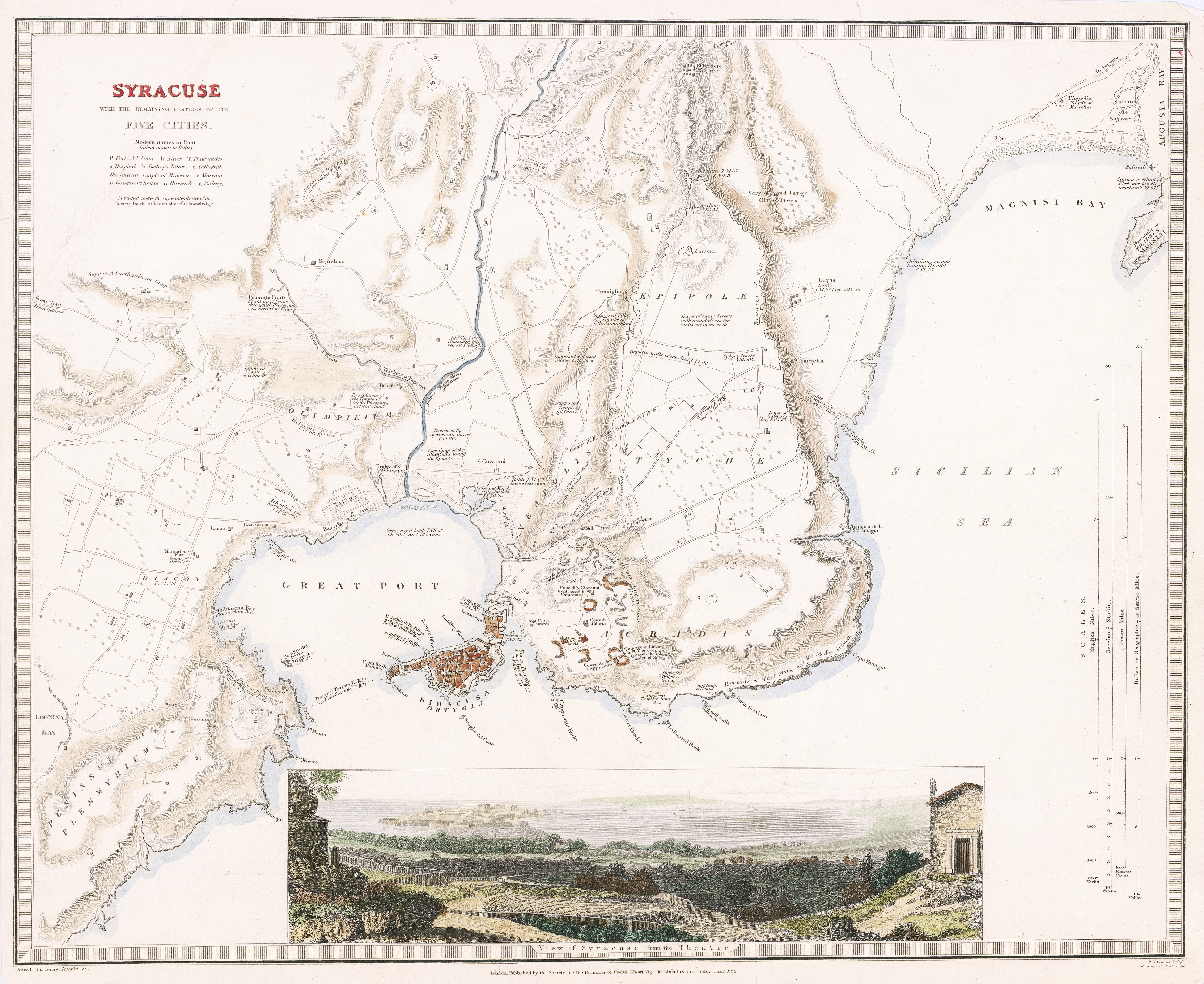
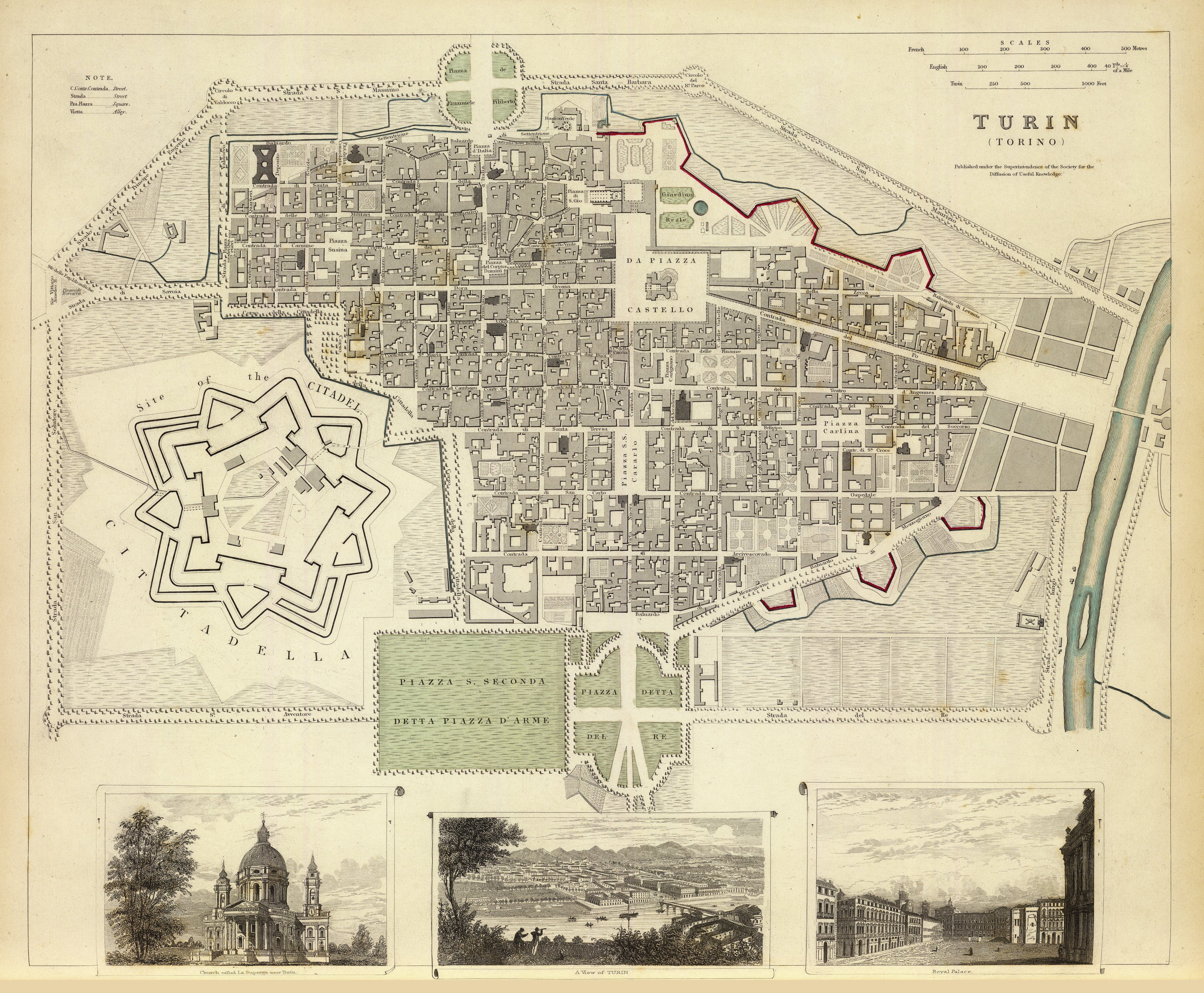
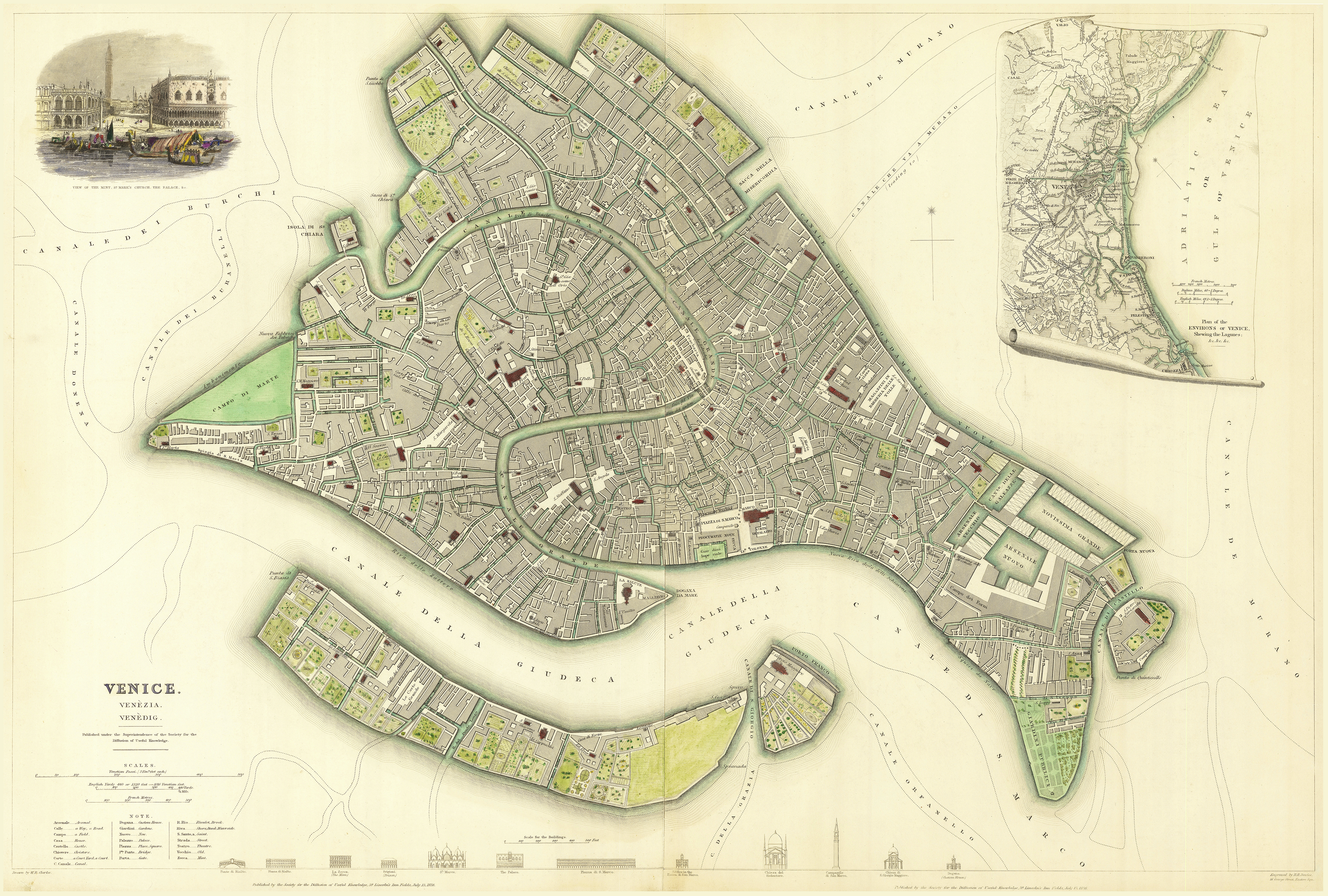
The plans are found in Vol. 2, on pages 162-212. At times the plans are colored by hand, and a number of either facades of key buildings drawn towards the bottom of the prints, or in some cases perspectival views. Copies of the two-volume atlas periodically appear for sale, and it’s still common to also find the individual plates of the for sale.
Below are the images of each of the historic cites found in the atlas. For greater detail the images can be found on David Rumsey’s Map Collection website.


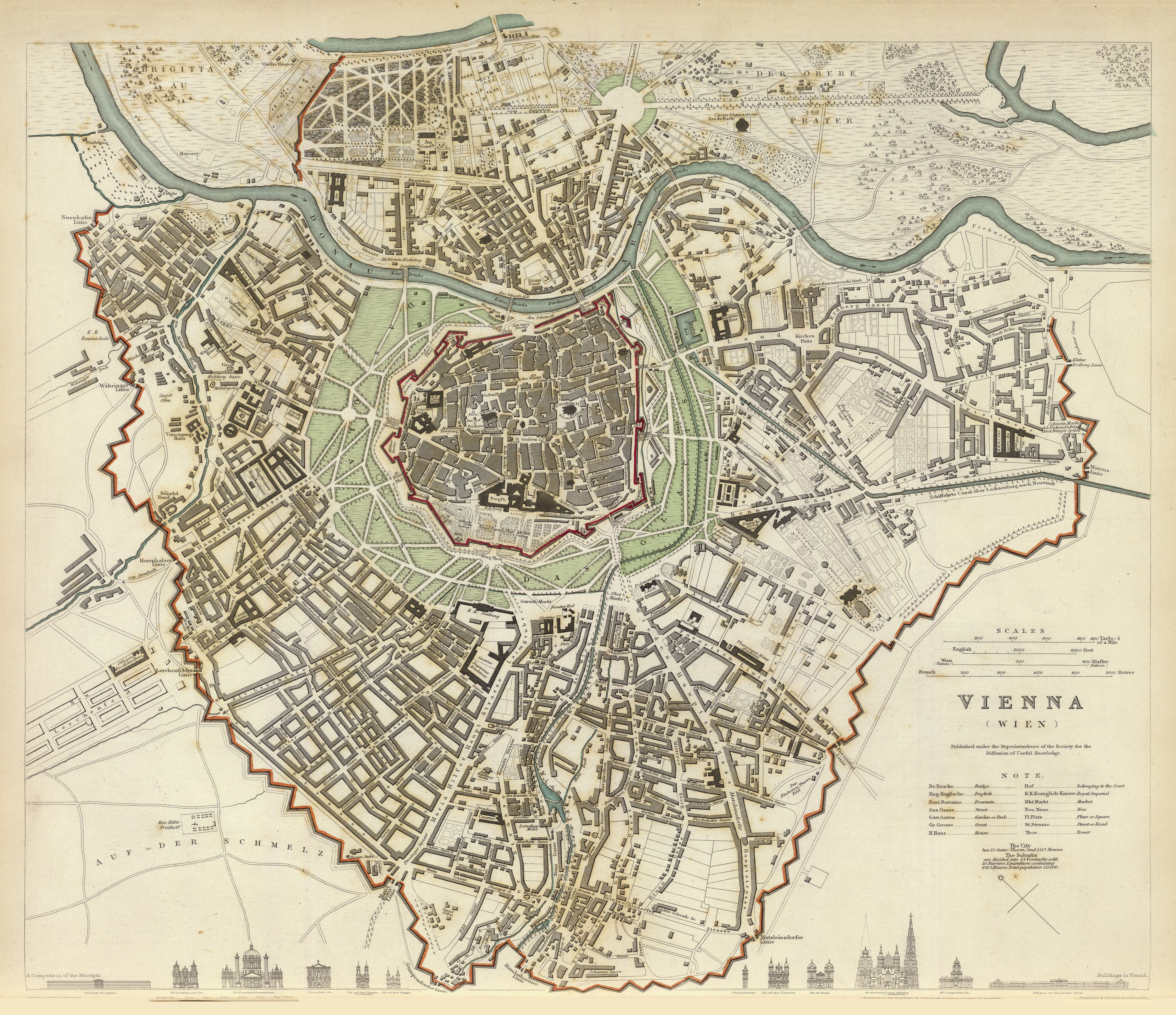

From a historic point of view these plans allow an urban theorist to study how various urban designs were implemented. Below is the 1833 plan of Vienna redrawn as a figure ground.

The plan illustrated below shows how the Vienna Ringstrasse design appeared in 1914.
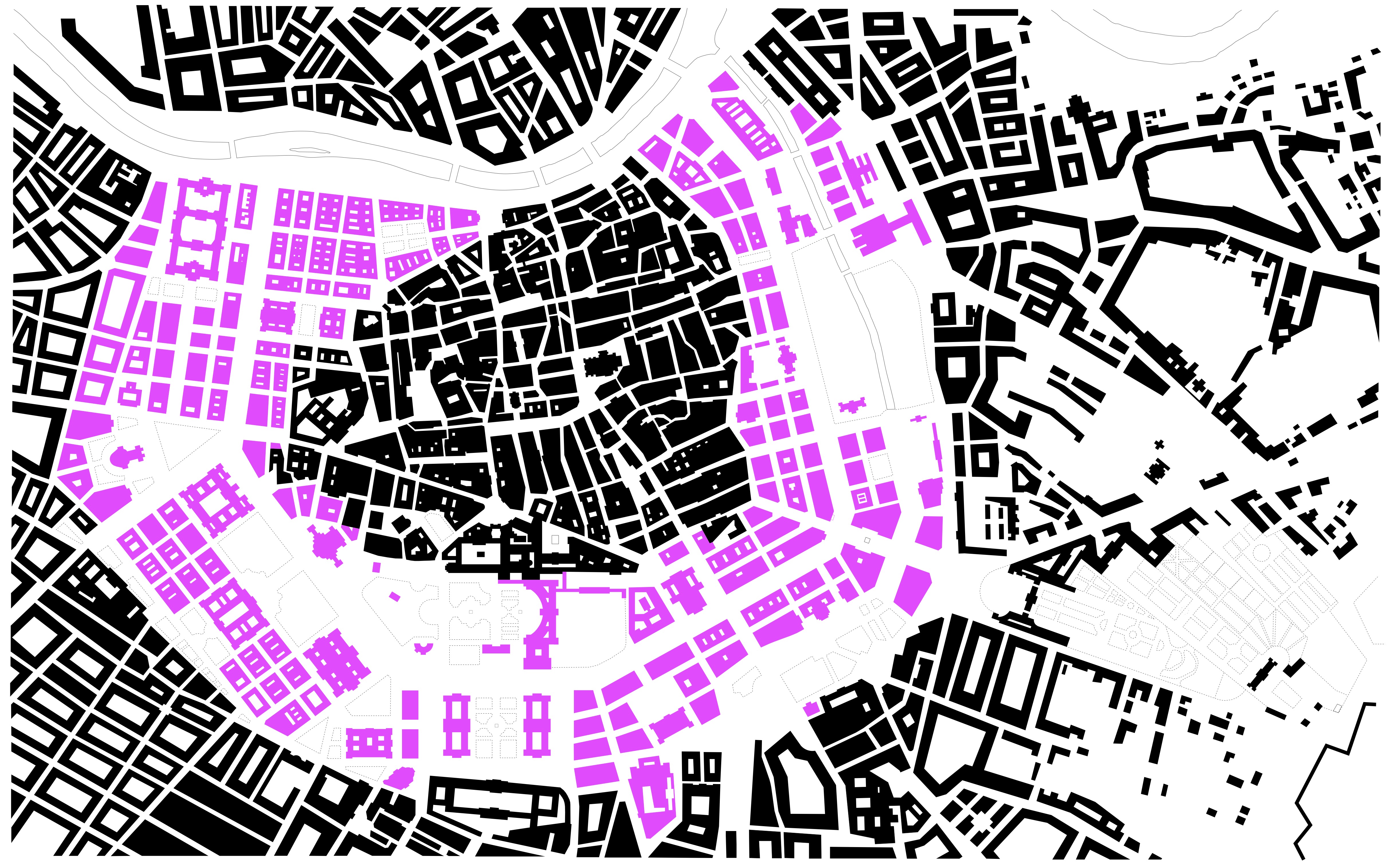
The area in black is what existed in the 1833 plan, while the area in pink is the added new design.


1 Comment