
Throughout the 17th to 18th centuries, the Grand Tour was mainly reserved for academics or the elite. Around 1840 rail transport was introduced, and the Grand Tour started to fall slightly out of vogue. With the introduction of train, the first form of mass-tourism was introduced. The 1800’s saw a period in which the Victorian middle classes toured Europe. As the century progressed, fewer cultural visits were made throughout Europe, and tourists began to also travel for nature, the weather, and spas. Grand Hotels began to be built and tourism remained very popular until the late-1920s and early-1930s, when, with the Great Depression and economic crisis, many could no longer afford to travel.

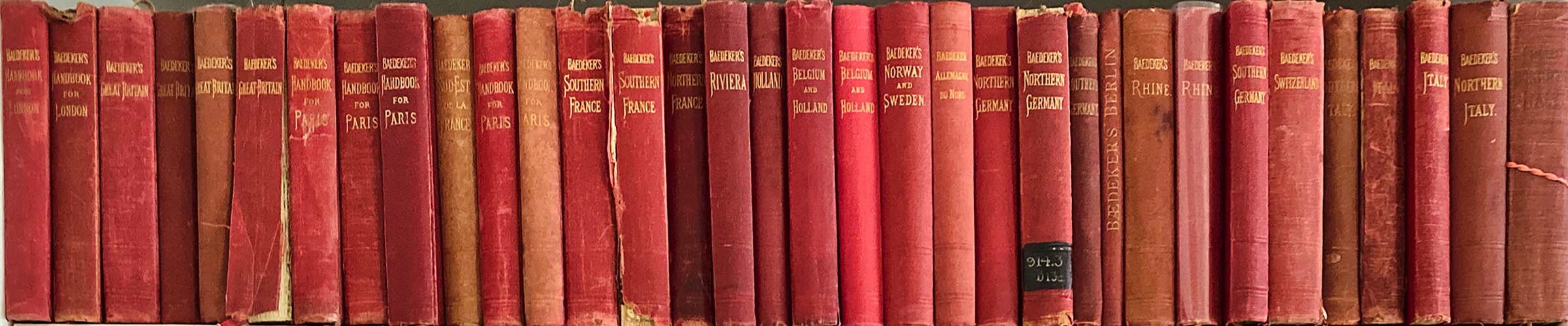
During the heyday of Victorian traveling, a travel guides known as “Baedekers” (named after the founder Karl Baedeker), was published. The guides contain, among other things, maps and introductions; information about routes and travel facilities; and descriptions of noteworthy buildings, sights, attractions and museums, written by specialists.
Although I find the perusing of Baedekers a great way to pass the time, my main interest has always been the large number of city plans found among their pages. Early on when I began writing my book on historic city plans, I started to collect these small red travel guides.

In the last ten years or so I’ve noticed a number of dealers have begun to sell the city plans separately, and at times for a price higher then even a cost of a whole guide book. In this Looking@Cities posting I’ve decided to begin to upload scanned images of the city plans found in my collection of travel guides. Over time I hope to have all the orthogonal city plans from old Baedekers uploaded here on this website.
(A List of Historic Baedekers can be found on Wikipedia)
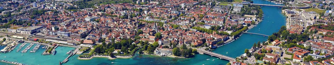
Baedeker “Northern Italy,” 1913
Baedeker “Germany,” 1910

2 Comments