
• City Gates or Points of Entrance 
City gates, in one form or another, can be found across the world in cities dating back to ancient times to around the 19th century.
City gates were traditionally built to provide a point of controlled access to and departure from a walled city for people, vehicles, goods and animals.
With increased stability and freedom, many walled cities removed such fortifications as city gates, although many still survive; albeit for historic interest rather than security. Many surviving gates have been heavily restored, rebuilt or new ones created to add to the appearance of a city.
In the past these entrances tended to be heavily protected. Although functional, the symbolic gesture of strength is commonly apparent when approaching and entering.
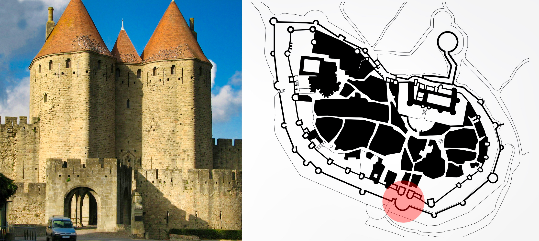
Historically the gateway to a city has been an actual physical fortified entrance, and typically represented a sign of strength and power to those entering for the first time. In the image above, the left photo shows the main gateway into the French town of Carcassonne. On the right the plan of the same city with the main gate circled in red.
As fortified cities grew the walls surrounding them developed along with them. At times the earlier walls were removed, and the materials were added to the building a new wall. Eventually the early fortifications were not needed, but the gates into the cities may still stand today. Below is an image of the Porta di San Frediano, a gate located on the west side of Florence, Italy, and south of the Arno River.

Note the remains of the earlier wall extending to the left and right of the gateway.
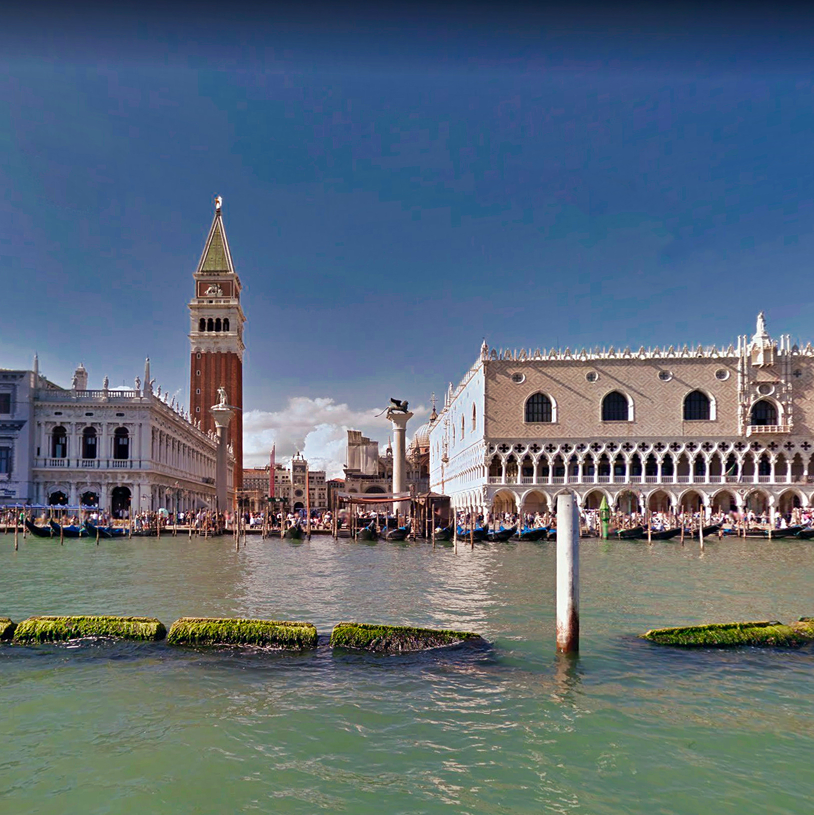
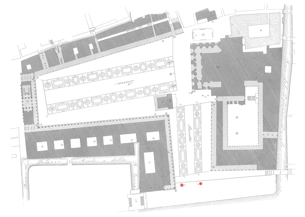
The concept of gateway can take on other forms than that of a fortified entrance. Here you see the major entrance to the city of Venice as you approached Piazza San Marco by boat. Note the two Columns, Saint Mark and Saint Theodore. These two columns stand as the entrance to the Piazza.

In some cities traces of earlier gateways into the city still exist buried within the city fabric. Shown in the map below are three stages of walls for the city of Milan, Italy.

In the map shown above, the Roman Republican walls are shown in red, with the later Roman Imperial (Maximian) walls shown in blue. The key in the upper left lists the gates (or porte in Italian) for the two roman walls. The line shown on black is the medieval wall, which was begun in 1156. This wall had seven main gates (Porta Ticinese, Porta Vercellina, Porta Giovia, Porta Comasina, Porta Romana, Porta Nuova and Porta Orientale) and about ten “pusterle” or posterns, which were minor gateways into the city. Most of the medieval walls were demolished between the 16th and 19th Century. The moats remained and were used as canals.
The circled areas in the make above illustrate gates that still exist today. The green circle is Porta Nuova and the purple is Porta Ticinese.
The two maps below show earlier stages of the fortified city, with the same colored circles representing the two gates existing today.


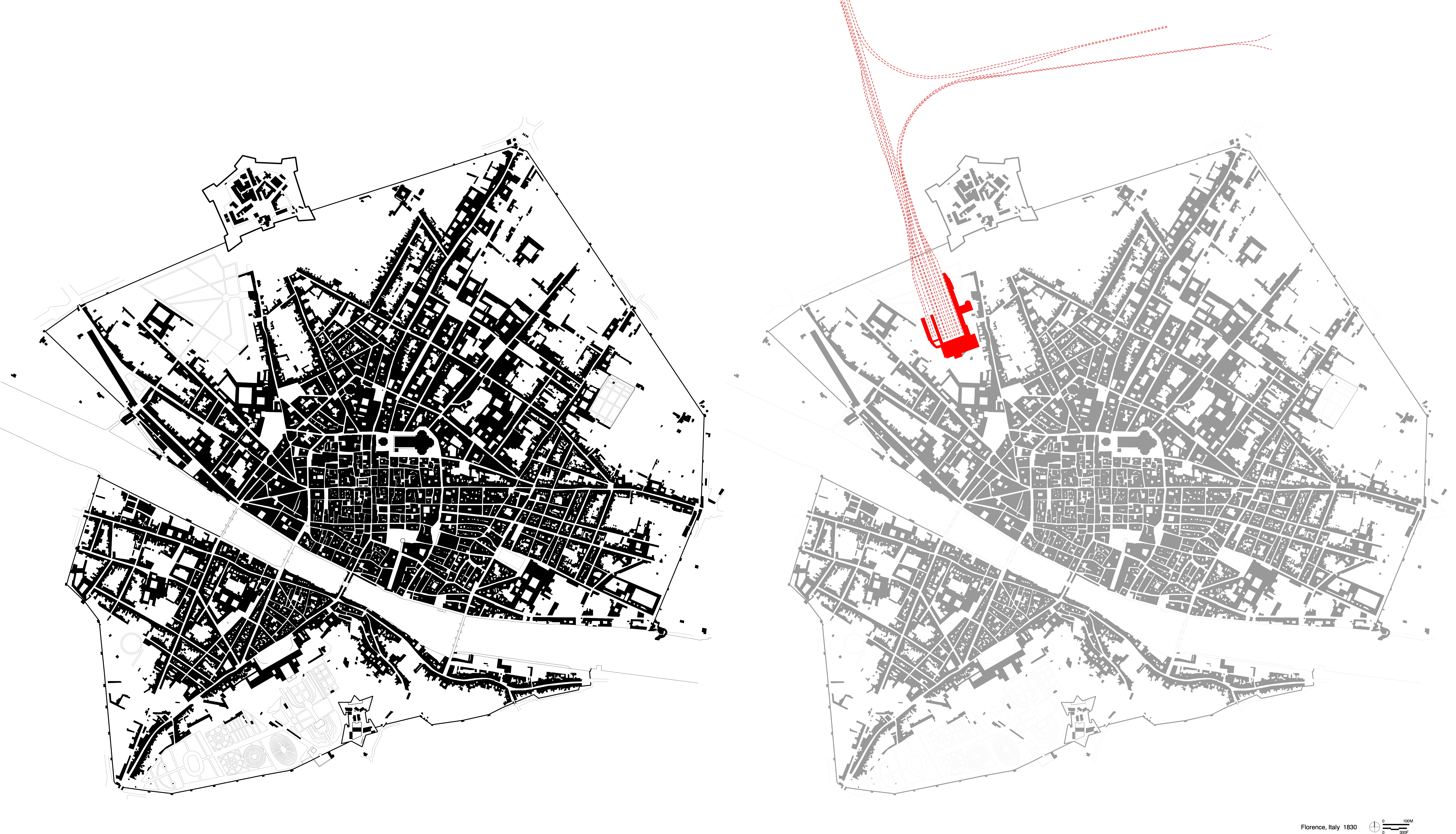
With the advent of the train a person’s first entrance to a city occurred within the former boundaries of a city’s physical wall. Shown in the image below is a plan of Florence Italy, on the left, as it existed in 1830. On the right is the location of the modern train station. The first train station in Florence was built circa 1845. The station was located in an open area north of the Dominican monastery Santa Maria Novella.
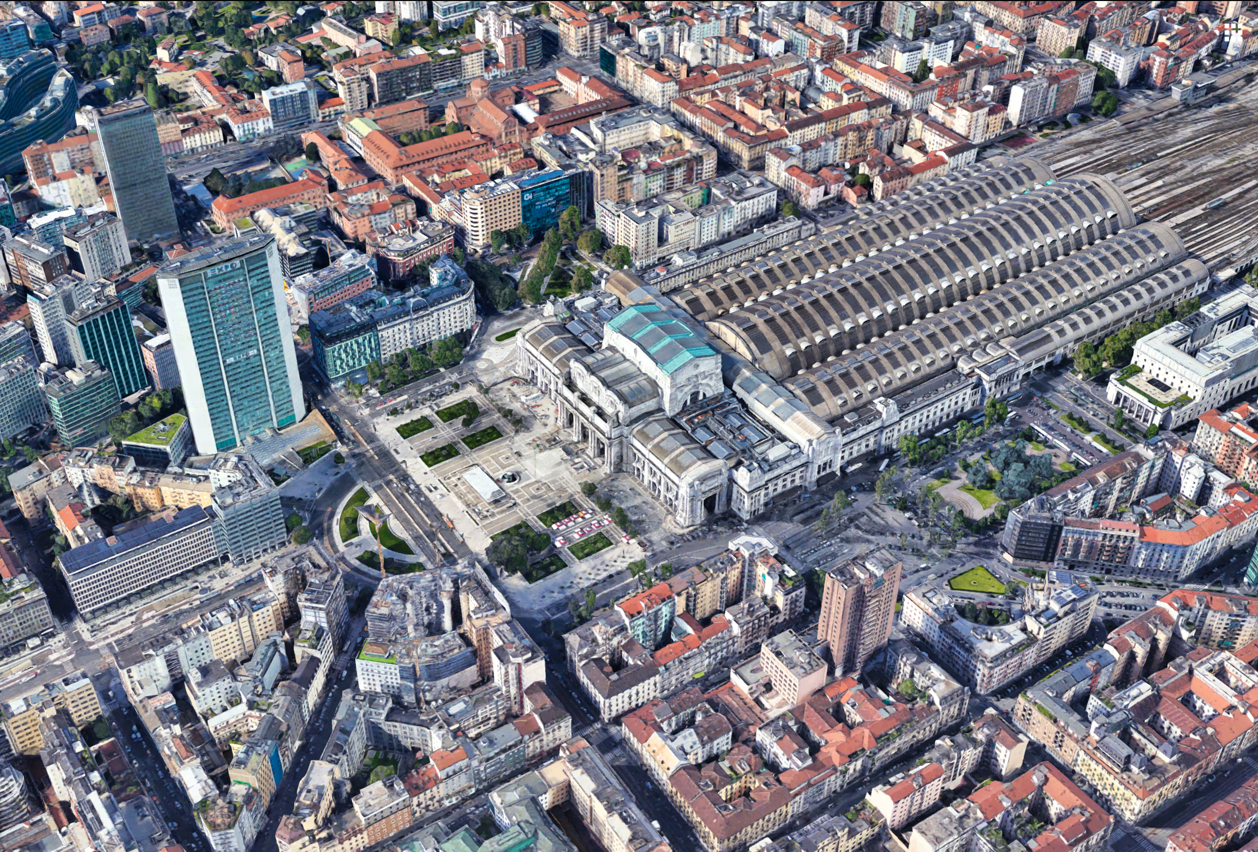
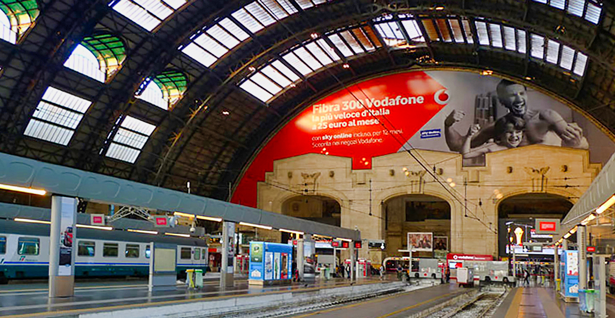
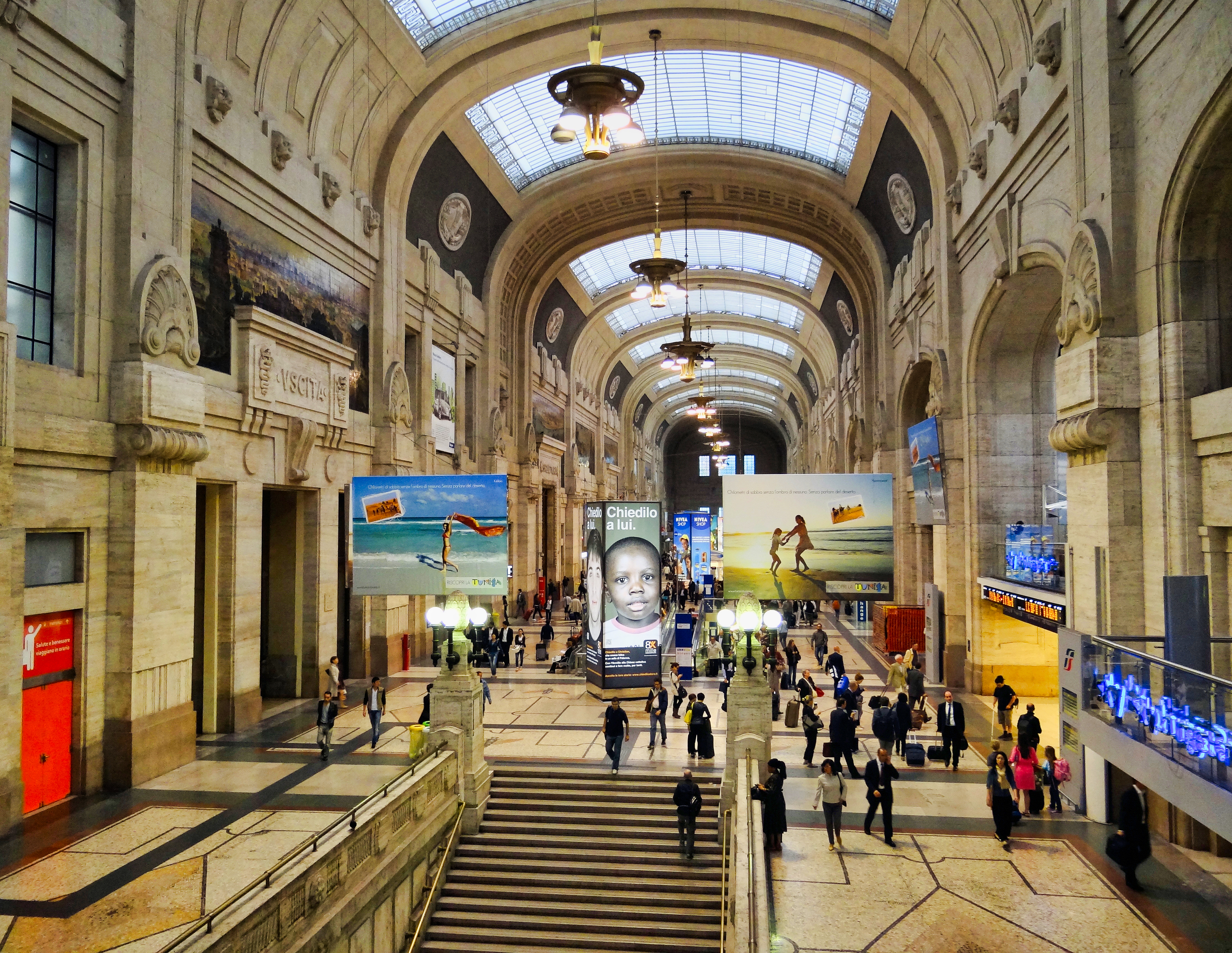
When you arrive by train in Milano you usually arrive at the Central Train Station. The following images illustrate what the views you encounter as you exit the station.

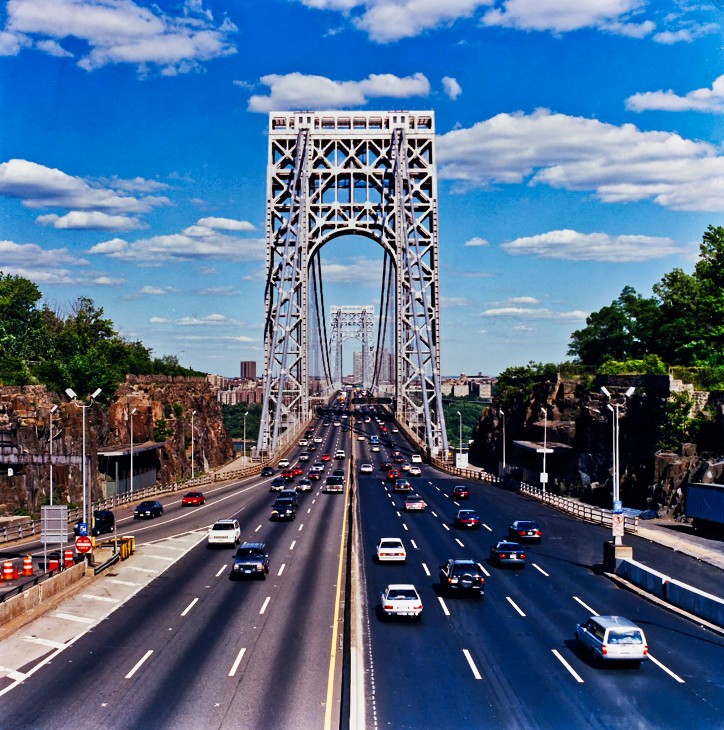
Without the need for fortified walls, today’s entry points into a city have changed. One type of gateway may be the arrival across a bridge.

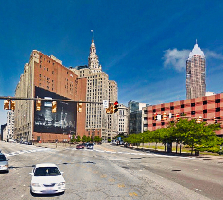
Today it’s hard to discern where a possible gateway may occur in a city, and at times it is only represented by a name. One example of this is Cleveland’s so-called “Gateway Area,” which leads you to “Public Square.”