

• Fields 
In 1979 Steven K. Peterson published the seminal article titled “URBAN DESIGN TACTICS.” In this article Peterson describes an Urban Element defined as field.
“When … area[s] in an urban setting are] recognizable and coherent it is defined as afield. Its subsidiary elements are
- texture
- street
- square
- block
- block unit.
Each of these elements, including the field, can be designed and manipulated in a corresponding relationship between plan and perceptual experience.
The field is an area of the city, which has distinct’ defining characteristics, achieved through’ clear edge, clear center, or distinct texture. It is mosaic in form, non-linear, non-axial, repetitive, continuous and possibly disordered. It has the design qualities of fabric or surface; its edges can be shaped; its inner area inscribed with pattern; it can be joined with other fields, overlapped and interwoven. As an aggregate formal entity, it sometimes corresponds to districts or neighborhoods.”

The city plan of Bari, Italy 1893, shows the two fields defined by texture, with the zone shown in orange representing a form of urban stitching as a transition from the medieval yellow zone, to the later 1800’s addition illustrated in red.
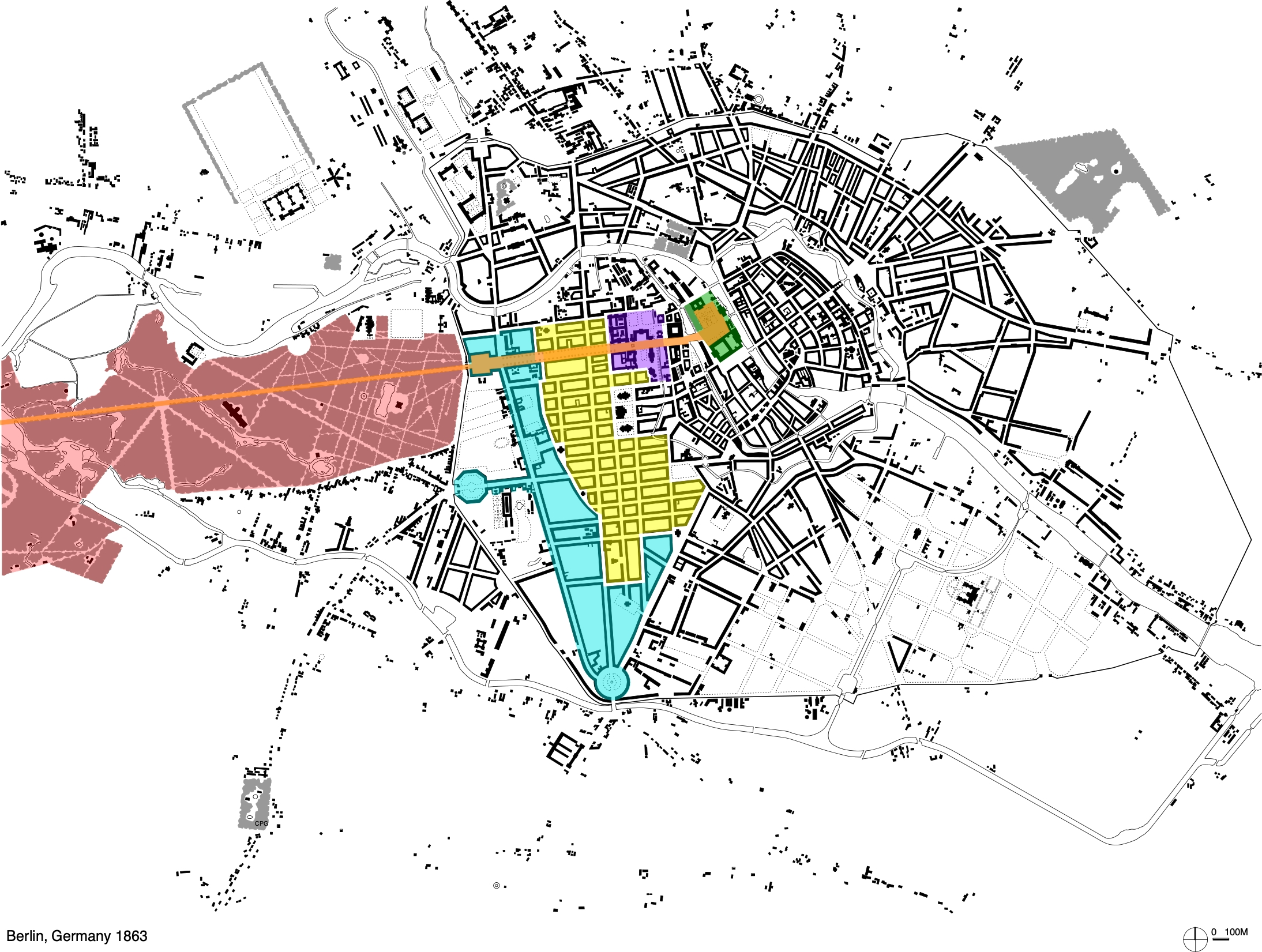
Above is the city plan of Berlin, Germany 1863, with a number of fields depicted. Note the orange zone of Unter den Linden & Bundesstraßerunning through the Tiergarten. Together these two fields connect the various fields shown.
In the map below is the area known as the 1st arrondissement of Paris.

The boundaries of the 1st arrondissement were set in the 1850’s, and is considered a political field. The map of the same area shown below, depicts the physical field illustrated in green.

Fields can also occur in an identifiable vertical massing, as illustrated in this view of Paris shown below.
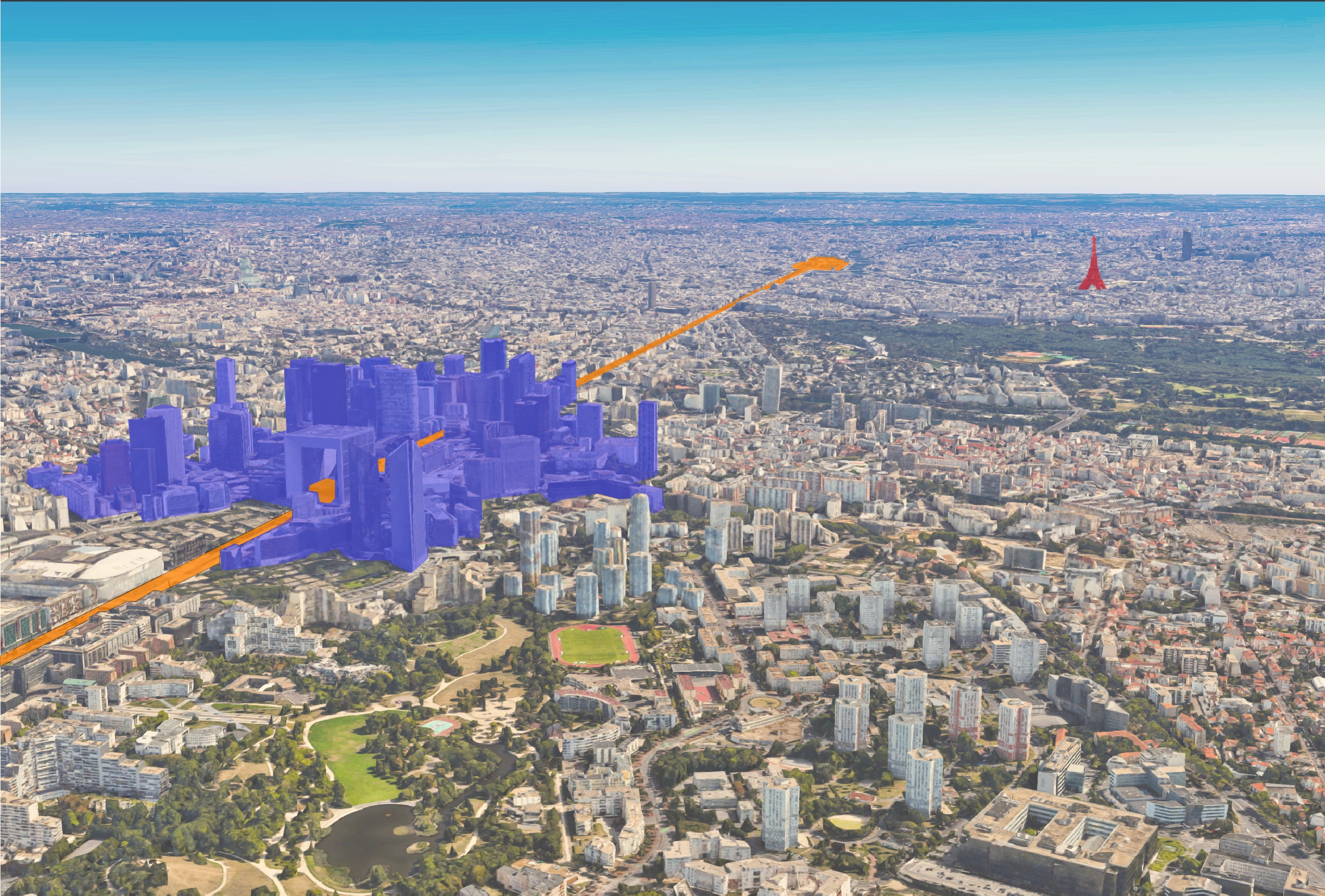
The area highlighted in blue is the area of the Grande Arche de la Defense. The orange stripe is the extension of the Avenue des Champs-Élysées, which begins near the Louvre, and ends at the Arc de Triomphe. The avenue then turns into the Avenue de la Grande-Armée, followed by the Avenue Charles de Gaulle, which then intersects the Grande Arche de la Defense. Off to the right, and shown in red, is the Eiffel Tower.
