
In the previous posting, The Urban Genome: The Rural Zone, I began a new series discussing what I call The Urban Genome. The concept behind the urban genome is a series of common basic urban typologies that makeup urban fabric, or cities.
As I mentioned in the City Edge posting, there are 17 elements that make up the different urban typologies.
They include:
- The Rural Zone
- The Approach
- Edges
- City Gates or Points of Entrance
- Circulation (Streets, Boulevards, Alleys, etc.)
- Galleries
- The Block
- Courtyards
- Fields
- City Spaces
- Open Spaces (Parks, Zoos)
- Object Buildings
- Terracing
- Siting (Geography)
- Monuments
- Water Conditions
- Ensemble
In this posting I will be discussing…..
• The Approach 
One aspect of Urban Design is to understand that every city is not always viewed from within. There are certain vantage points as one travels towards a city and begin to view the skyline, or the first glimpse of the urban fabric. Important cities have various, or one pentacle, focal point. At times the approach is from above as the traveler arrives via a nearby mountain or hill.
The print below, by Francesco di Lorenzo Rosselli, is of Florence, Italy as it existed circa 1475. It shows a view on a hill that is the transition zone, where you get your first view of the city coming over a hill from the southwest. Note the chain around the border and the author showing himself within the locked area. This is symbolic of this bound protected state they always viewed the city in. In a later posting I’ll discuss what a city offered, beyond just security.
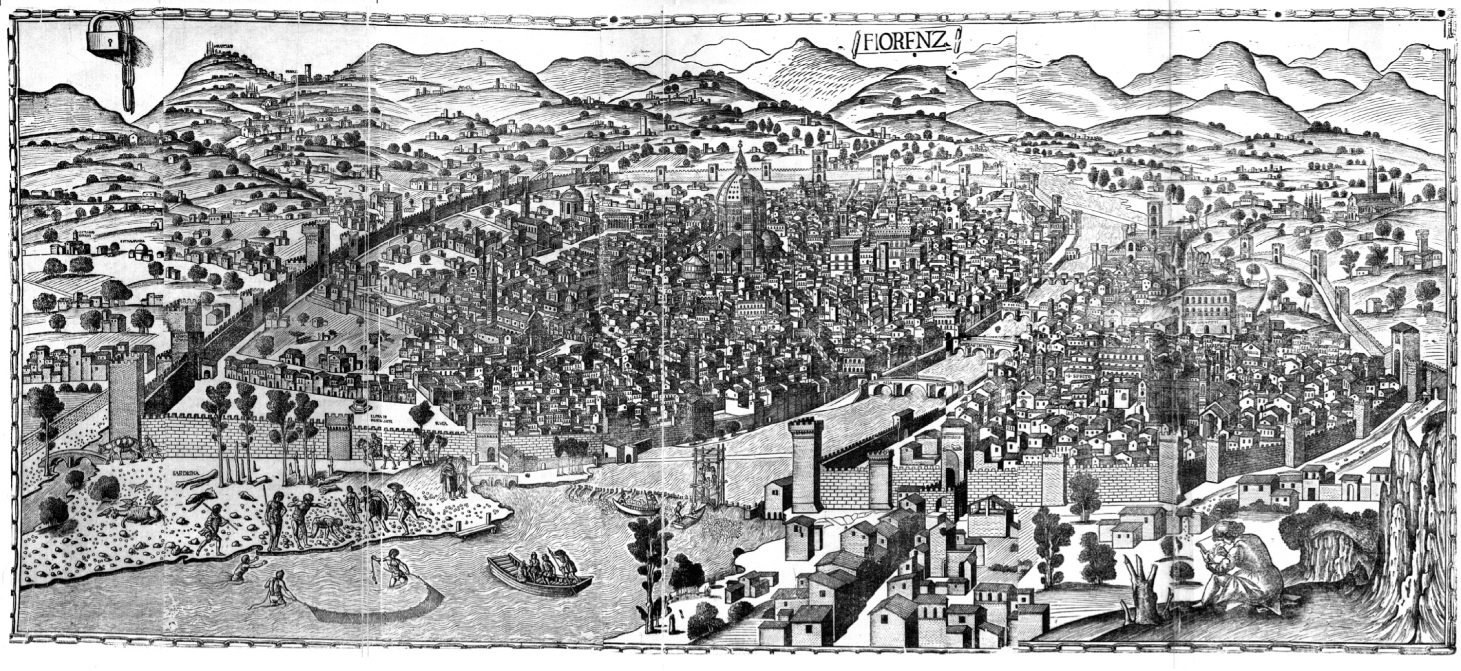
Also note the lack of trees It could be possible that this shows the deforestation of the area of that time, since the trees tended to be used as fuel, as well as the same area could have been farmed.

The image above of Florence today is taken from Google Maps. The view is from Giardino di Villa Strozzi. One of the hills south of the river Arno, and west of the city of Florence. The view of the 1475 print was taken approximately from this vantage point.

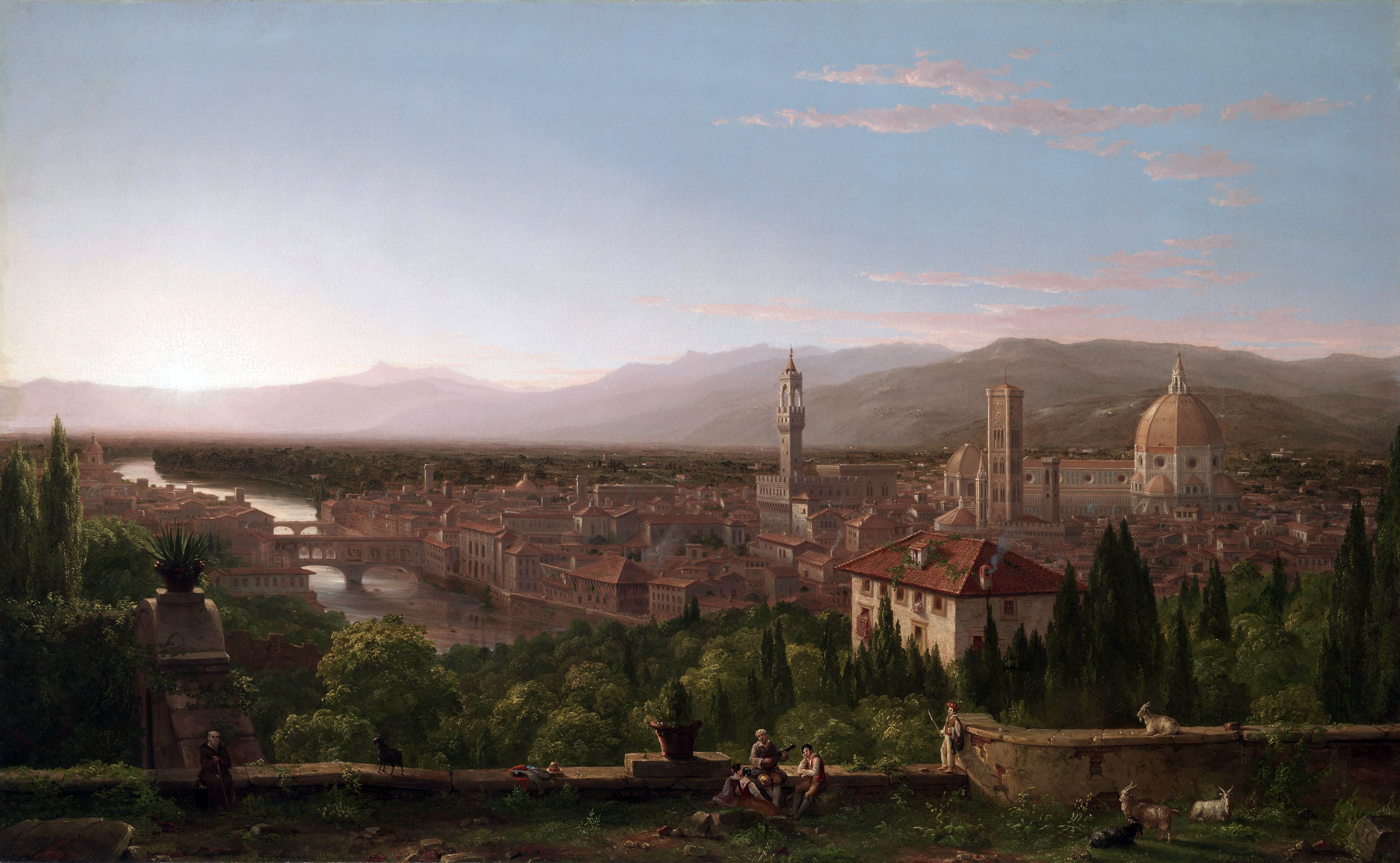
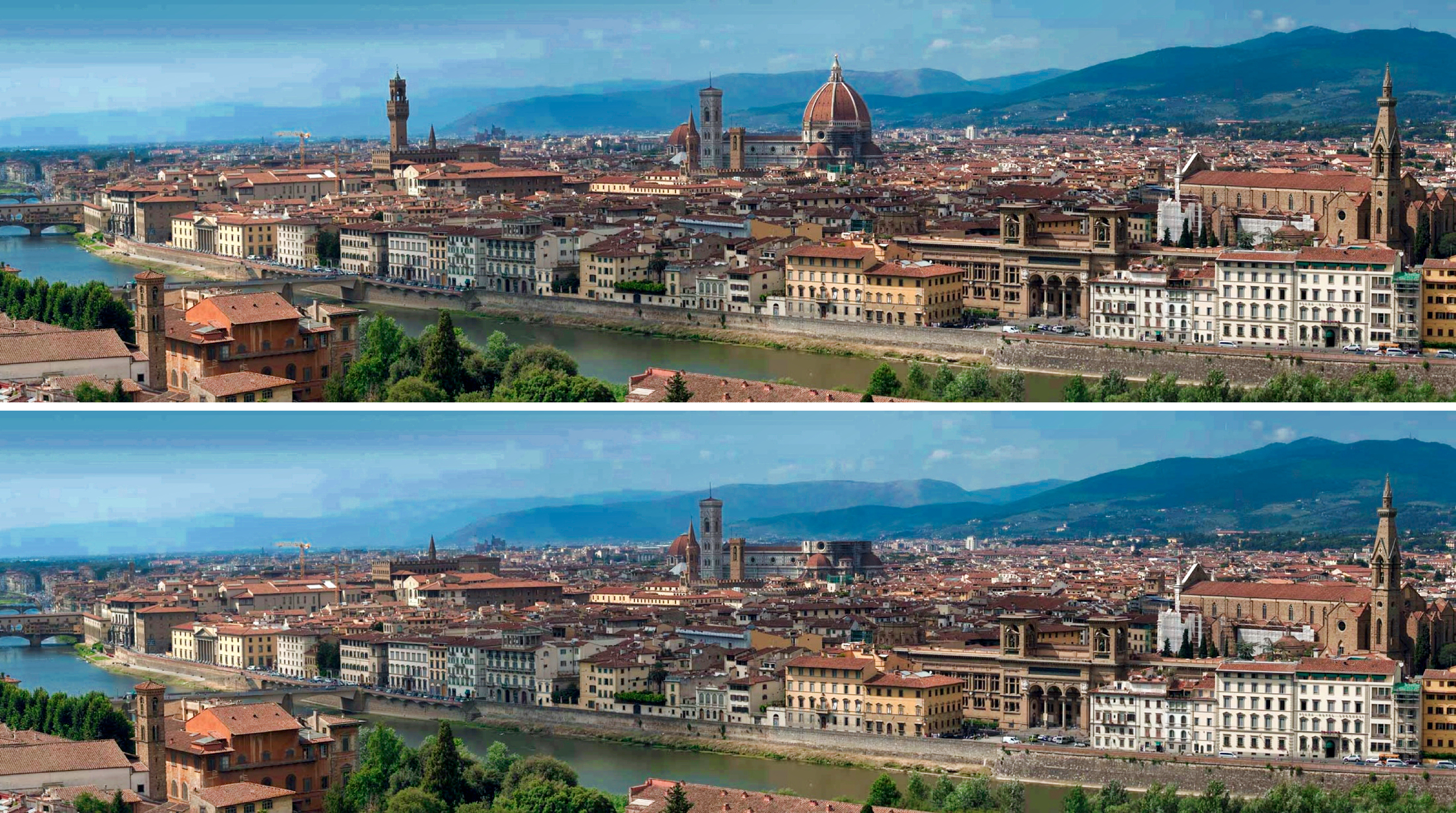
The painting below, titled View of Florence, is by the American painter Thomas Cole, 1837. Painted from the area known as San Miniato al Monte, this view is south of the river Arno, and east of the city.
Below is a similar view, taken from the same area, as Florence looks today.

Note in both images the Duomo and towers as central focal points. Brunelleschi, the designer of the Duomo, had this in mind when he designed the Cupola. This structure has become synonymous as an image of the city.
In the case of Carcassonne, as shown in the image below, the medieval wall becomes the dominant feature in the approach to the city.

The first view of a city today though typically occurs via the ring interstate roads. In the image below is a first view of Cleveland, viewed from south looking north.

Historically some views of cities were approached from the water. Here is a view of Cleveland from the Cuyahoga River as you travel north.

Today we are not limited to viewing an approach to a city at ground level. One of the first views of a city people see is most commonly from an airplane. Due to this, a number of cities are recognizable by key urban landmarks from the air. Shown below, an aerial view of Manhattan with its recognizable shoreline and the void area of central park.
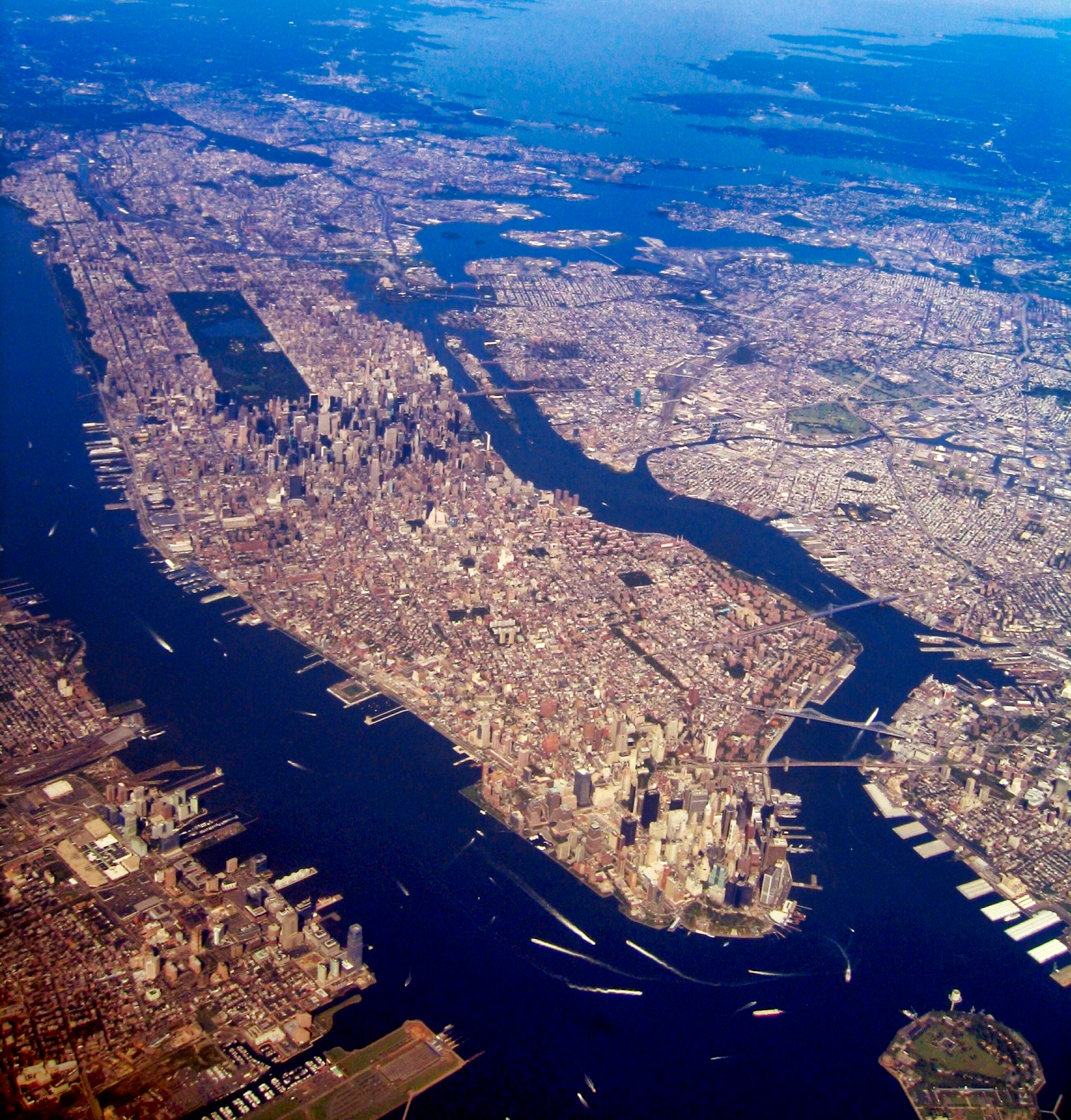
As described in the image of Manhattan above, when approaching a city, key recognizable features are sometimes viewable. Ultimately these manmade, and/or geographical, features become recognizable landmarks for a city.
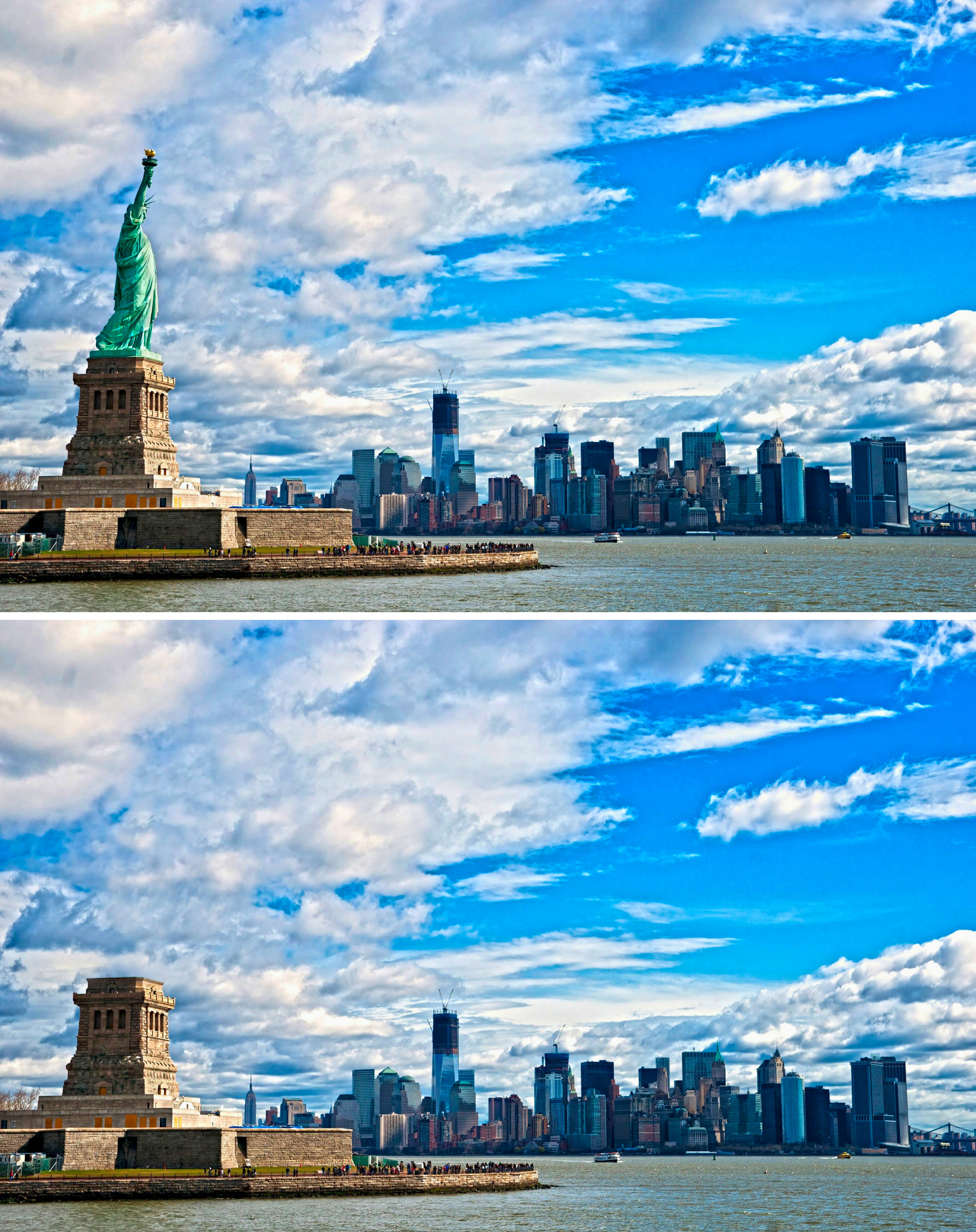
The following are images that illustrate a number of these landmarks, alongside an image of the same view with the feature(s) removed to demonstrate my point.


If you are familiar with key landmarks of a city, it’s possible to create recognizable silhouette. Without labeling the silhouettes below see if you can identify the urban settings they represent.
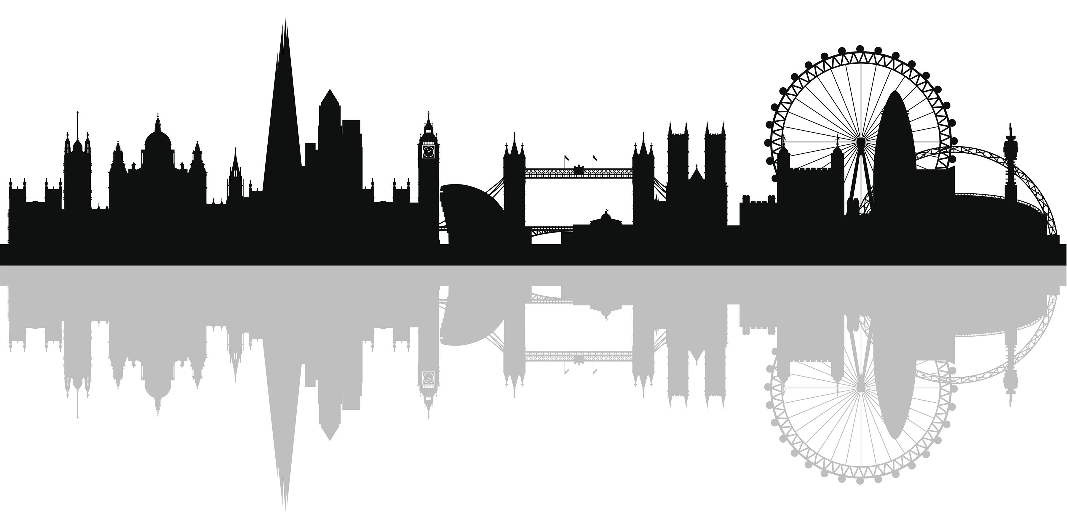
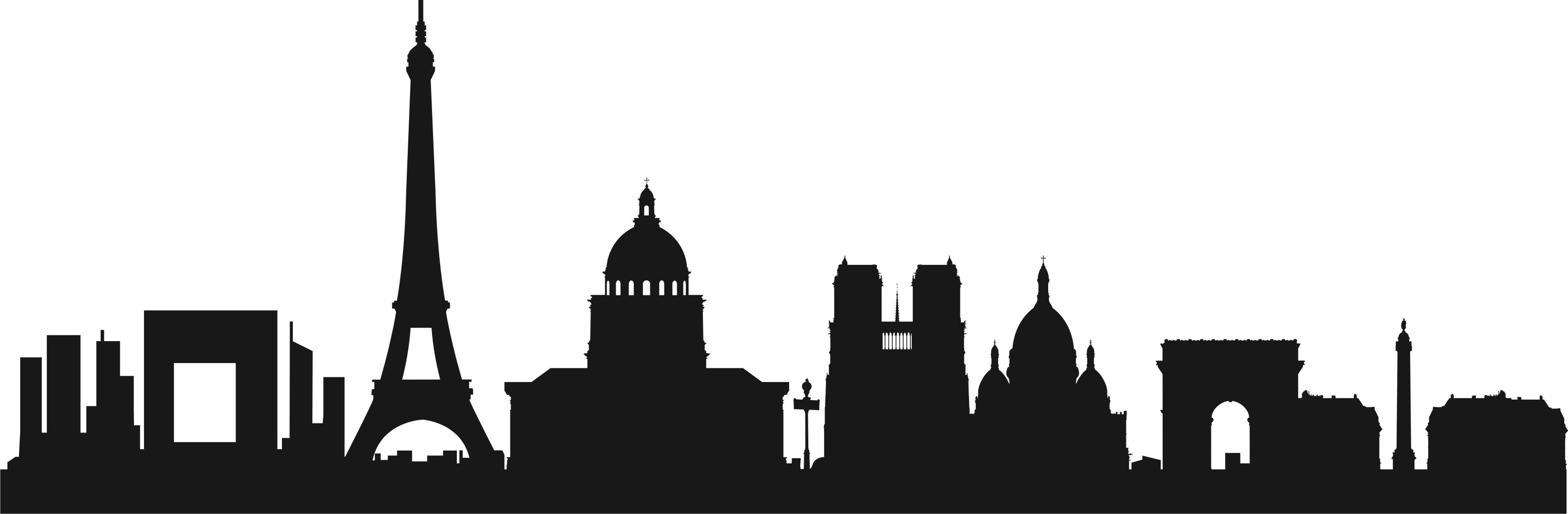

It’s very easy to make a silhouette of a city. Find an image(s) that includes the key landmarks representing the urban setting. You don’t have to perfectly trace the actual outline of the skyline, as shown in the examples above. These silhouettes are created by grouping the recognizable features. At times though tracing the actual outline of the skyline may be important as the most recognizable feature. Shown in the image below is the island of Mont Saint Michel, France. Followed by the silhouette I created in Photoshop.

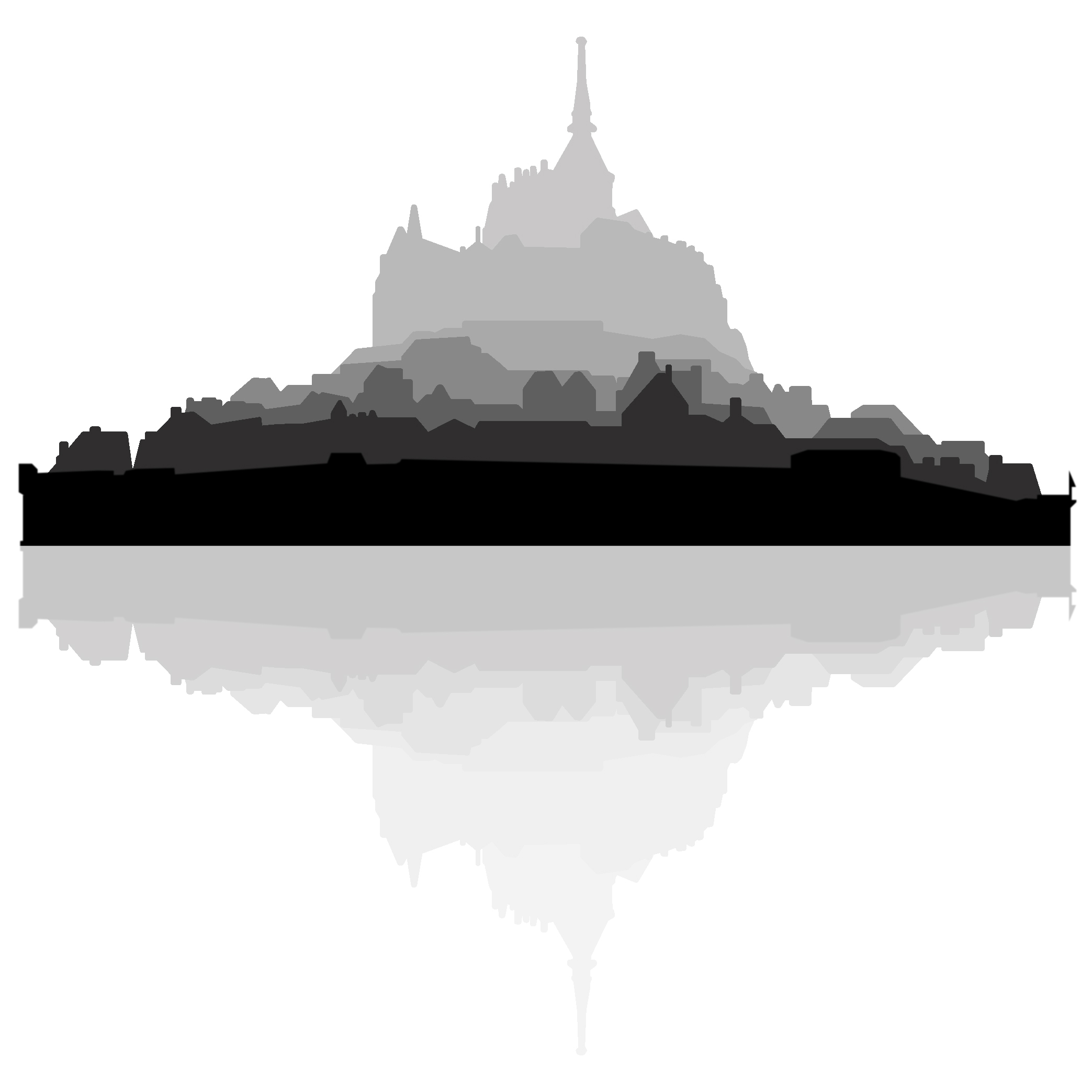
As you’ll note, I only used the image as a bases for my interpretation of what I thought Mont Saint Michel best looked like in a silhouetted view

1 Comment