“Urban design is a synthetic, inventive mapping of physical conditions which establishes whole areas of the city. In other words, it is architecture.”
(Peterson, Steven. “Urban Design Tactics. Roma Interrota” Architectural Design Profile, Vol. 49, No. 3-4, 1979)
Introduction
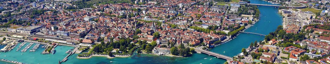
Between 2000 and 2008, suburbs in the country’s largest metro areas saw their poor population grow by 25 percent—almost five times faster than primary cities and well ahead of the growth seen in smaller metro areas and non-metropolitan communities. As a result, by 2008 large suburbs were home to 1.5 million more poor than their primary cities and housed almost one-third of the nation’s poor overall.
(by the Brookings Institution)
Today we understand that to continue to spread outward into empty land is not the answer since open land is now a precious commodity. With this understanding the return to city living has been on the rise for some time now. Suburban sprawl has reached its peak and the need for denser city living, with all the amenities at hand, is on an increase. This being the reality, cities, as we traditionally know them will have to adapt to technological and economical changes, and with the exodus of those following the work market, in many cases we find cities shrinking allowing for large empty areas of once densely populated areas.
Many books have been written on urban design, but typically these are written for the graduate student and professionals, focusing on the technical components of urban design, and never explaining how the city fabric is constructed. This entry is for anyone interested in cities, how they are formed, and ultimately looks at how to design cities. I’ll begin the following series on what I call “The Urban Genome” by approaching the subject from a typological direction, breaking the city down into its parts, studying their relationship, and establishing the foundations before describing the process of urban design.
Urban design is architecture but at a denser more massive scale, and ultimately creates urban space. To understand how to design at an urban scale you must first know your medium, the city,
It’s common in most urban design text to illustrate the “how to design” and assume students know and understand the urban fabric, but to really understand the underlying principles of good urban design the student must first grasp the basic makeup of a city.
To begin it is important to differentiate between the physical versus the non-physical aspects that makeup a city.
The non-physical aspects of a city makeup are primarily the functions that inhabit the physical aspects, such as education, businesses, government, and religious, to name a few. Consider the non-physical aspects as the programs that form the body of city.
To fully grasp the elements that make up an urban setting we move in the direction of finding standard elements which all cities have. These elements can be seen as pieces, or various types. This typing is commonly called typology, or Typomorphology, whereby the type is the piece you are studying, and morphology is the study of the form or structure of the individual piece.
Typology
Typomorphological studies reveal the physical and spatial structure of cities. They are typological and morphological because they describe urban form (morphology) based on detailed classifications of buildings and open spaces by type (typology). Typomorphology is the study of urban form derived from studies of typical spaces and structures. Typomorphology is an unusual approach to urban form. First, it considers all scales of the built landscape, from the small room or garden to the large urbanized area. Second, it characterizes urban form as a dynamic and continuously changing entity immersed in a dialectic relationship with its producers and inhabitants. Hence, it stipulates that city form can only be understood as it is produced over time.
(from Getting to Know the Built Landscape: Typomorphology, Anne Vernez Moudon, from: Ordering space: types in architecture and design / edited by Karen A. Franck, Lynda H. Schneekloth, New York: Van Nostrand Reinhold, Pub., 1994, p. 289.)
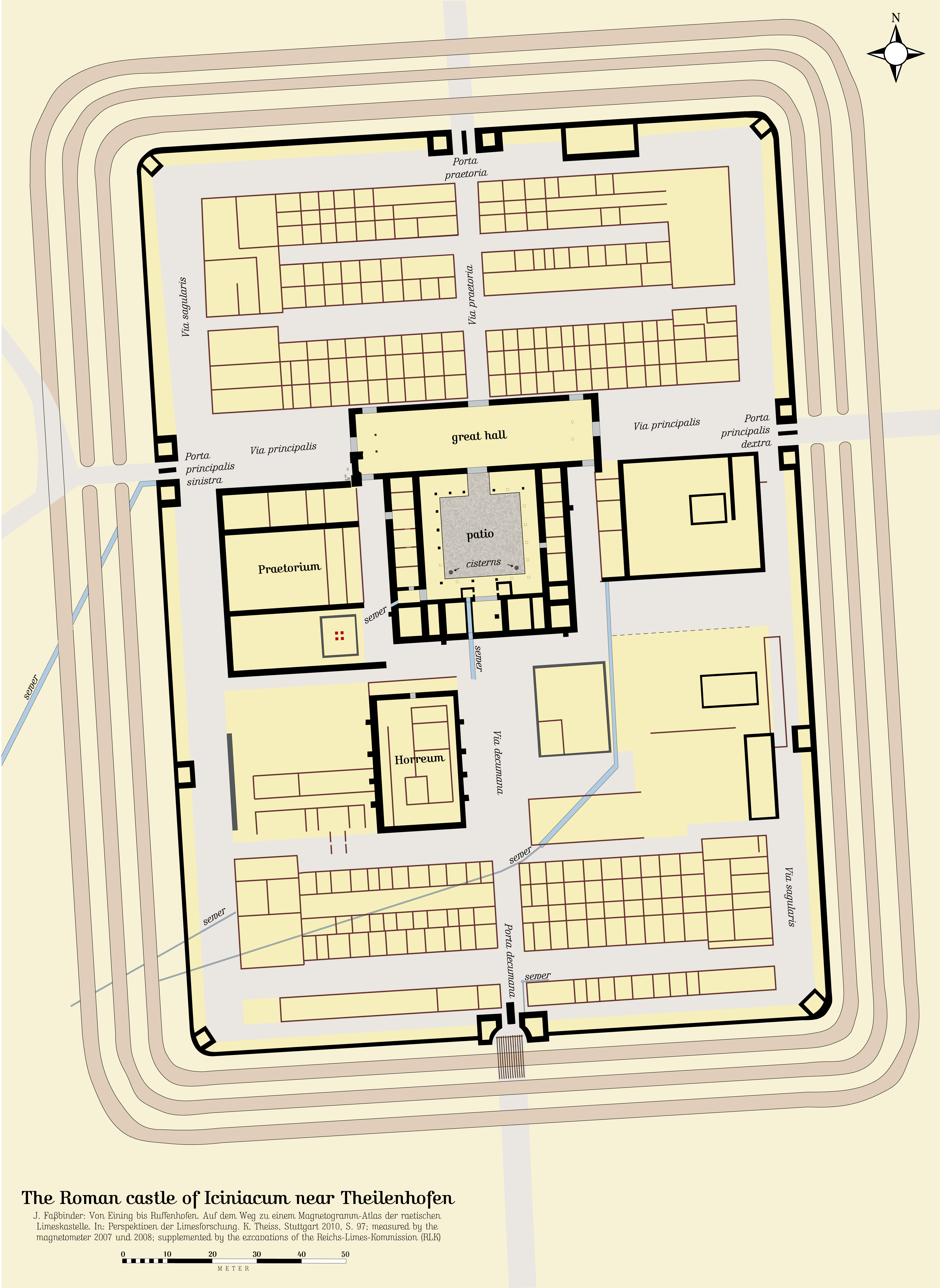
The idea of typology within urban planning isn’t new. The Romans used the idea for their Roman legion camps as they conquered the then known world. The permanent camps where know as castra stativa, “standing camps,” and had a set formula for their layout. This standard layout, which could vary depending on various conditions, allowed for the fast construction of their base camps, and therefore an area to defend and be protected.
Historically, here in the US, the study of Typomorphological at the urban scale is not as prevalent as in Europe, where there are originally three schools of thought, the Italian (developed in the 1940’s & 1950’s), the English school (developed in the 1940’s & 1950’s), and the French school (developed in the 1970’s.) All three schools of Typomorphology, or better known as Urban Morphology, believe that the built landscape (i.e. urban fabric) must be understood in three fundamental directions: time, form and scale.
Typologies are part of the workbench of urban designers. They can be used as tools in problem-solving.On the other hand, tools are usually made to performa single task, and typologies are usually adaptable and extendible to fit a variety of contexts. In urban design the concept of morphology is also significant since it deals with spatial structure and form.
(The form of cities : political economy and urban design, by Alexander R. Cuthbert, Malden, MA ; Oxford : Blackwell Pub., 2006, p.308)
To begin then let’s look at elements that all urban settings share. These elements makeup generally 17 different urban typologies.
They include:
- The Rural Zone
- The Approach
- Edges
- City Gates or Points of Entrance
- Circulation (Streets, Boulevards, Alleys, etc.)
- Galleries
- The Block
- Courtyards
- Fields
- City Spaces
- Open Spaces (Parks, Zoos)
- Object Buildings
- Terracing
- Siting (Geography)
- Monuments
- Water Conditions
- Ensemble
——————————————–
-
The Rural Zone
Historically there were two places you could live, either inside or outside the city. The Italian word for city is civita, is the root of civilized. To be civil, or a citizen, meant you had certain rights and protection of the city. Those inhabiting the area outside the city were considered uncultivated, uncivilized, uncontrolled and wild.
For centuries to live in a city, or to be a member, denoted city residence & brought freedom from customary rural obligations to lord and community: Stadtluft macht frei (City air makes you free). The area outside the city (typically walls) meant you were entering an area that was not protected, or wild. Although this area was farmed, or hunted, to be safe one had to live inside the city walls. This allowed you to be called a citizen.
This rural zone is usually made-up of natural and agricultural land, and when in the rural zone there is typically no connection visually with an urban setting.
The concept of the ‘Rural Zone’ might have been easier to distinguish early on in relation to urban settings since the identifiable rural-zone has shrunk compared to earlier times.
As an example, I’ll begin with a plan of Munich from the 1740’s. (north is up on the following three images)
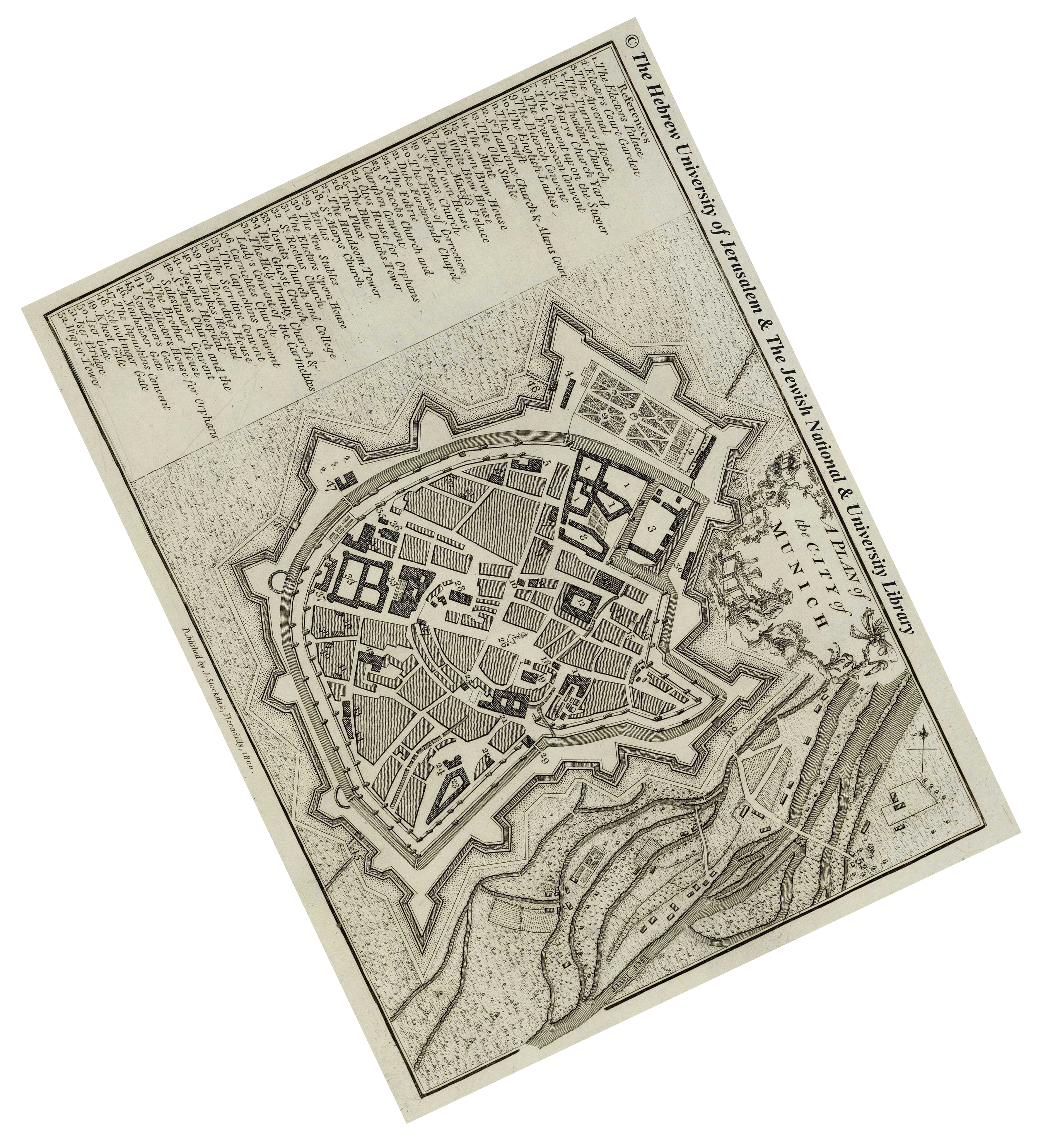

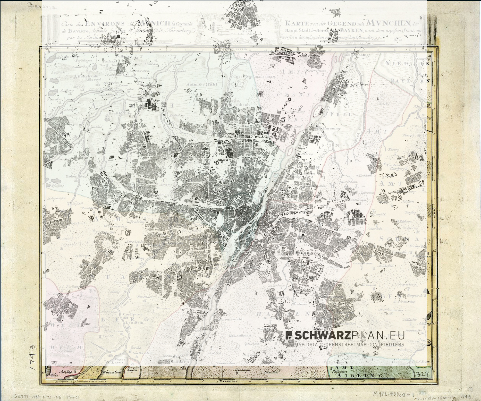
As you can see, the area that was once a large rural zone has drastically been reduced over time as the population has grown.
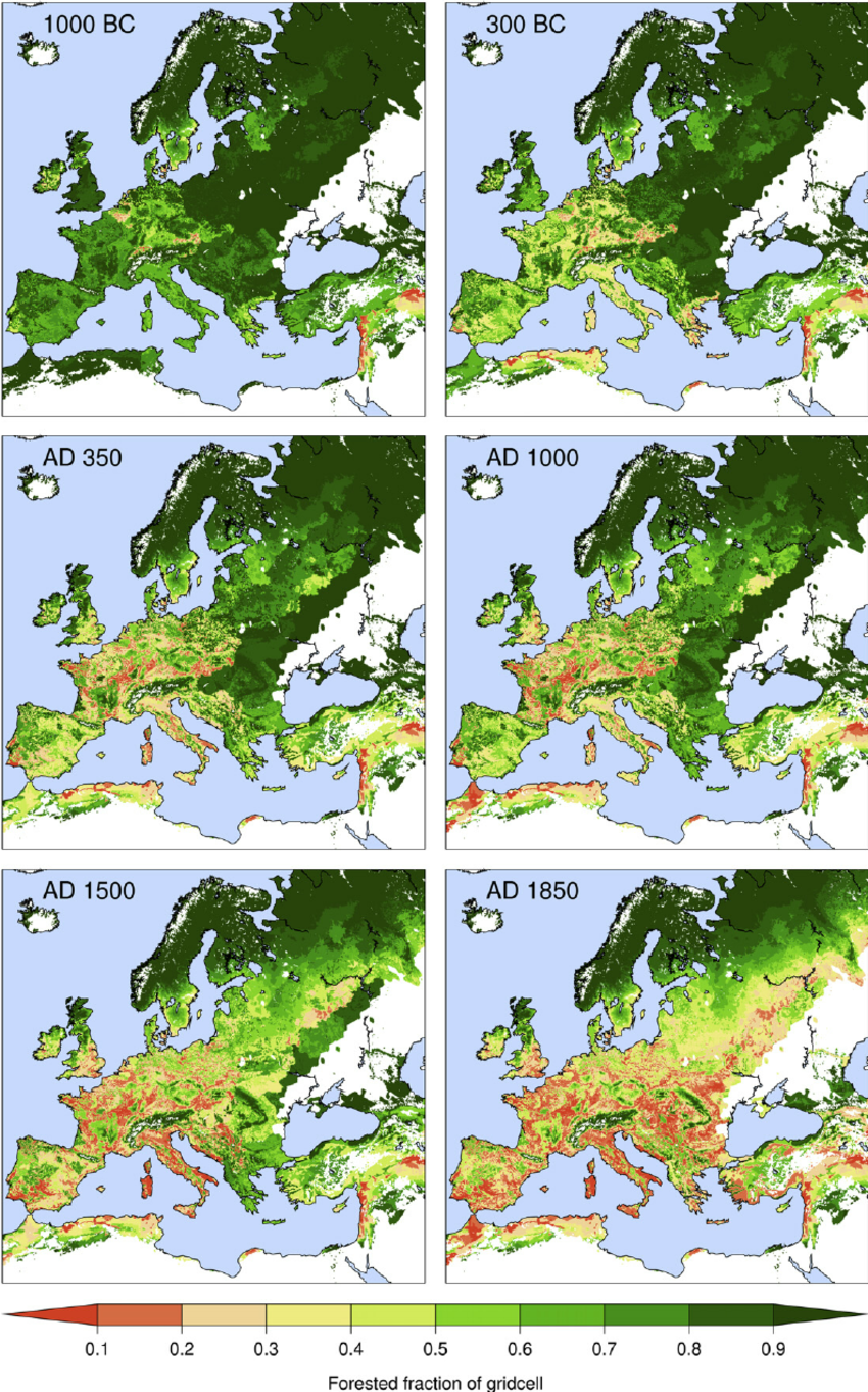
It’s important to note though that it is not just the expansion of urban settings that have changed the Rural Zone, but also the landscape has changed over time.
In the series of 6 images shown below you see how the landscape has changed via deforestation over time, from 1000BC – 1850AD.
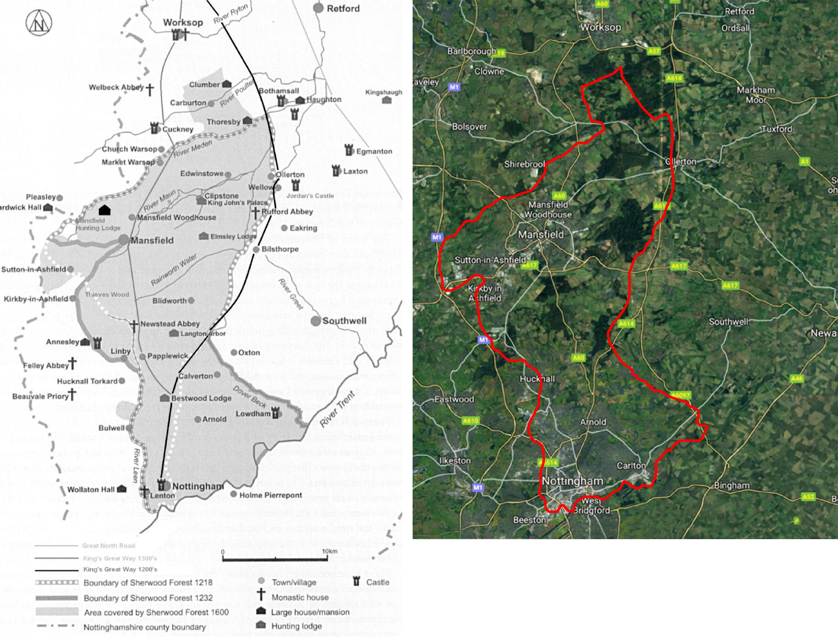
So historically what did this possibly mean? In the past, when a person’s citizenship was revoked you were cast out of an urban setting and left to fend for yourself. It was common for people to then become outlaws (or outside the law of the city) to survive, and the idea of hiding in the woods and preying upon passers-by was common. An example, the tale of Robin Hood. He and his men hid in the Sherwood forest and robbed from those that passed through. The earliest historical reference to a possible Robin Hood began around the early 1200’s.
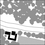
In the image below, and to the left, shown in gray is the extent of the Sherwood Forest from 1218 – 1600. The image on the right is a Google Map image as of 2017 with the same boundary outlined in red. Note the reduction of the Sherwood Forest, which is the darker green.
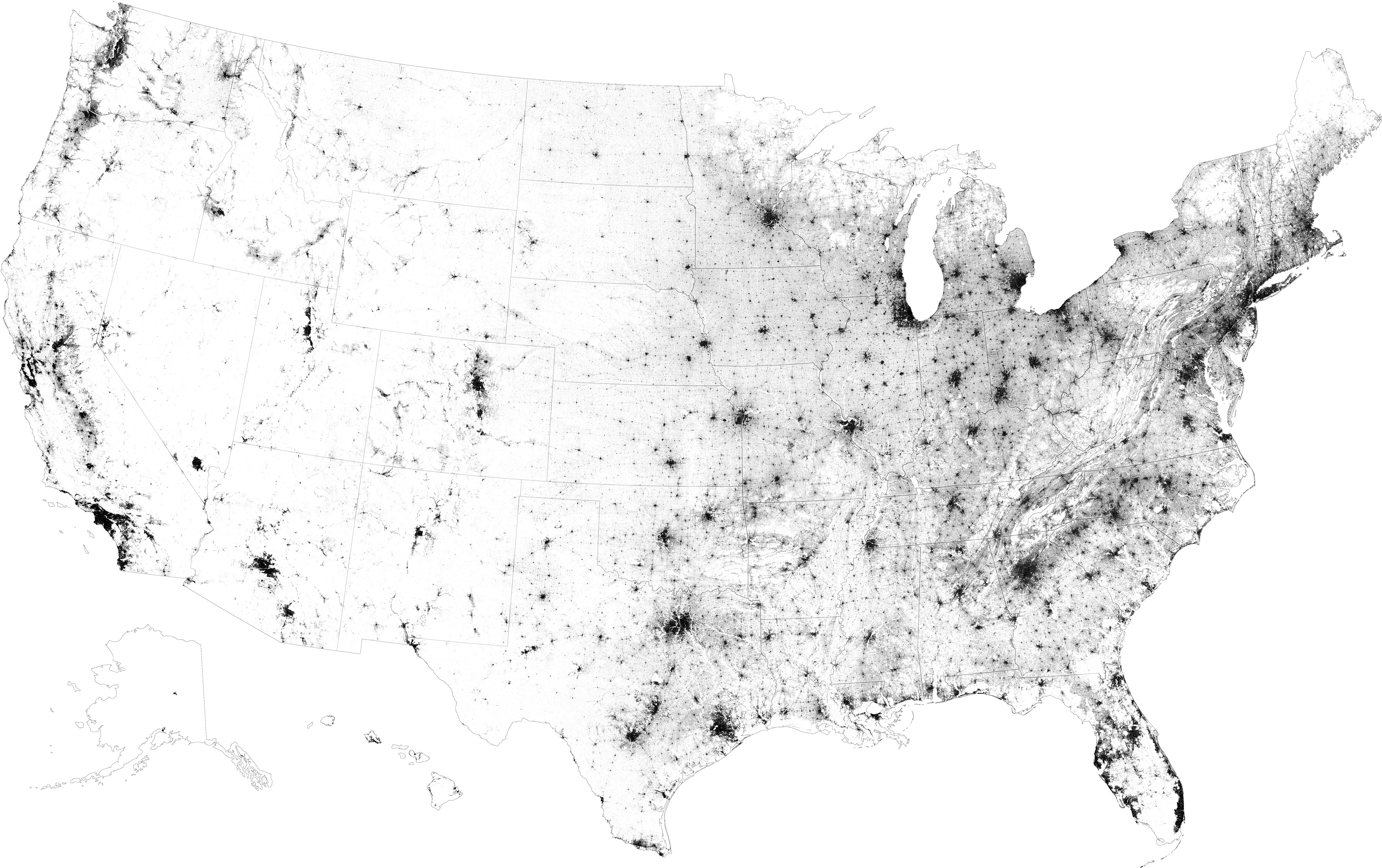
Recently the New York Times published an article titled A MAP OF EVERY BUILDING IN AMERICA. In this article the NYT accessed a huge database that Microsoft released to the public this year. This map showed every structure built in the United States to date.
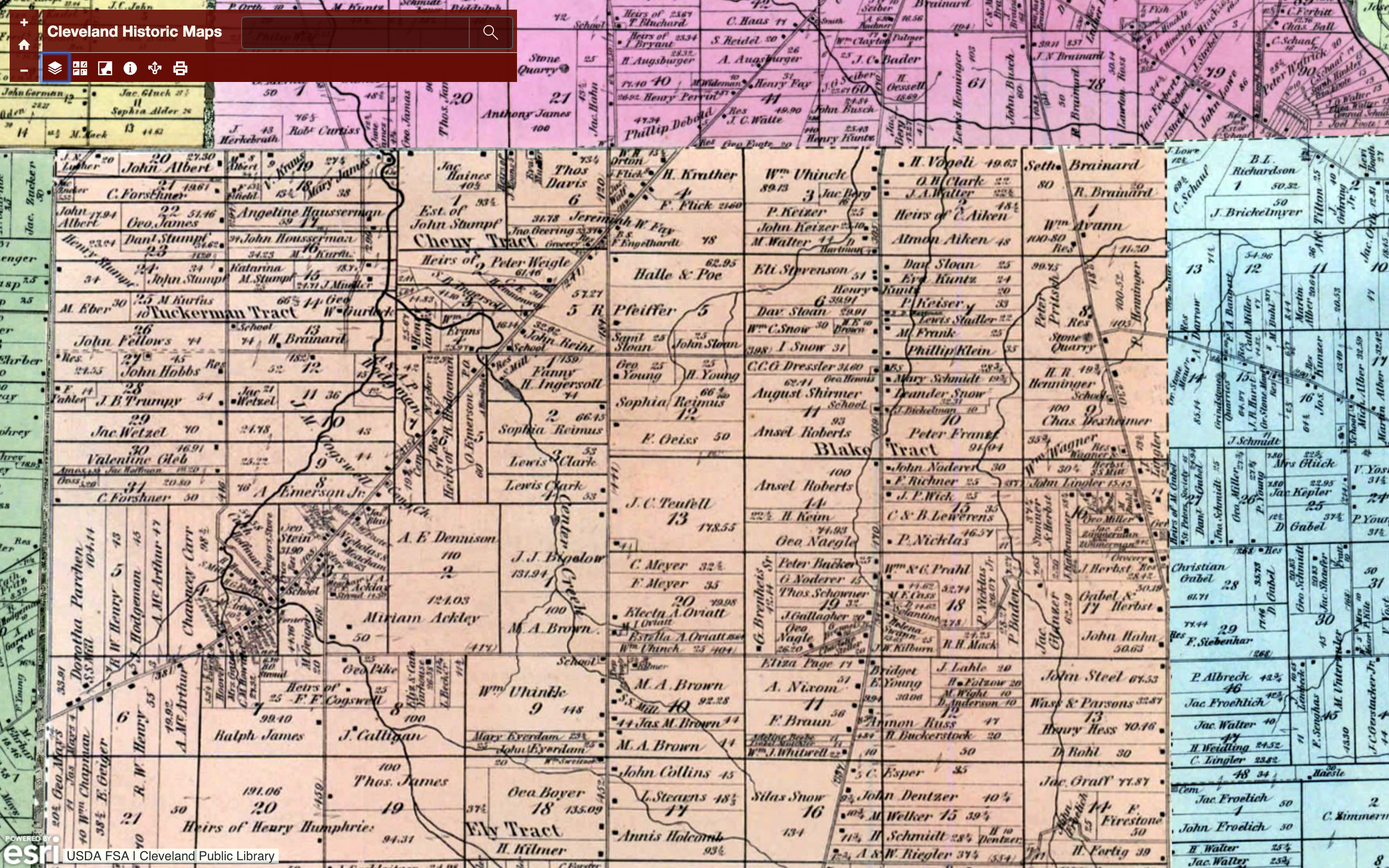
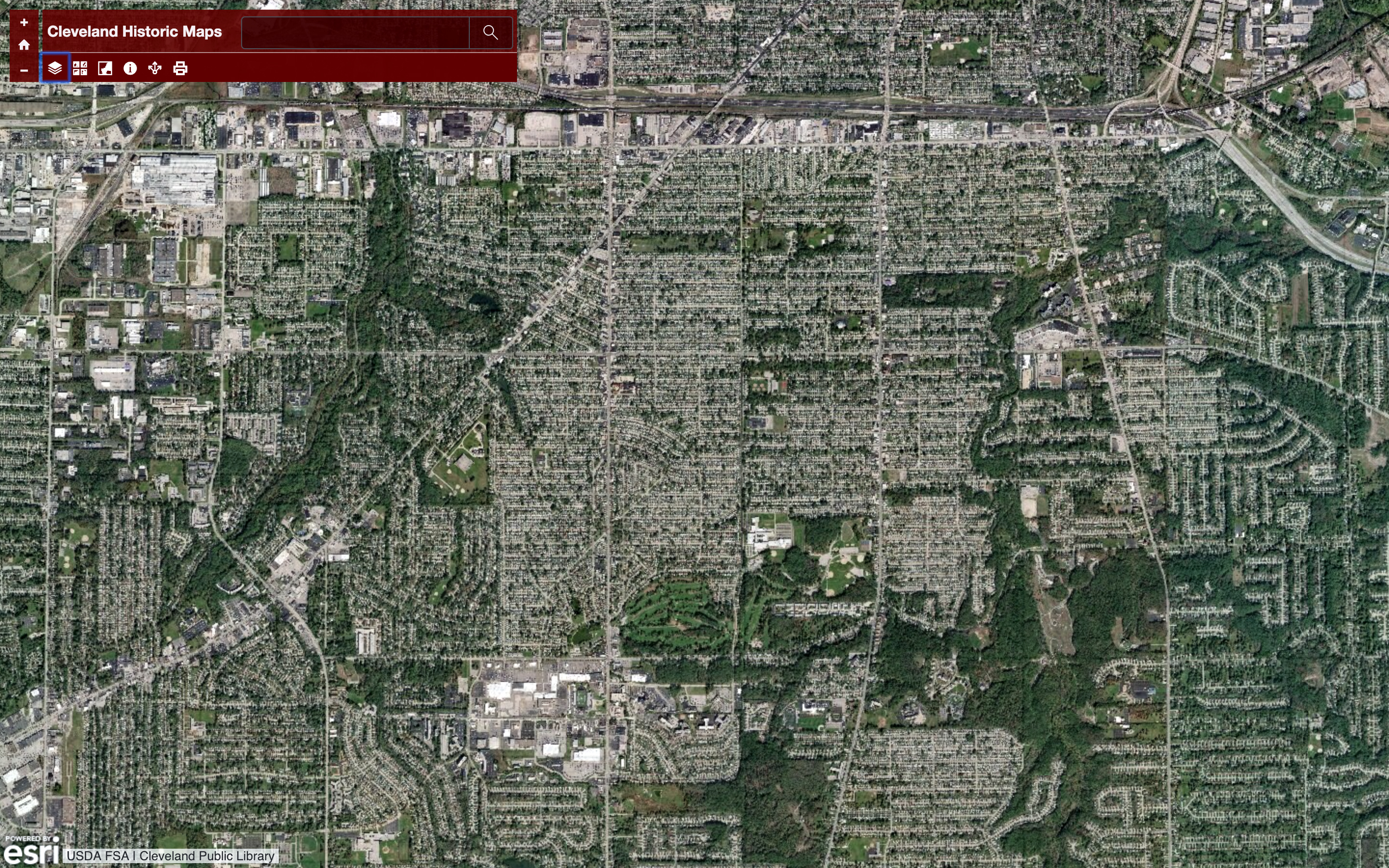
But what is considered rural? The definition in general is, a rural area or countryside is a geographic area that is located outside towns and cities. In years past what we considered the boundaries for rural were easier to distinguish, while todays boundaries are hard to discern. Below are two maps comparing the same area near Cleveland Ohio, 1874 versus today. The difference is obvious.
———————————————————————————————————————————–
In the post to follow I will address each of the other Urban Typologies I’ve listed above. I would greatly appreciate your thoughts and comments on this topic of what I’m calling, The Urban Genome.
Thank you for your time, and I hope your 2018 was a successful year..

1 Comment