

Cities are fascinating places to study. What we see at face value is actually built typically over time. A number of years ago I became intrigued with the term palimpsest to describe the historic layers a city has.
The term palimpsest comes from the Greek Palimpsestos, which means “scraped again”. Prior to the use of the printing press manuscripts were made of parchment, which is prepared and scraped animal skin. It was common to reuse parchment, and since the material is amply more durable than paper, the text would be erased by scraping it with a knife. This scraping process couldn’t completely eradicate the ink, so a ghost-text was left behind. Once the parchment was reused the new text appears to float above the residue, and at the same time be integrated into the old portion.

By applying the term palimpsest to cities, we can begin to view where we live as having layers of history. Layers that can sometimes be in plain sight, or at times visible by scratching away some of the existing fabric.
I’ll use the town I live in as an example (or case study), Shaker Heights, Ohio. For years as I’ve either driven or walked through my town I’ve noticed certain anomalies. Before I go into these inconsistencies though I’ll give you a brief history of how Shaker Heights came about.
Shaker Heights was established in 1909 and was incorporated as a village in 1912. The name Shaker Heights has origins in two local sources. The village was laid out on land formerly owned by the North Union Community of the United Society of Believers in Christ’s Second Appearing, more commonly known as Shakers. “Heights” refers to the plateau east of Cleveland that rises 468 higher than downtown Cleveland. A majority of the cities residing in this plateau commonly contain the name Heights, i.e. Cleveland Heights, University Heights, Euclid Heights, to name a few. This area is actually the far western edge of the Alleghany Mountains, known as the Piedmont Region, and as you move west towards Cleveland, and drop in elevation, you cross into the beginning of the Plains Area of the US.

Ralph Russell established the North Union Shaker Settlement in 1822 with just over 80 individuals. Between 1826 and 1854, the group dammed Doan Brook (shown in the image above), which made Upper and Lower Lake, and established three grist-mills and a sawmill. The colony peaked around 1850 with around 300 settlers. By 1889 the congregation had dwindled, causing the colony of North Union to close. The remaining Shakers were then relocated to colonies in southern Ohio.
In 1905, the land was bought by brothers M.J. and O.P. Van Sweringen, who envisioned a garden city style suburb for the design. The 1922 city plan shows the town with two rapid transit lines running to downtown Cleveland, indicated with a center red line. The plan shows an underlying grid, but with curved intersections, and a few winding roads. The design of the town is called garden city style. Common to the garden city is a green zone, dedicated to portraying a natural setting. This green zone in Shaker Heights included dense forest with walking and horse paths, lakes, and open areas. The green zone also included a member only country club, with golf course, which can be seen in the area to the south/east of the green area on the map below.
One method of looking for anomalies in a city is to study old maps. Once these city maps are identified they can be scanned and converted to digital images. Digitizing maps makes it possible to quickly resize and adjusted them to the same scale. The maps are then placed on layers, and the analysis process begins, as shown in the image below.

Shown above is the original map of 1858 with the opacity reduced. The existing structures are then outlined as small black rectangles, the water features of the time are traced in blue, and existing major roads are drawn in brown. The area show in red is the outline of Shaker Heights in 1922.

By combining the two maps of 1858 and 1922, and varying the opacity, you are able to see where the original Shaker settlements were located, and how the existing streams and lakes were repositioned. All the existing Shaker structures were eventually eliminated.

In the closeup below, the area shown in pink, and the grouping of buildings illustrated in light blue, are structures that exist today. The area in pink is Warrensville West Cemetery. The first burial within the cemetery occurred in 1811.

This 1919 photograph shows the Cemetery prior to the development of the area as a commercial center for Shaker Heights. The picture was taken at the newly constructed rapid transit entrance near Lee Road and Moreland Boulevard (now Van Aken Boulevard).


In the image below the outlined buildings, shown in light blue, represent houses that existed along Chagrin Boulevard prior to the inception of Shaker Heights.

There are three noticeable differences upon first glance of these houses. Differences discerned by studying the surrounding context of the other homes in the area. The first difference is their set-back from the street, the second is the size of the lots appearing larger, and the third is the style of the houses are earlier than those built around them.
Below are photos of each house indicated above. (Reading the numbers left to right)

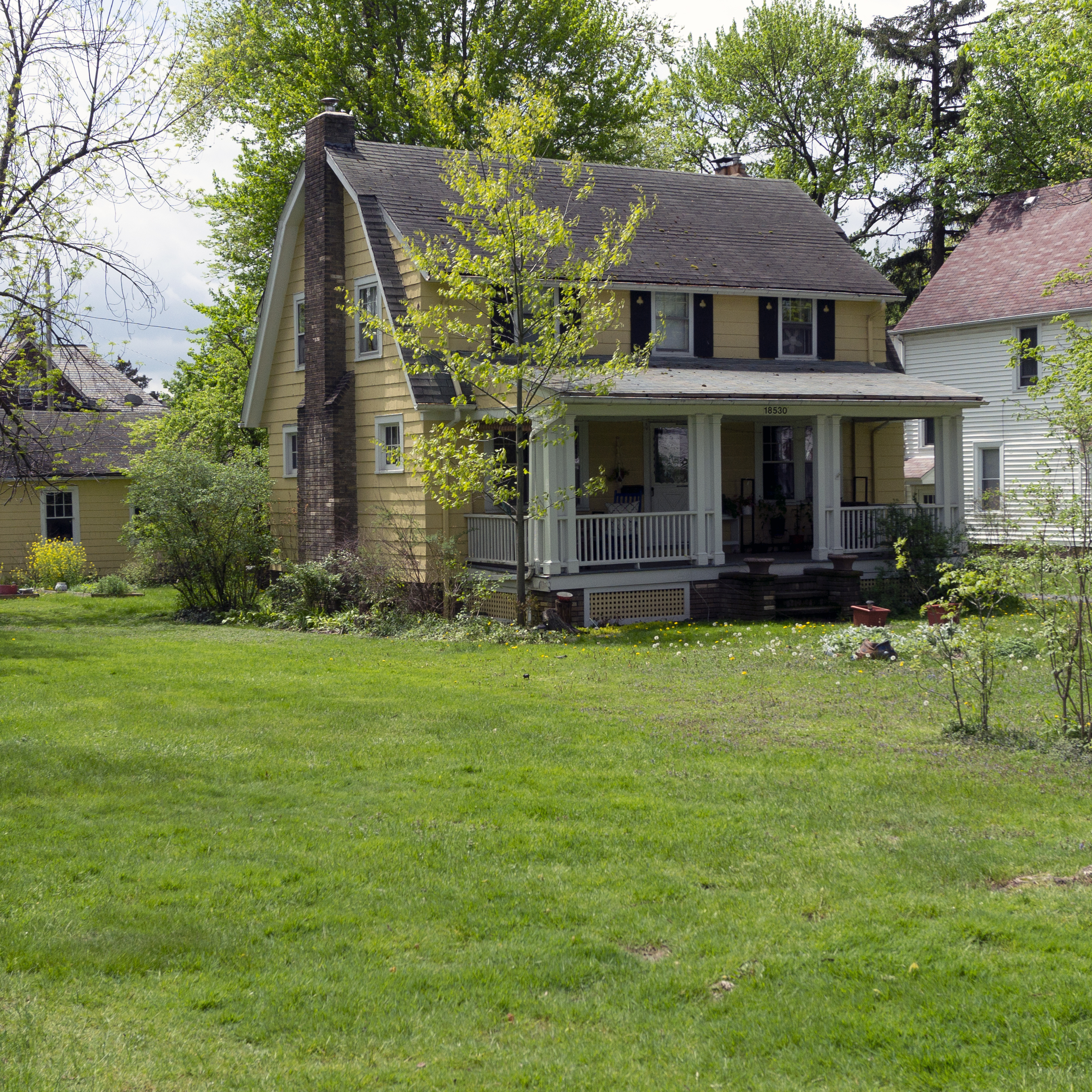
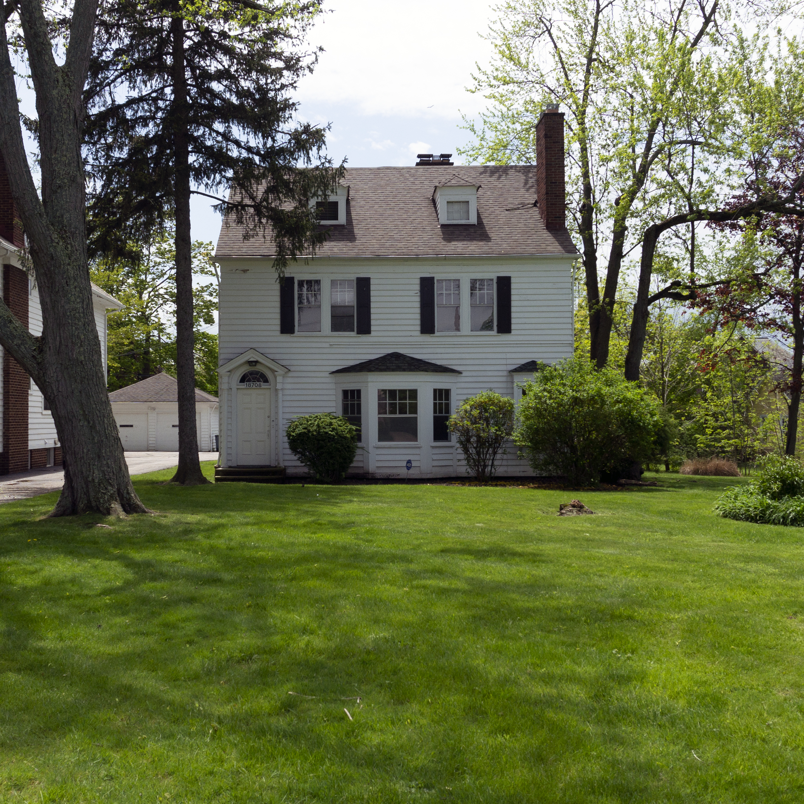

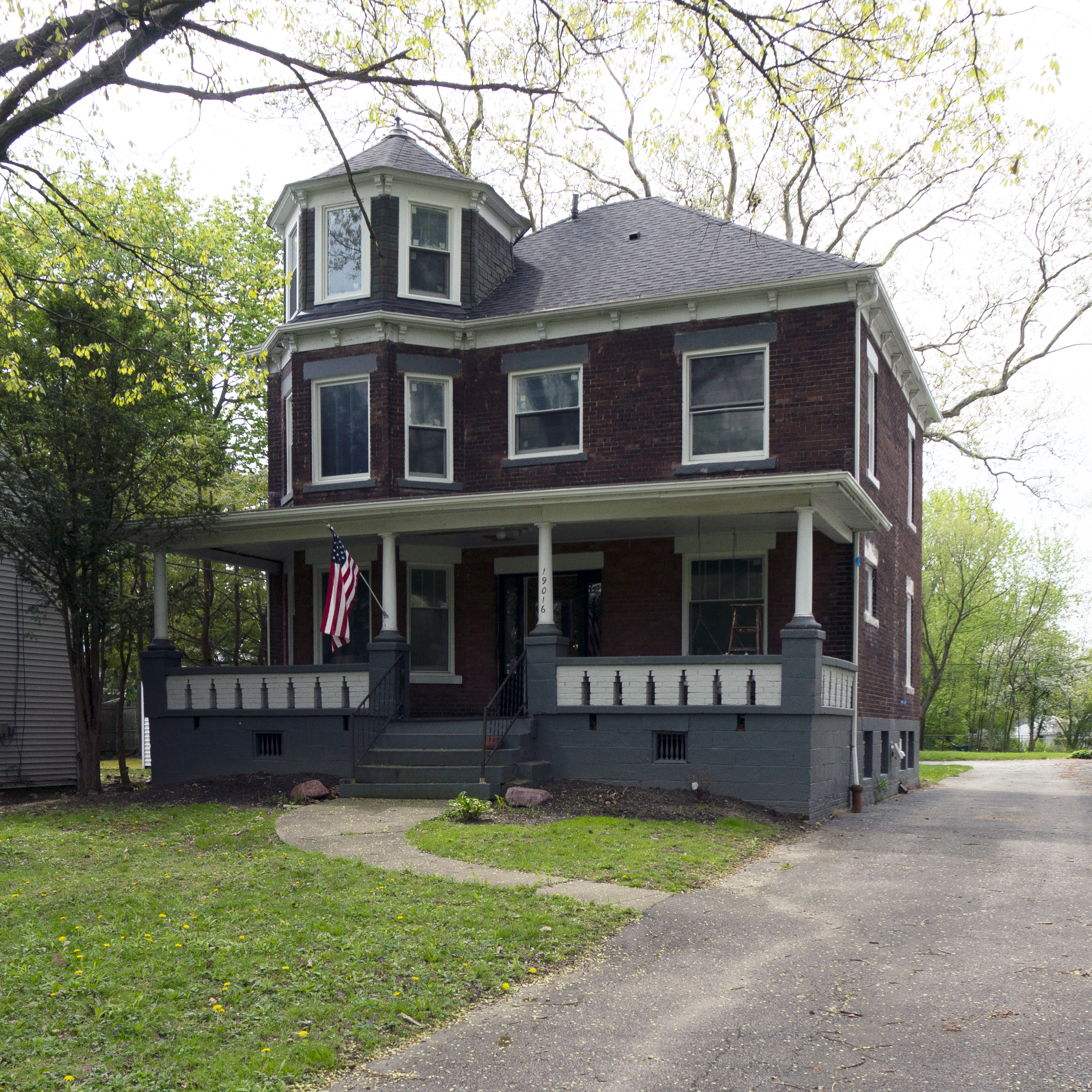


The original zoning for Shaker Heights set the new homes closer to the road, the lots drawn up are smaller than the older homes, allowing for more homes per acre, and the style of the homes shown above are closer to those of the 1800’s. One final observation, the original zoning for the homes in Shaker Heights did not typically allow front porches. This simple stipulation of ‘no porches’ changes the dynamics of how people interact. This discussion will be addressed in a future posting.
For further information on the history of Shaker Heights please visit Shaker Heights Historical Society.
This ends my first posting on ‘looking at cities.’ In future posts it’s my intent to share things you may not always notice when interacting with a city. Things you maybe see every day and take for granted. I’ll share with you my passion of looking at cities and my discoveries of those hidden gems that are sometimes right in front of us, or just below the surface. With a little scratching you too can begin to see the beauty that lies in any city, town, or village. And it’s my hope that eventually you’ll share what you’ve discovered in your town, or those you’ve traveled in.

1 Comment