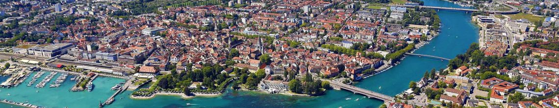


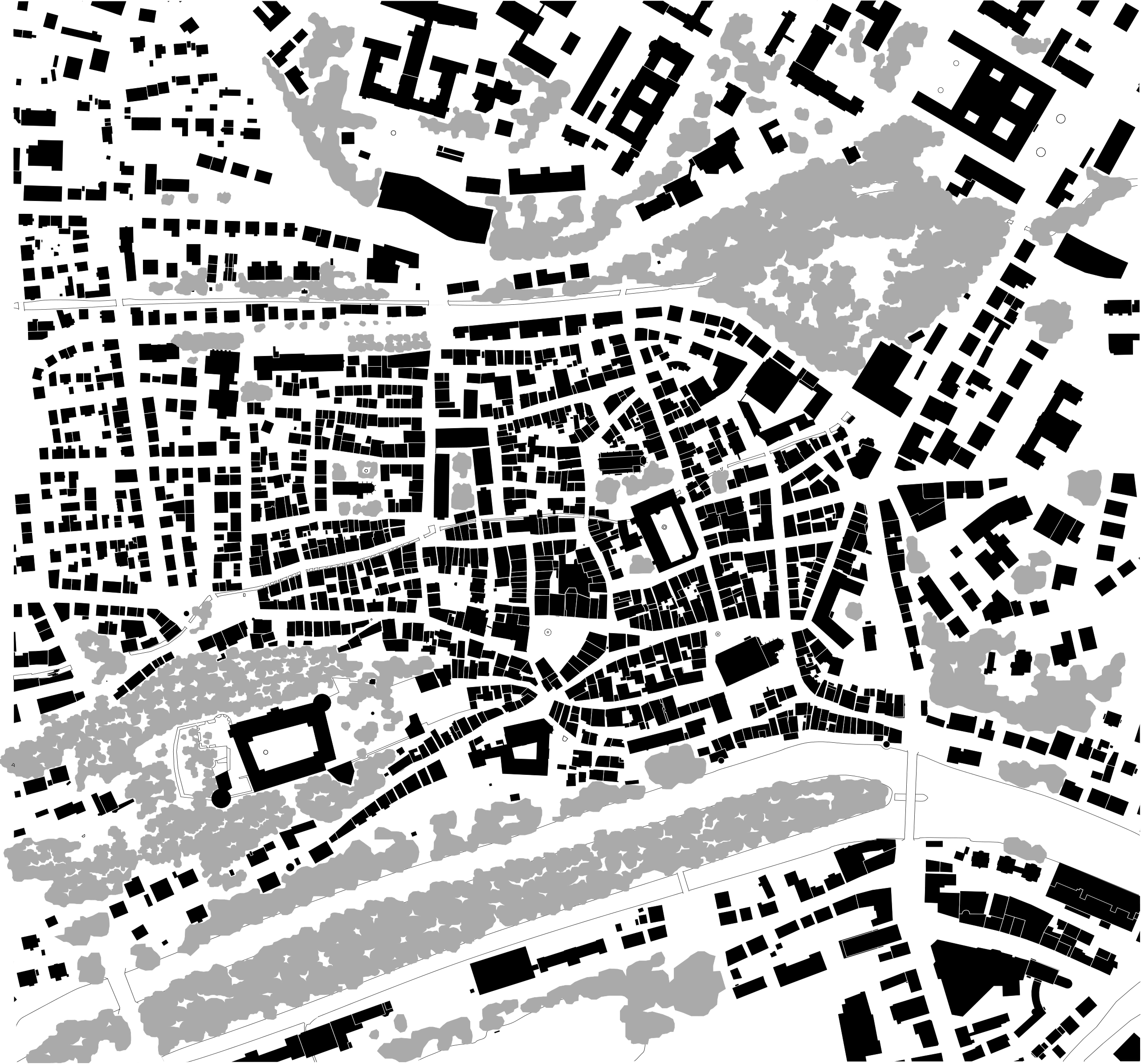
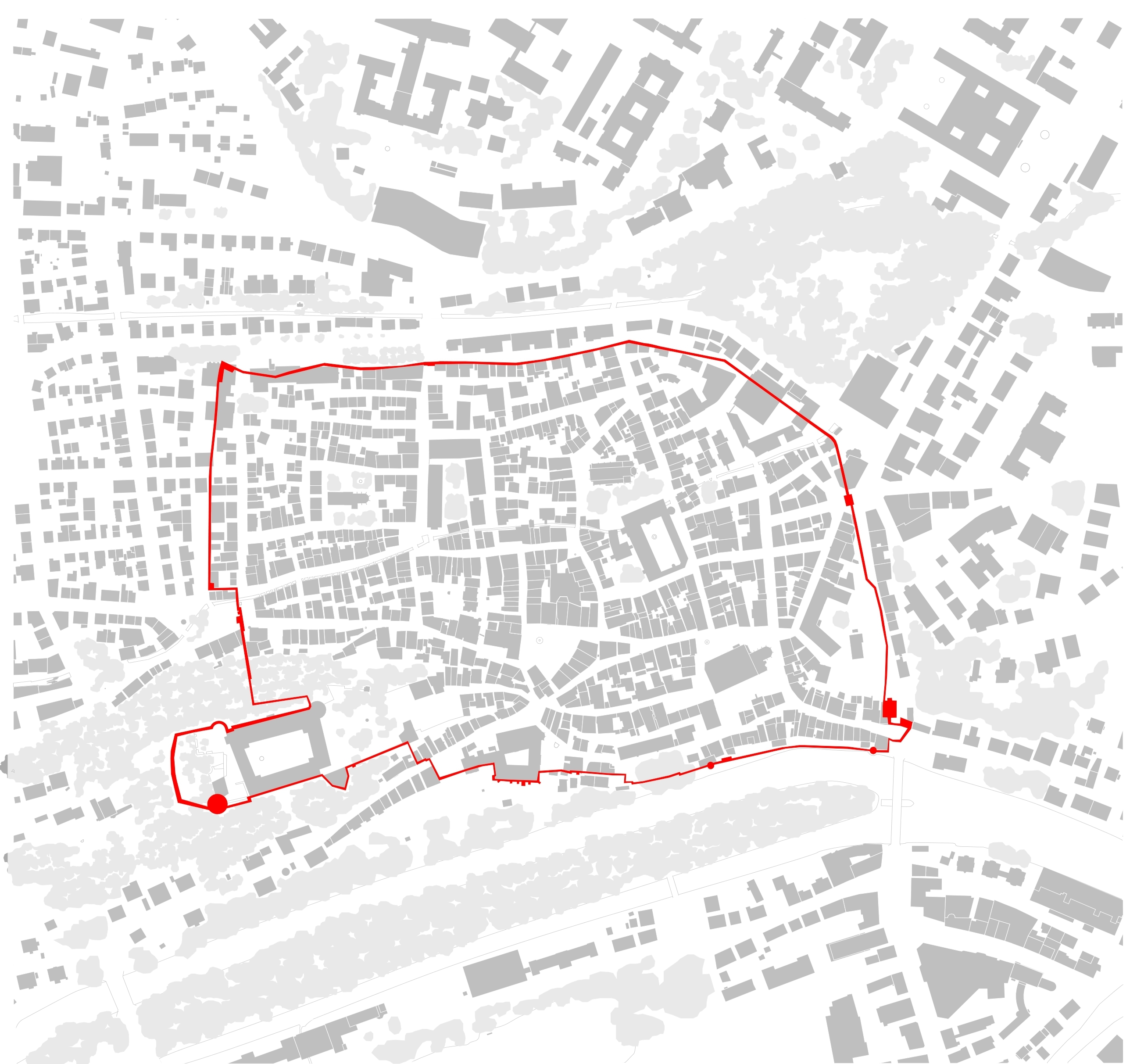
A number of years ago I discovered a book on medieval new towns titled, “Florentine New Towns: Urban Design in the Late Middle Ages,” by David Friedman. I found it interesting that during my studies of urban design I had never been introduced to this urban typology. I was taught that the urban typology of the medieval ages was stereotypically organic in nature. The question then arises, “What makes medieval new towns so different than other towns of that period?” The answer, their orthogonal grid. A quick comparison below are two examples of medieval towns. The first shown below is the German town of Tübingen. Note the seemingly haphazard arrangement of the town blocks in the first illustration, and in the second the bounding city wall. This town is most likely conforming to the geography, and possibly was developed around the castle (Schloss) located to the south-east. This plan tended to be the typology we were told was most common.

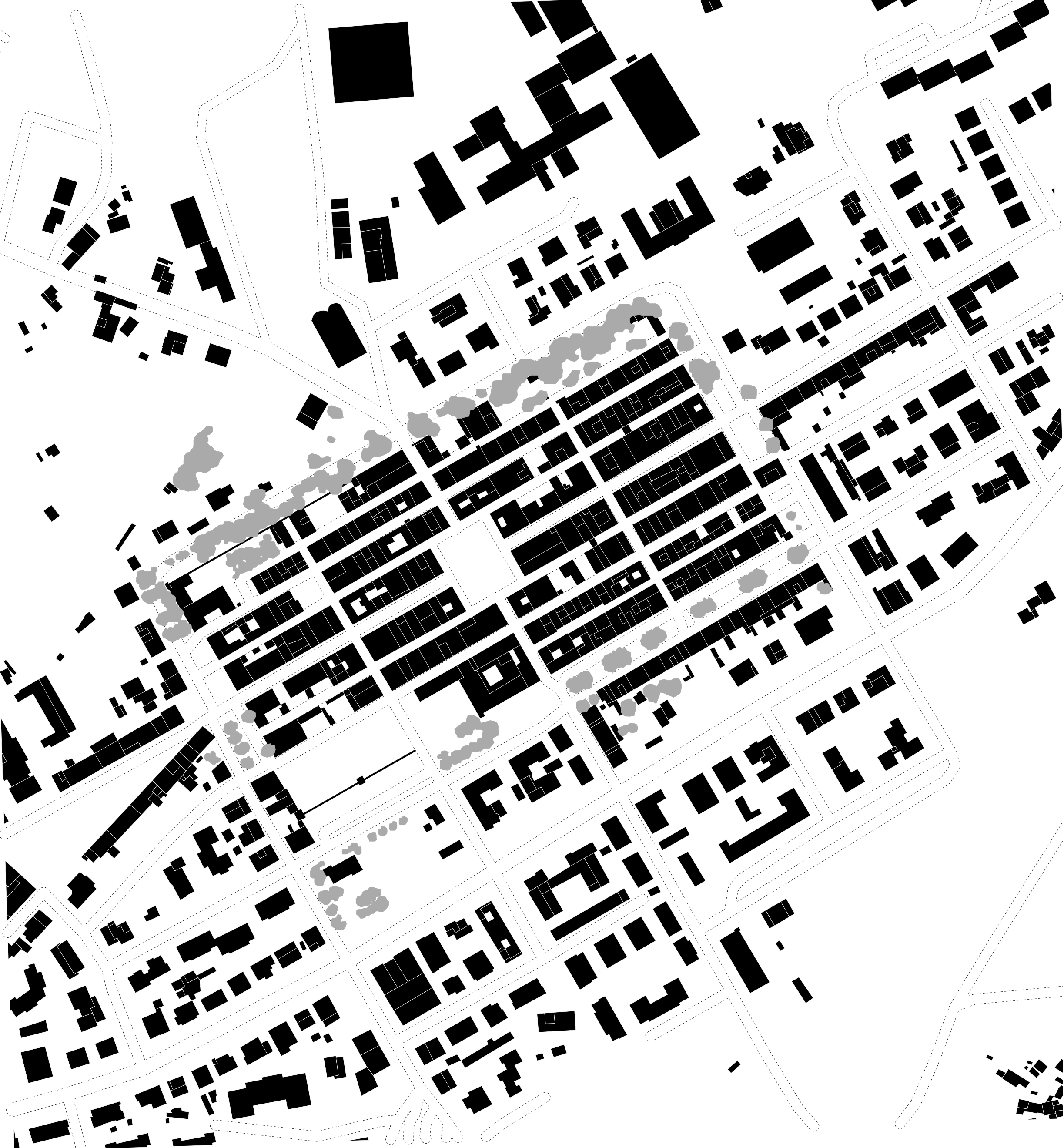
Compare Tübingen to the Italian medieval new town of Terranuova Bracciolini, with its ridged orthogonal grid.
In this posting I’ll briefly cover a number of cultures that used the orthogonal grid as an urban design tool and were possible precedents for medieval new towns, I’ll discuss why the medieval settlements were planned this way, and what possible geometry and tools were used to lay out these towns. First though I’ll cover cultures that used an orthogonal grid in their urban designs and preceded medieval new towns.
The use of the Grid in Indian Urban Forms
In the culture of India, the square is a symbolic representation of the earth. It connects the four points established by the primary opposites, north, south, east, and west, or the sunrise and sunset and the two opposite ends of the world axis. The square then is divided into nine equal parts and those nine are again subdivided into another nine. This diagram is known as the Vástupurusamandala and is one of the foundations for laying out a city plan, and ultimately paying homage to Brahma. [1]
[1] “The Idea of A Town: the Anthropology of Urban Form in Rome, Italy and the Ancient World”, by Joseph Rykwert, Cambridge MA, MIT Press © 1988
Rykwert writes that the process of laying out the boundaries for an Indian city, found in the Verdic & Hindu religions and the mandala diagramVástupurusamandala, is very similar to that of the Romans and the Etruscan. In all three observances an ox is used to dig a furrow for the city boundaries/wall, and when the ox approached the area to house the gates the plow was raised. To read further explanation on this information read Rykwert’s chapter five “The Parallels” in the above-mentioned book.
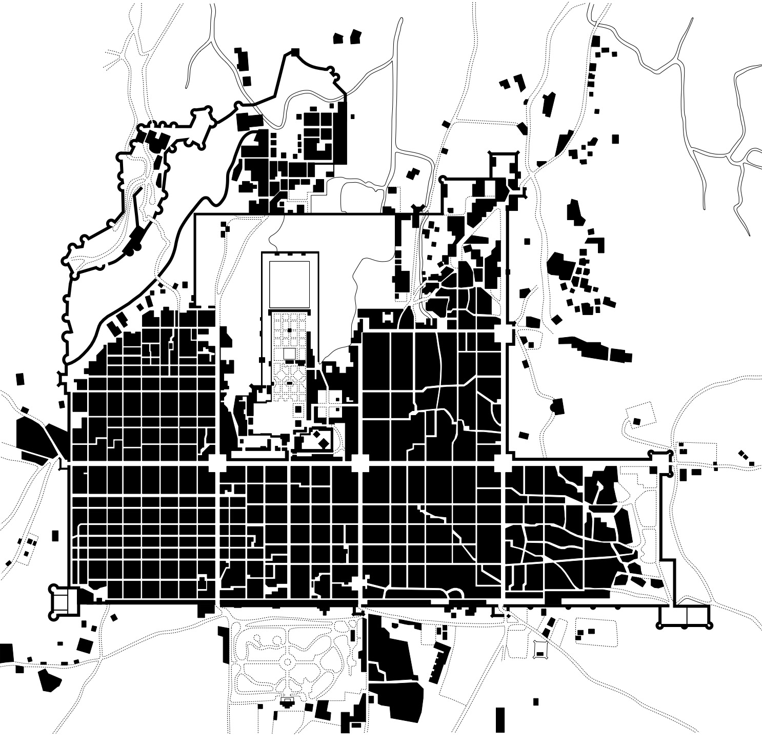
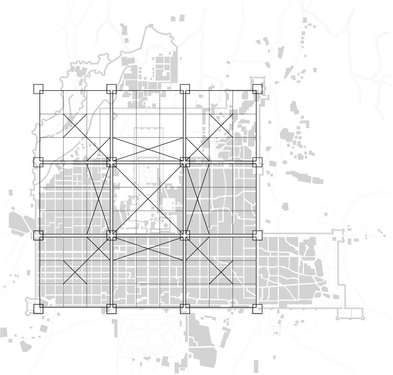
Jaipur, India – Built in 1727 A.D. by Maharaja Sawai Jai Singh, with the young Bengali, Vidyadhar Bhattacharya, who formalized the city’s plans in the grid system. The wide straight avenues, roads, streets, lanes and uniform rows of shops on either side of main bazaars were arranged in nine rectangular city sectors (Chokris) in accordance with the principles of town planning set down in the ‘Shilpa Shastra’ – an epochal treatise on the Hindu architecture.
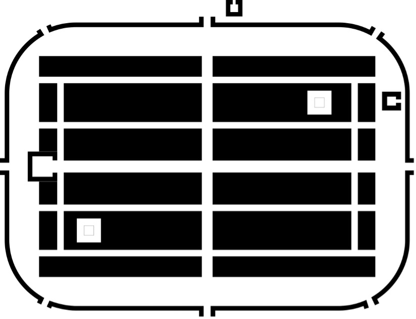
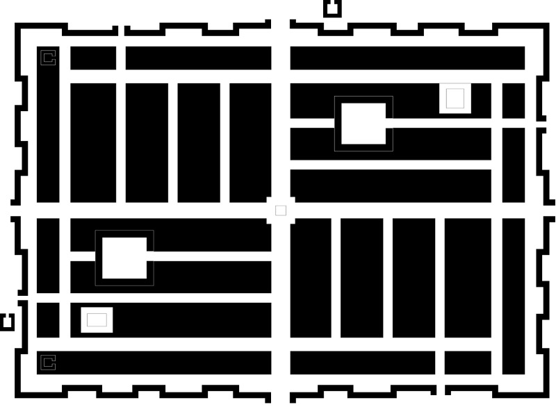
Shown above are four of the eight village plan-types specified by the Manasara Silpasastra (after E.B. Havell)
The use of the Grid in Chinese Urban Forms
In ancient China the Hung fan, or the ‘Great Plan’, specified the five elements and the five numbers which the (mythical) dynastic emperor Yü received from heaven. Yü then measures and the divides the earth into nine regions, or one square divided into nine sections. This diagram underlies much of Chinese divination and remains a staple of Chinese surveying town plans.

Another ancient from of divination is Feng Shui, or wind and water, is the ancient practice of placement to achieve harmony with the environment and the forces of nature and is estimated to be more than 3000 years old. Traditional or classical Feng Shui is an ancient Chinese belief system that addresses the layout of cities, villages, dwellings, and buildings.[2] The architect I.M. Pei had to grapple with Feng Shui’ when he designed a bank in Hong Kong in 1982. Even today when designing a building in Hong Kong you cannot circumvent dealing with Feng Shui. Although Pei did not redesign his building due to the complaints many neighbors said the building adds an intimidating appearance to the Hong Kong skyline, adding that it looks like a cleaver about to hack up its banking competitors. One of those rivals, the Hong Kong and Shanghai Bank, constructed two structures that look like cannons on top of its building, and then pointed them at its nemesis to counteract negative influences.[3]
[2] Lewis, Mark Edward (June 2006). The Construction of Space in Early China. SUNY Press
[3] Refer to an article titled, “Hong Kong blends myths, reality “, by Mike Pramik a Dispatch, Business Reporter, June 10, 1997
The use of the Grid in Greek Urban Forms
There are generally two types of Greek city forms, the parent free form type and the colonial city. Typically, both parent and colonial cities had central areas, an Acropolis, located on a raised or plateau, which presented a natural fortification. These sites, classically located on a natural rock citadel, contained a place for temples, but also offered a place of refuge if the area were attacked. Around the plateau houses would be built spreading outward from the rock fortress. Characteristically in a desultory pattern for the parent city, and in a structured pre-laid out grid for the colonial town. Eventually a surrounding wall would be built, and the settlement became a fortified town. “The Acropolis was seen as the core of the town, and the town was (seen as) the core of the city-state, which included both town and country.”[4]
[4] Cecil Stewart: “A Prospect of Cities: Being Studies Towards a History of Town Planning,” p. 5
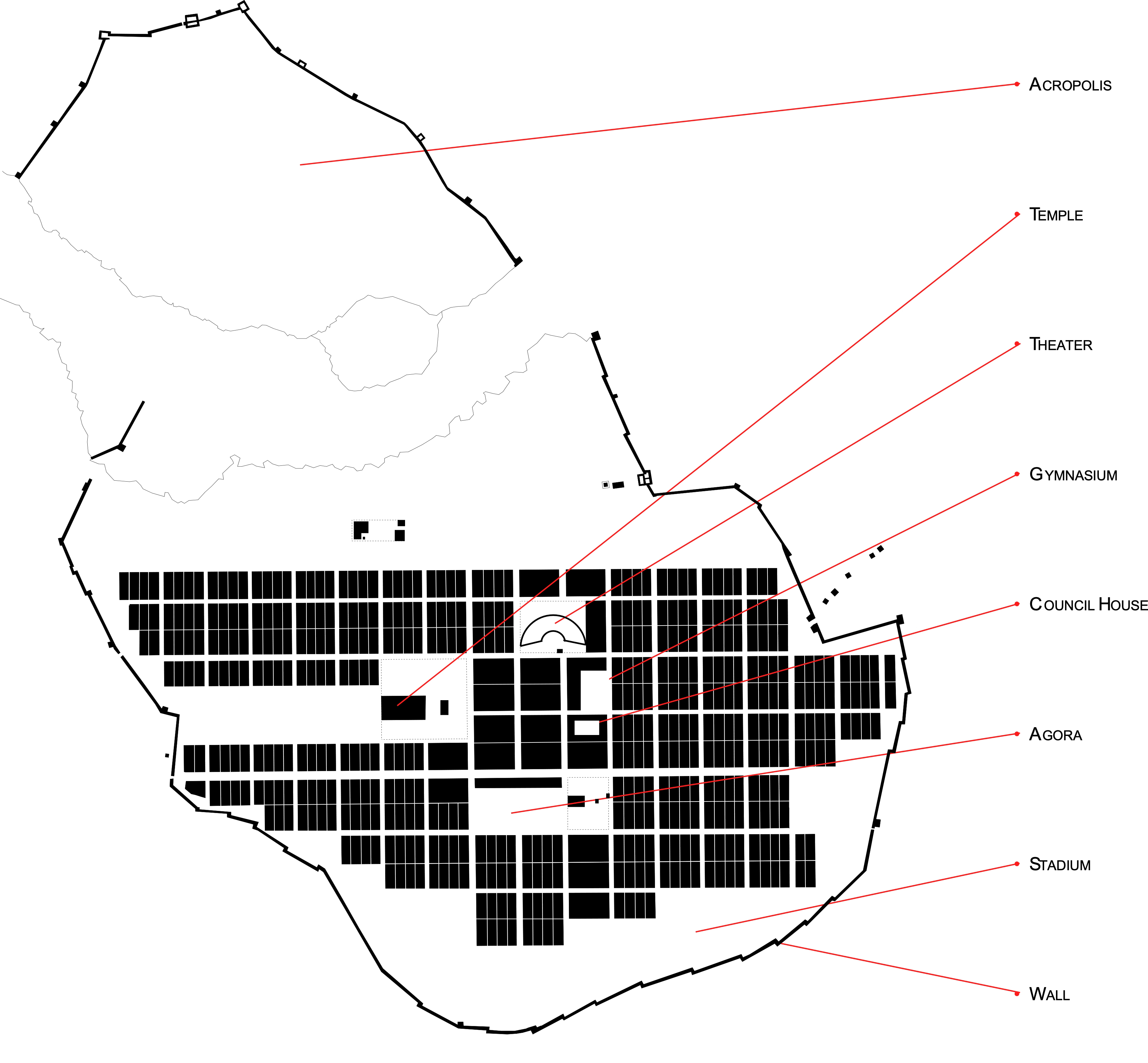
Colonial progression occurred when the parent cities became to crowed to house all of its occupants sufficiently. The Mediterranean coasts became the perfect sites for these Greek new towns. Although the parent city states were situated inland for protections, the new town preference was by the sea, allowing for easy trade, but also permitting a line of escape in an emergency. It is normally attributed to Hippodamus for introducing the first gridiron plan into the prototype of the first colonial Greek towns. This plan type, versus the free form design of their parent cities, provided an orderliness and expediency to layout and construction. All the basic elements of a Greek city were incorporated into these colonial cities – the walls, the Agora or gathering-place, temples, theater, gymnasium, and numerous official buildings. The wall layout generally followed the lay of the land and was usually irregular in shape. The plan for the city occurred from the inside out, a major difference from the later Roman grid-plan town. The Greeks began by laying out the grid of their streets and ended with the construction of the walls, while the Romans began with the layout and construction of the walls, and then the layout of the street plans. Besides the colonial prototypes, located for their trading purposes, the other type of Greek colonial new towns expansion, and the largest number built, is attributed to Alexander the Great. The purpose for his new towns, similar to the later Roman legion towns, was for strategic purposes, or imperial outposts.
The use of the Grid in Roman Colonial Settlements & Legion Towns
Roman legion towns, or castra, begin to develop as the Roman Empire expanded its borders beyond the city of Rome. The form of the Roman legion town is typically in the shape of a rectangle or square. One reason for the rectilinear form is due to defensive means, since a town in the shape of a circle allowed for an attacking army to concentrate their forces equally, while a rectilinear shape required the attacking army to divide its troops. The creation of a Roman town though was not usually created for defensive means, but classically for offensive reasons. As the empire grew, out-post had to be established to protect the conquered land, and though the location was customarily determined by economic and politically reasons, the physical location of the town was ideally located on lands that allowed for the famous straight and flat Roman roads to easily approach one of the towns four gates.
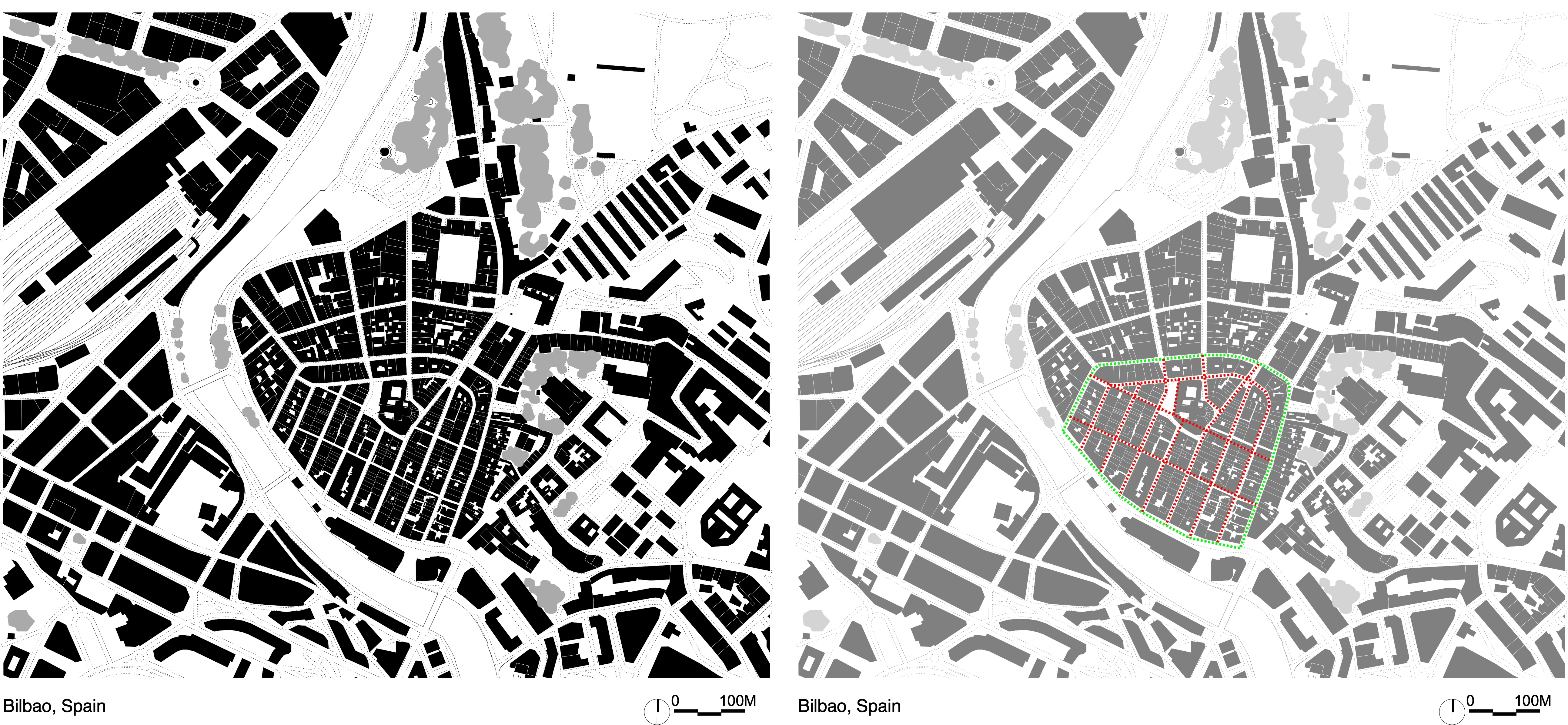
The grid design is usually attributed to the Greek town layout, but it is known that in the Bronze Age, circa 1400-800 BC, in an area between Po and the Apennines there existed more then 100 settlements. One of the largest of these was Terramara of Castallazzo di Fontanellato, located just west of Parma. This village was rectilinear in shape, had a grid plan, and had two major cross streets with an internal open area that is similar to the forum found in the later Roman legion towns.
As the Romans began to expand their territory and sent out their legions, they would set up campsites in the region they planned to focus their conquest. For expediency they followed a set plan. These campsites would typically become the foundation for more permanent settlements.
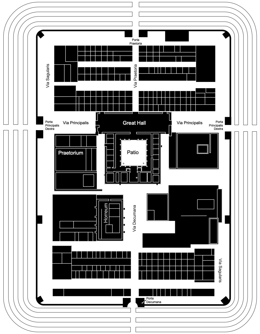
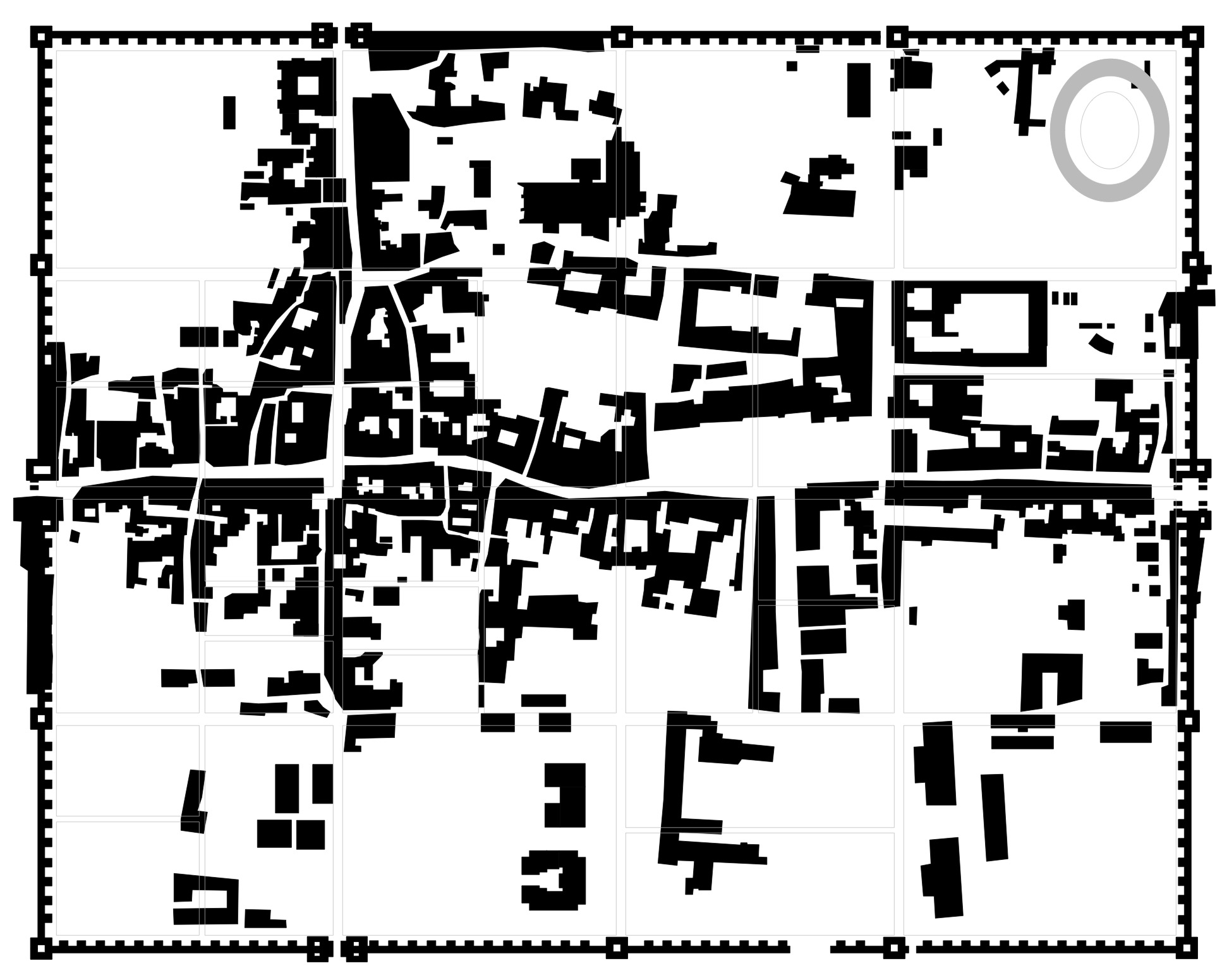
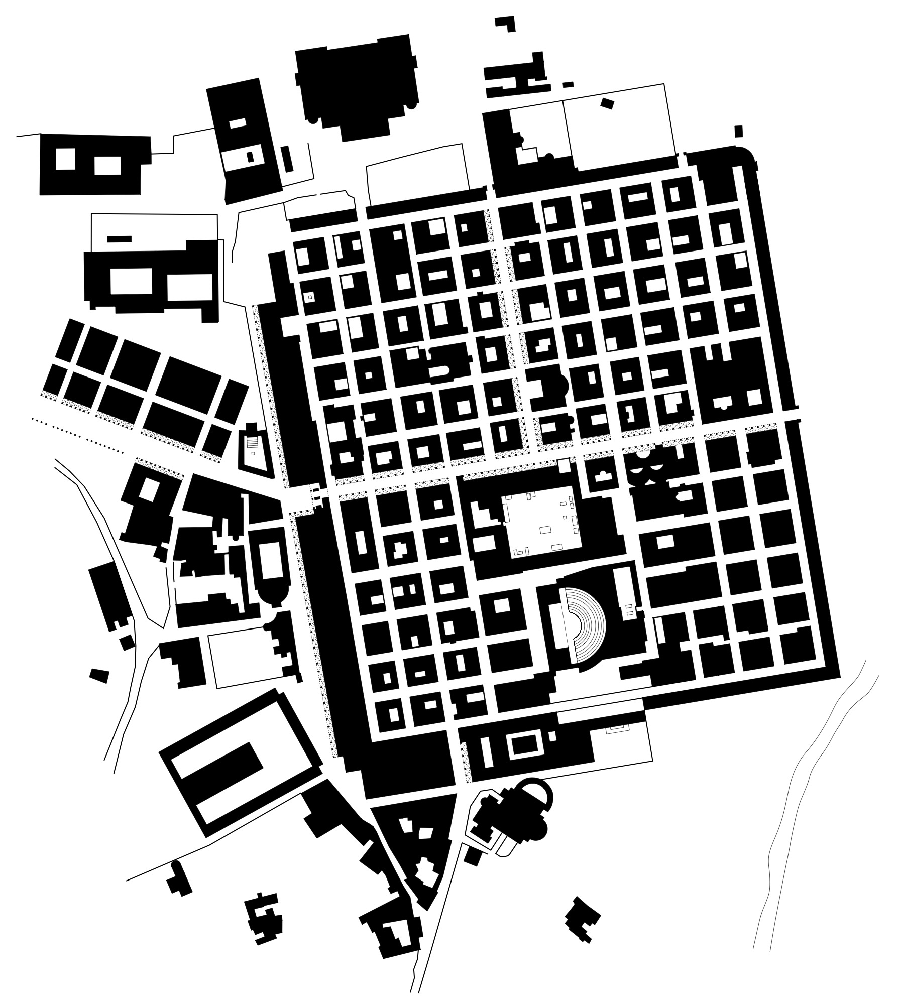
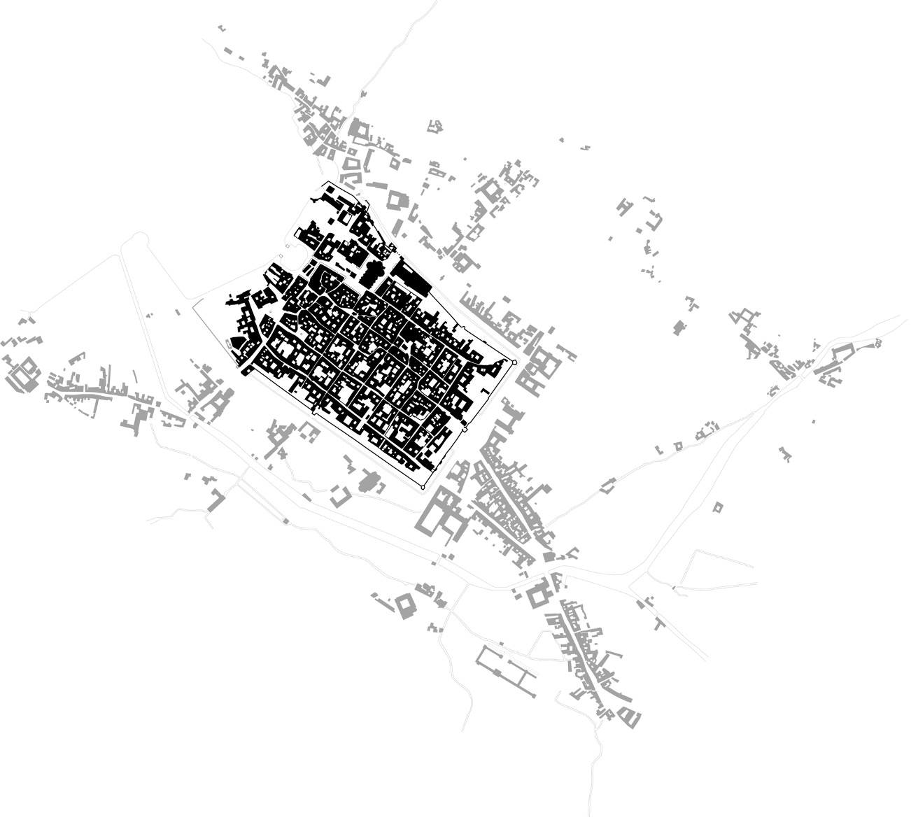
Permanent urban settlements tended to follow a repetitive set of guidelines for its design and layout. The shape, as I mentioned, is typically rectilinear and varied in size due to the importance of the settlement. Located within the rectangle were two cross streets that formed the infrastructure for the street organization. These two streets are known as the decumanus, running east/west, and the cardo, running north/south. The intersection of these two streets was where the forum was typical located, either at the actual intersection or just to one side. Secondary streets completed the grid structure and form blocks known as insulae are created. The elements that made up the typical Roman Legion town were the wall with a series of towers incorporated into it, four gates, the cardo & decumanus, insulae, forum, temples, theater, public bath. Located either inside or outside the walls were an amphitheater and coliseum. Also, the town was typically located near some form of water source, a river, lake, or larger body of water. Aosta, Italy 1950.

Another excellent example of a Roman settlement is Timgad, Algeria. The city was founded ex nihilo as a military colony by the emperor Trajan around 100 CE. It was intended to serve primarily as a bastion against the Berbers in the nearby Aures Mountains. It was originally populated largely by Roman veterans and had expanded to over 10,000 residents of Roman, African, as well as Berber descent. Although most of them had never seen Rome before, and Timgad was hundreds of miles away from the Italian city, Trajan invested densely in Roman culture and identity.
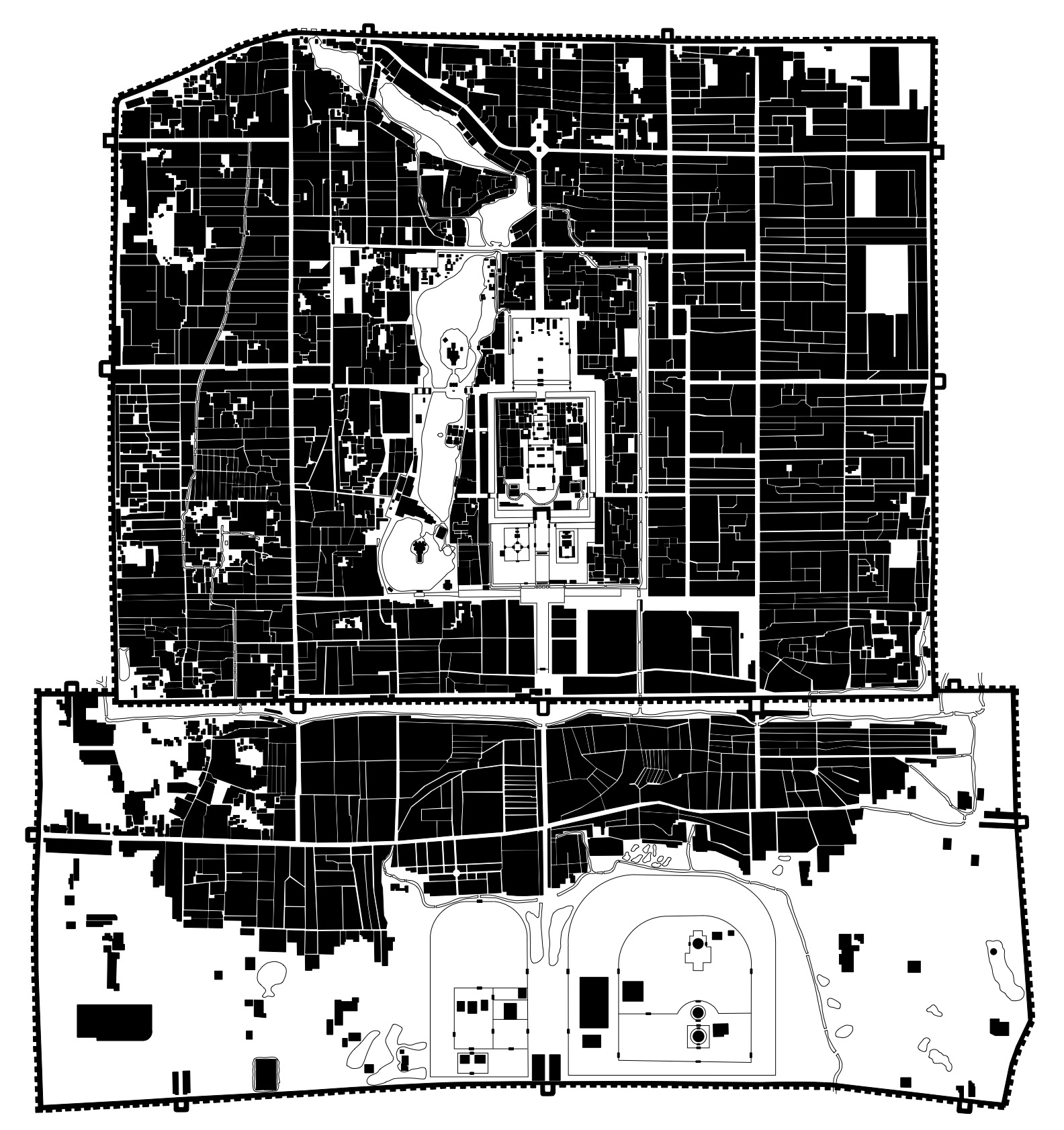
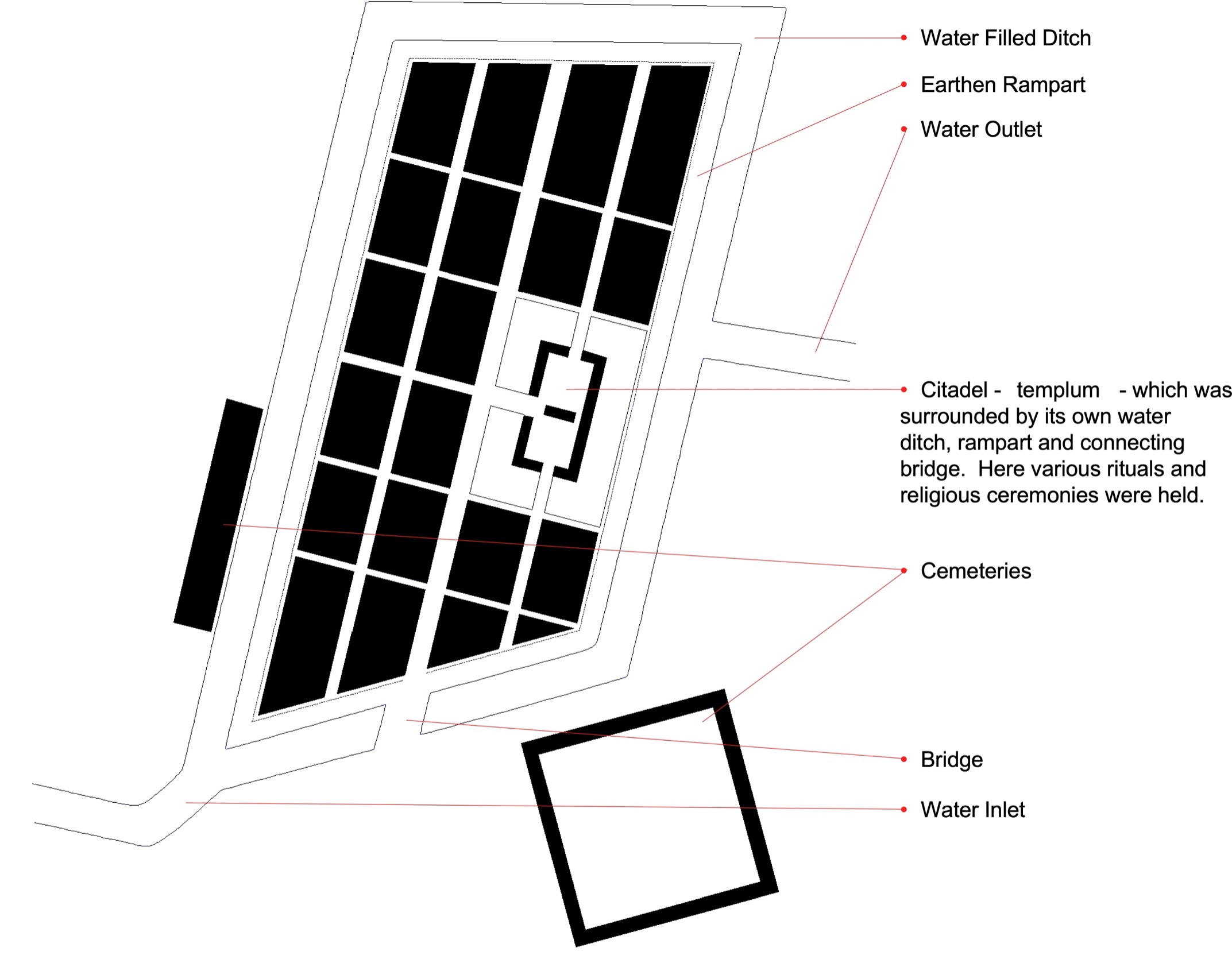
Too fully understand the mentality towards the layout of Roman legion towns it is important to understand the symbolism of their beliefs. The Romans, as early as the Etruscans, believed that the heaven was divided into four parts by two axes crossing each other at right angles. The diagram for this division was called templum in Latin. The two main intersecting lines were oriented towards the four cardinal points, with the north south called cardo and the east-west lines the decumanus. A city conceived and laid out according to the templum was not considered an ordinary place, but was considered sacred, and any city built was done so along these sacred principles.[5]
[5] 1 E. A. Gutkind, Vol. IV: “Urban Development in Southern Europe: Italy and Greece,” pp.16-18
The following describes the founding ceremony by Plutarch (Romulus)
Romulus, having buried his brother Remus, together with his two foster-fathers, on the mount Remonia, set to building his city; and sent for men out to Tuscany, who directed him by sacred usages and written rules in all the ceremonies to be observed, as in religious rite. First, they dug a round trench about that which is now the Comitium, or Court of Assembly, and into it solemnly threw the first-fruits of all things good by custom or necessary by nature; lastly, every man taking a small piece of earth of the country from whence he came, they all threw them in promiscuously together. This trench they call, as they do the heavens, Mundus; making which their center, they described the city in a circle round it. Then the founder fitted to a plough a brazen ploughshare, and, yoking together a bull and a cow, drove himself a deep line or furrow round the bounds; (anticlockwise) while the business of those that followed after was to see that whatever earth was thrown up should be turned inward towards the city, and not let ant clod lie outside. With this line they described the wall, and called it, by contraction, Pomoerium, that is post murum, after or besides the wall; and where they plough over, and left a space; for which reason they considered the whole wall as holy, except where the gates are; for had they adjudged them scared, they could not, without offense to religion, have given free ingress and egress for necessaries of human life, some of which are in themselves unclean.
The Romans followed a drawing board grid system to laying out their towns and countryside alike. The division of the land allotted to a new colony was part of the creating of the town itself. The common unit of the grid system was a square and was called the centuria quadrata with a side of 20 actus (776 yards) and an area of 200 jugera, (.75 acre), which corresponded to an area that could be plowed by a man with two oxen in one day. This form of division at right angles continued into the towns. The Romans clung to a scared formula that restricted their freedom and forced them into an endless repetition of the same plan.
There were three types of Roman legion towns.
- Coloniae: either newly formed or native settlements allied to Rome with full Roman privilege and status.
- Municipia: generally important tribal centers replaced with formal Roman chartered status, but only partial Roman citizenship for the residents.
- Civitas: administration and market centers for minor districts, which were design in the castra shape.
The actual rectilinear form was not always followed as a strict guideline though. The layout did not always follow a true north/south grid, and at times, due to either building on an existing town or an uneven layout of the land, the town structure would appear almost amorphous shape. As shown in the illustration of Como, the town conforms to the water edge, and as shown in the illustration of Arezzo, in some cases an arises due to the layout of the land.
It’s also interesting to note that when an English town has the suffixes –chester, –caster and –cester (old -ceaster), are commonly indications that the place is the site of a Roman castrum, meaning a military camp or fort.
In all three of the examples the rectangle, and Cardo and Decumanus, should be apparent.
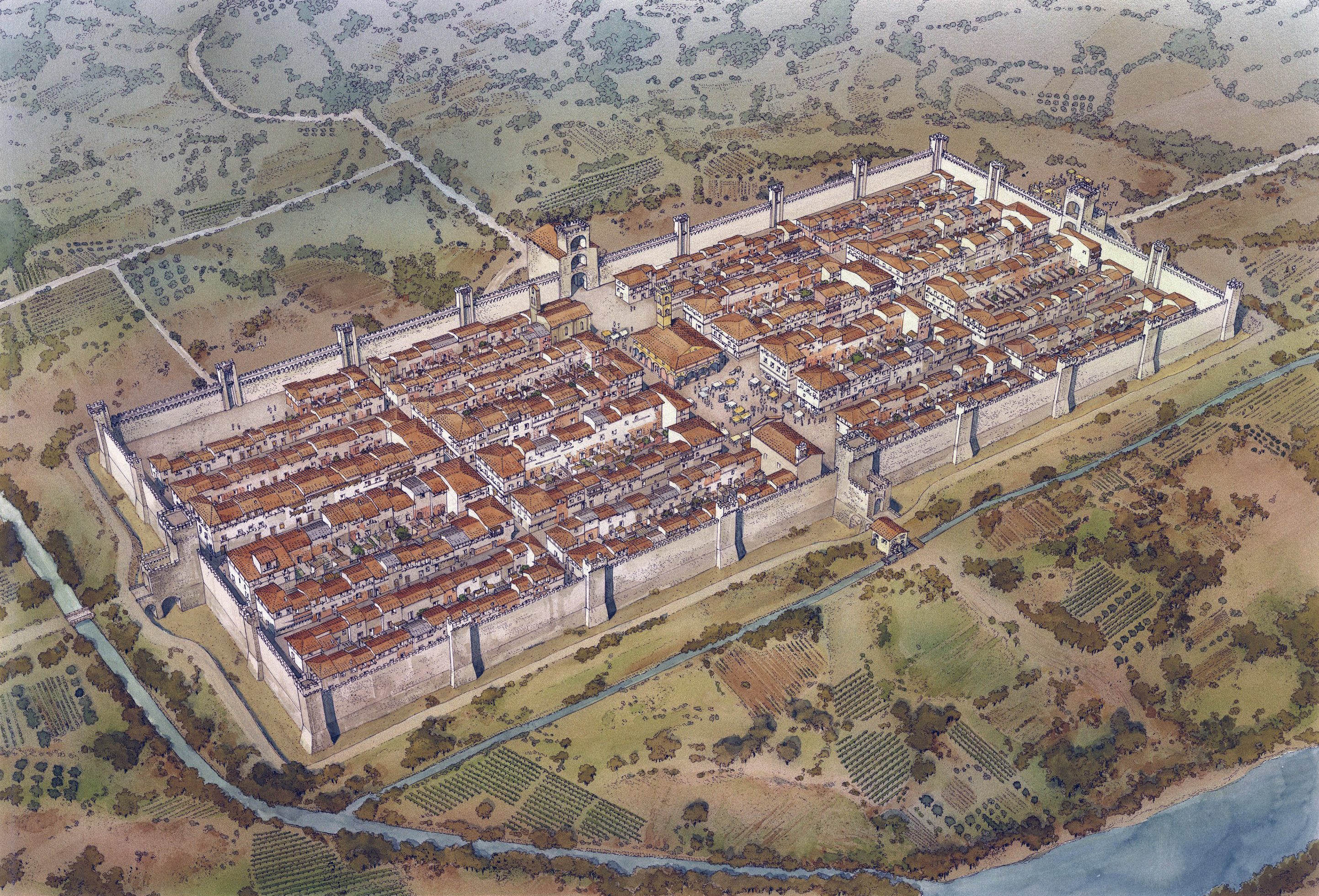
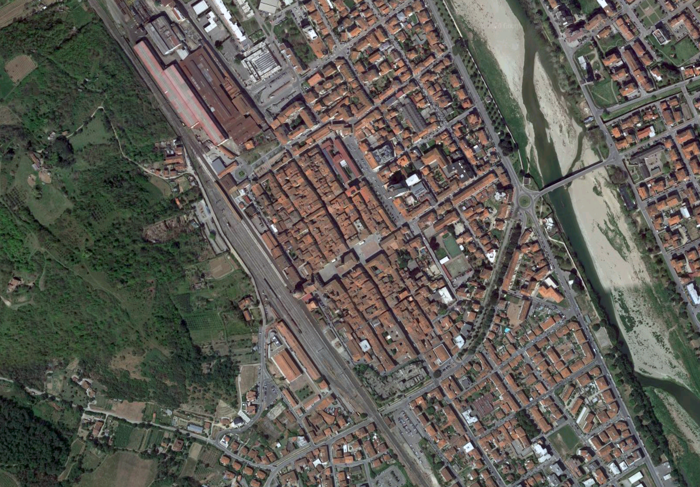
The Medieval New Town and the use of the Orthogonal Grid
With a need for housing due to a population increase in the twelfth century, plus a need to protect territorial borders, medieval new towns were quickly built as outposts under the auspices of cities and royal gentry throughout Europe, but primarily in England, Italy, France, and Germany from the twelfth century on.
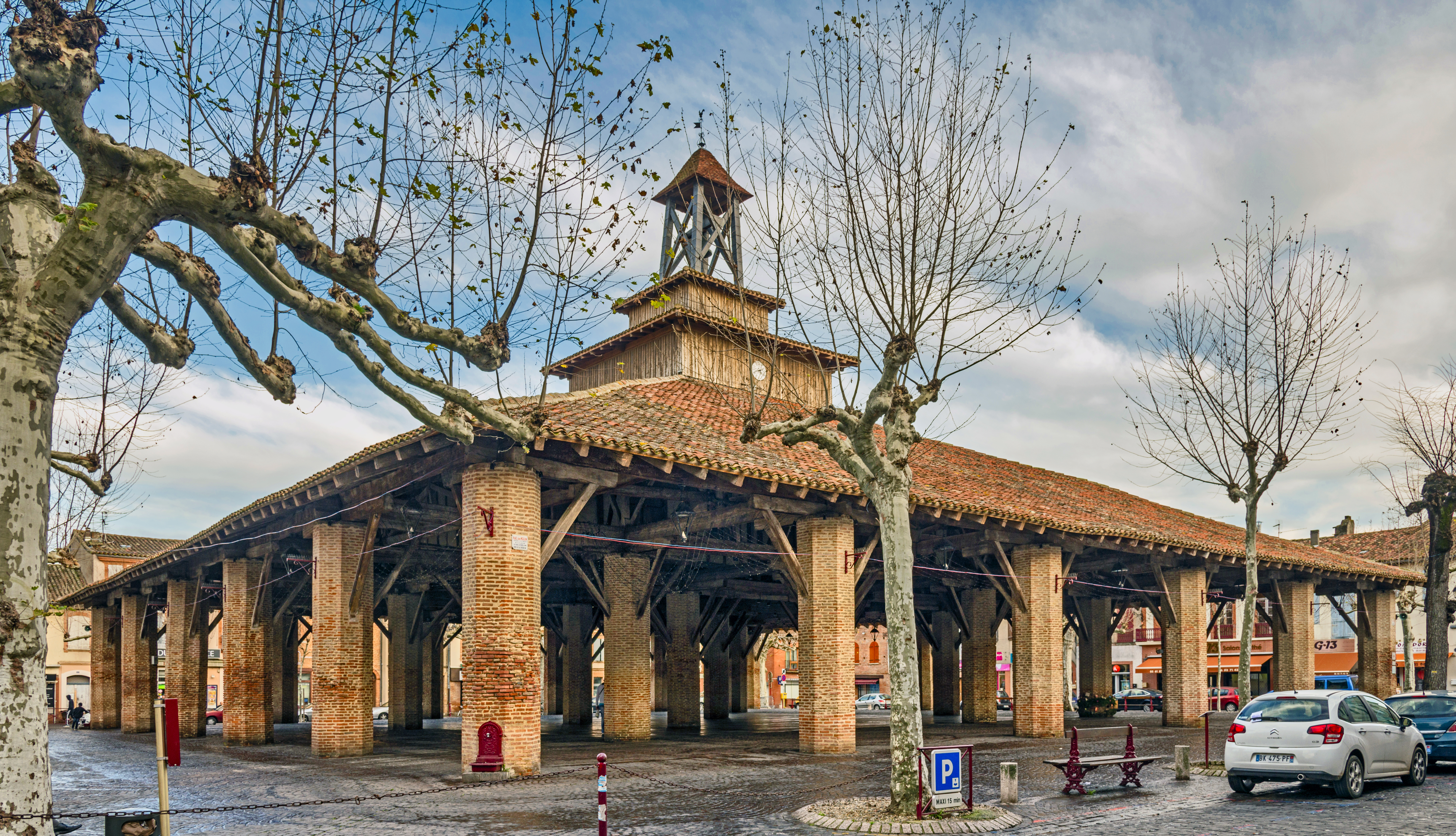
Due to the need for expediency in their construction these new towns typically follow the pattern of Roman colonial settlements, using the grid plan, and included main street markets and regular central squares.
Major tax incentives, such as lifetime tax exemption on the houses to be built, in addition to free land for building, were necessary to induce the colonists to leave the central cities to populate these new towns.
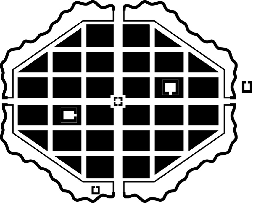
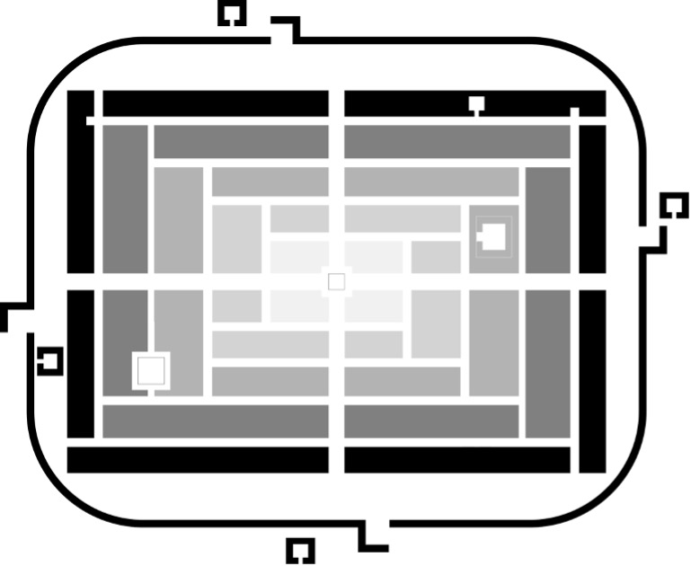
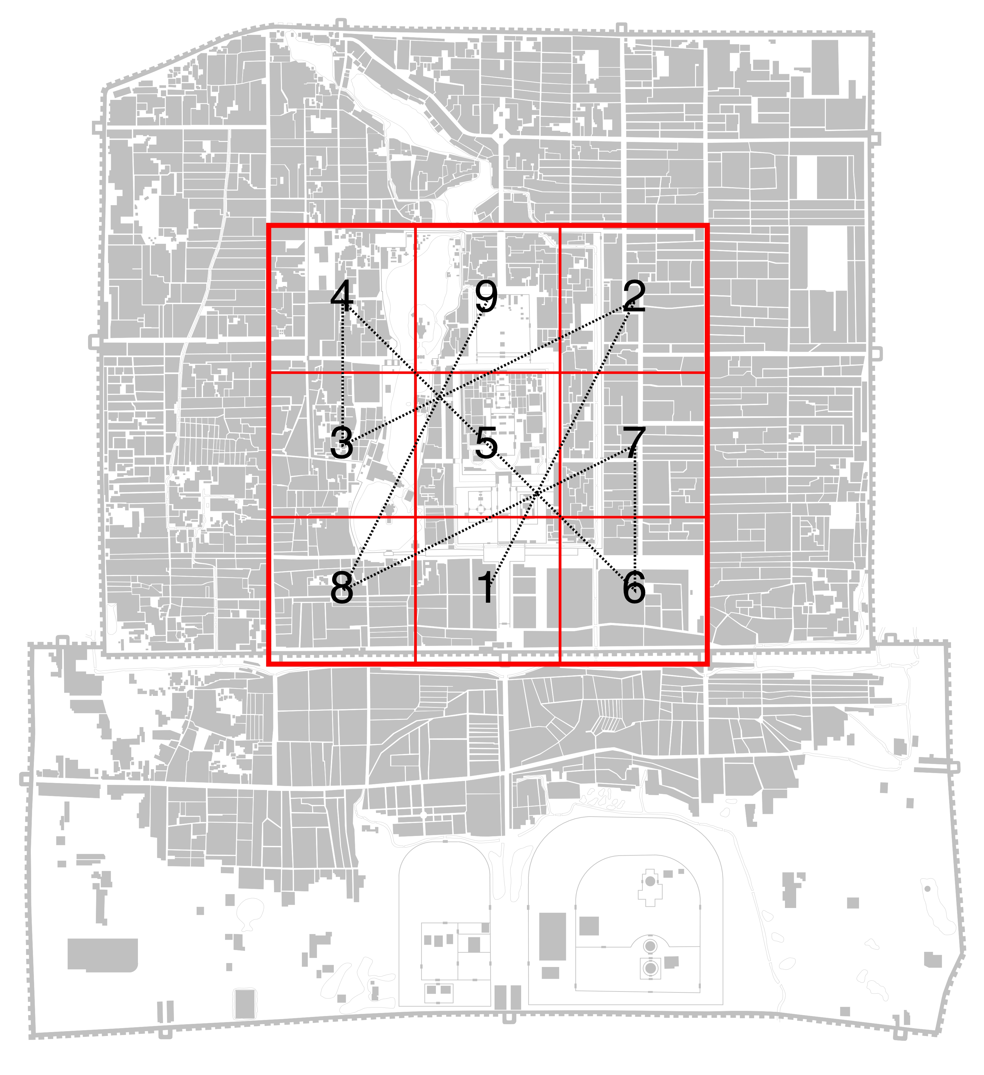
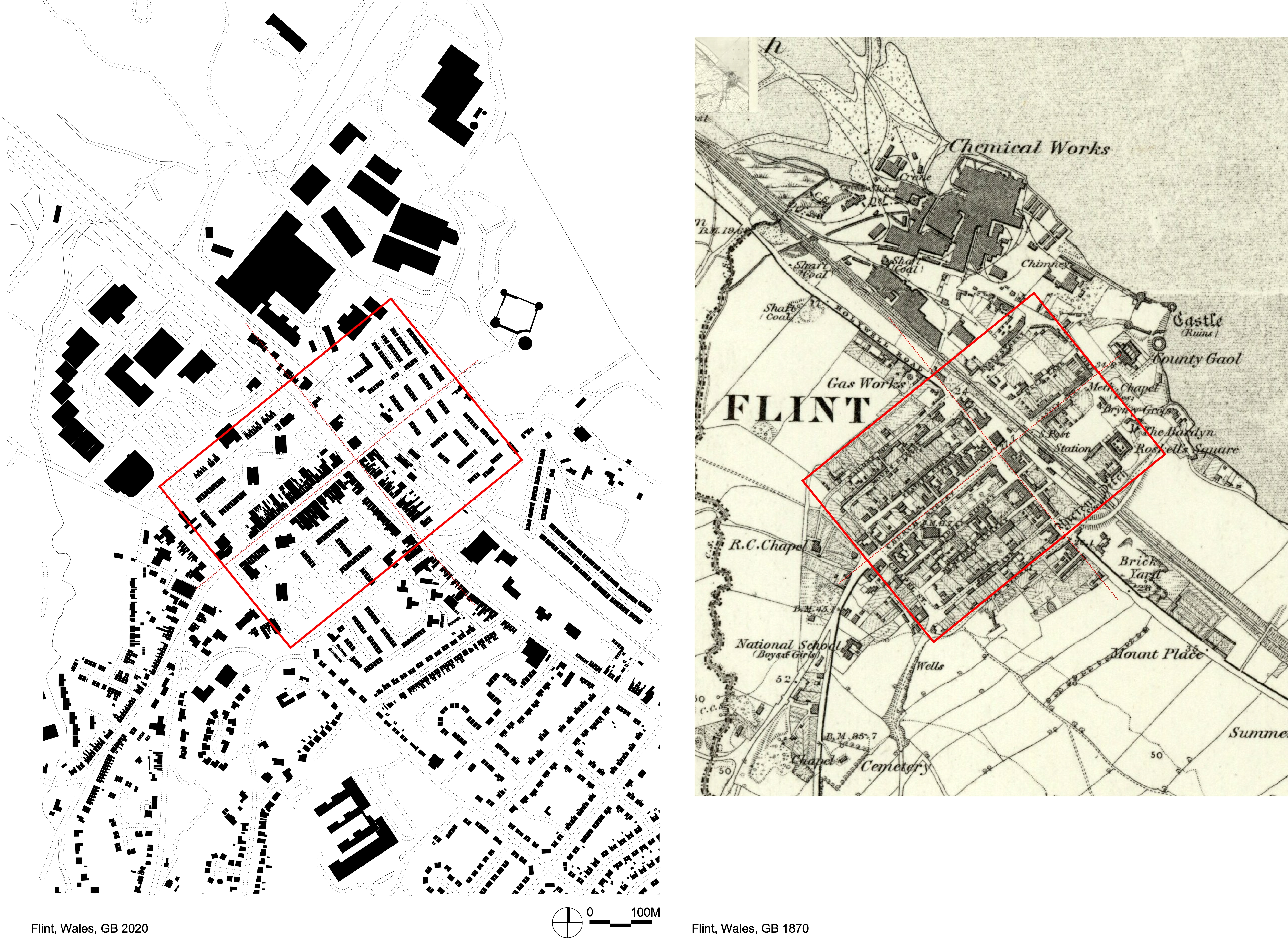
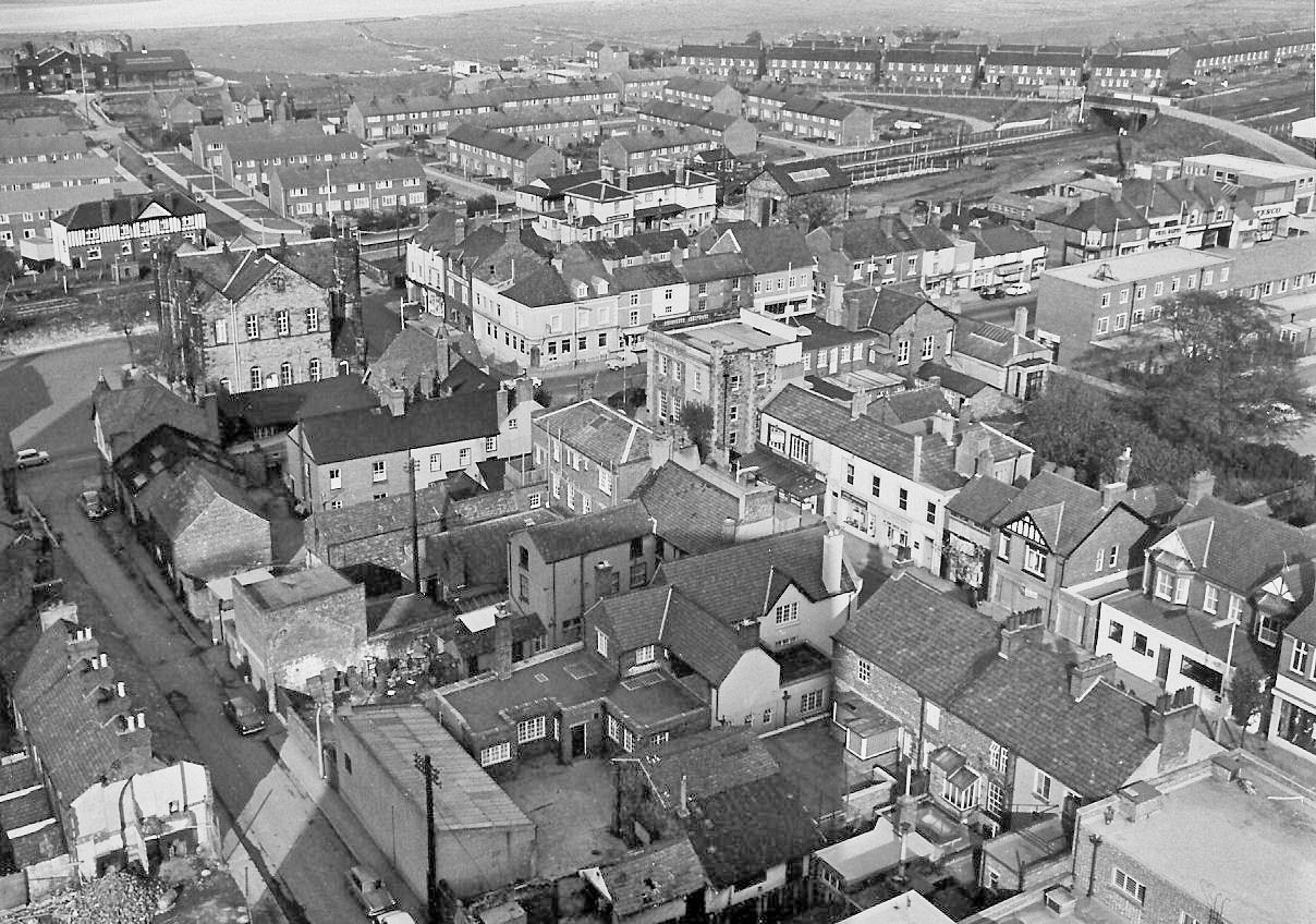
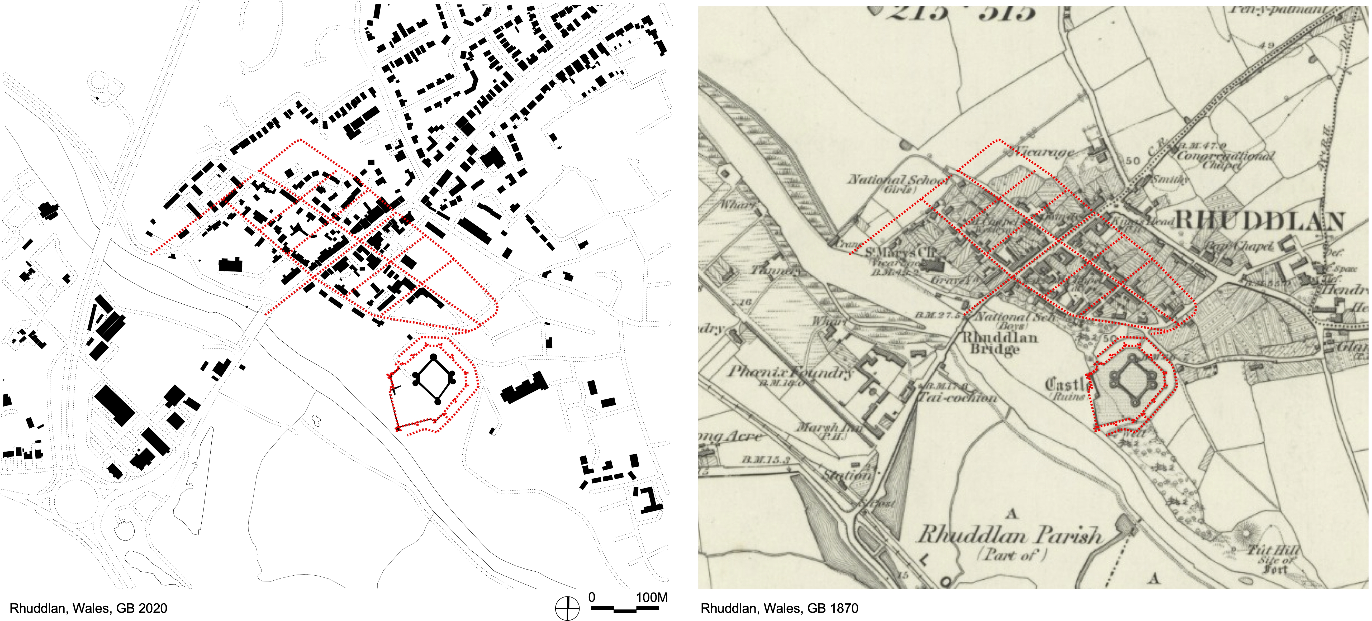
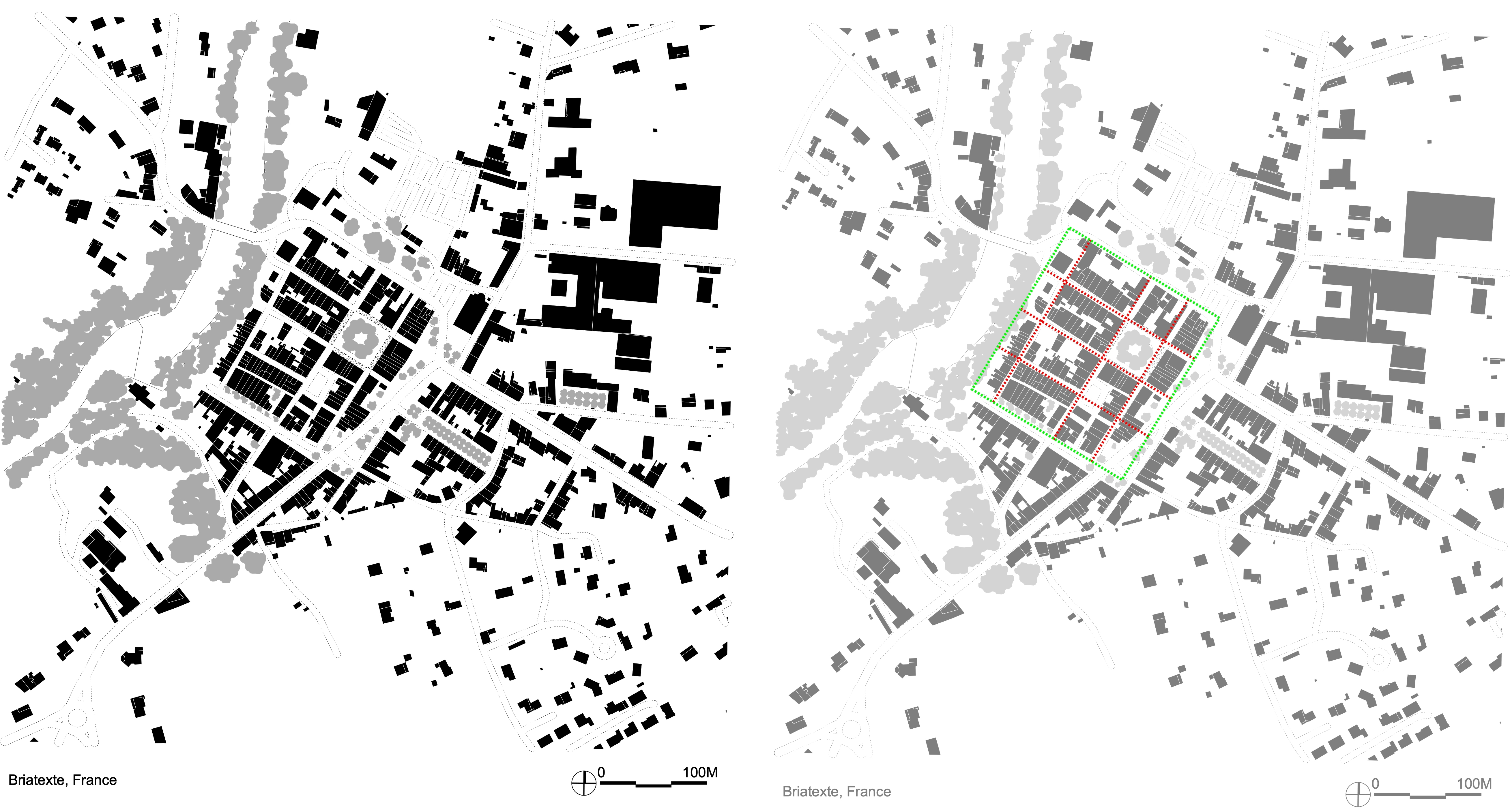
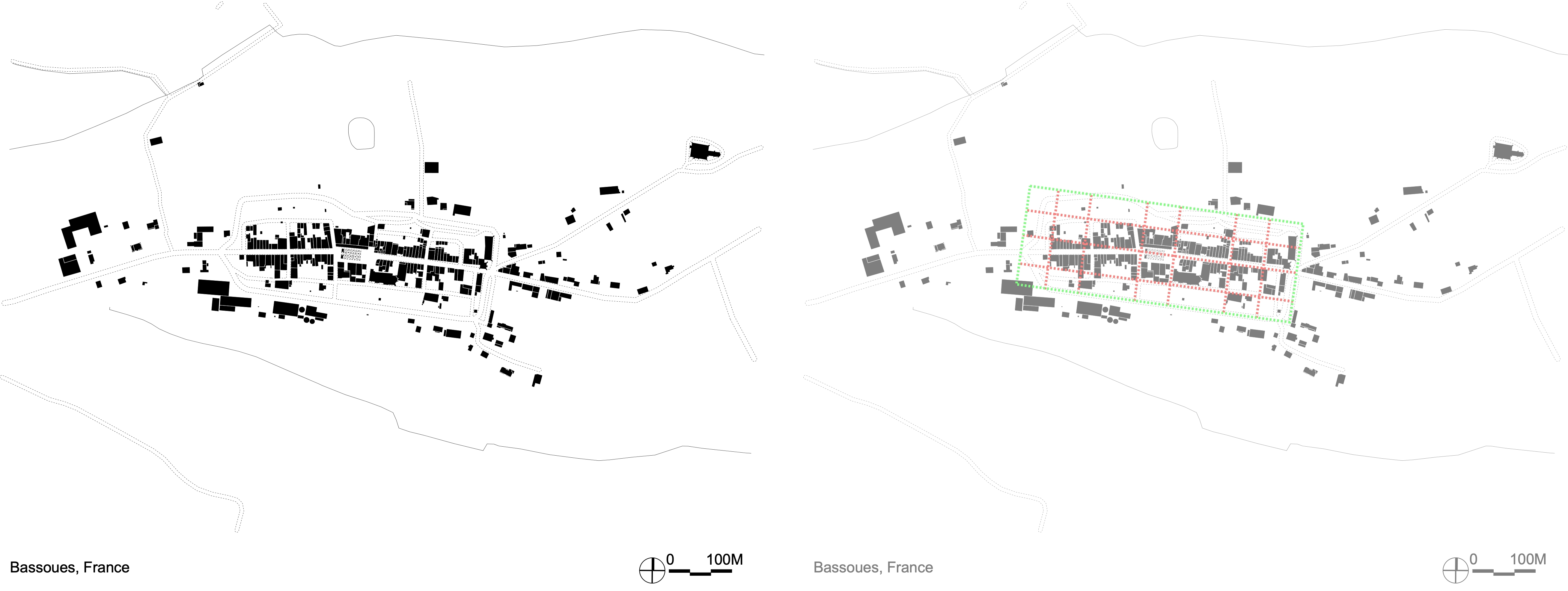
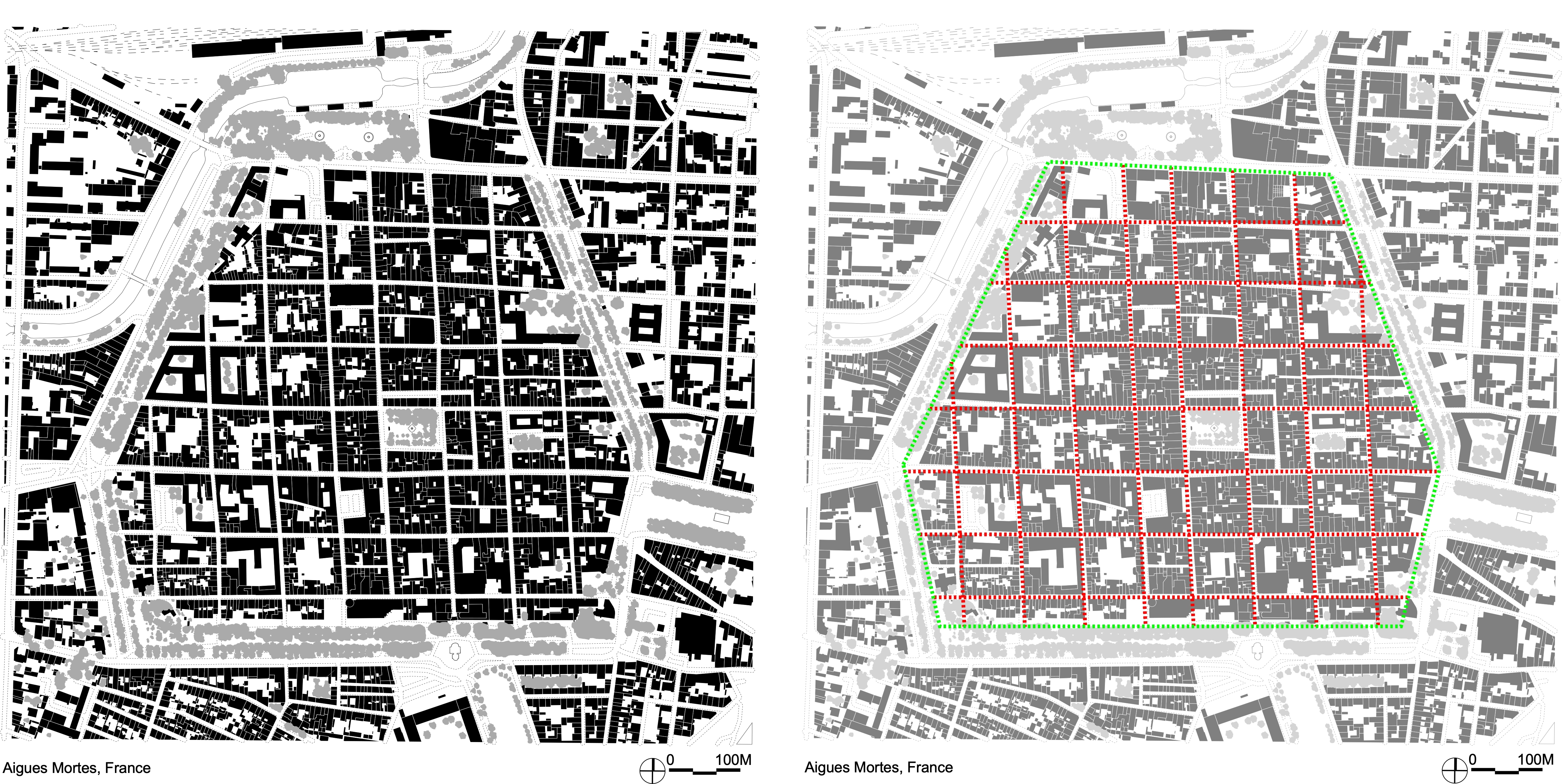
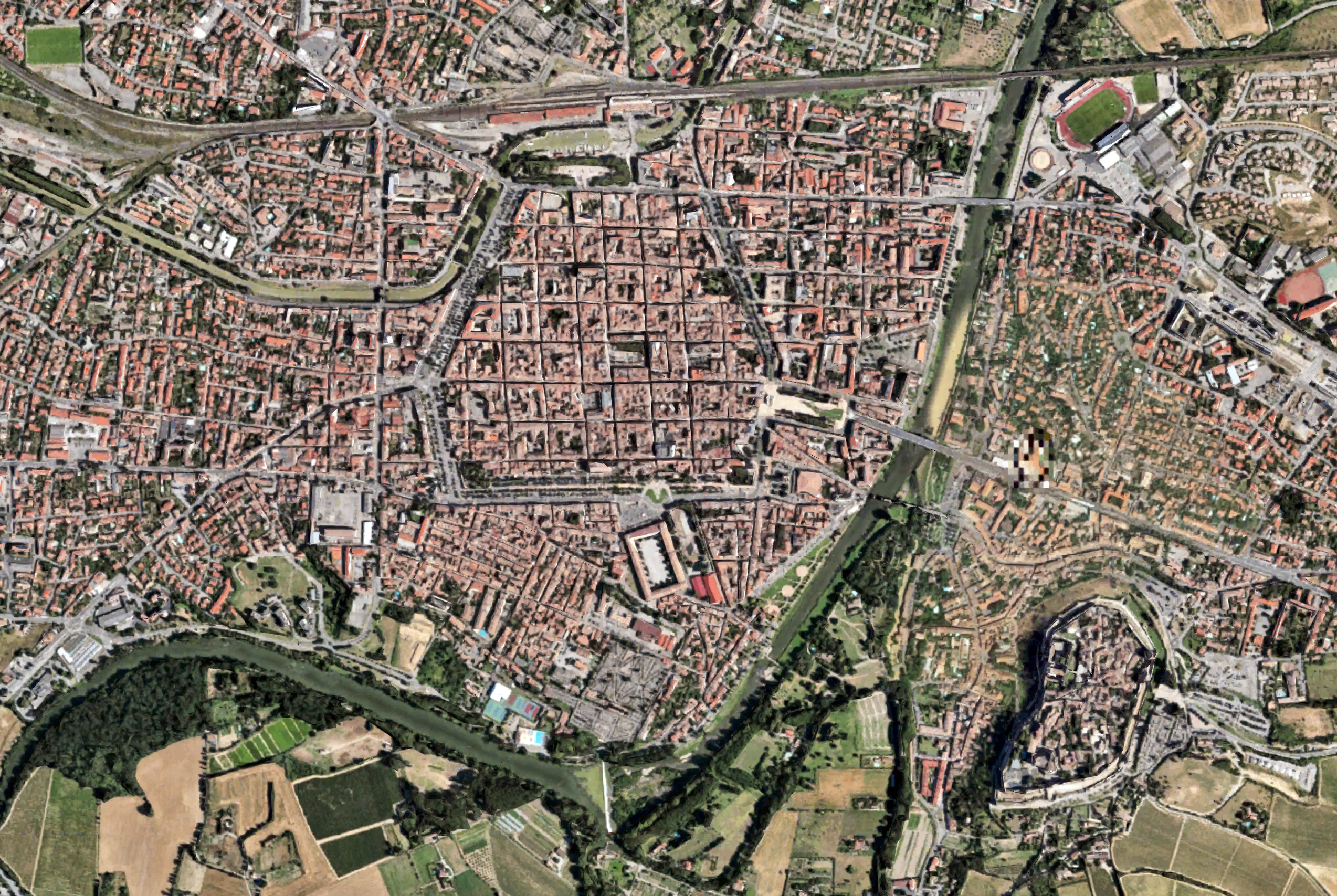
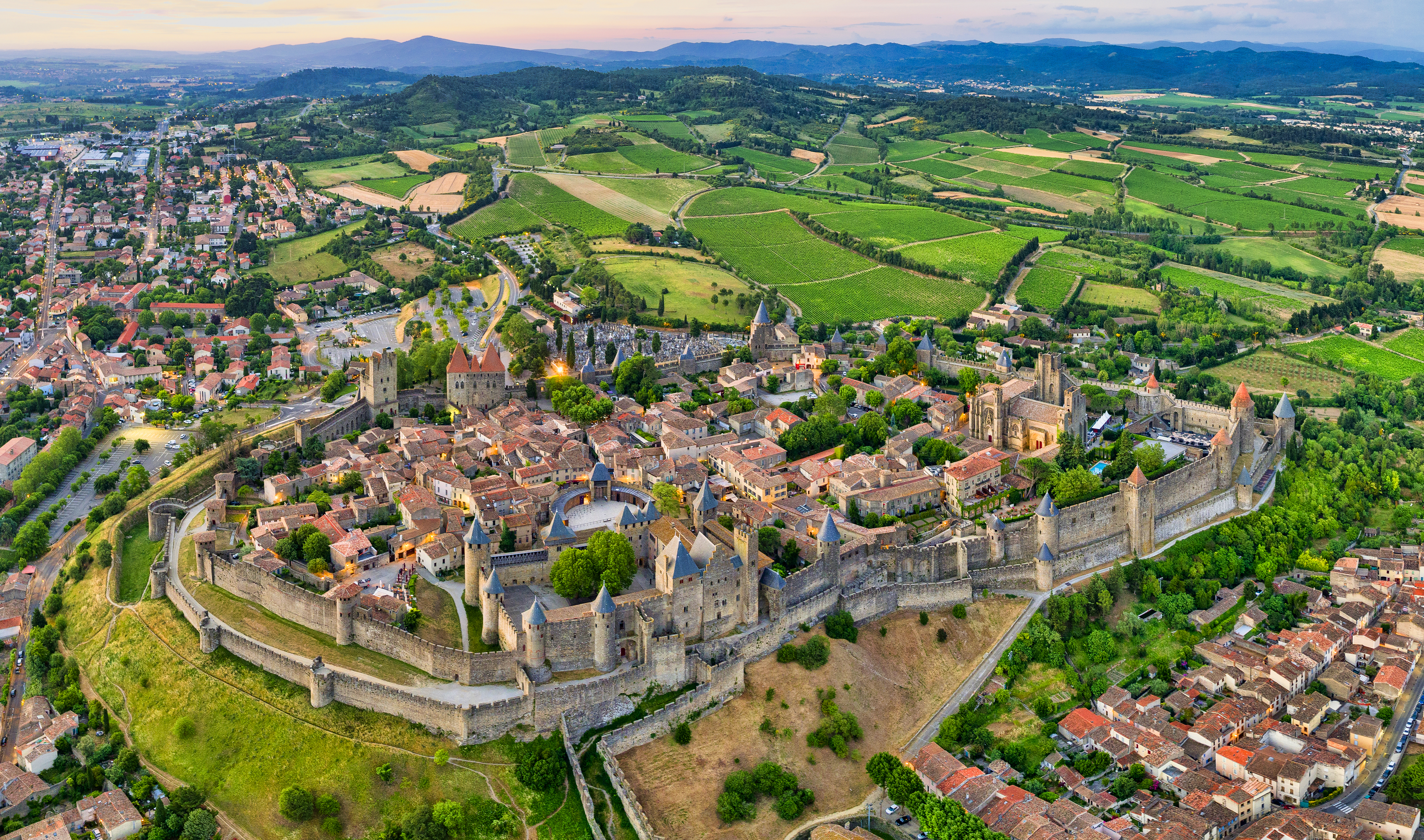
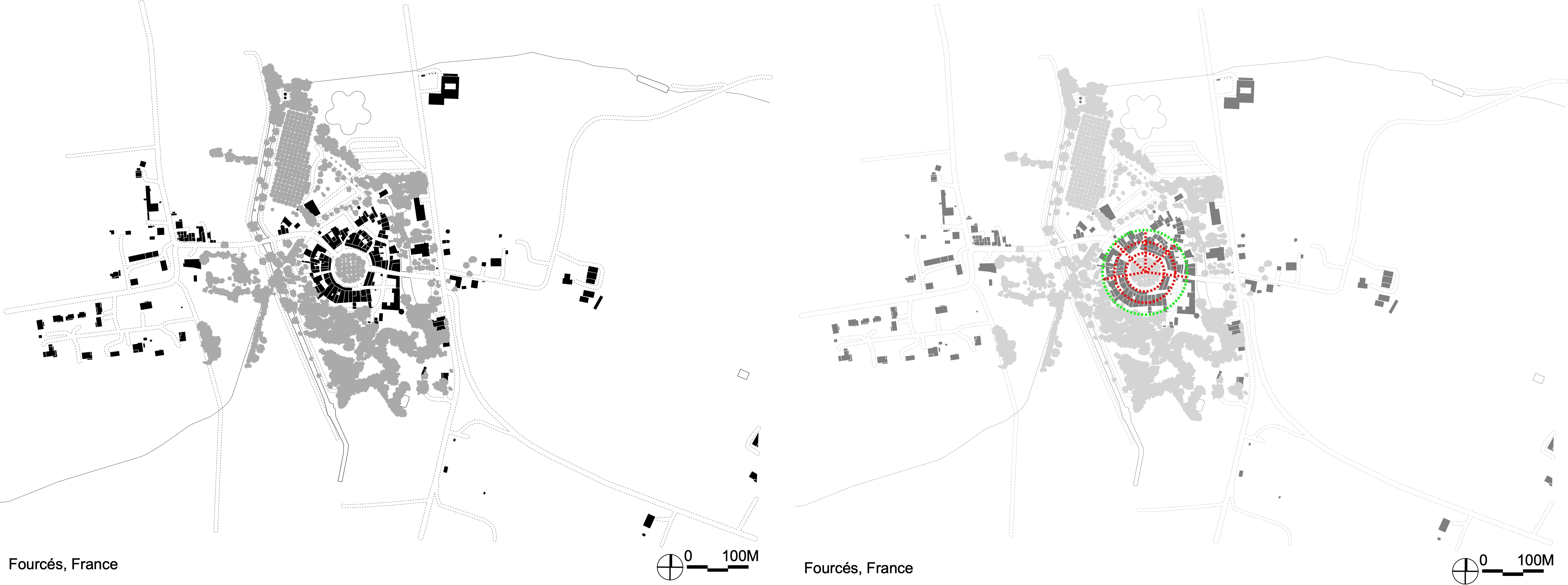
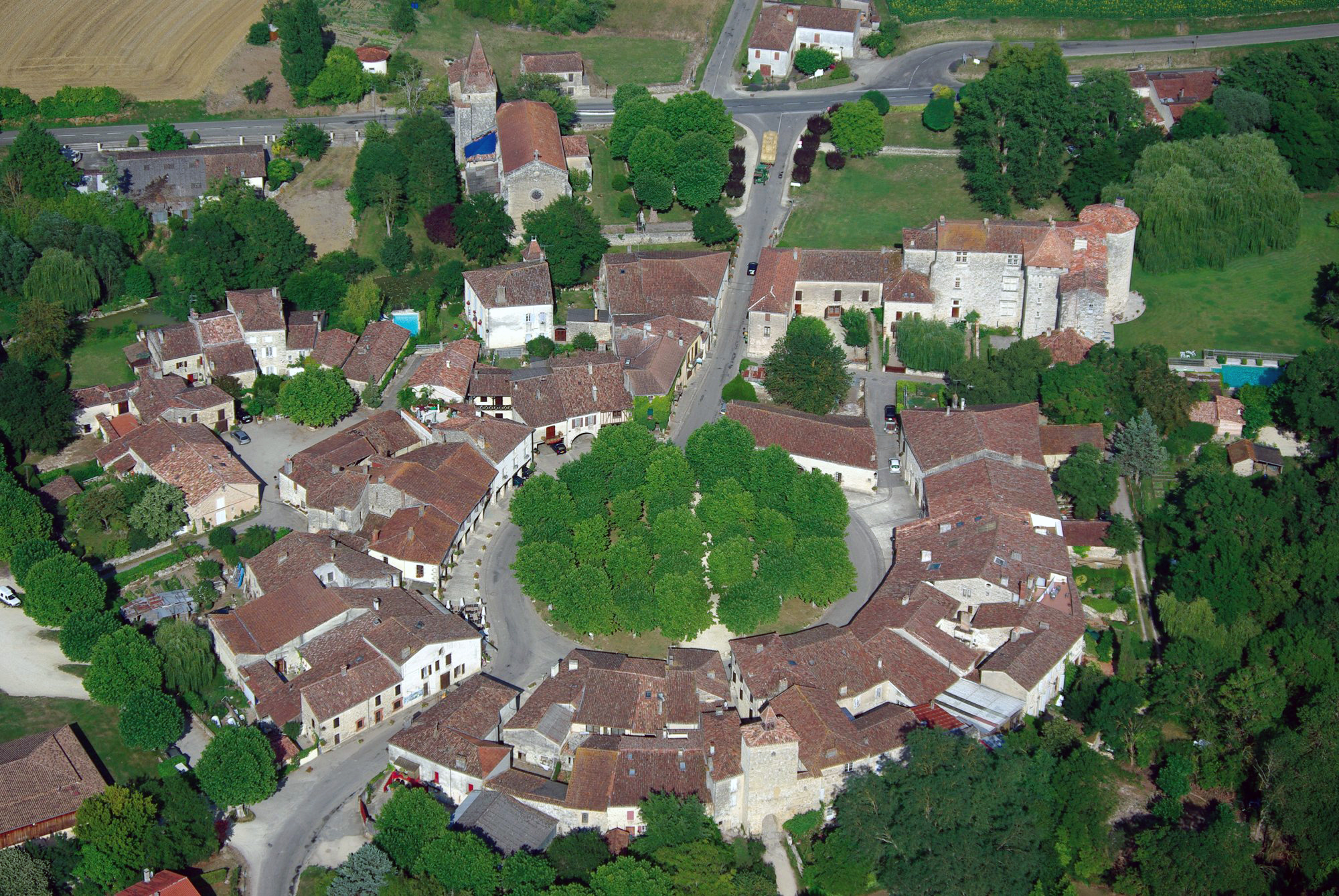
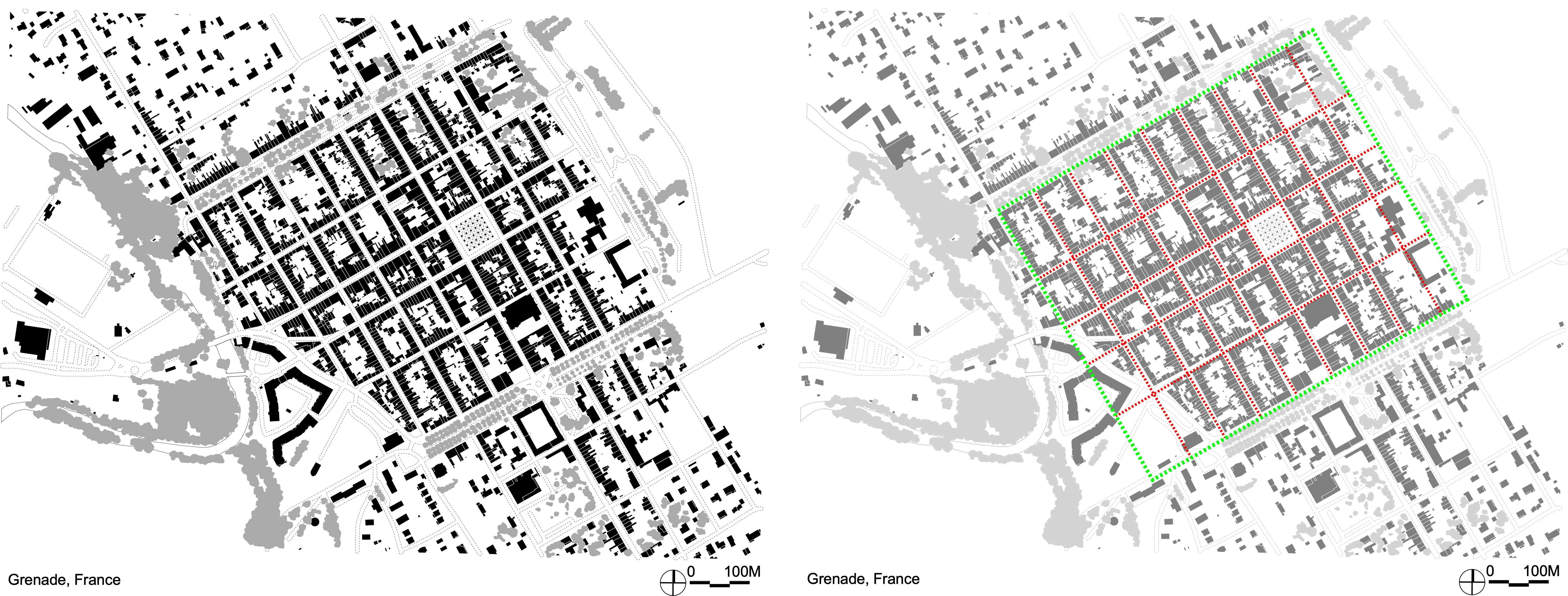
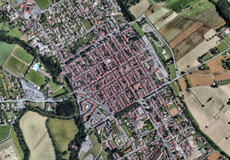
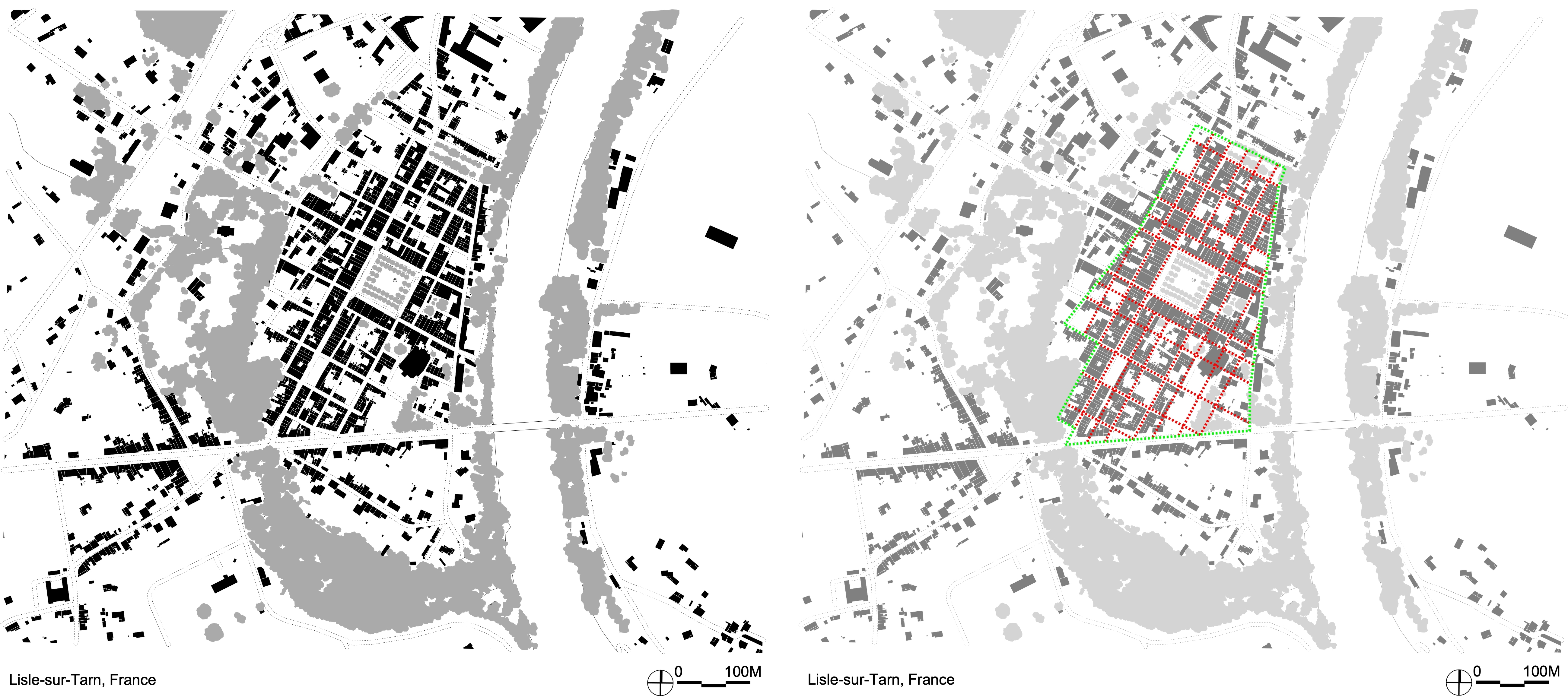
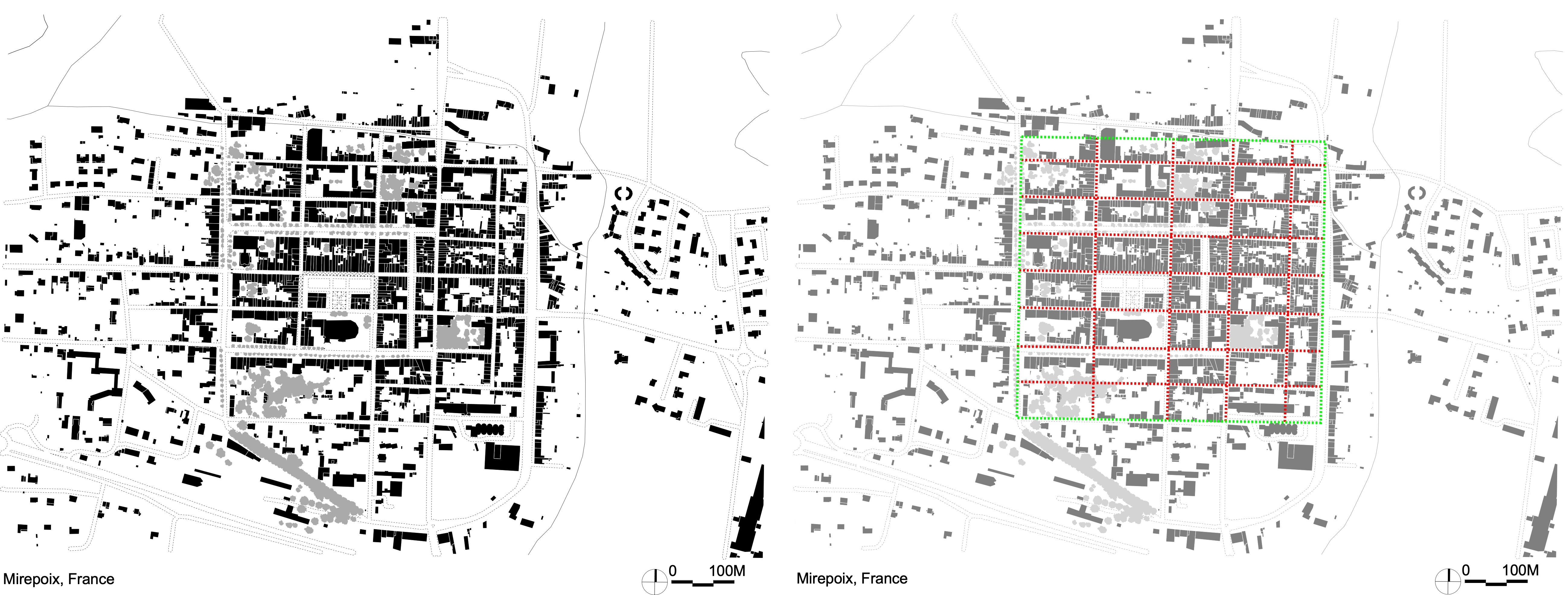
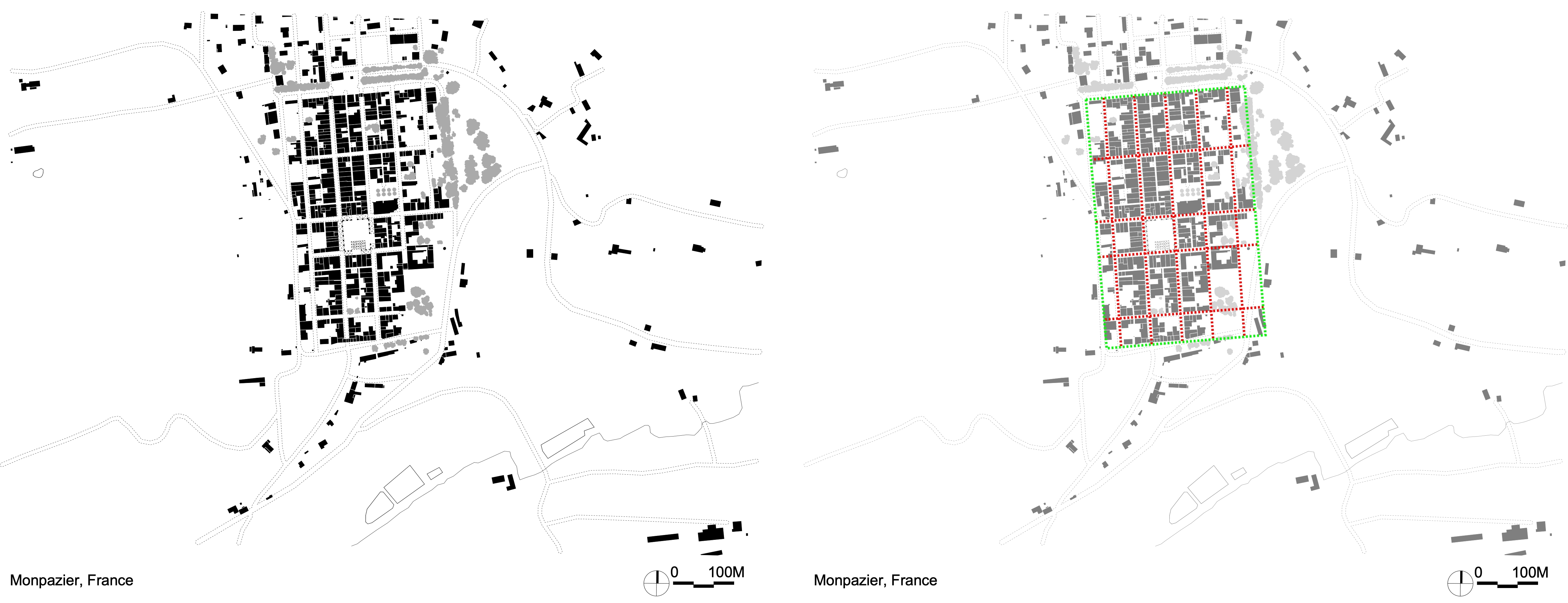
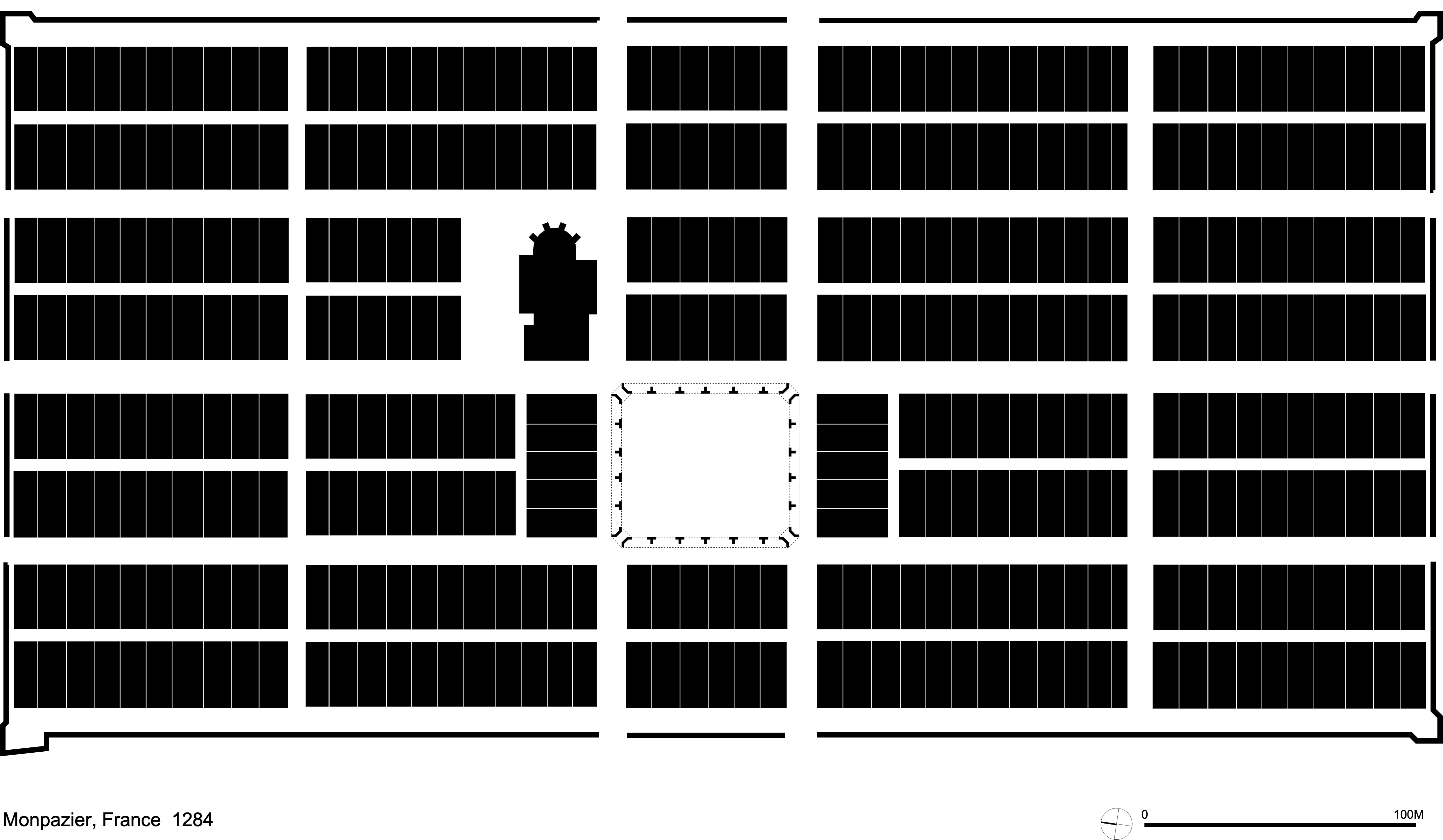
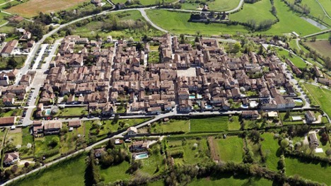
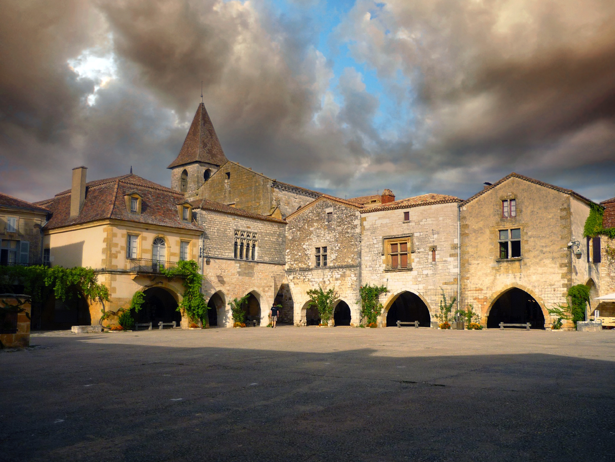
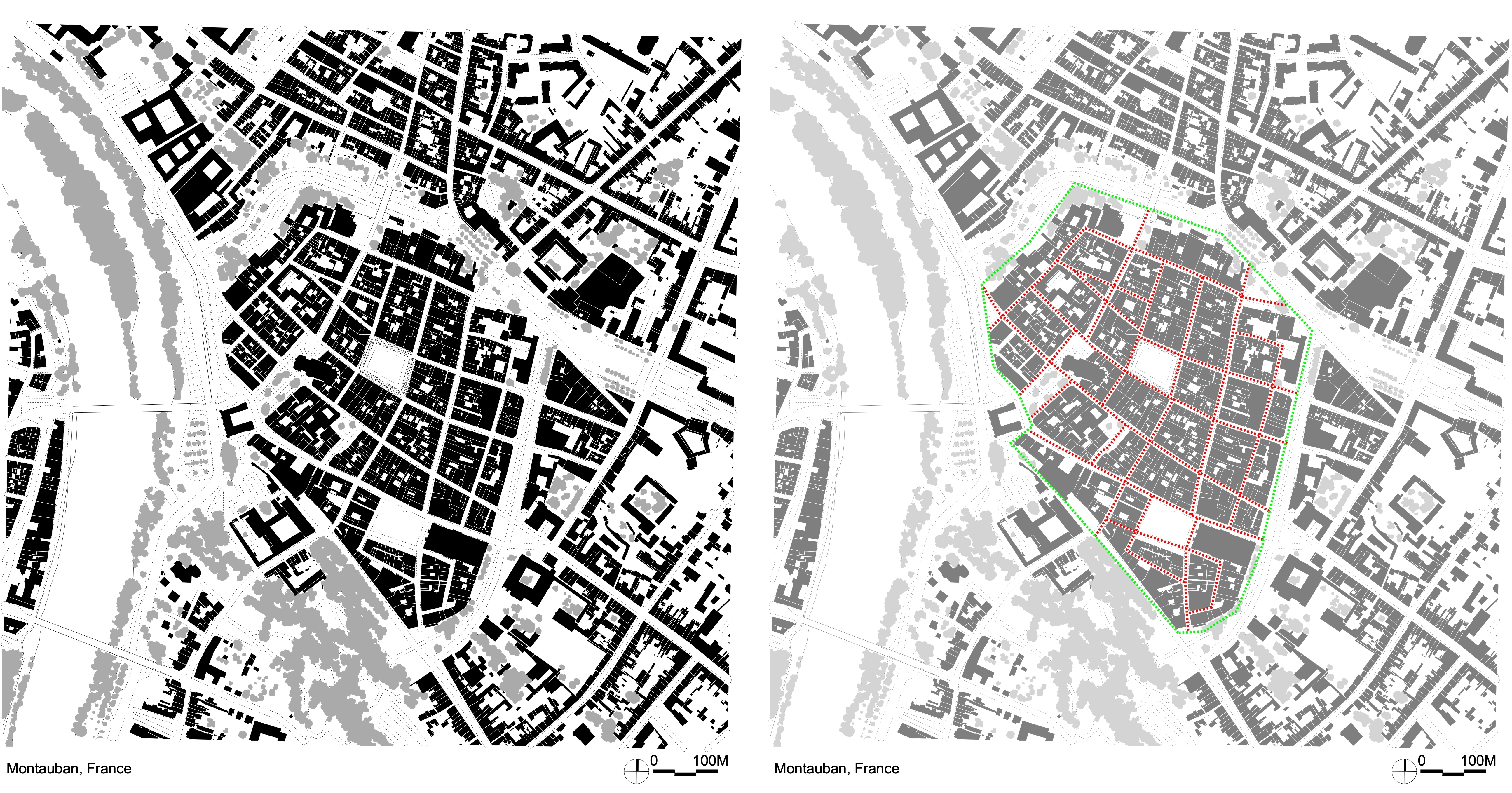
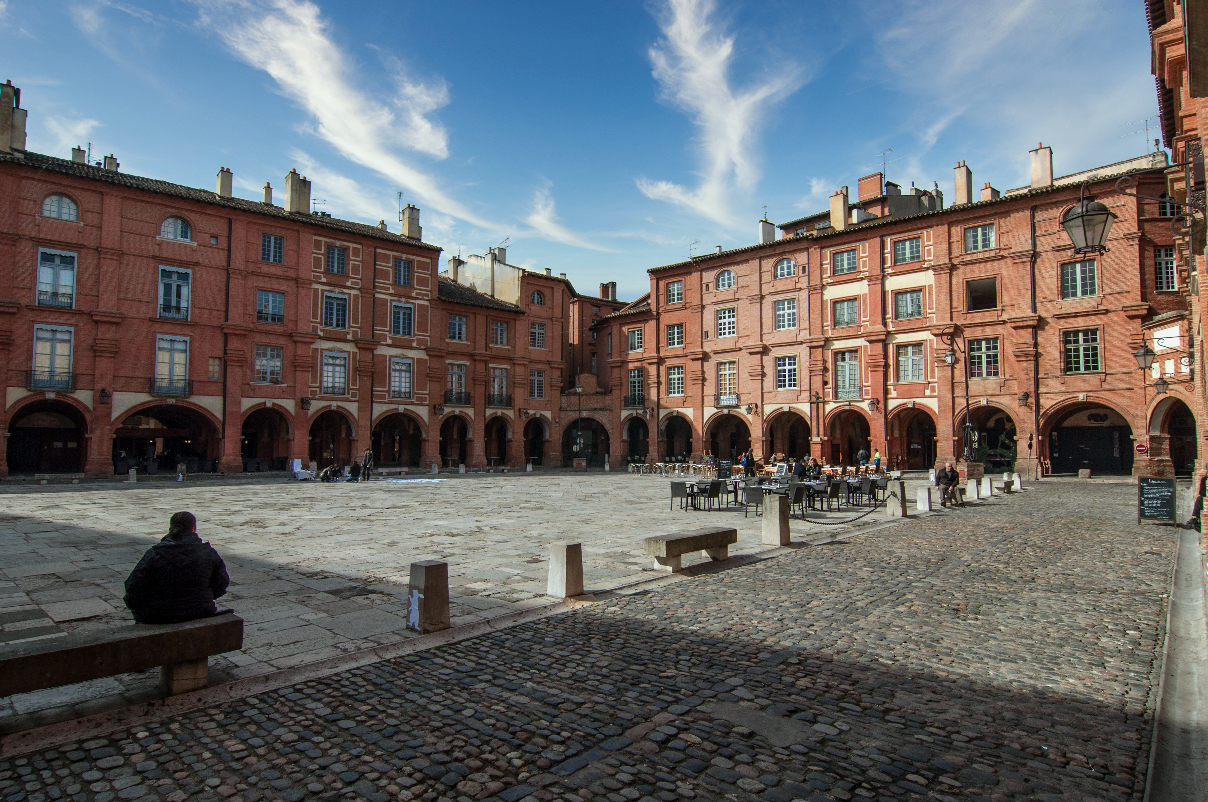
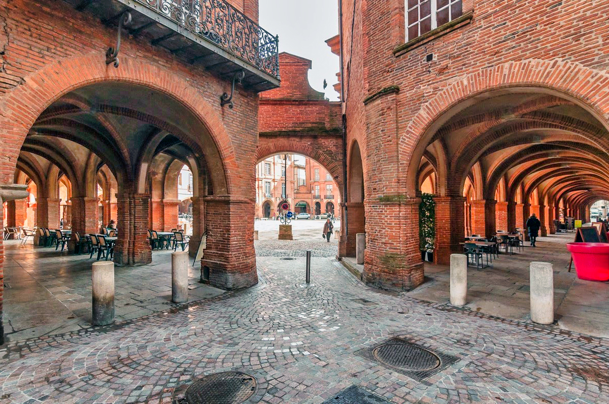
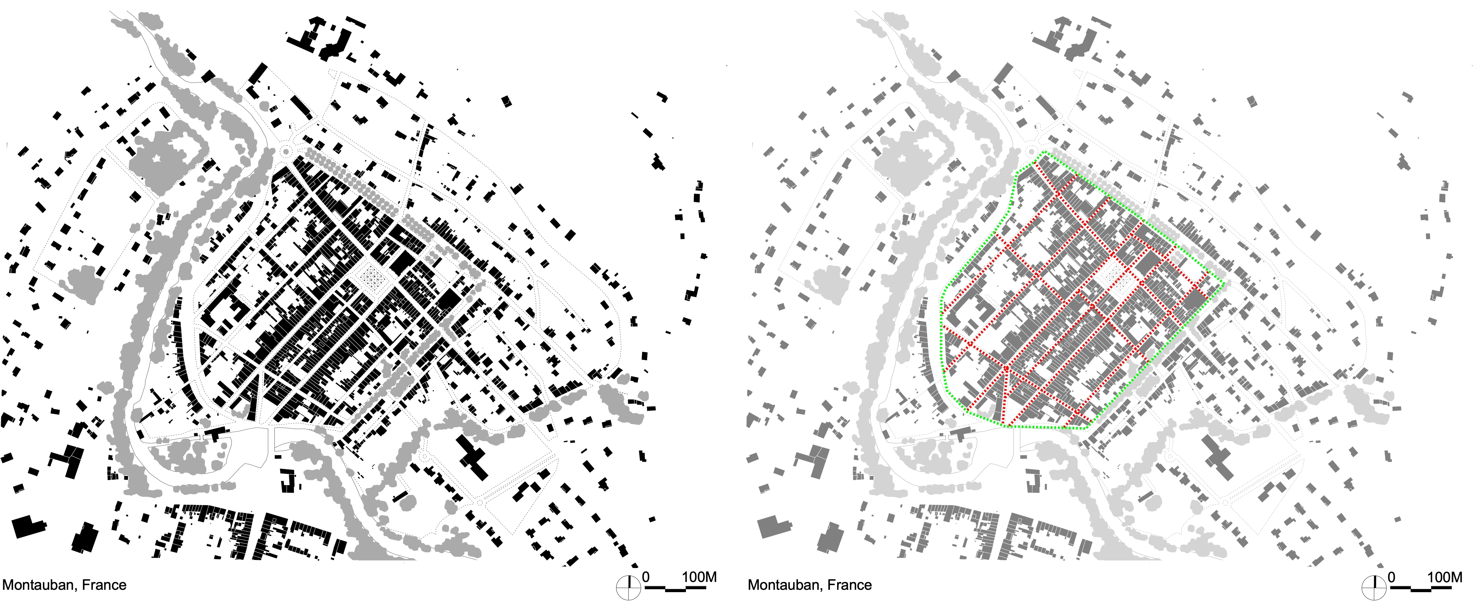
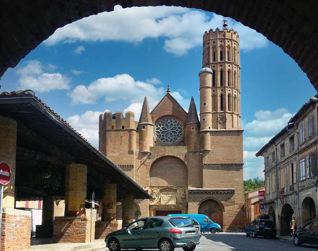
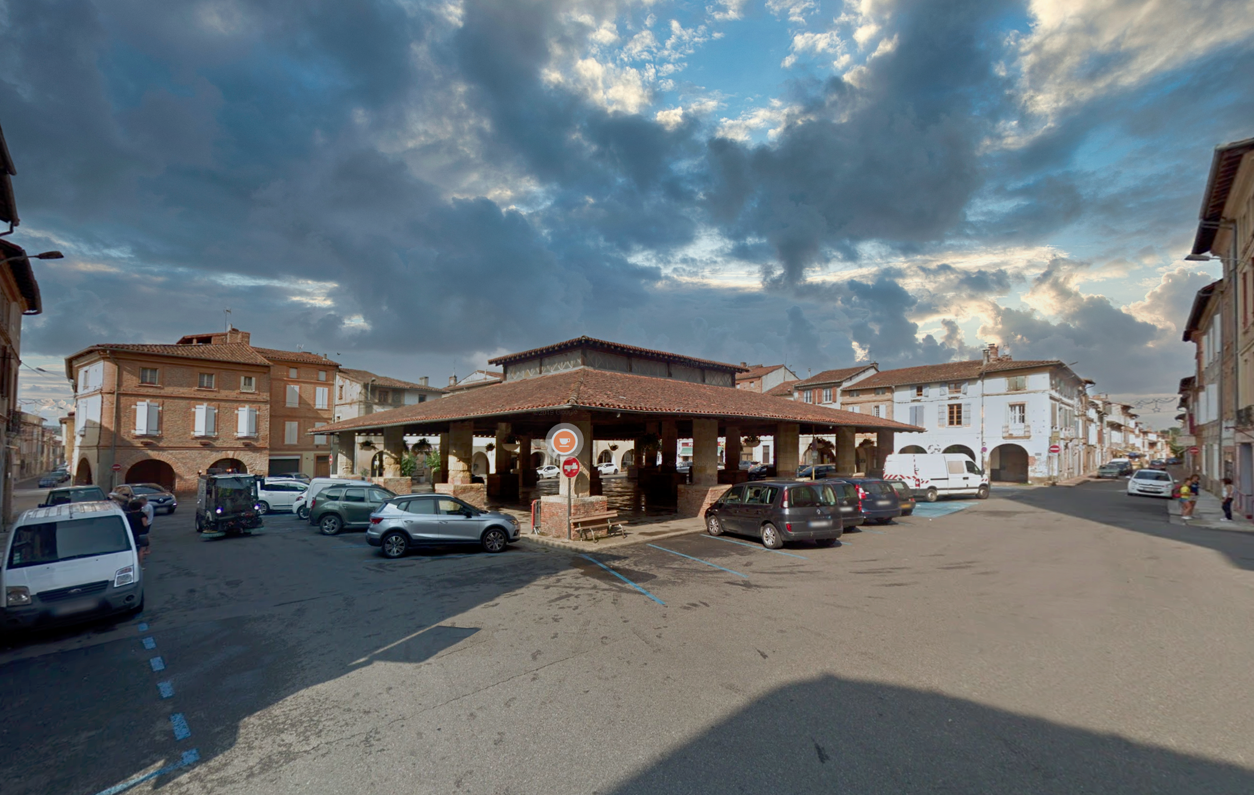
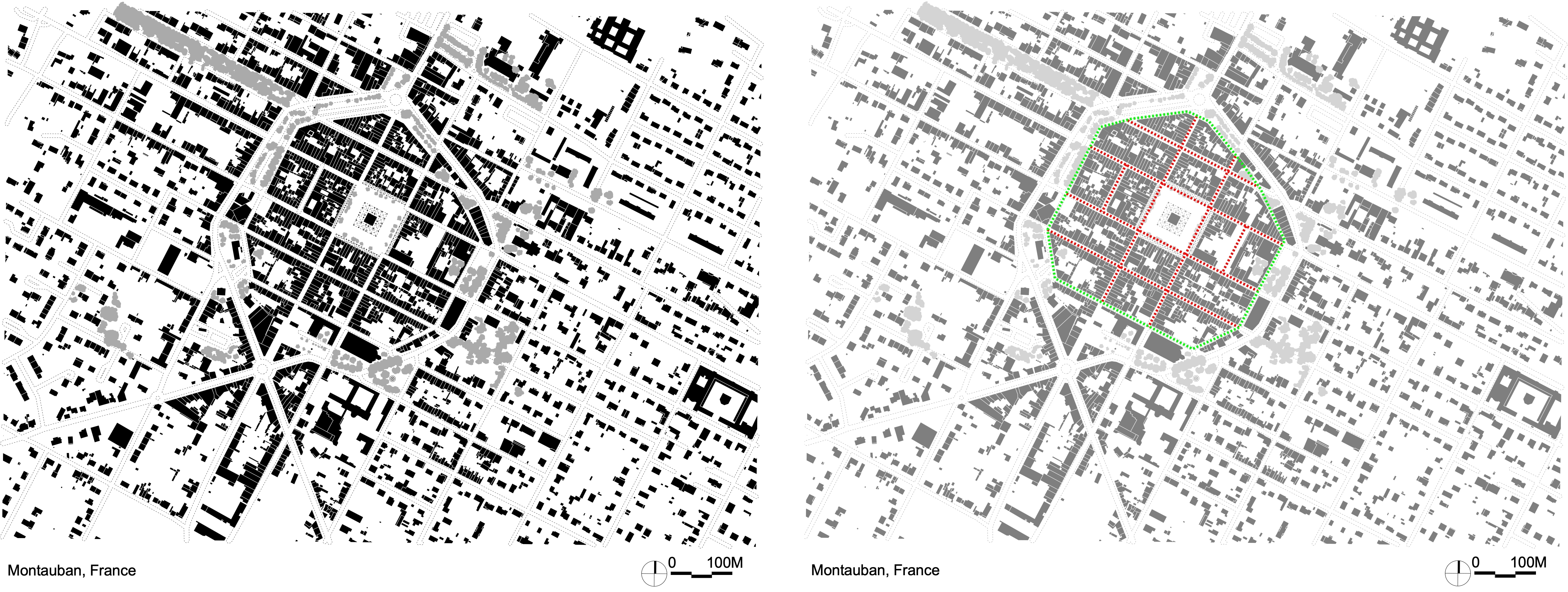
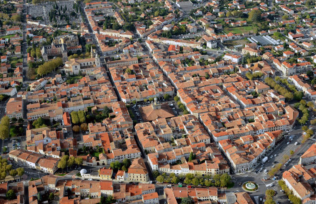
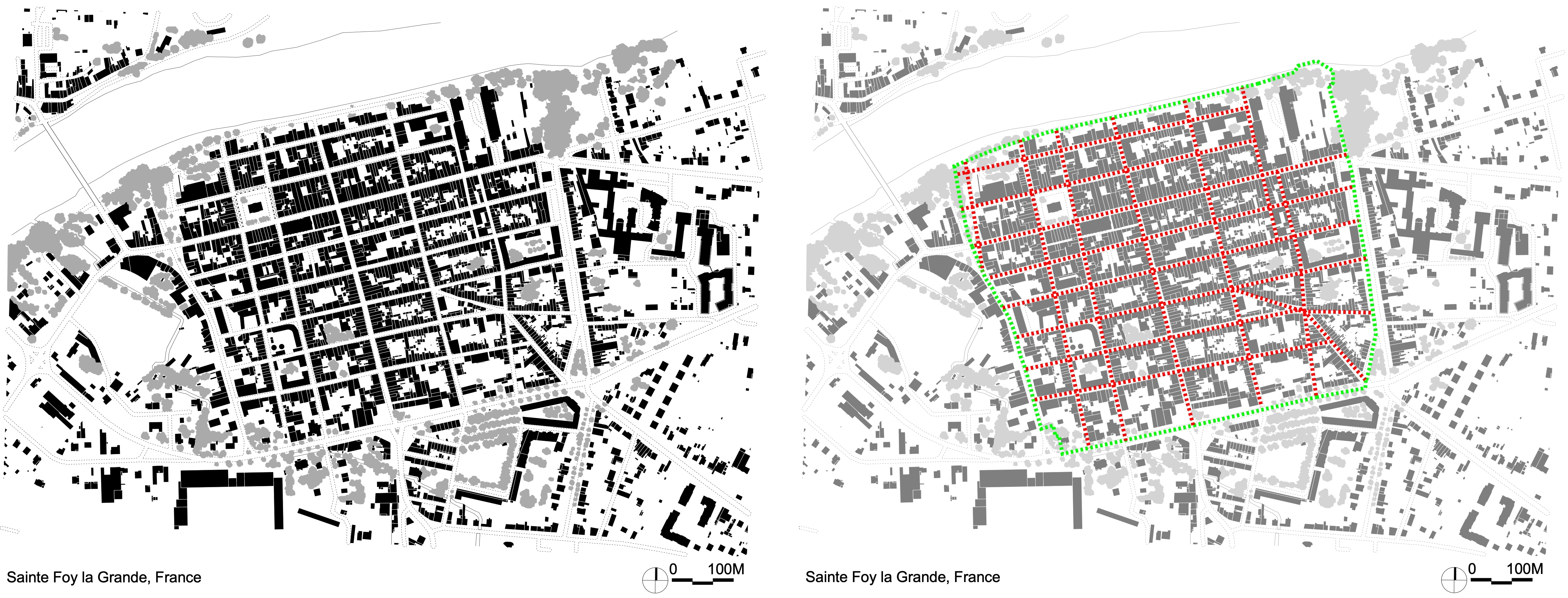
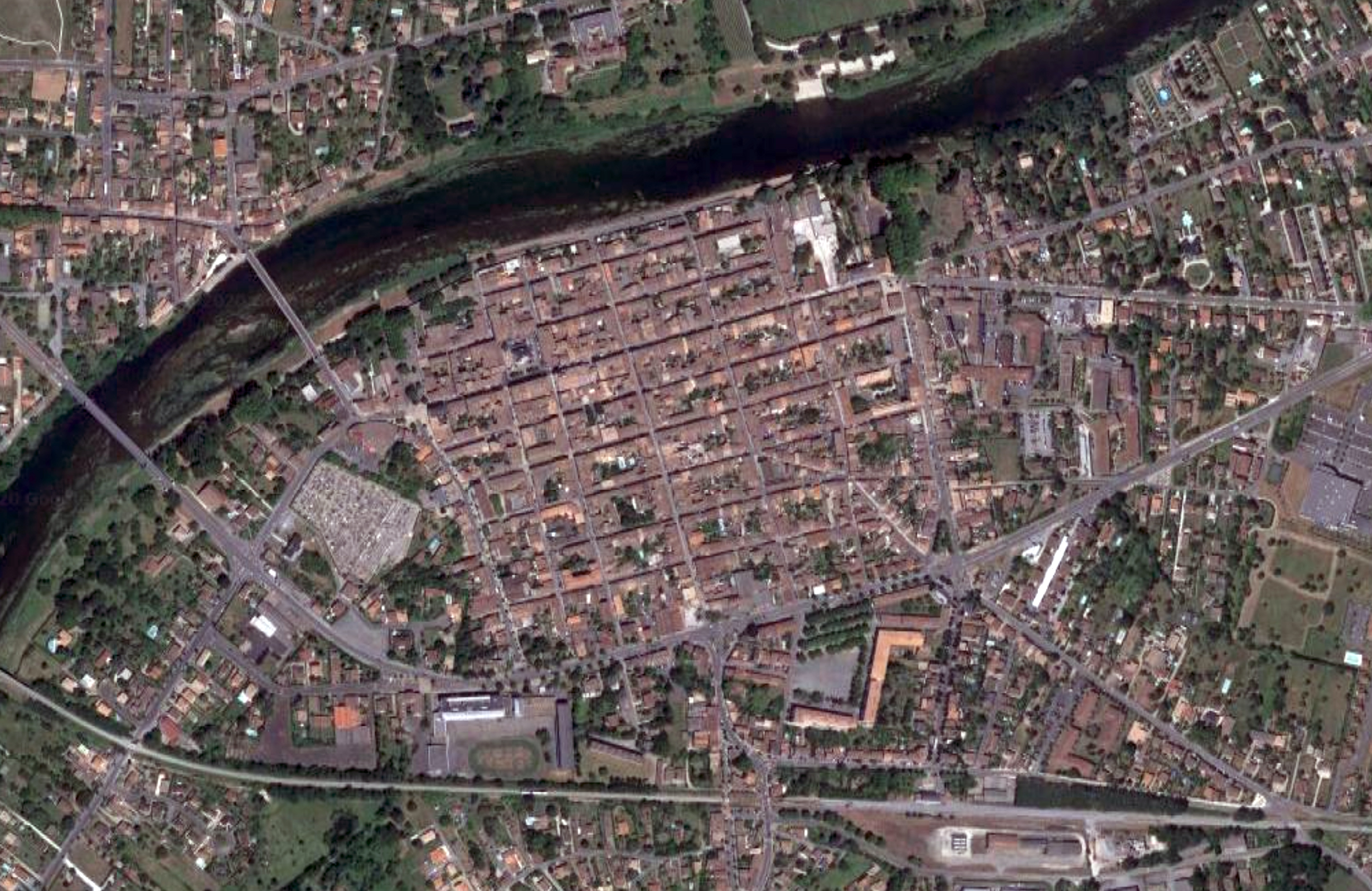
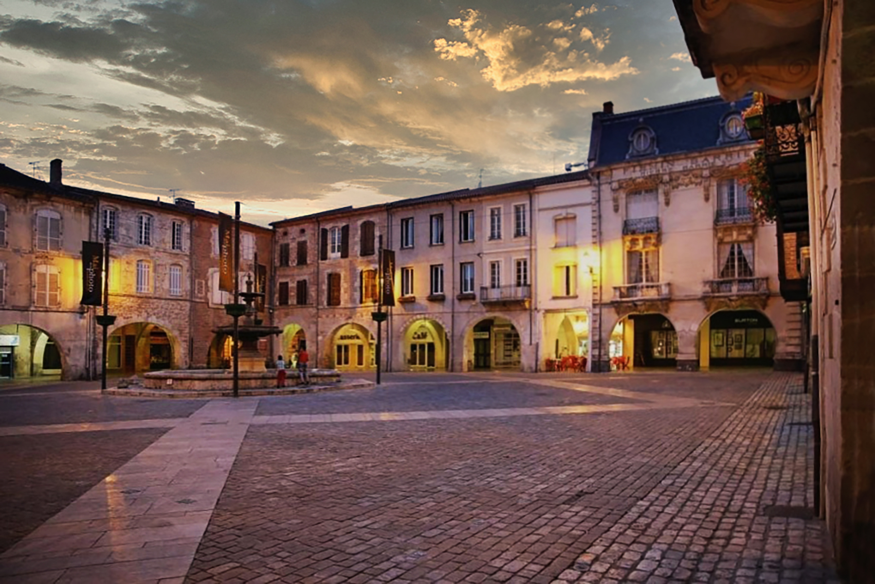
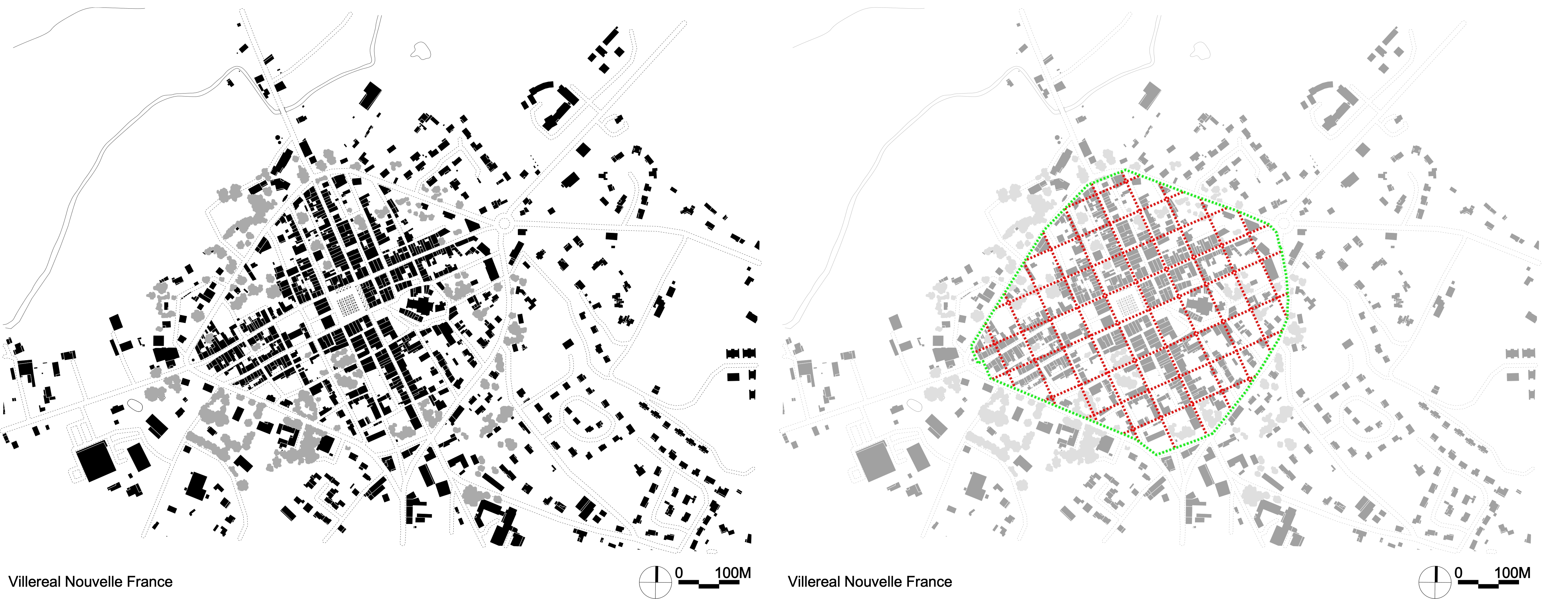
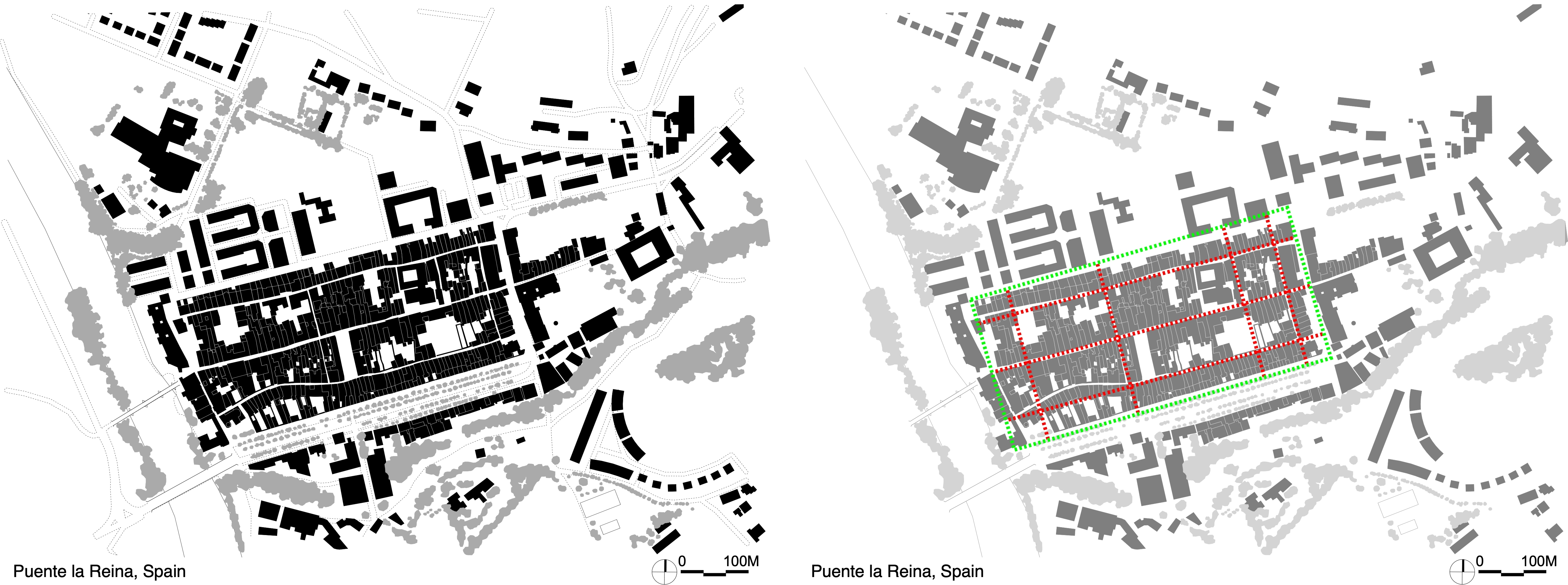
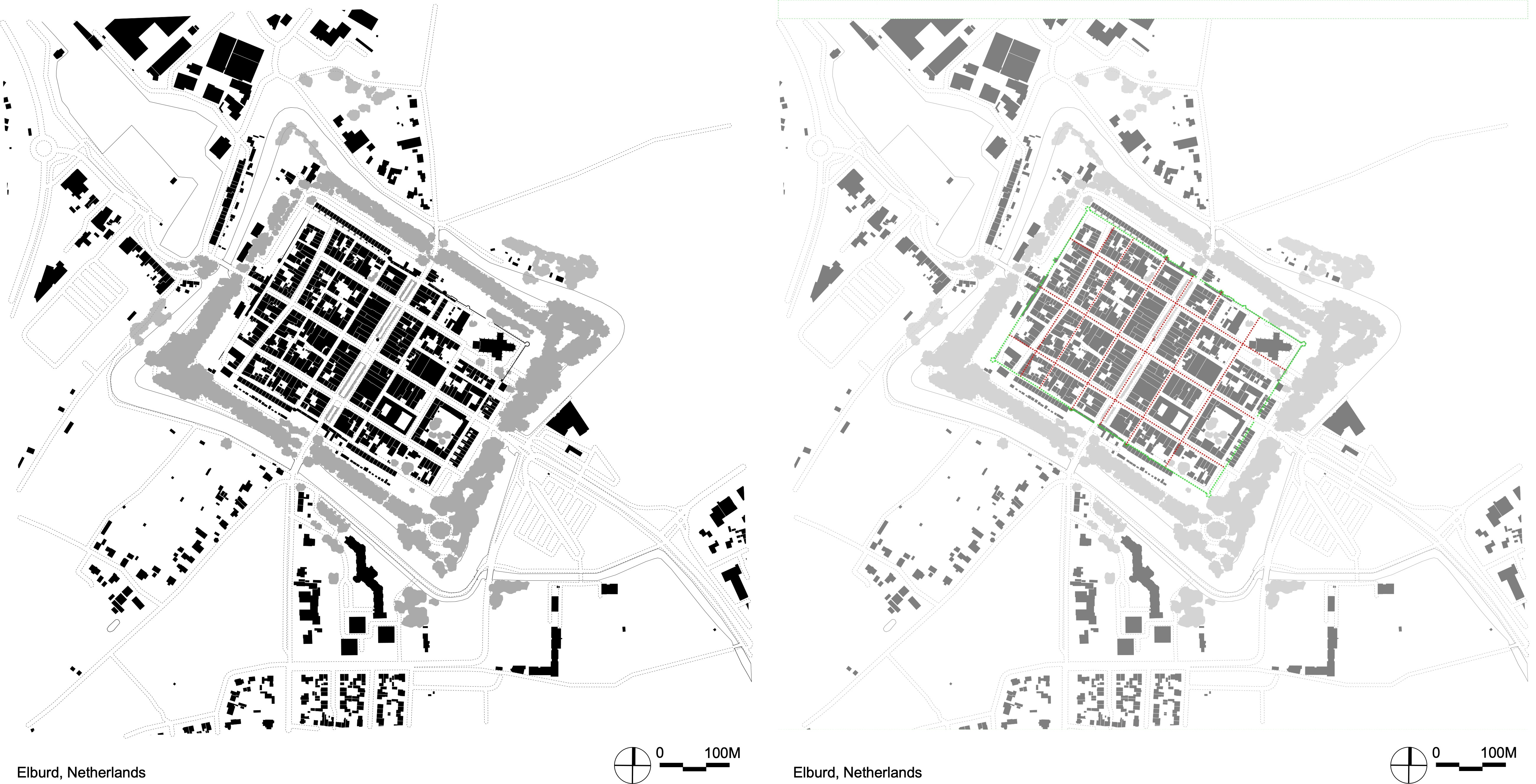
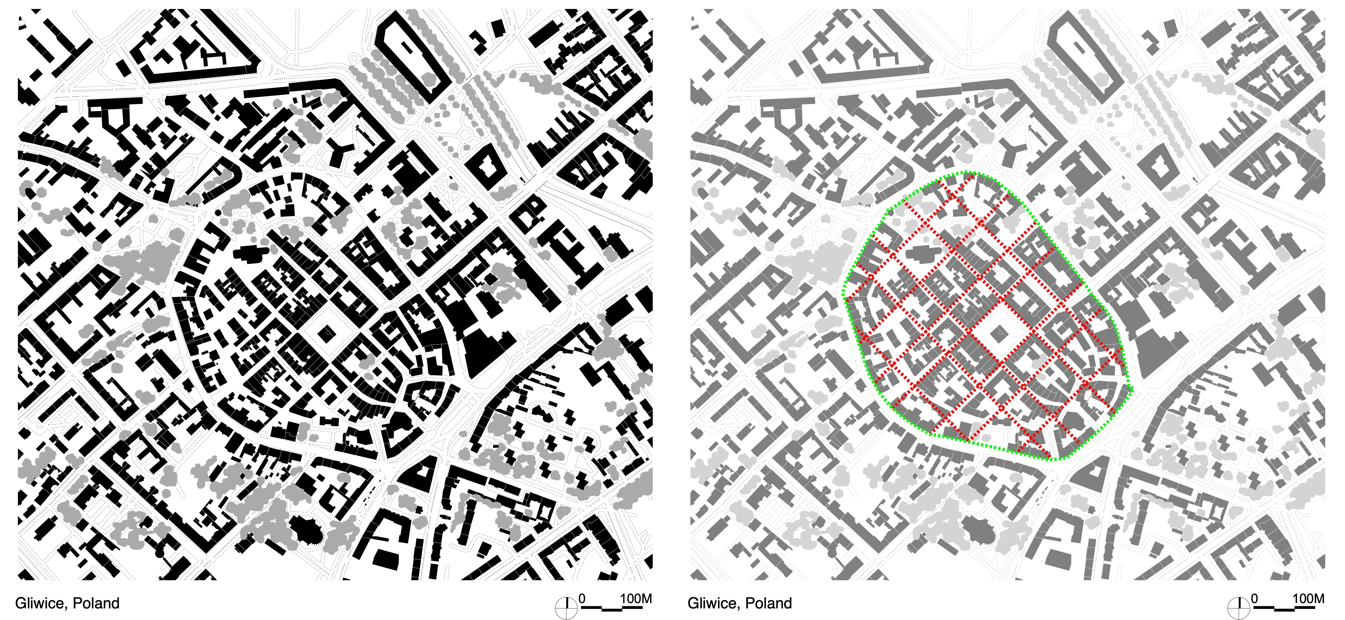
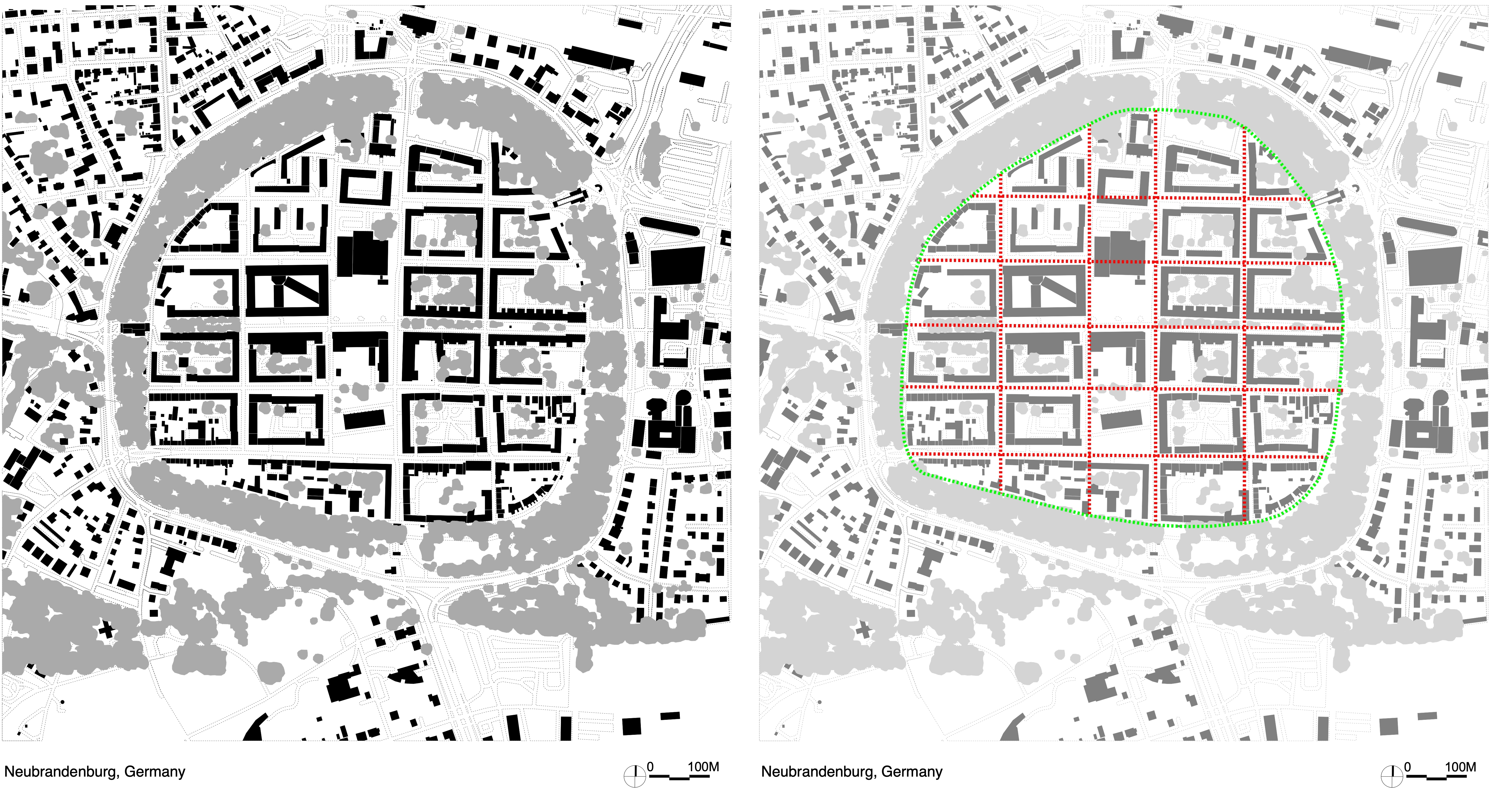
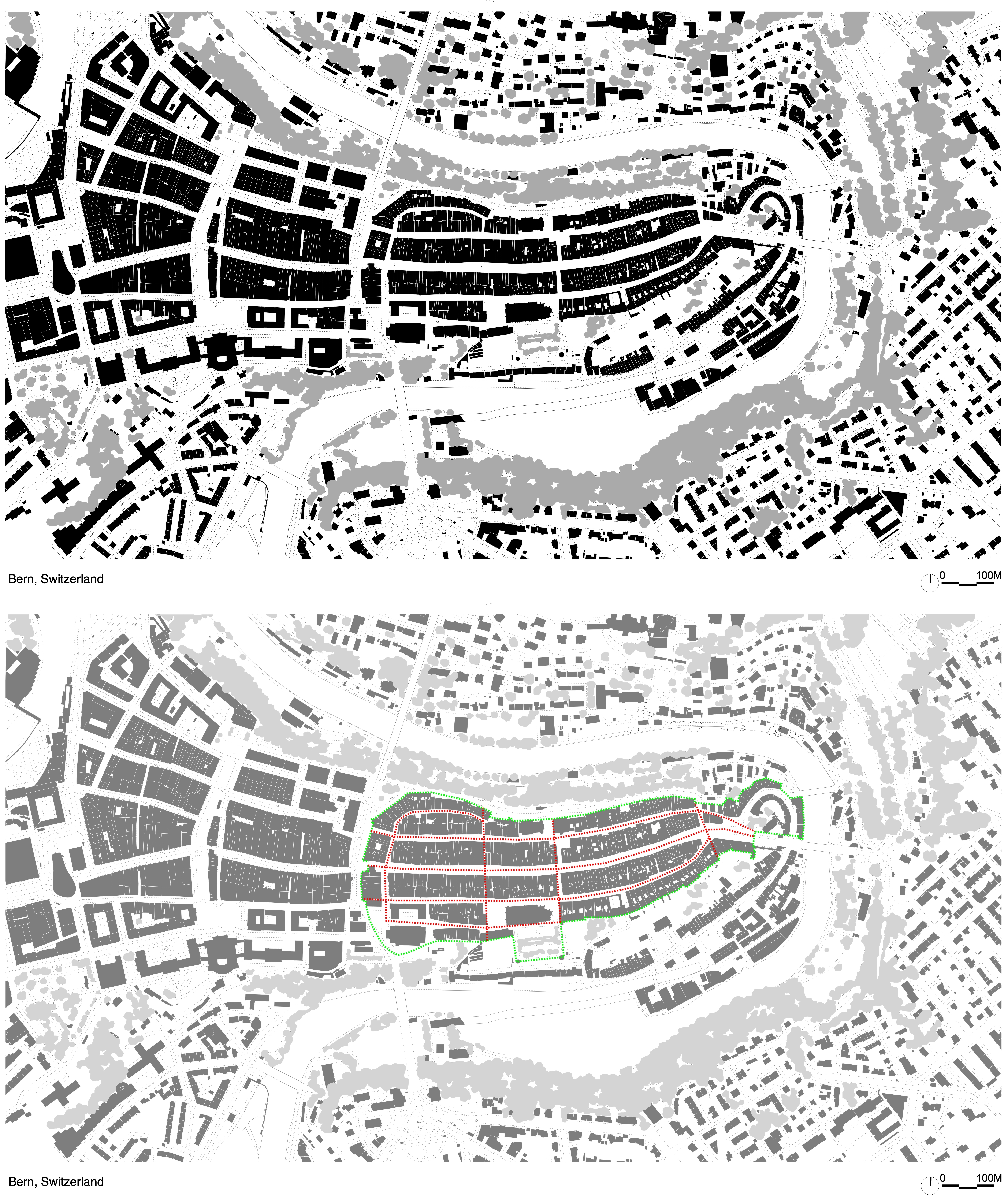
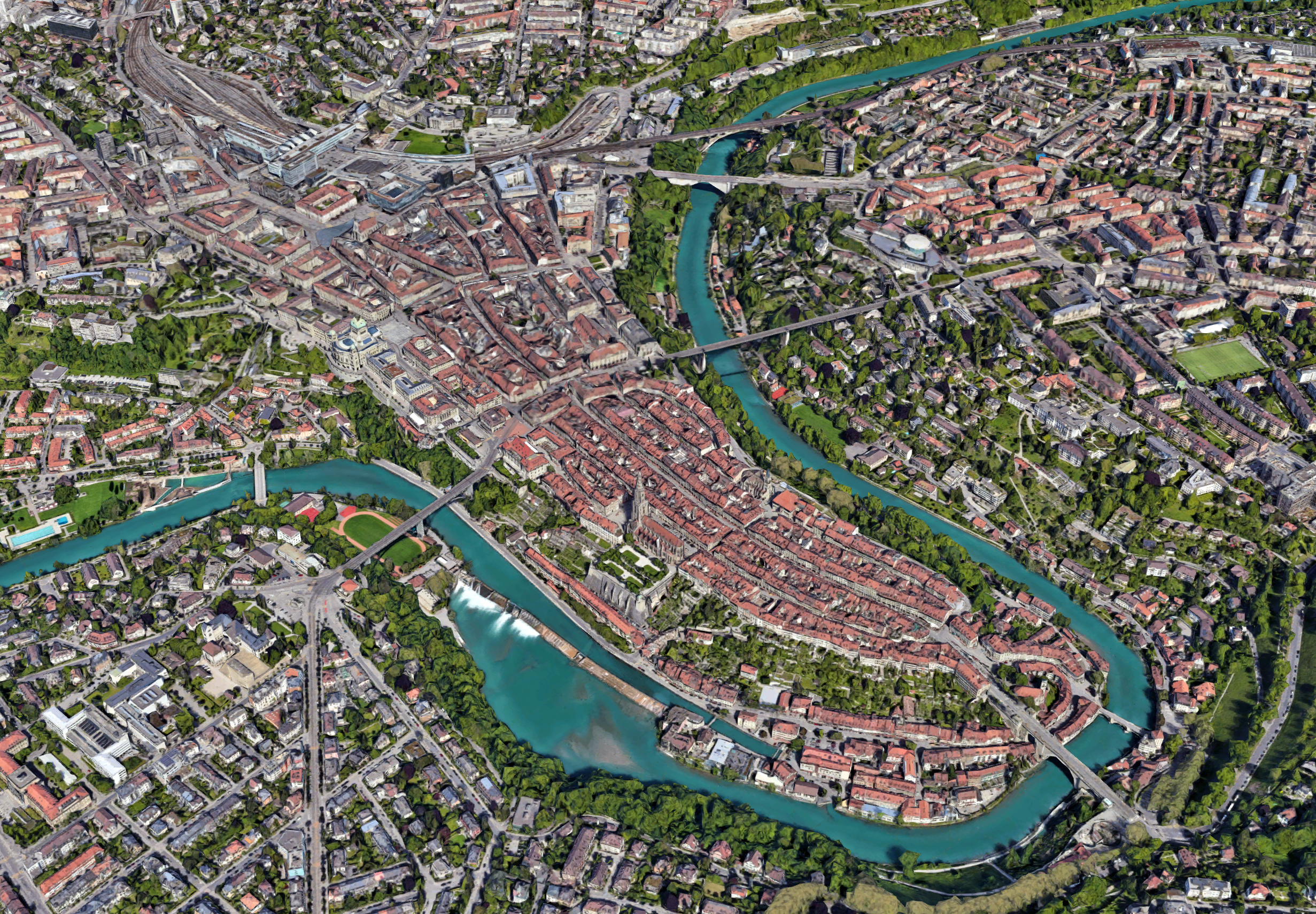
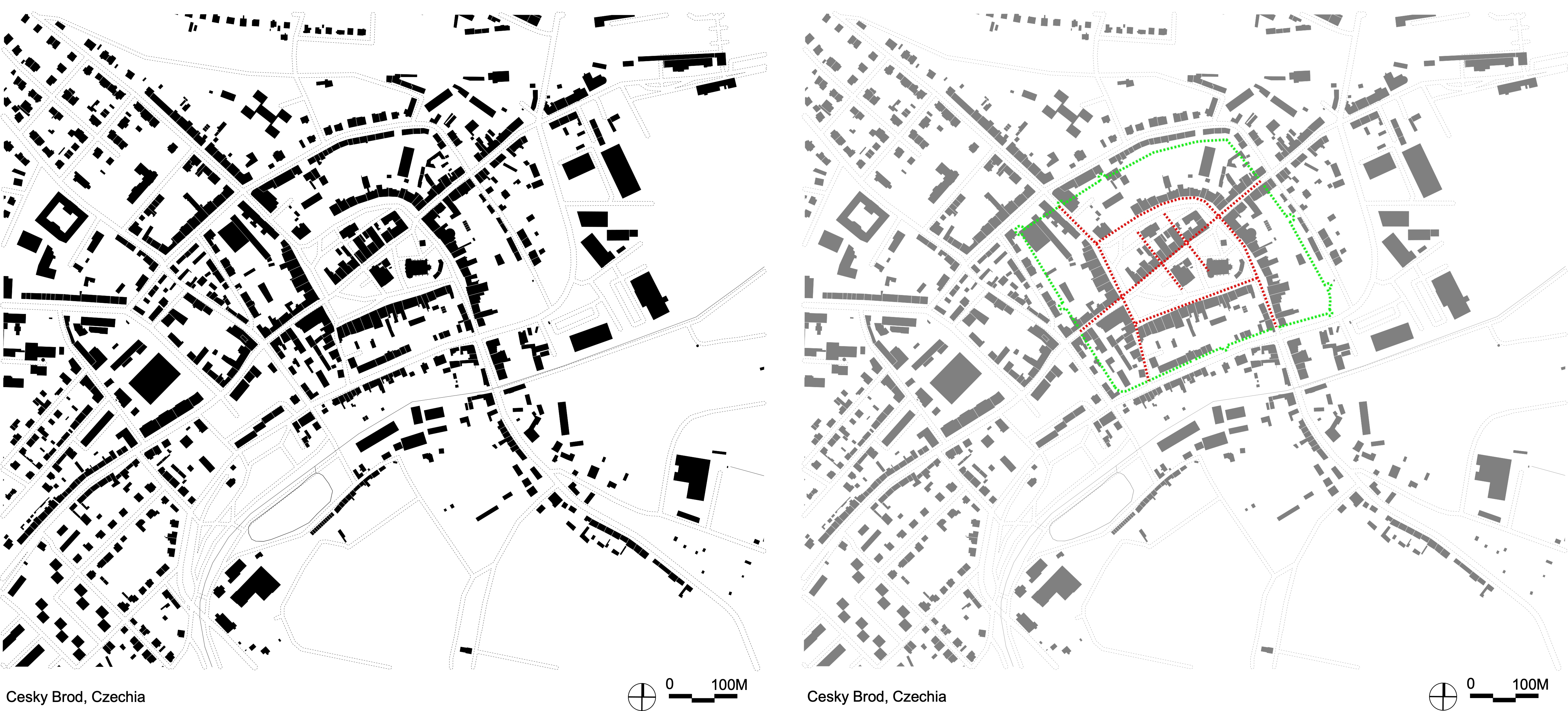
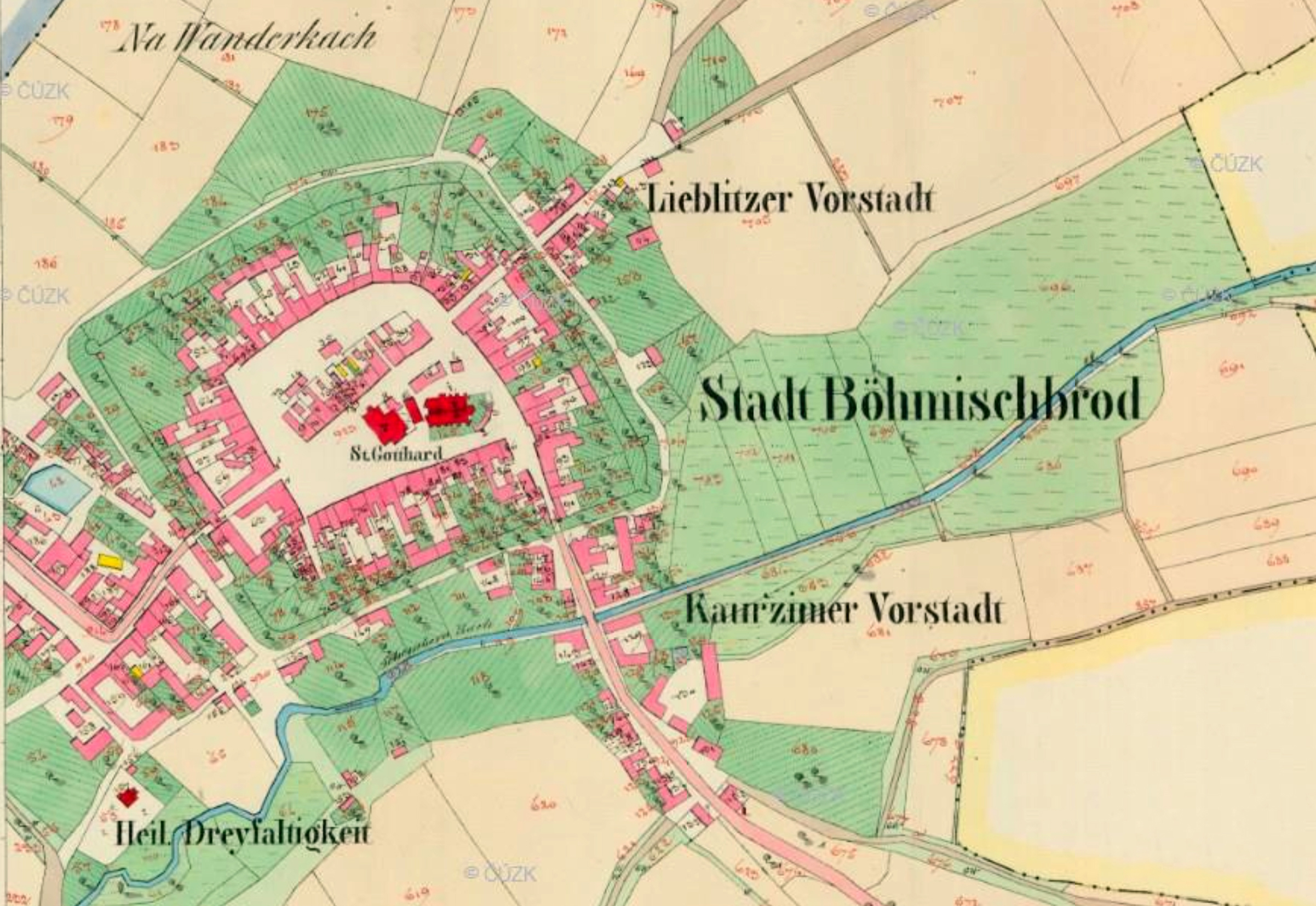
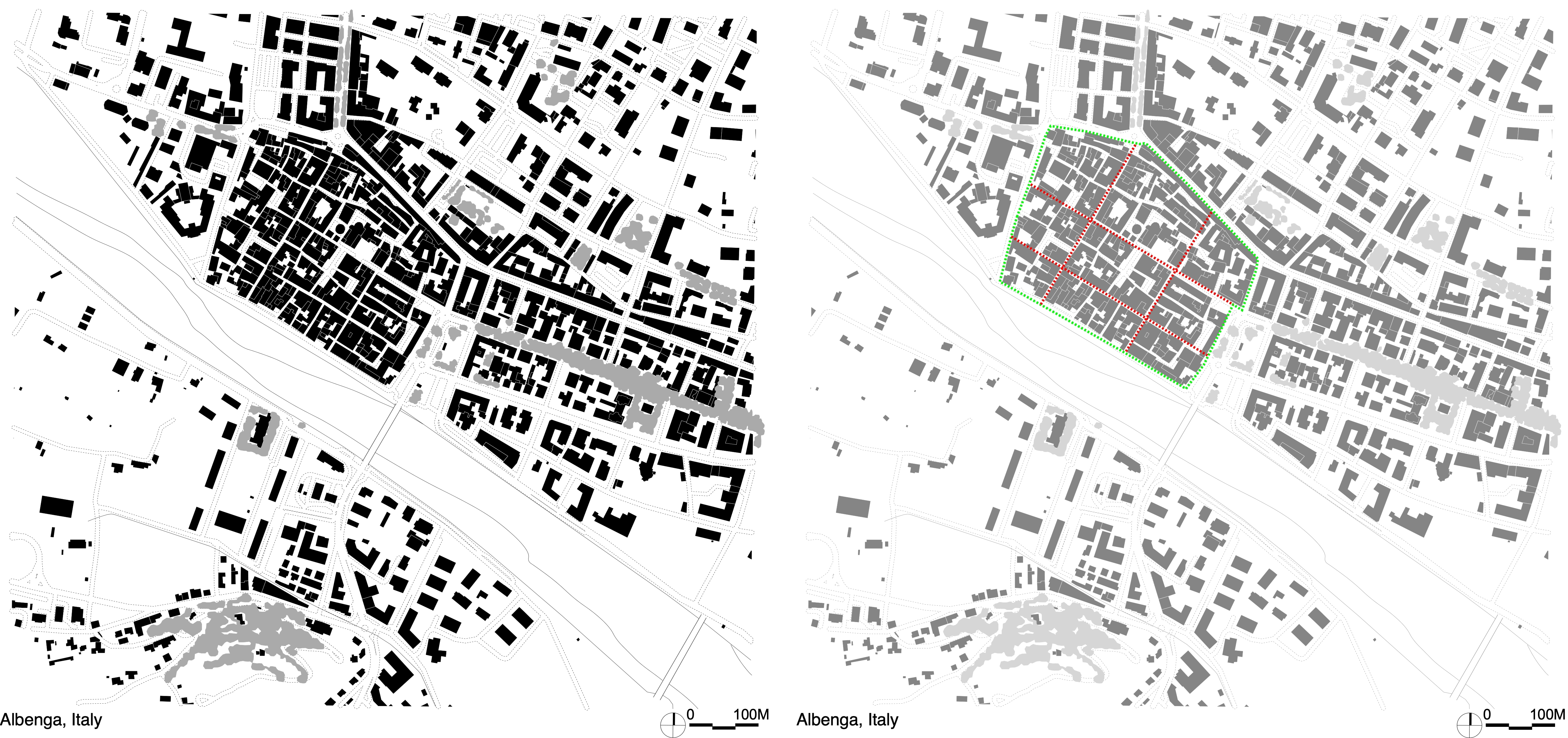
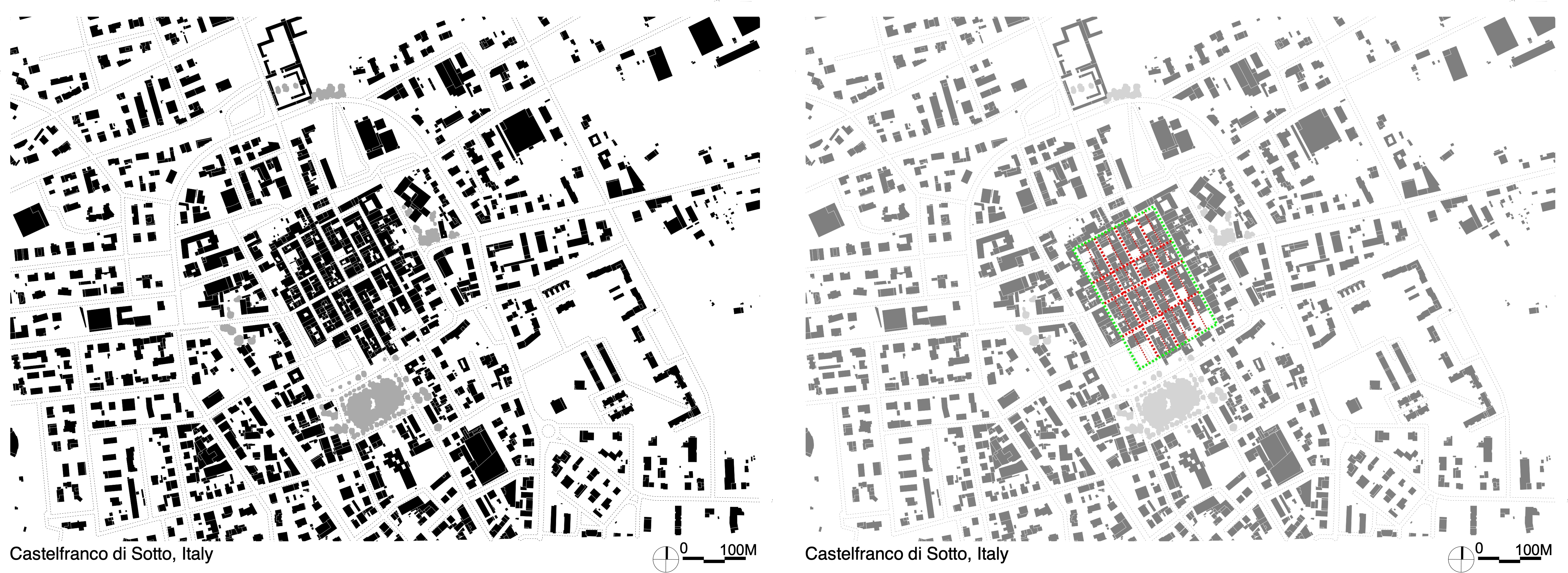
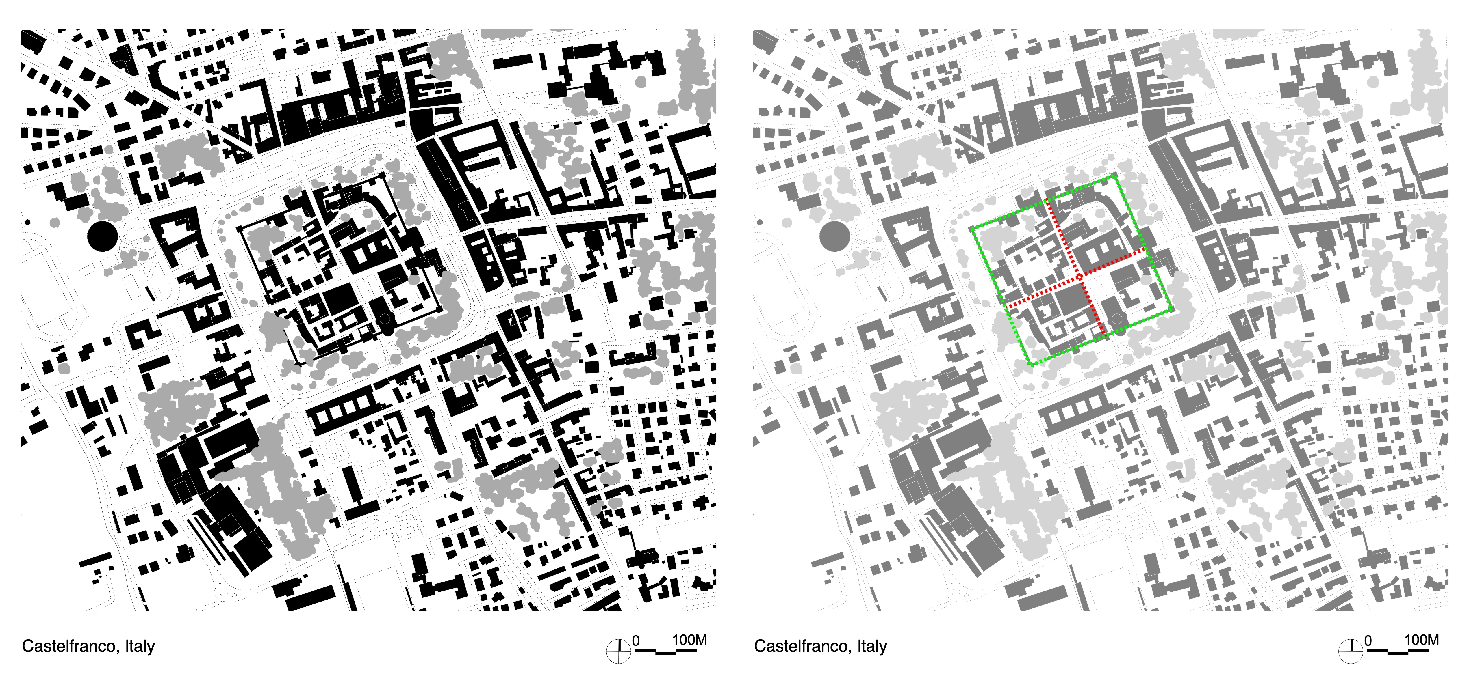
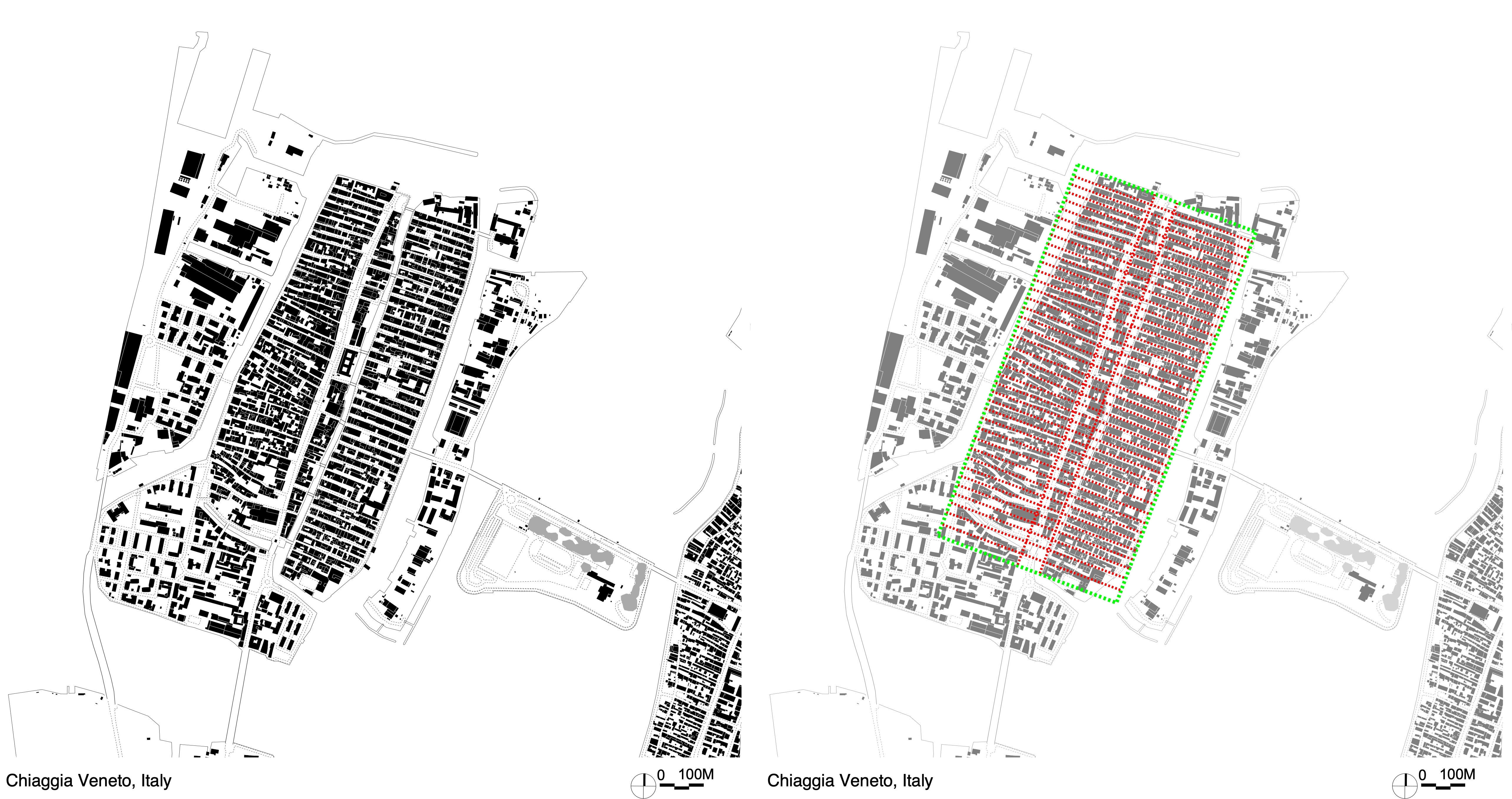
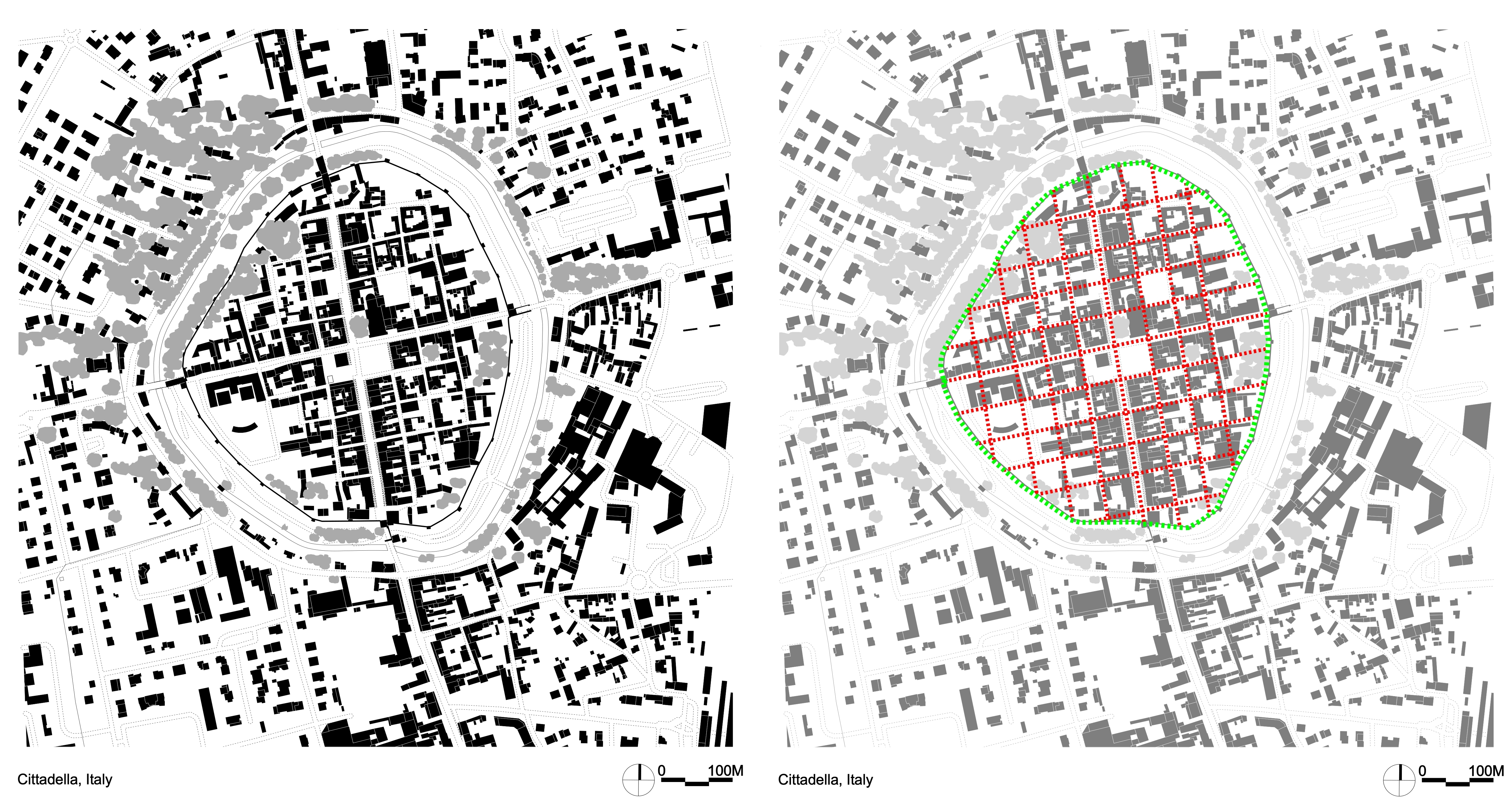
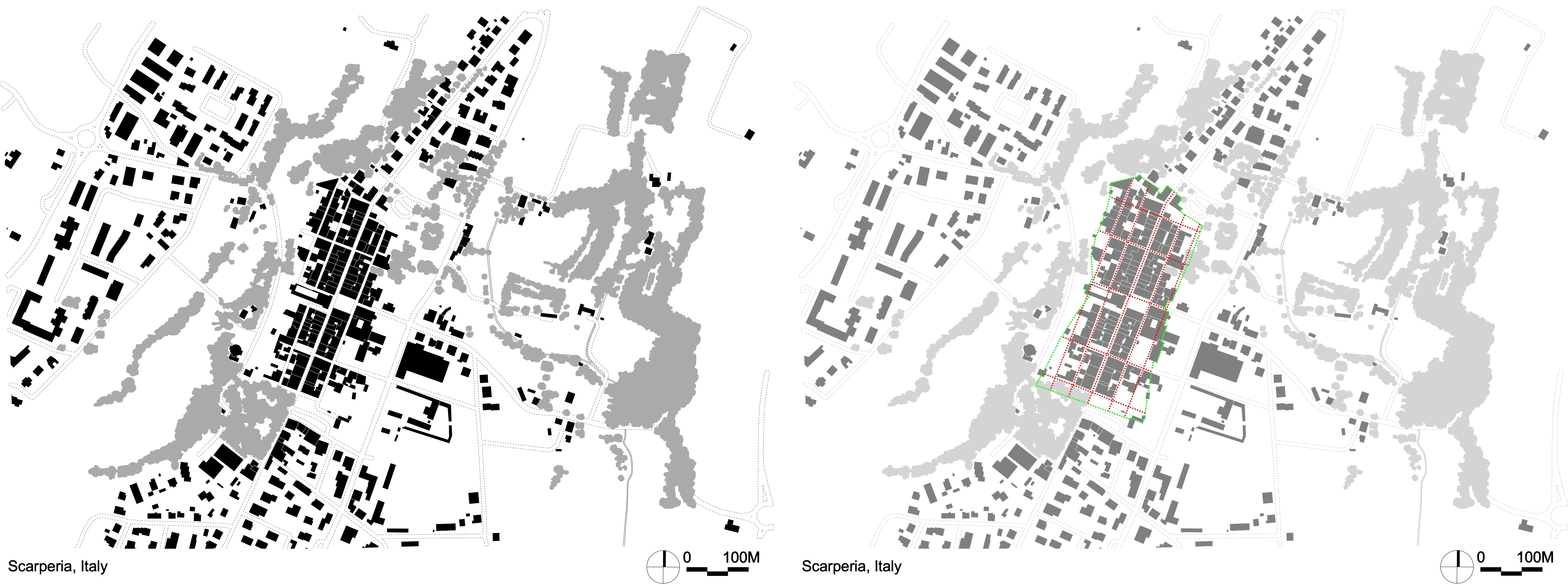
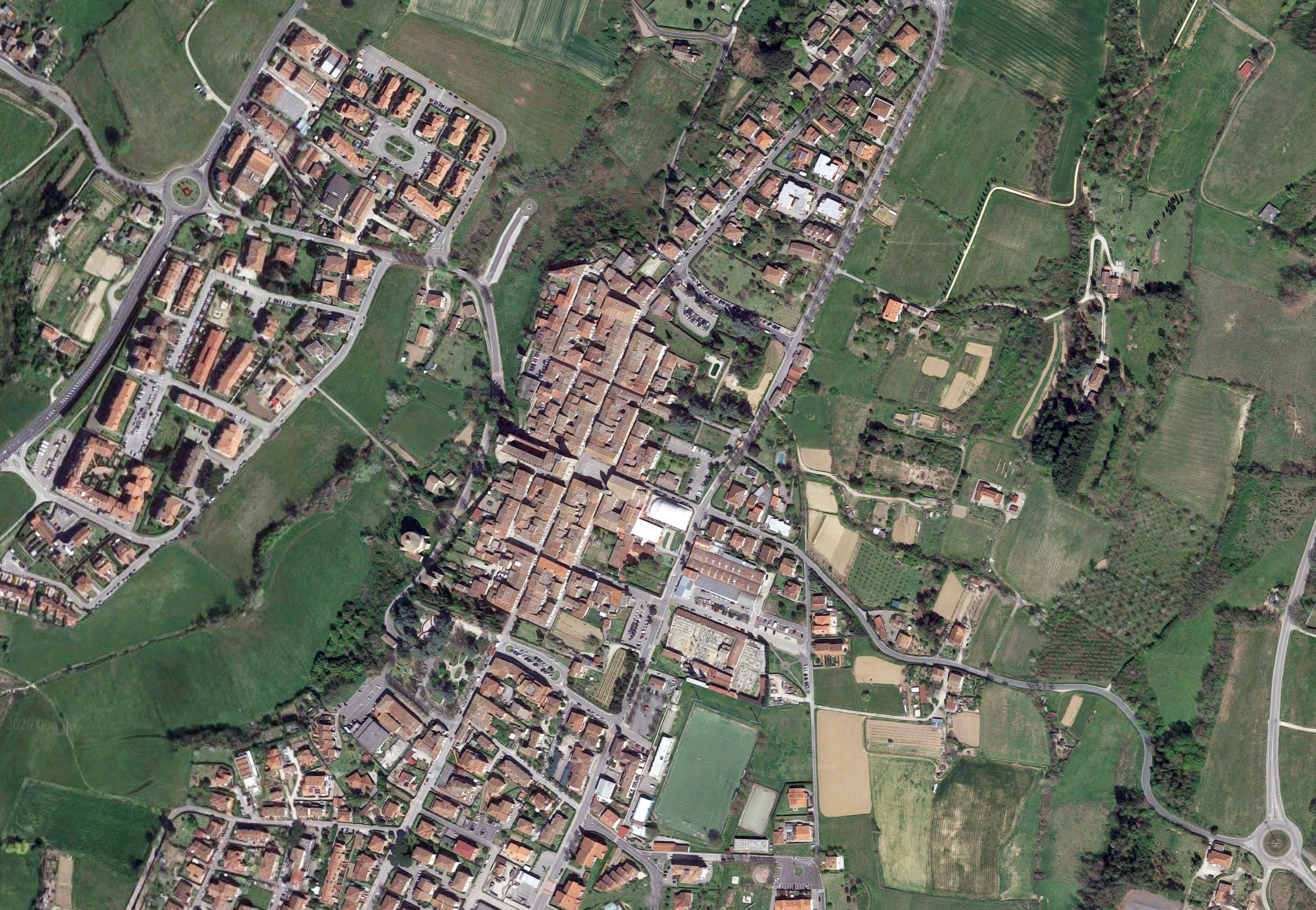
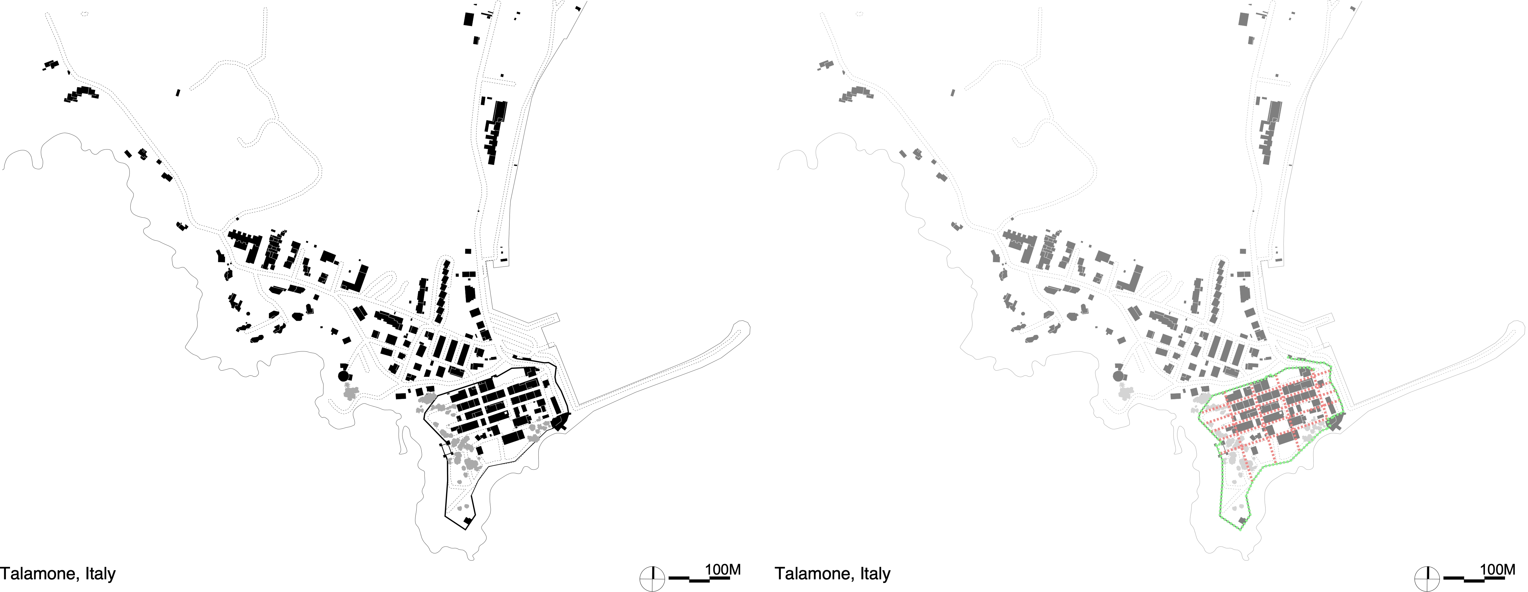
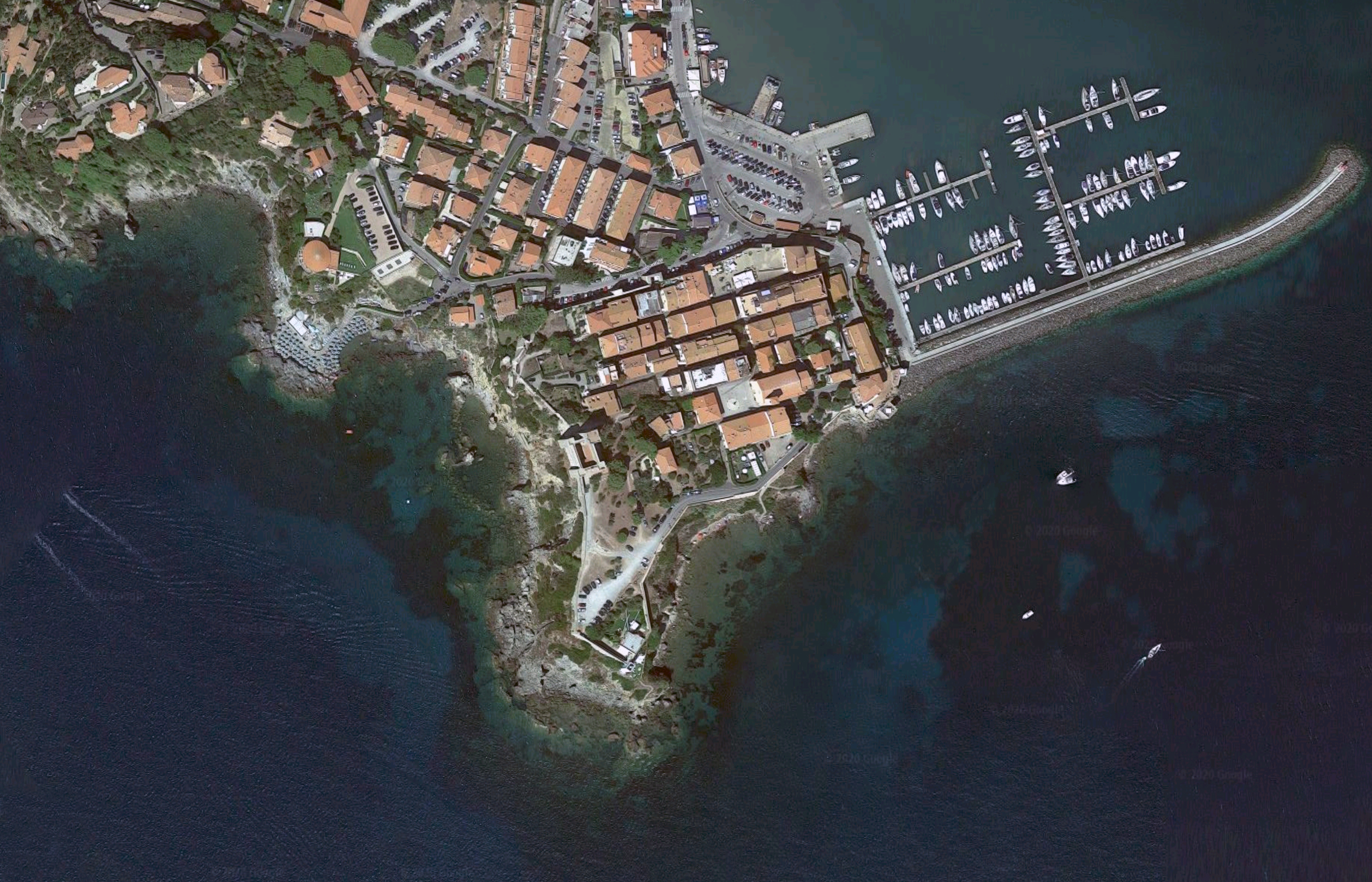
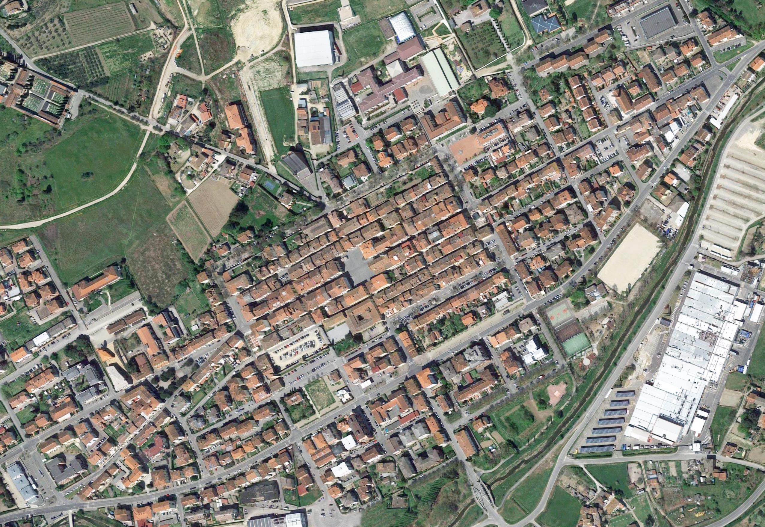
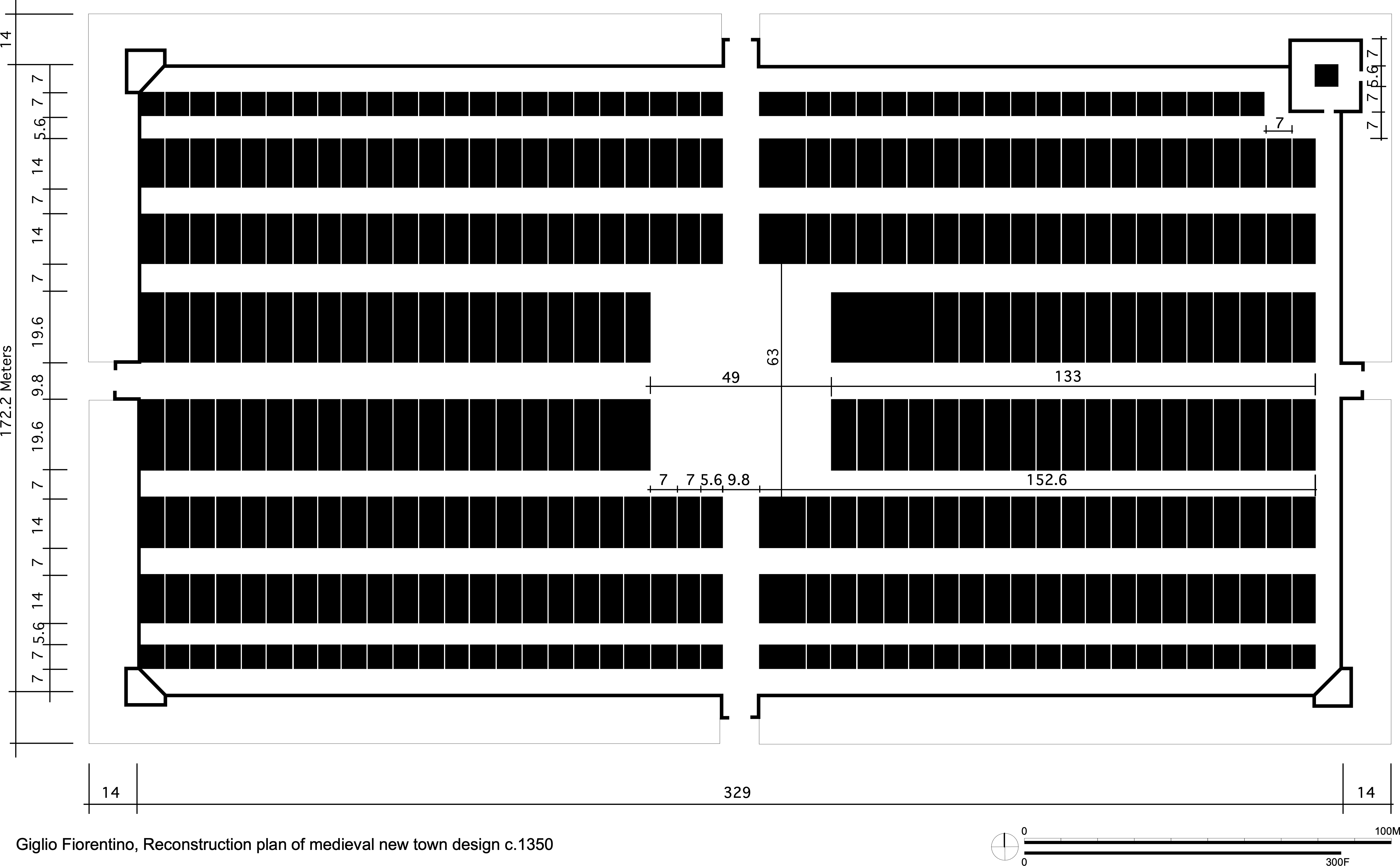
The following are a series of figure ground drawings illustrating plans of medieval new towns throughout Europe. I do not plan to go into the political history of the area, or why the cities were actually created. I’ll referyou to variousreadings if you’d like to do further research into the subject. What I will do, after I illustrate all the plans I’ve drawn, is to discuss some of the various repetitive conditions I’ve noticed during my research. I’m also supplying accompanying analysis, and possible earlier maps of the cities, along with some photos I’ve discovered that either show an aerial view of the urban center, or a photo of the major town square.
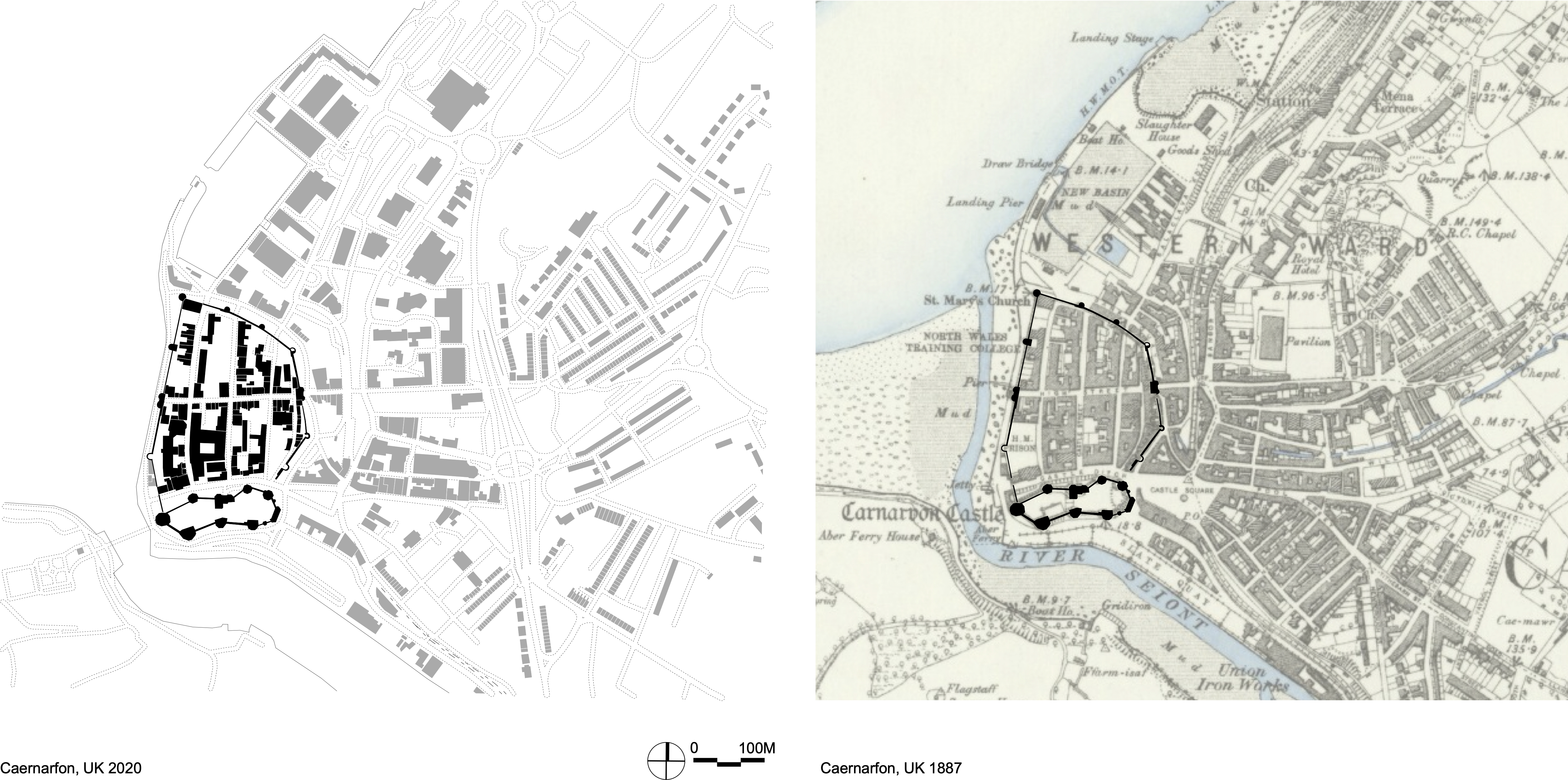
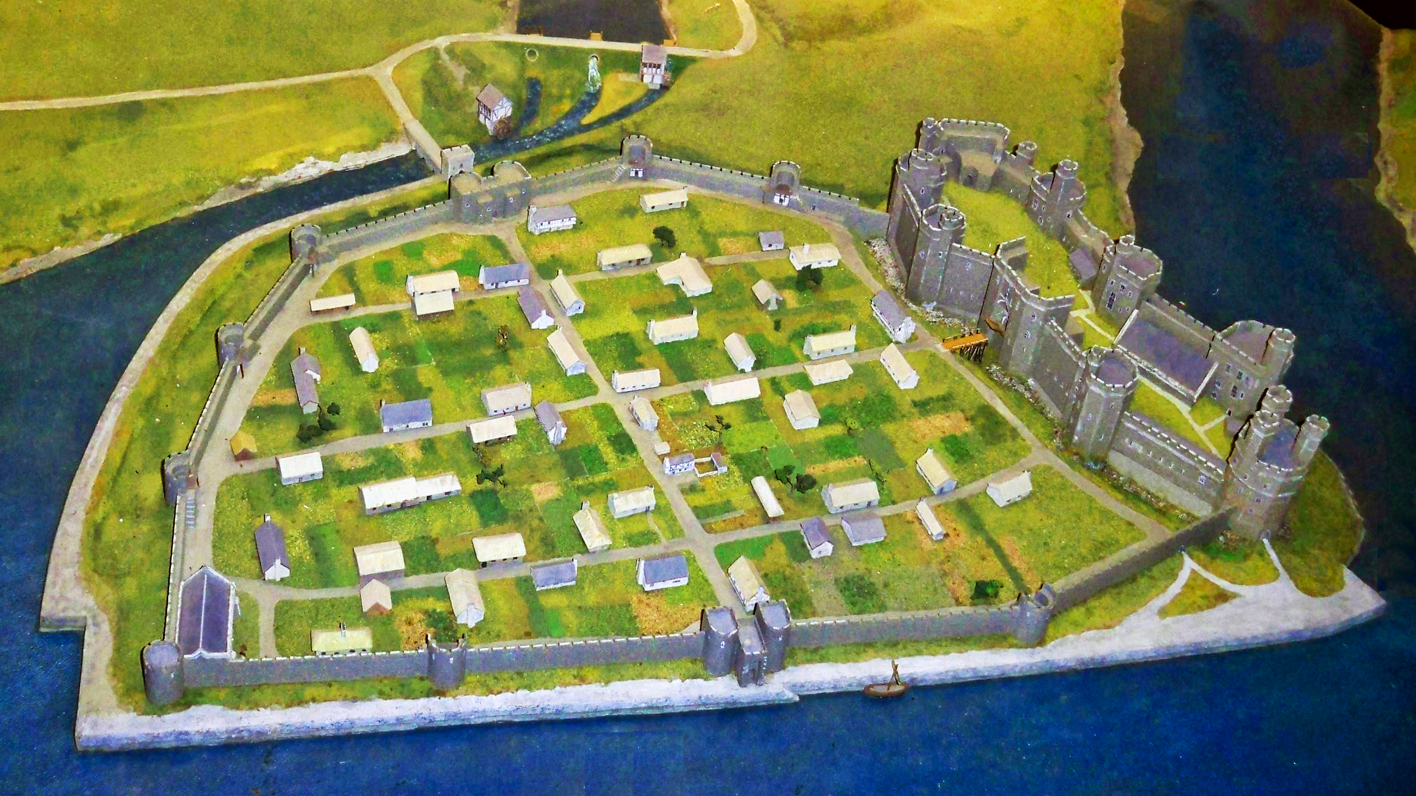
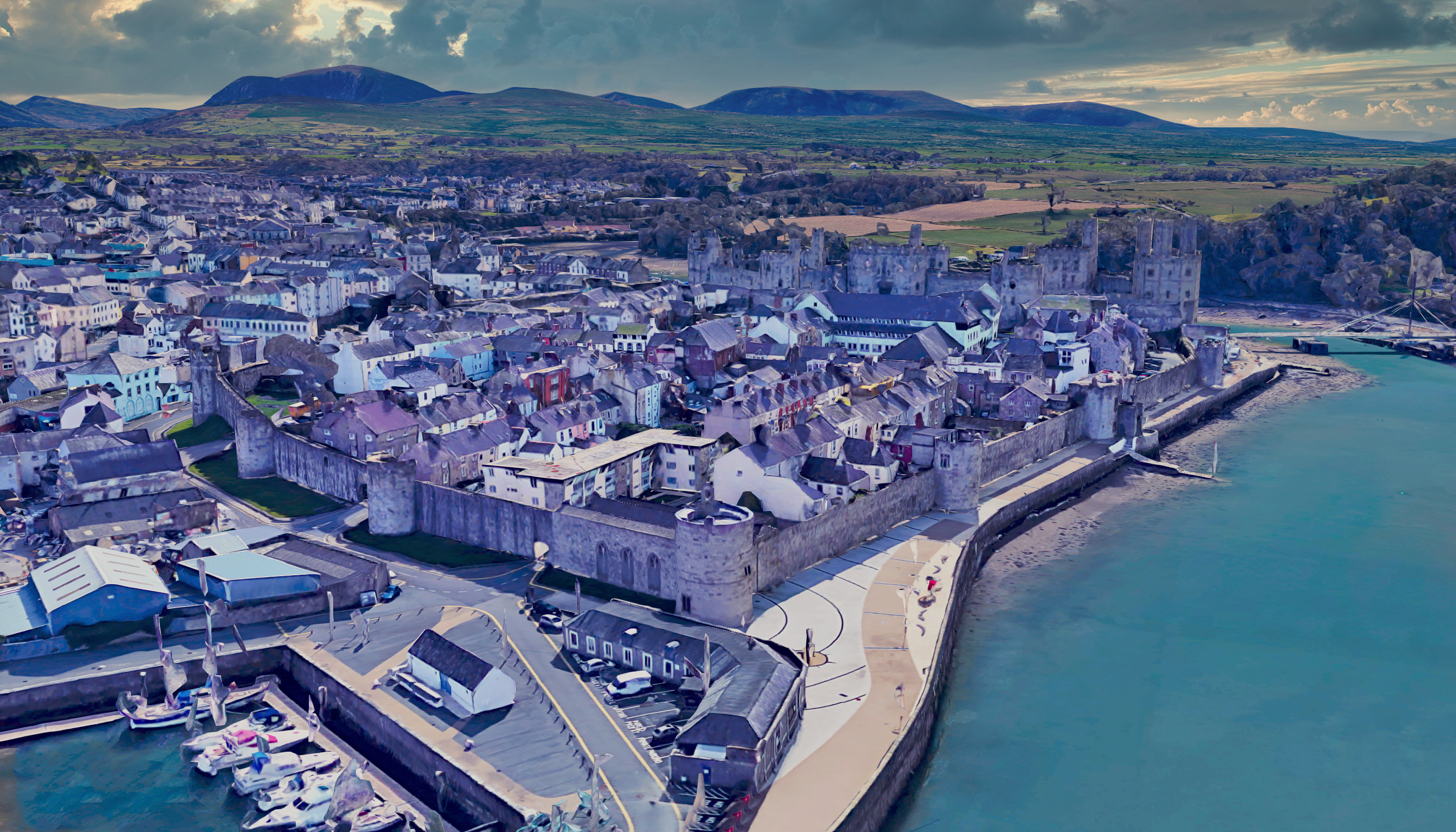
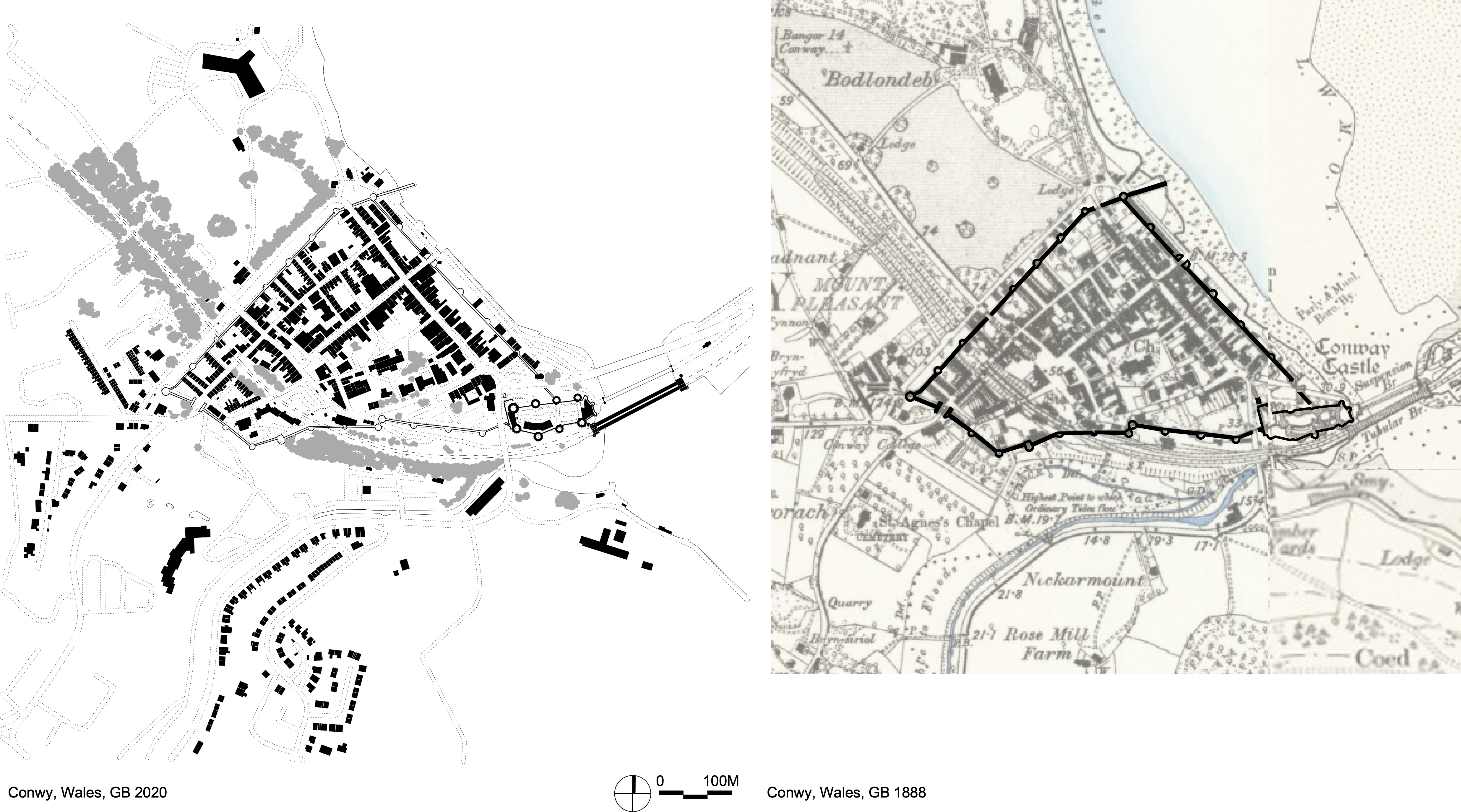
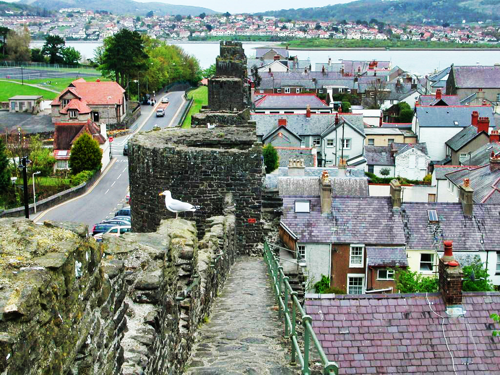
• British Medieval New Towns – Commonly Called Plantations (the towns shown below are all located in Wales)
After 1277, and increasingly after 1283, Edward I embarked on a full-scale project of English settlement of Wales, creating new towns like Flint, Aberystwyth and Rhuddlan. Their new residents were settled by English migrants, with the local Welsh banned from living inside them, and many of these settlements were protected by extensive walls.
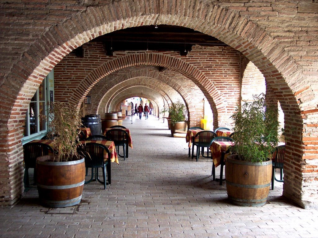
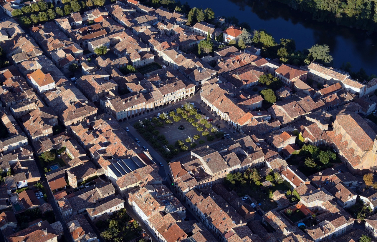
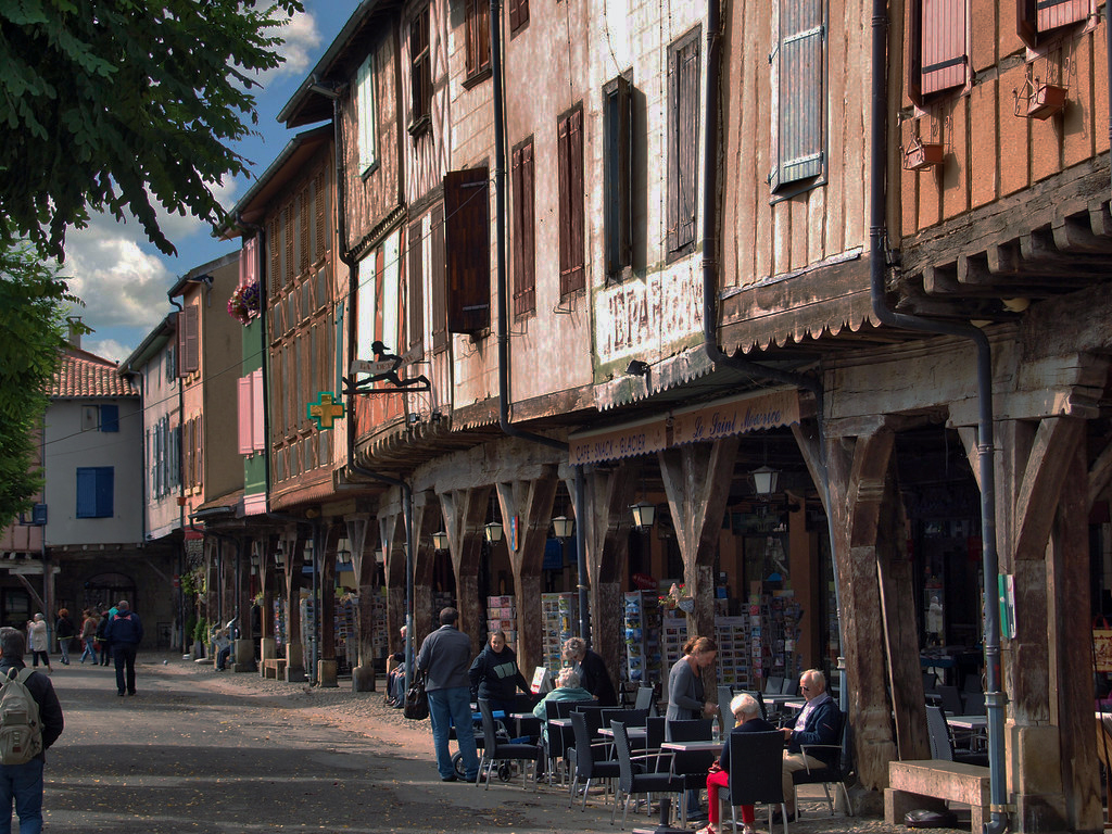
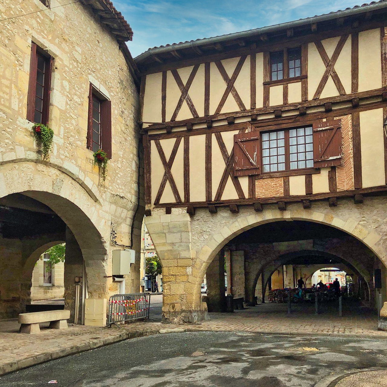
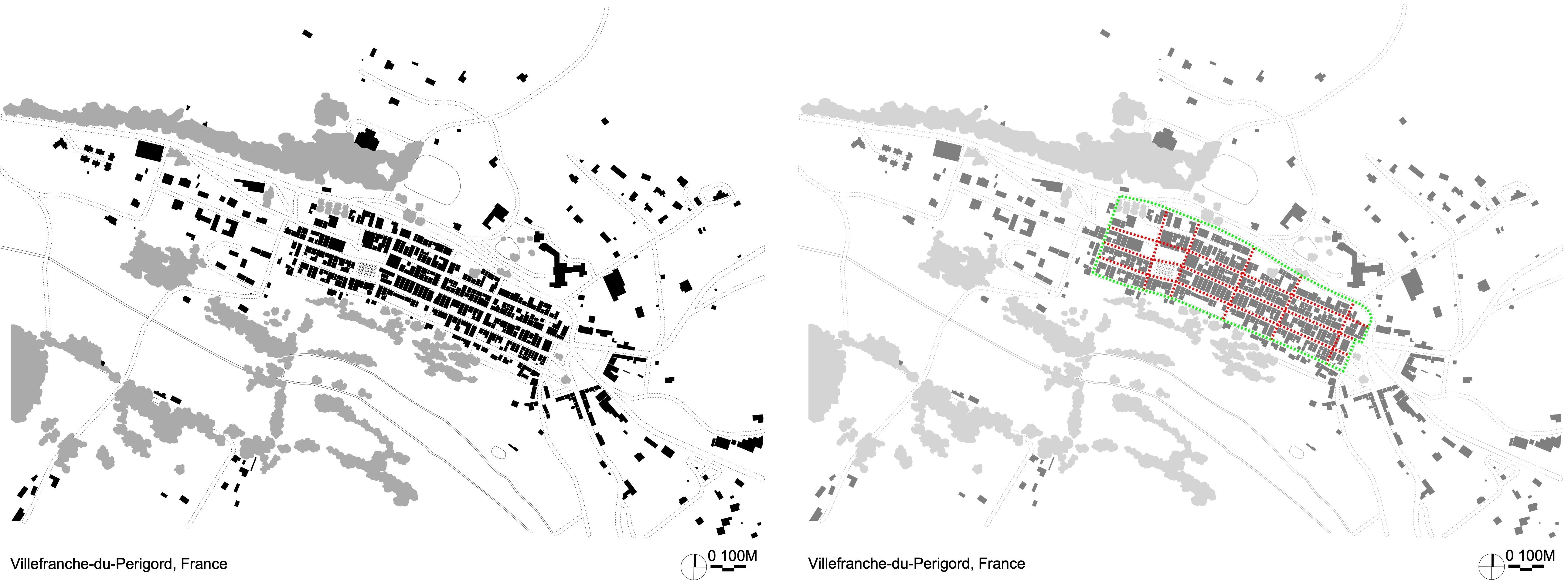
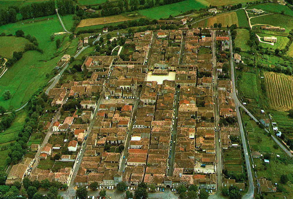
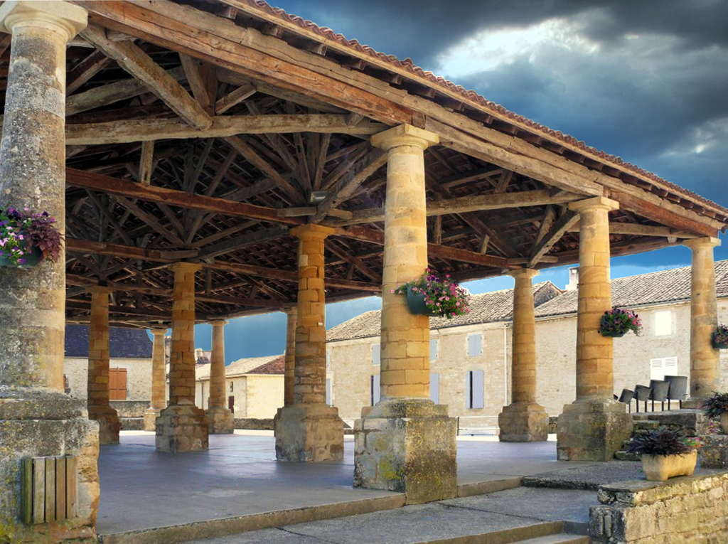
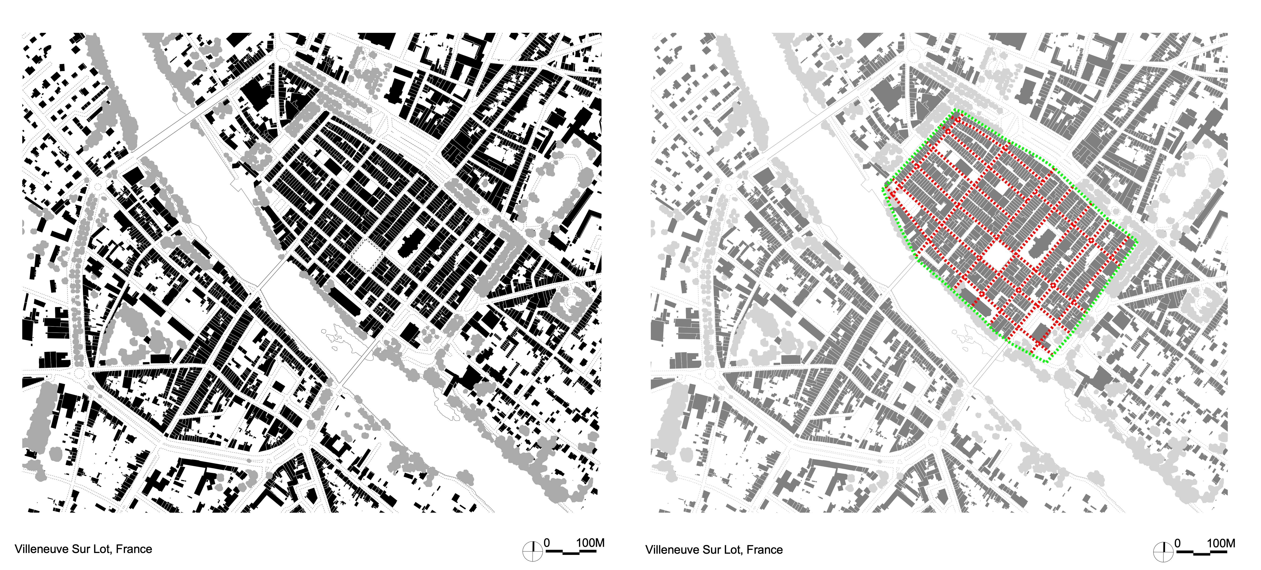
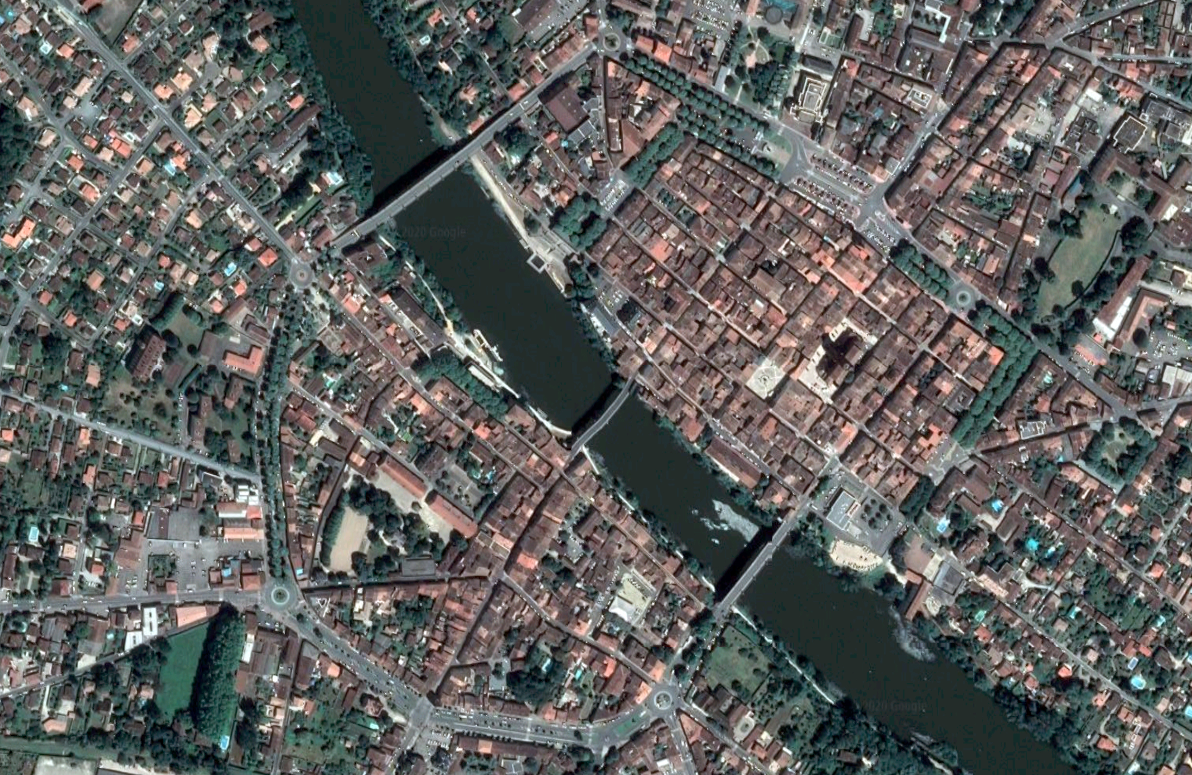
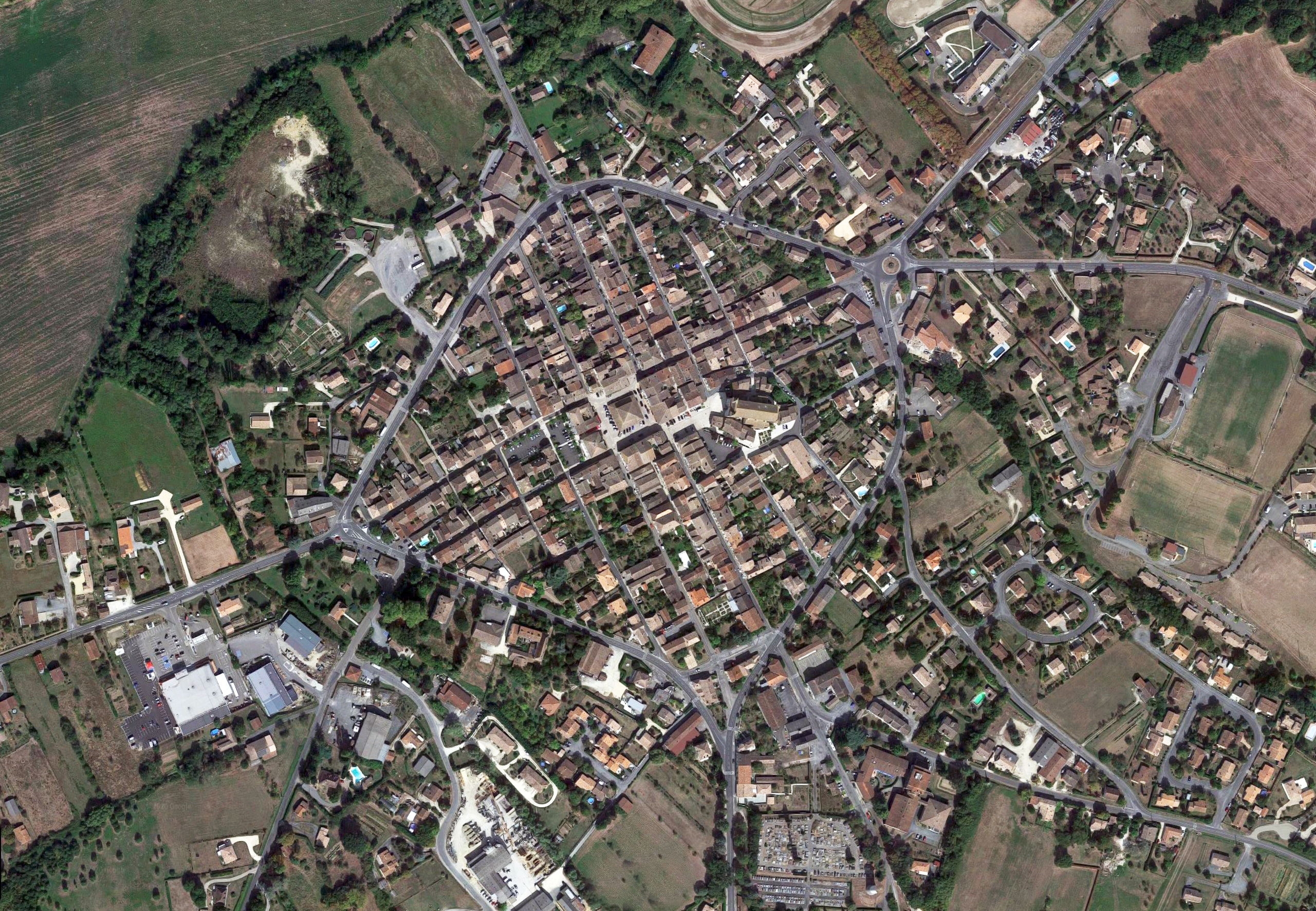
• French Medieval New Towns – Commonly Called Bastides
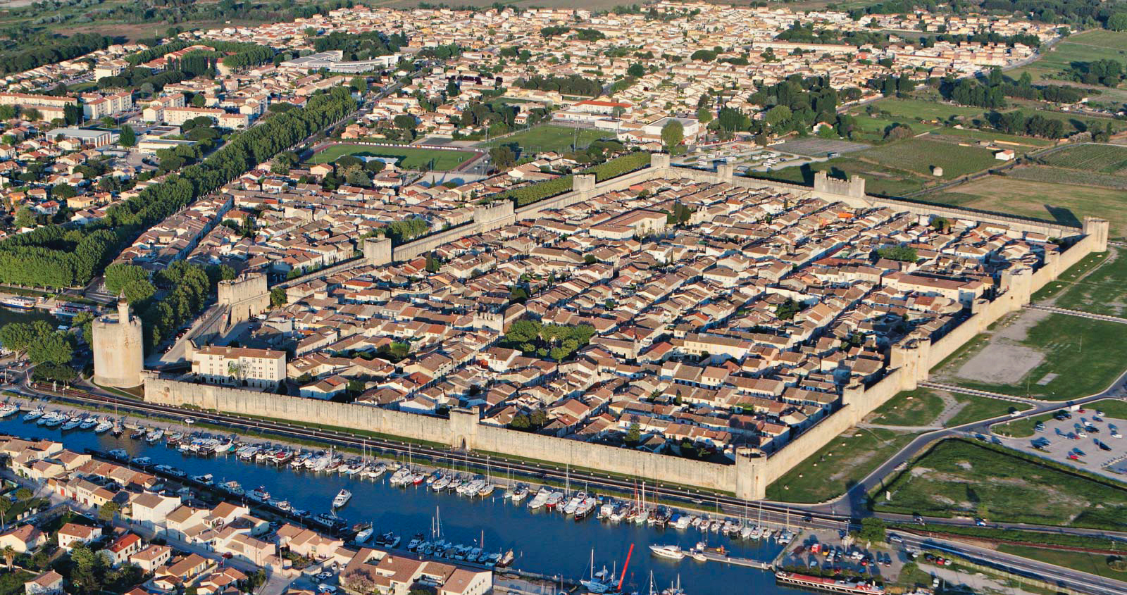
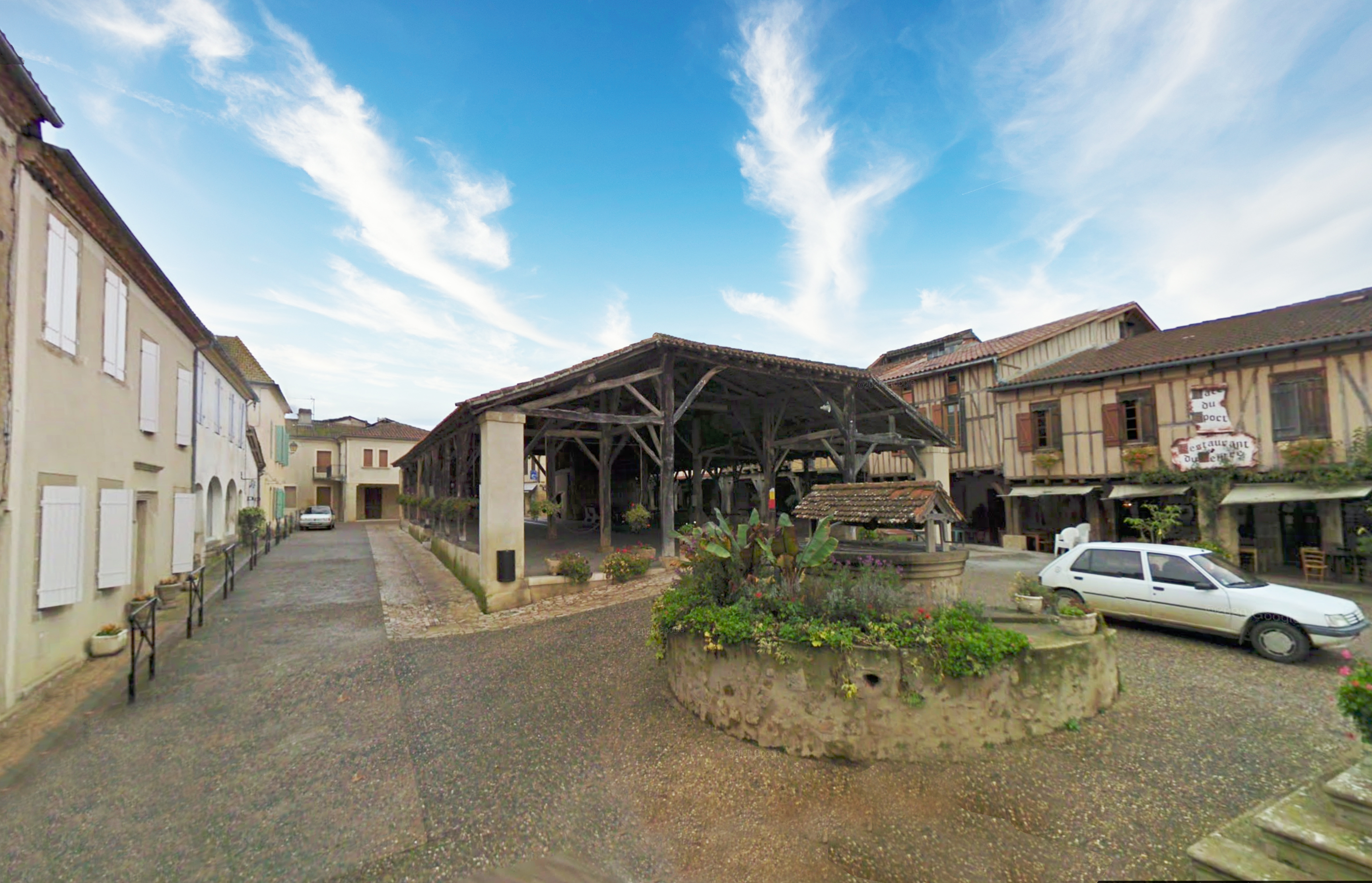
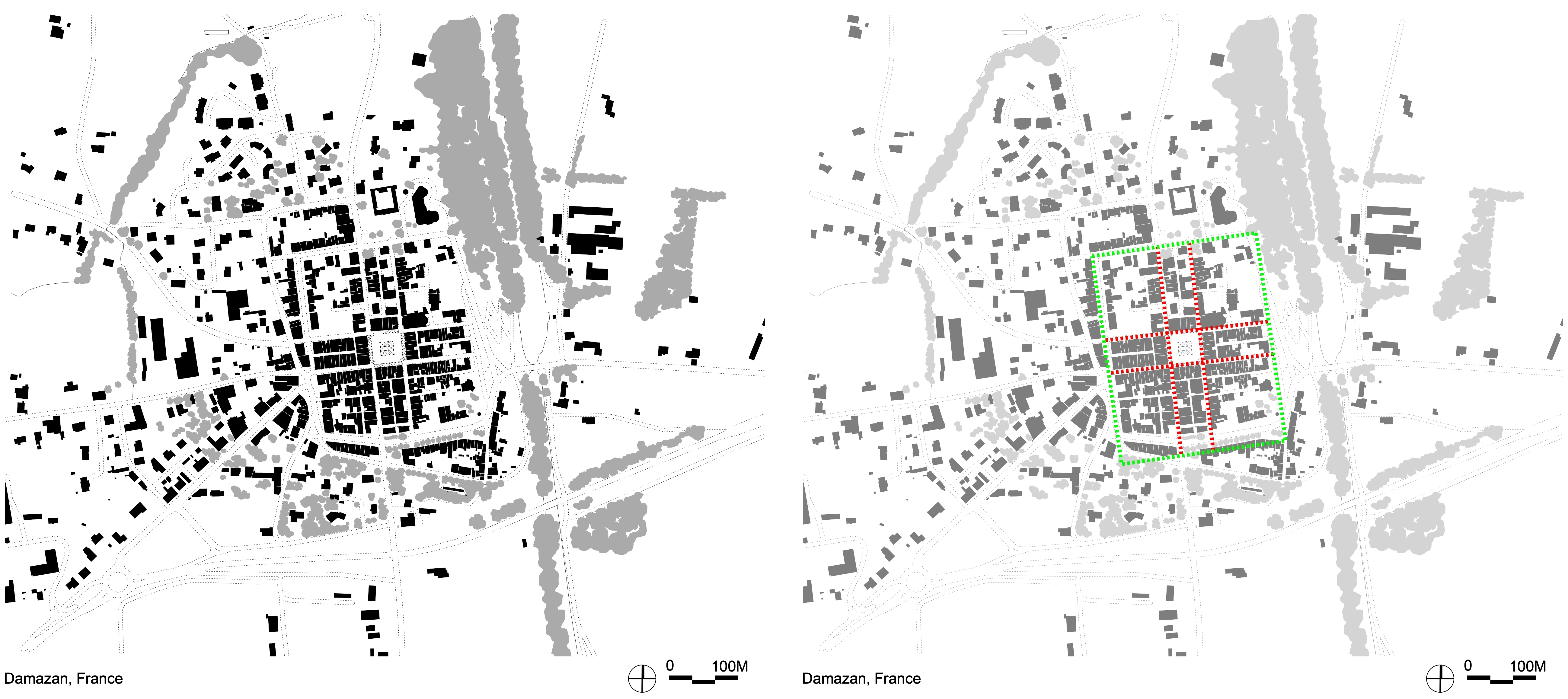
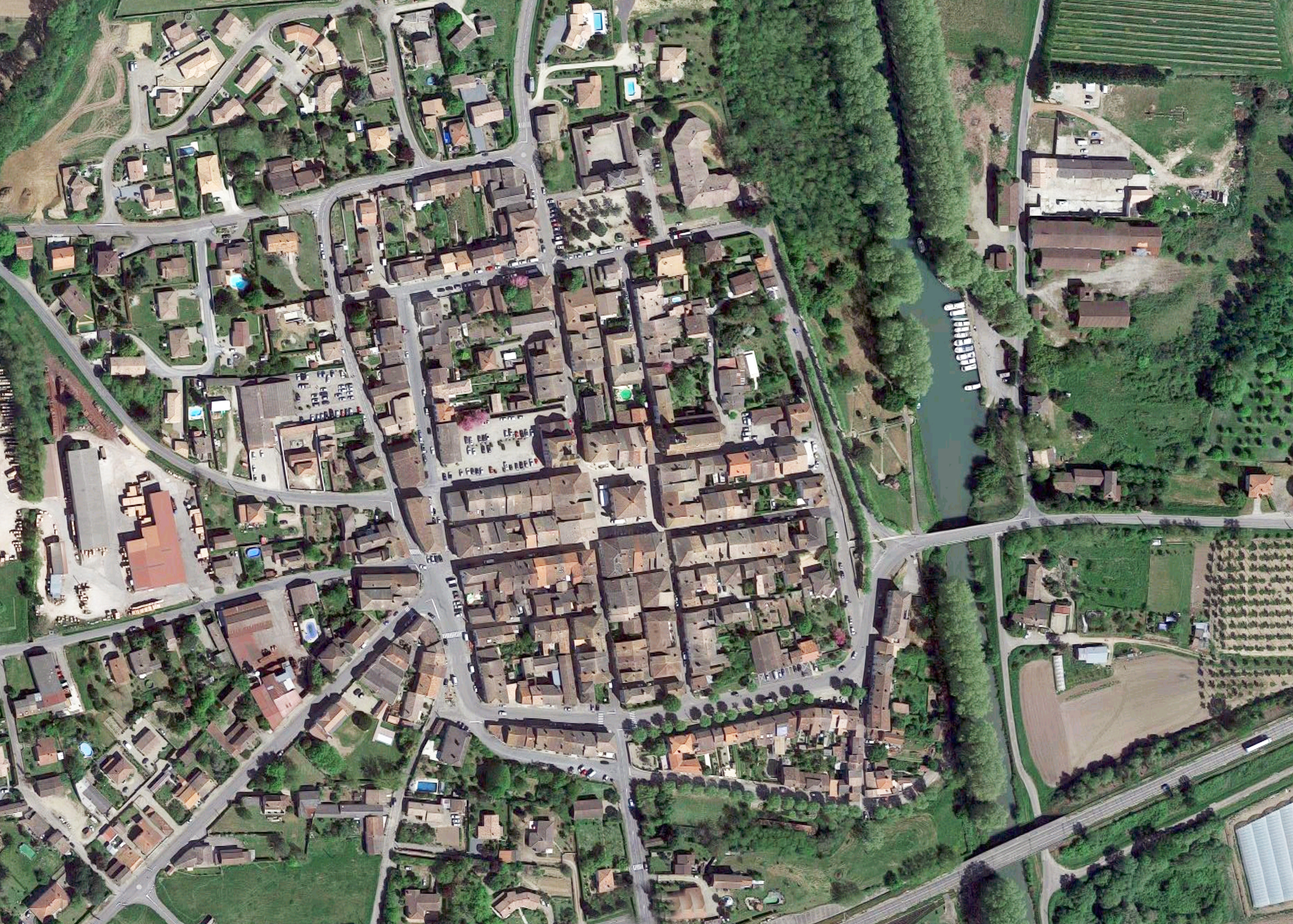
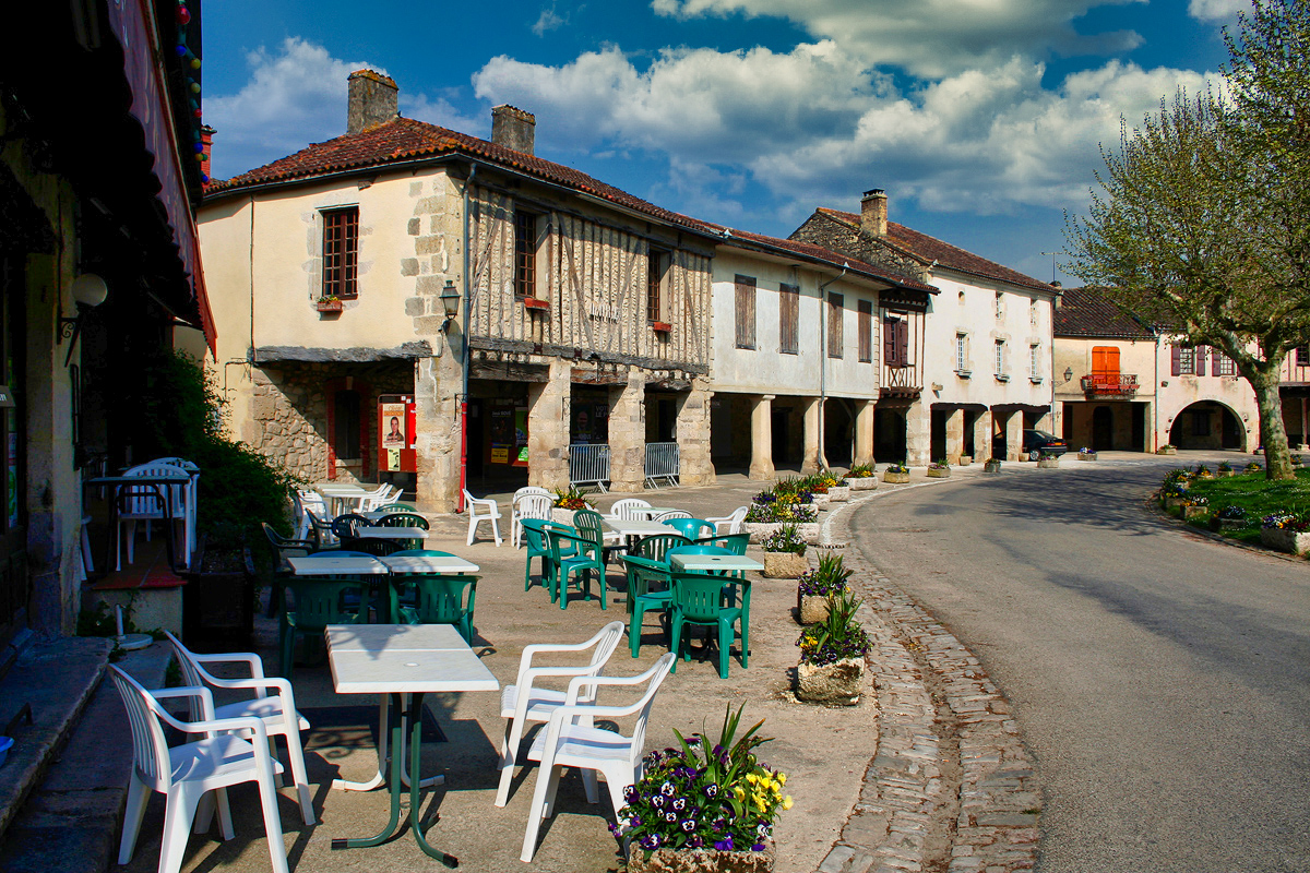
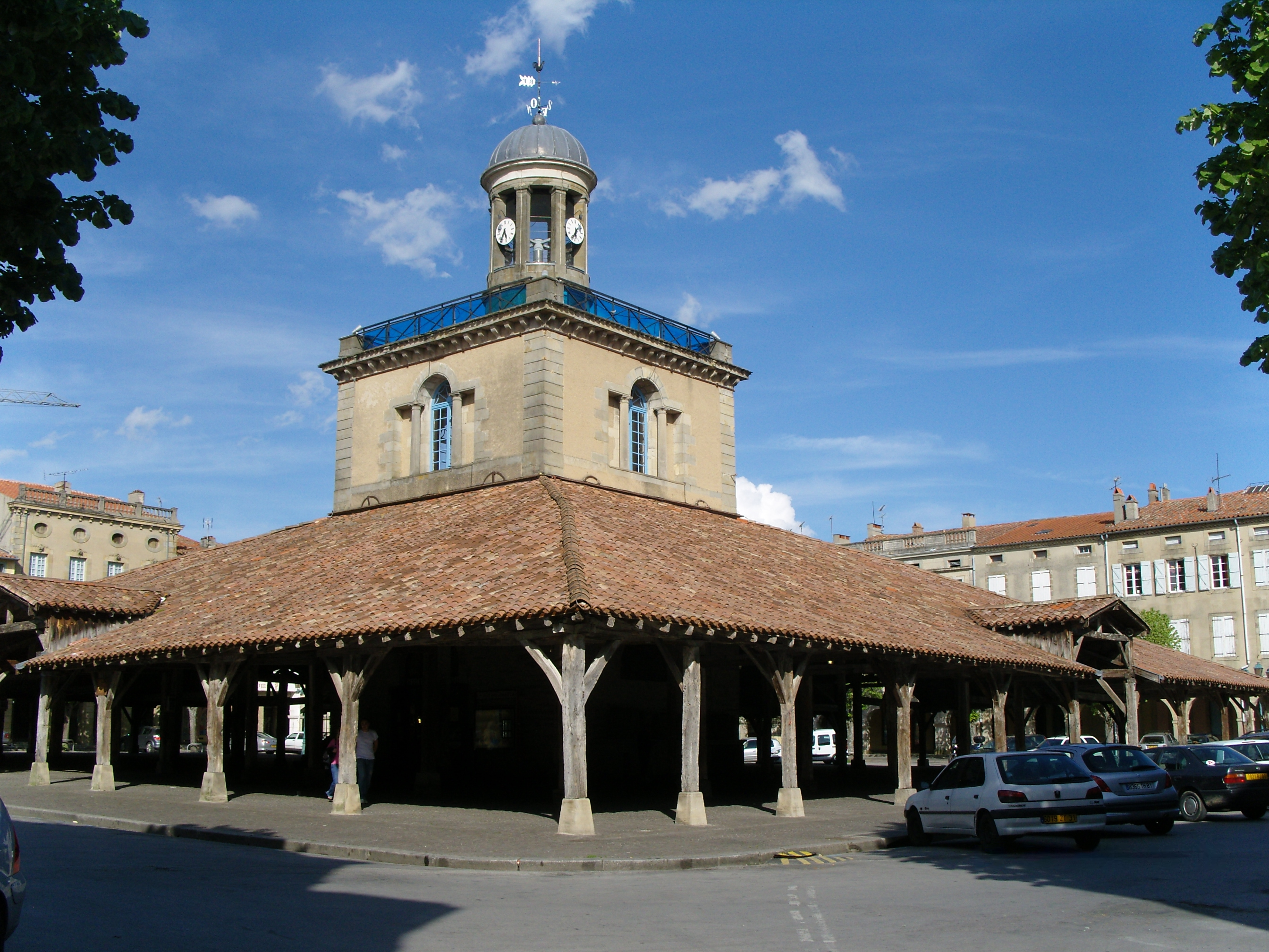
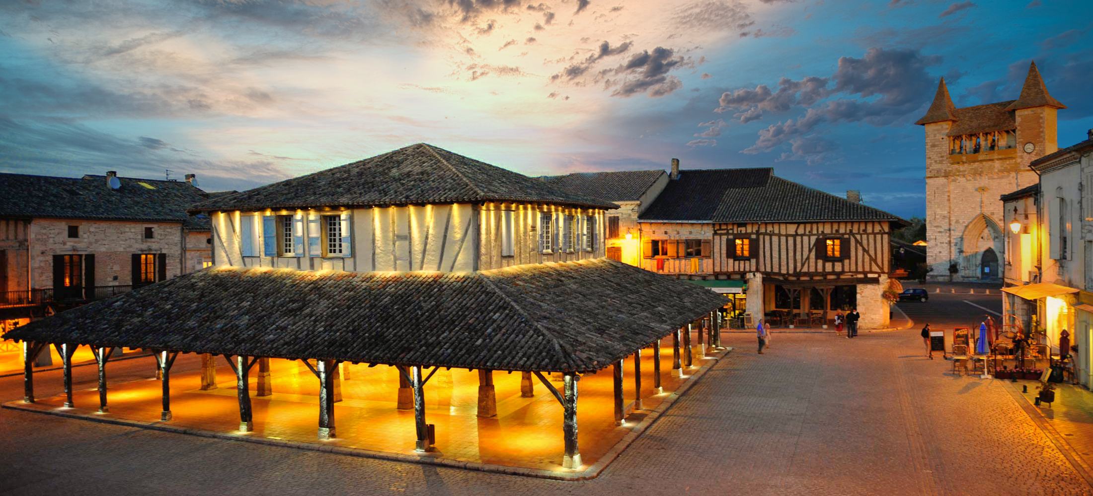
Villefranche-du-Perigord, France
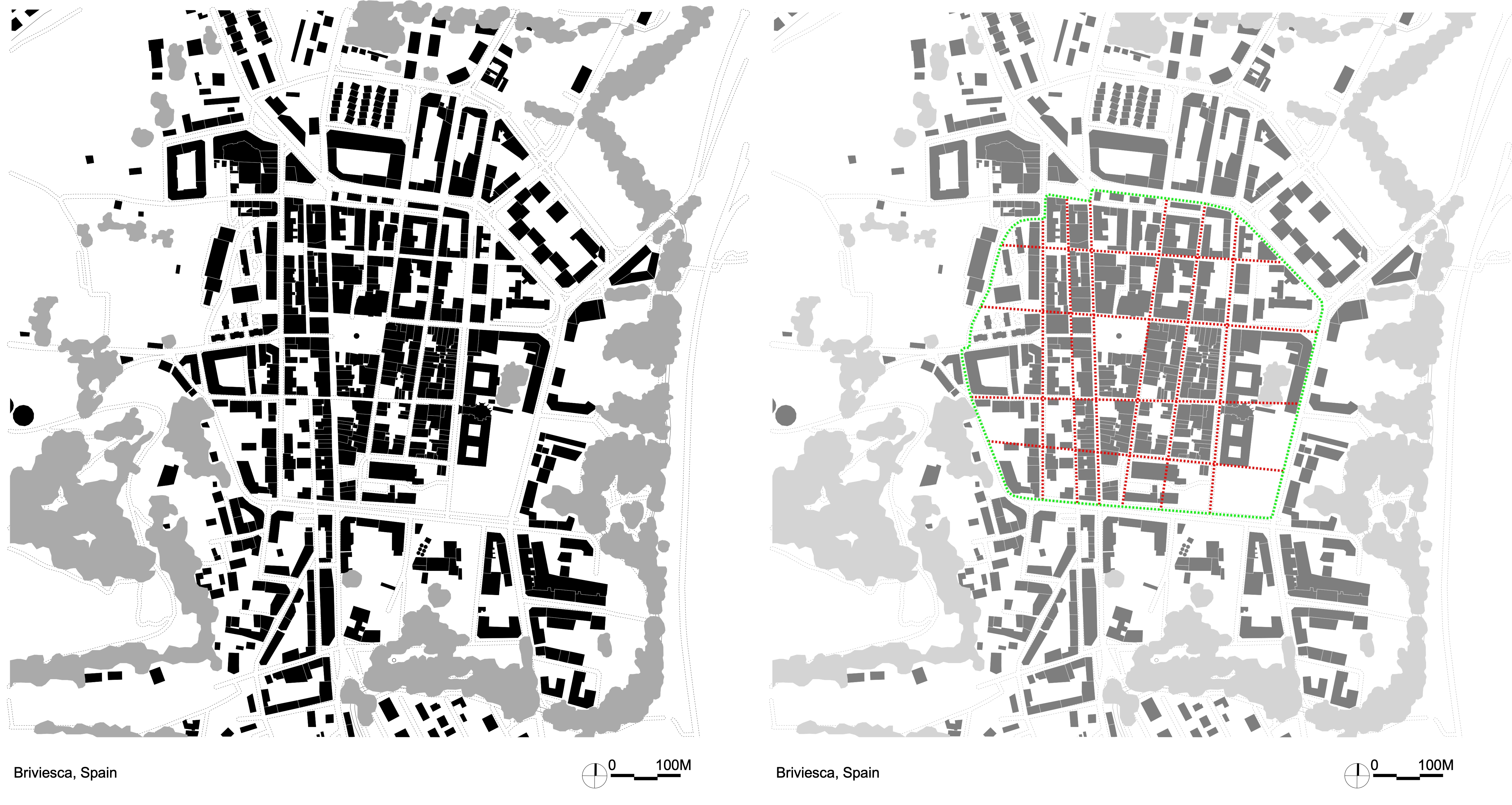
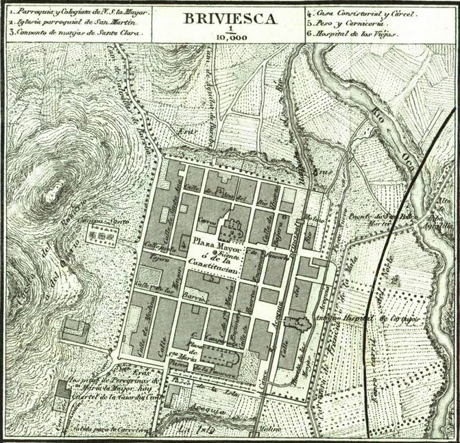
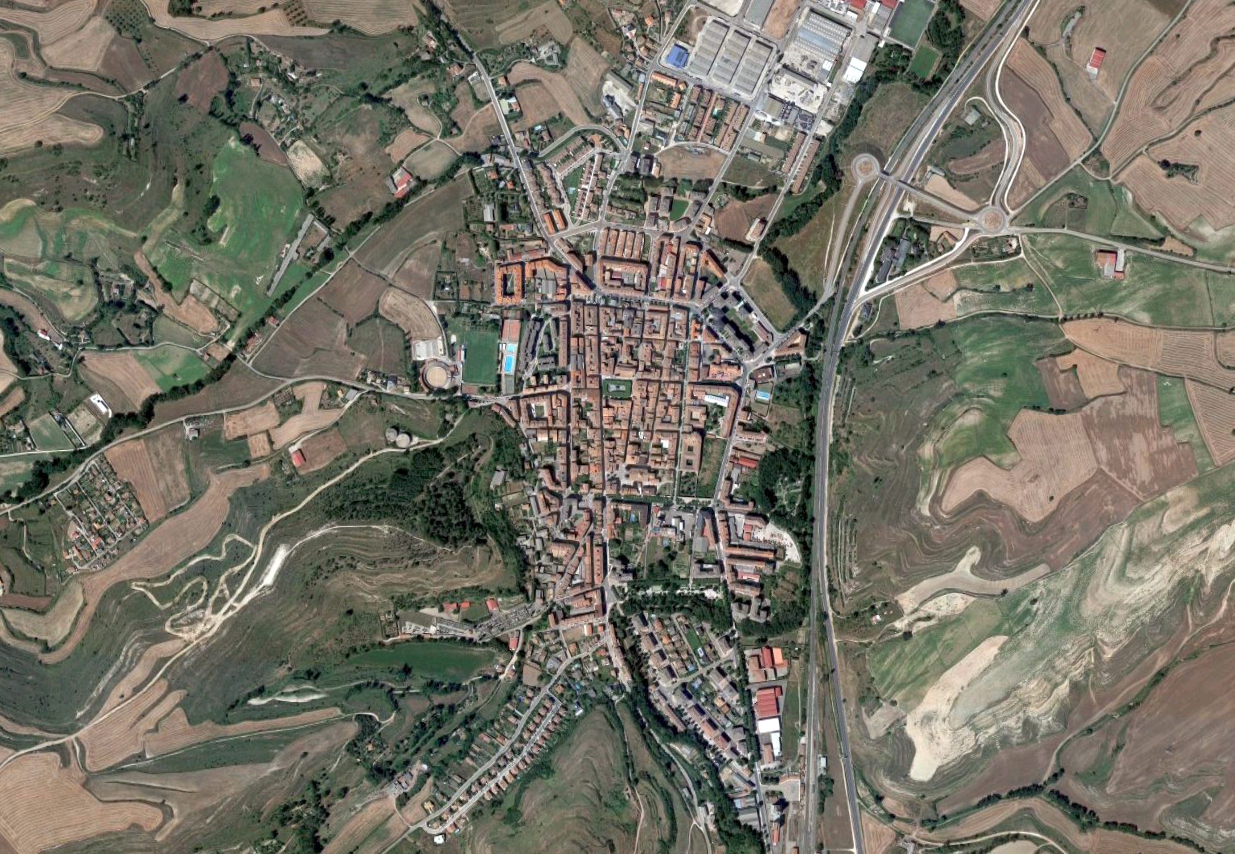
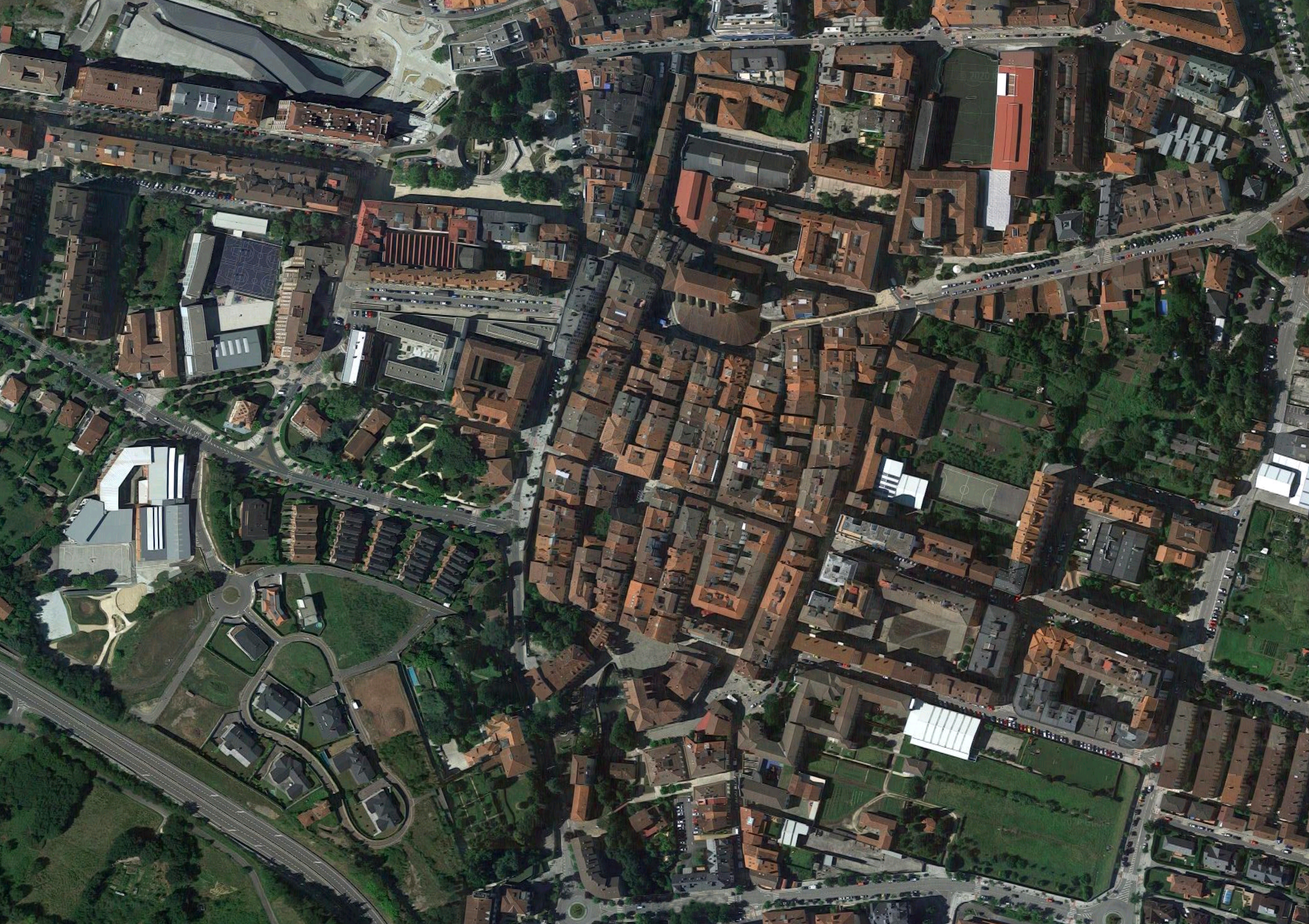
• Spanish Medieval New Towns
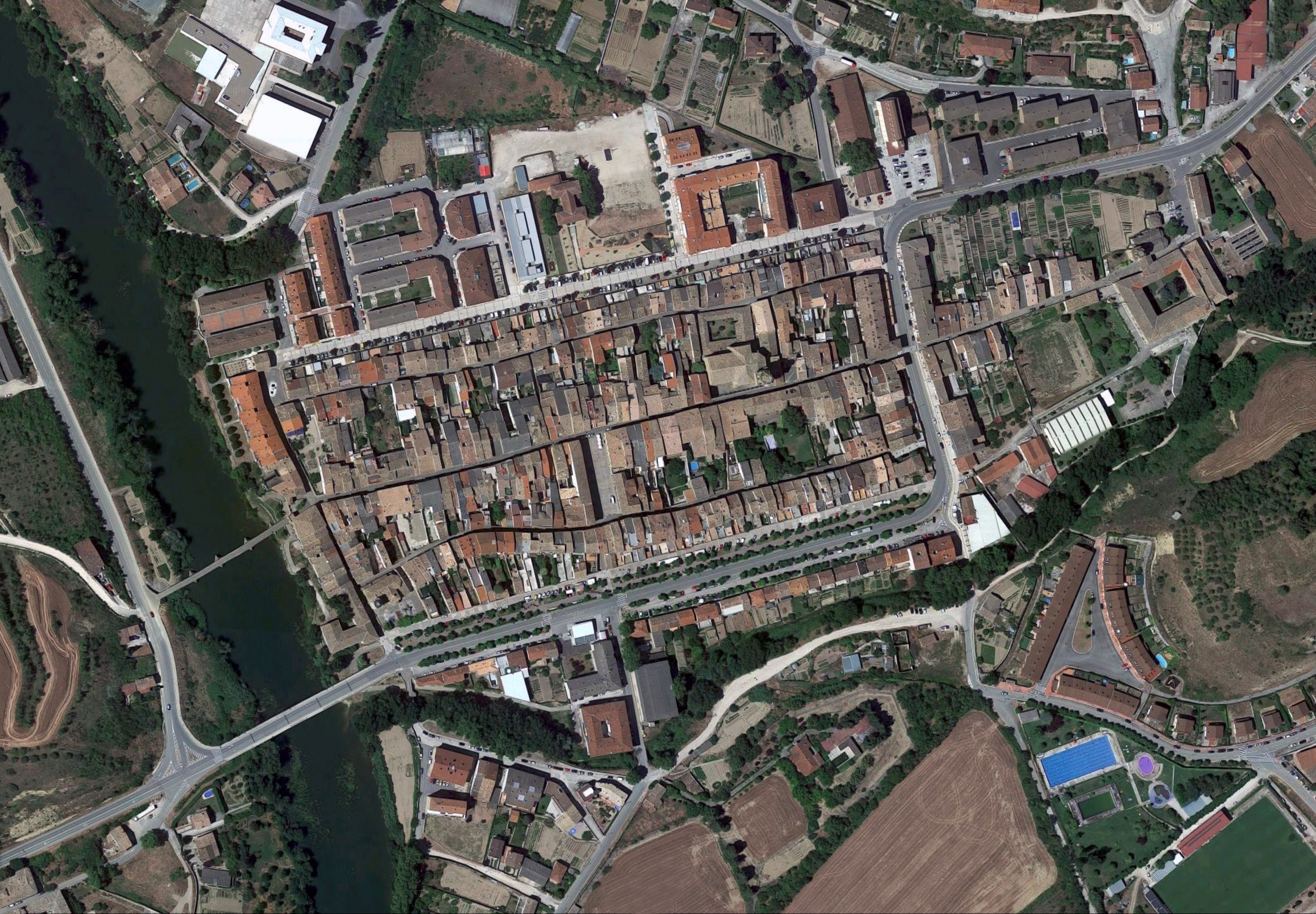
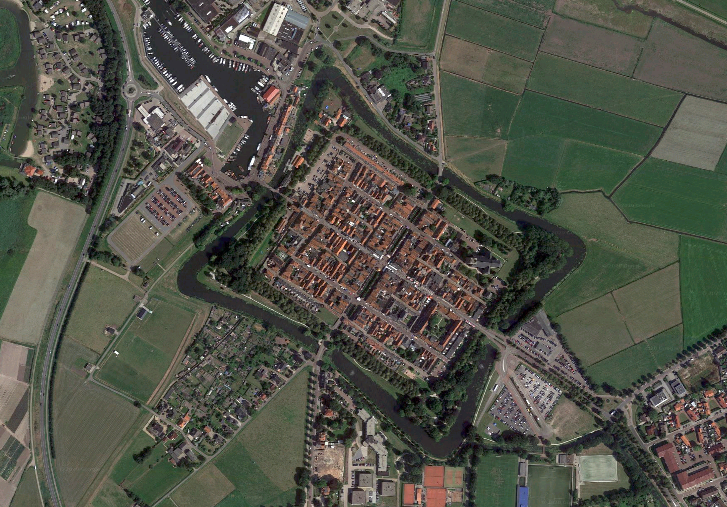
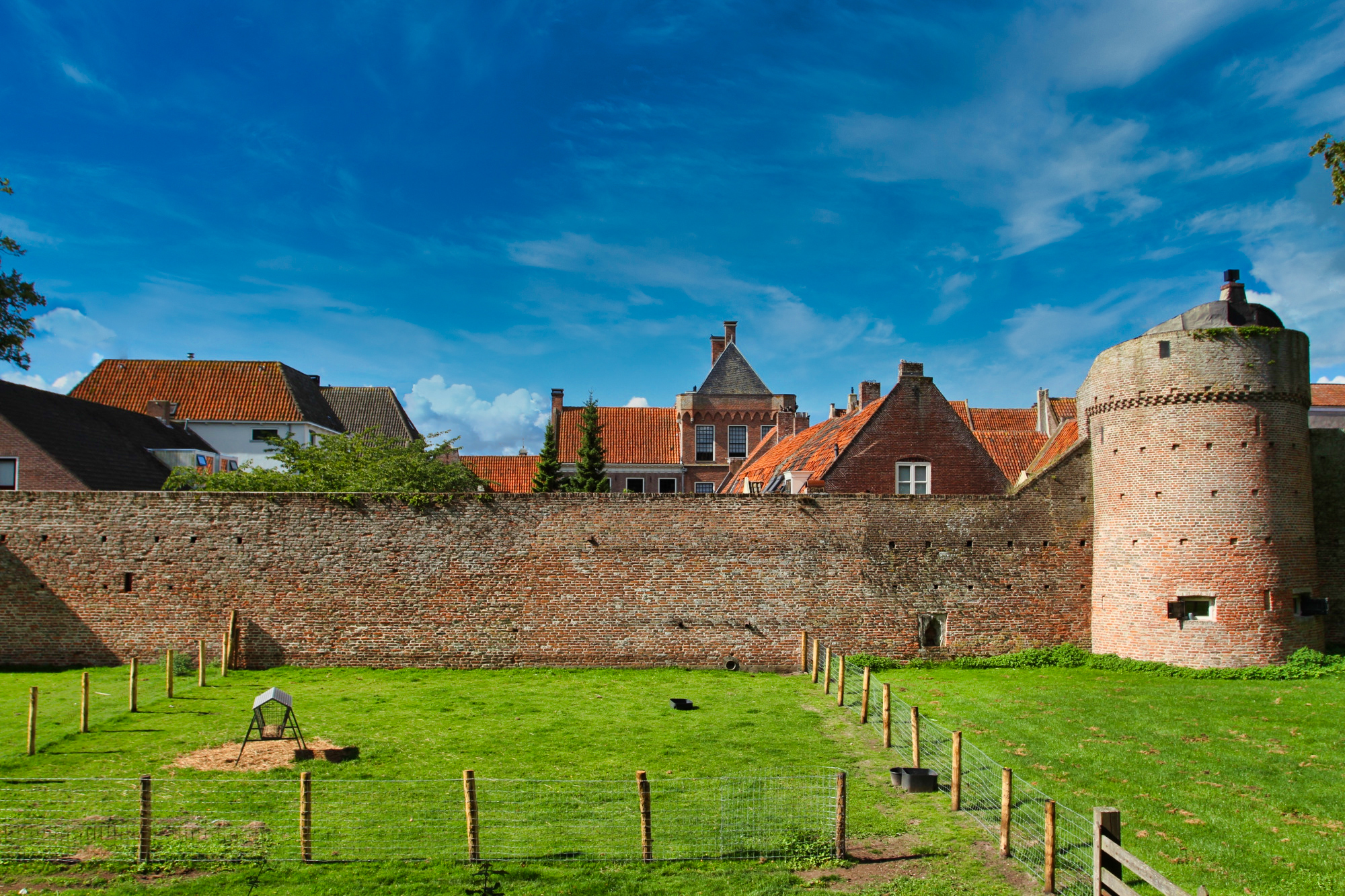
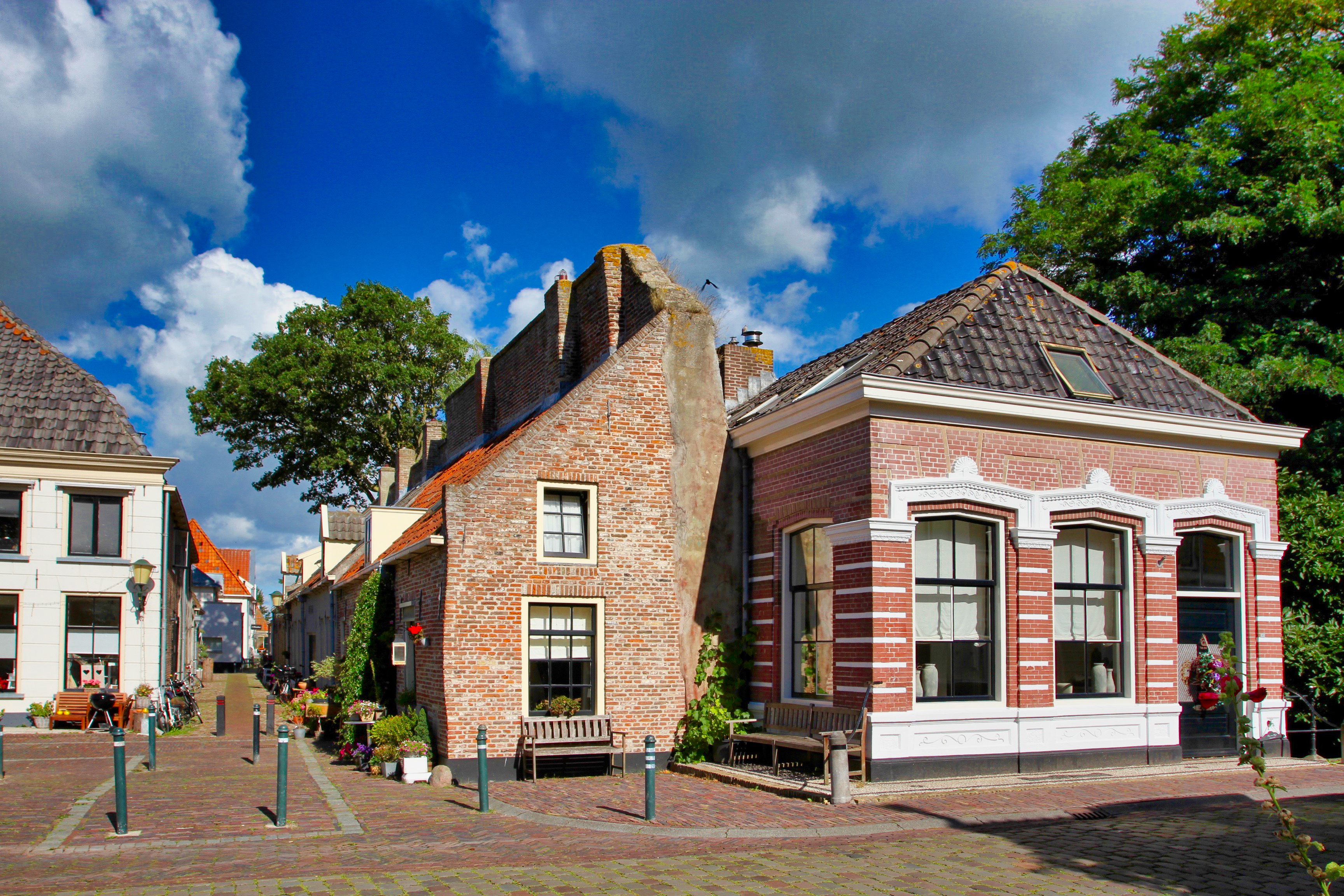
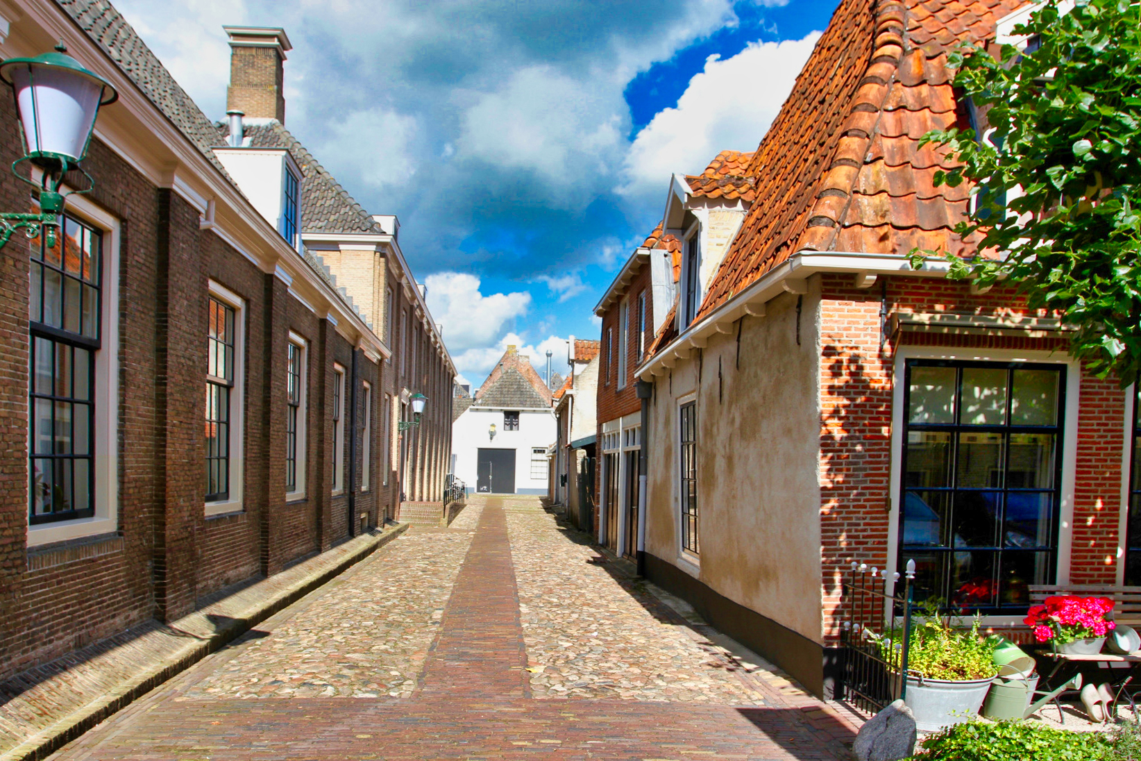
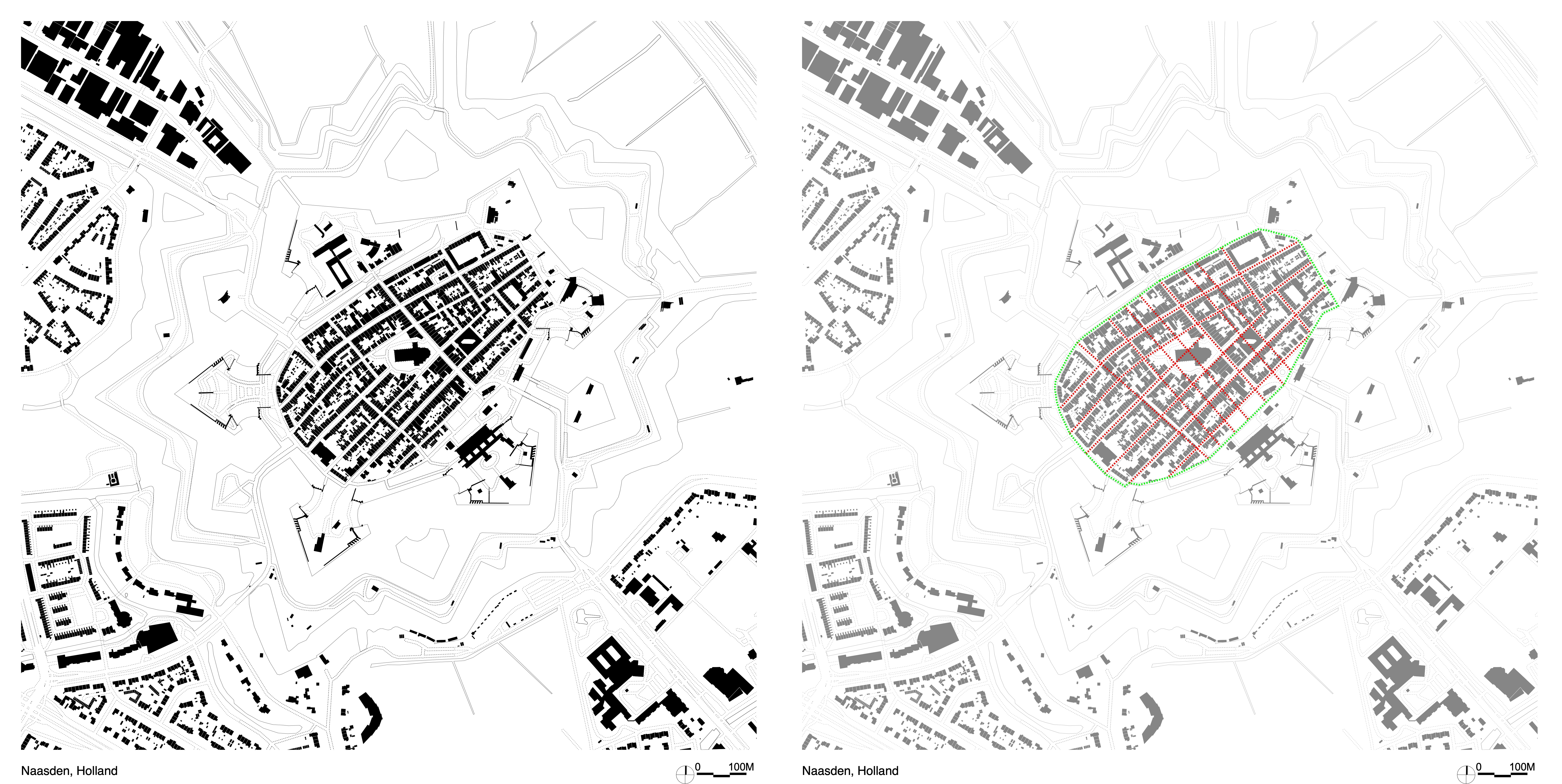
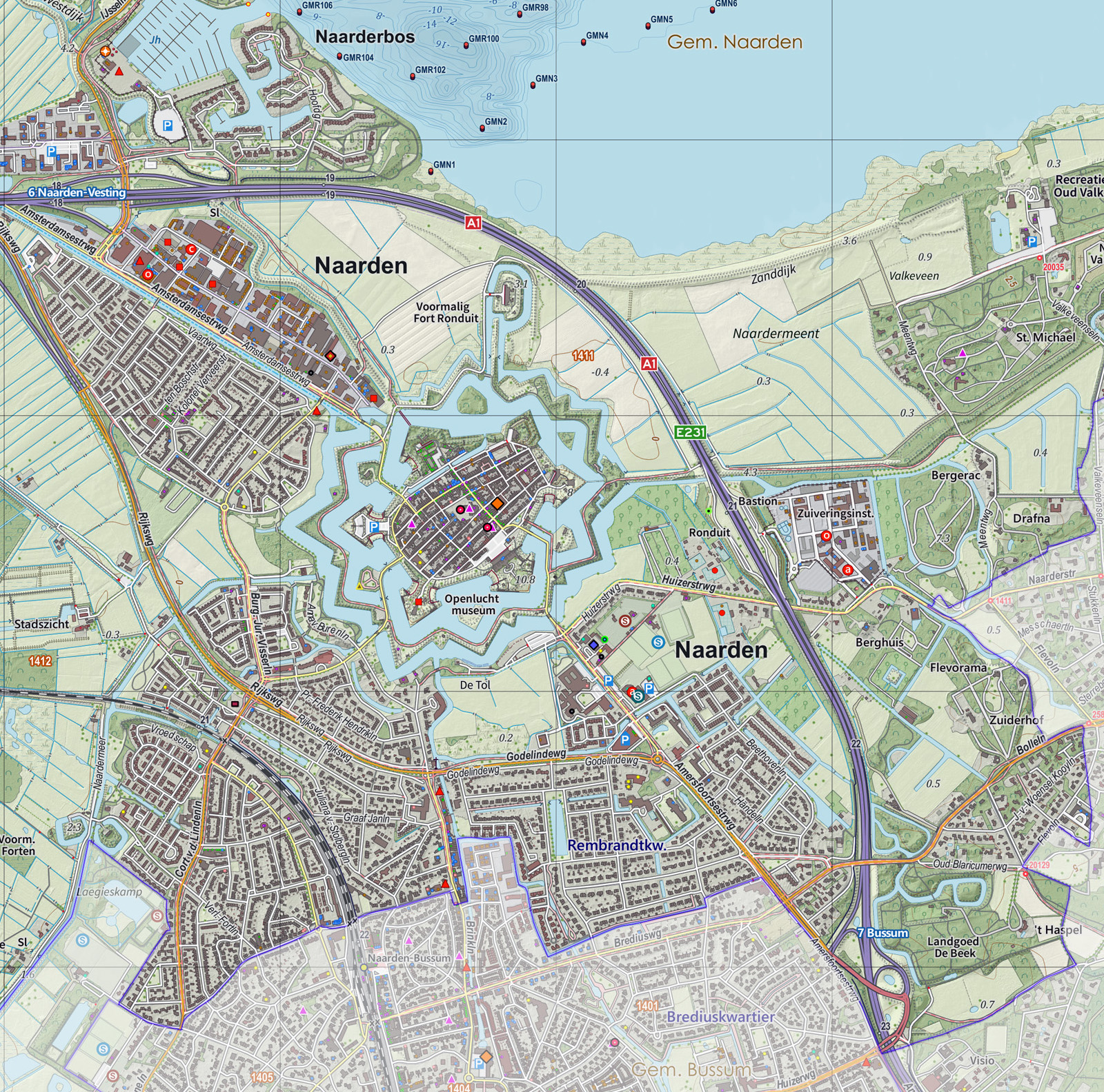
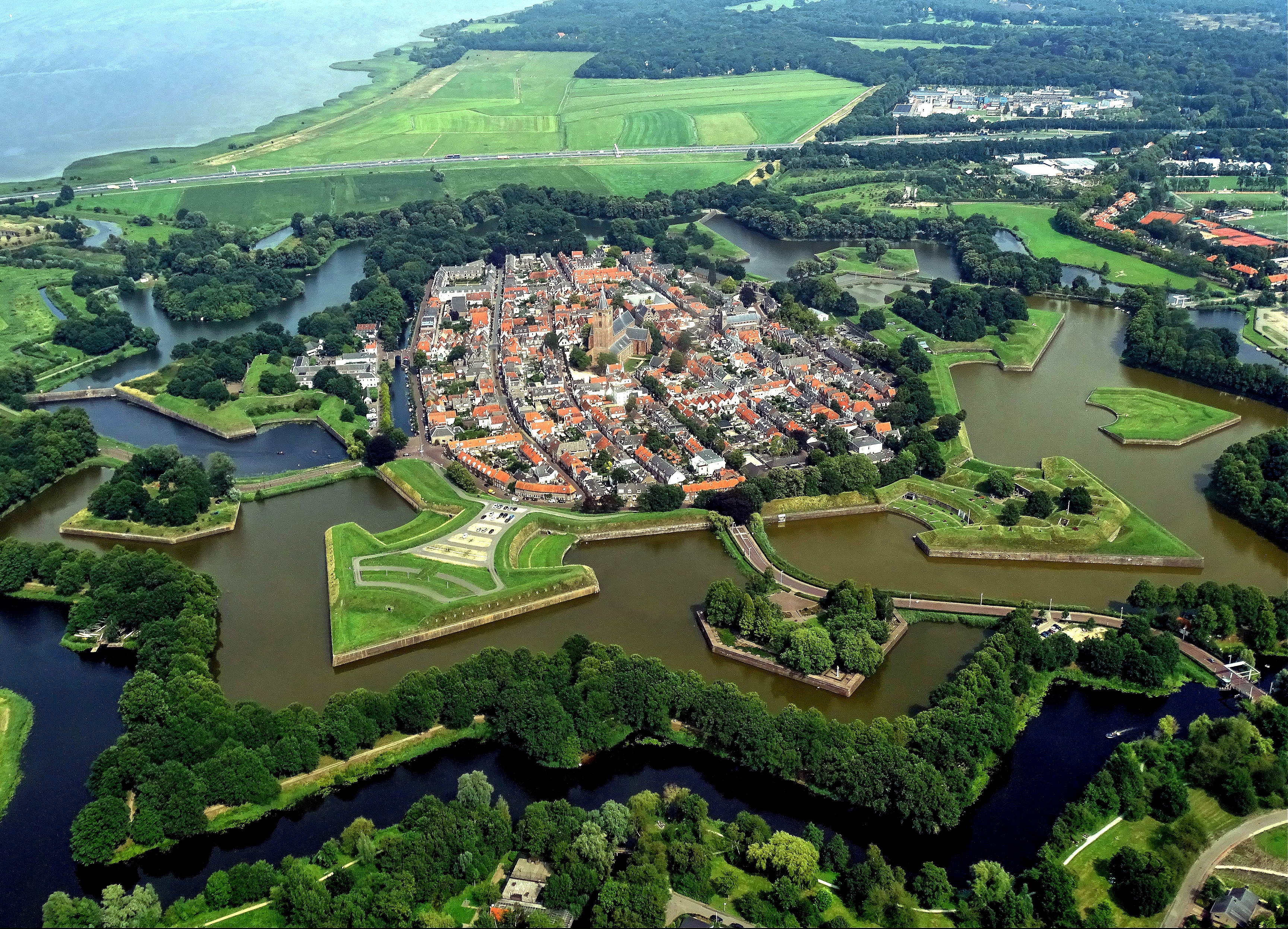
• Dutch Medieval New Towns
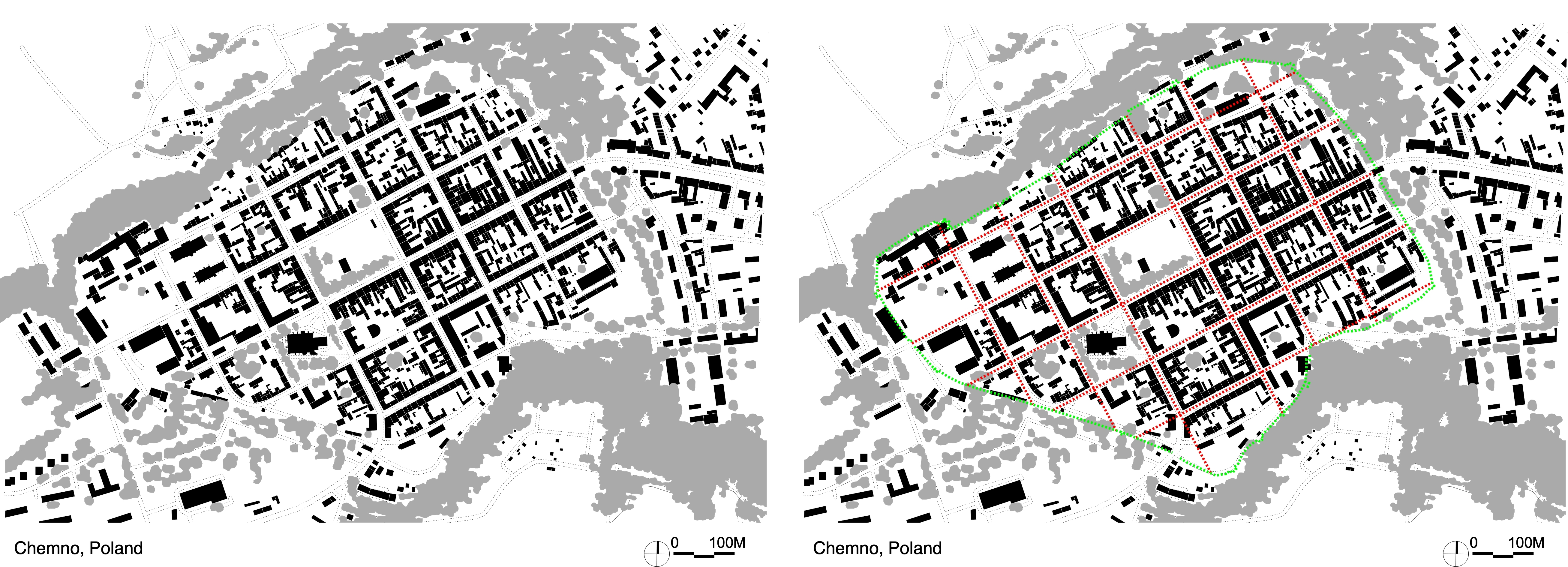
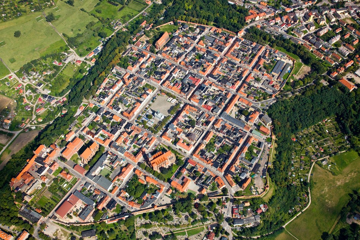
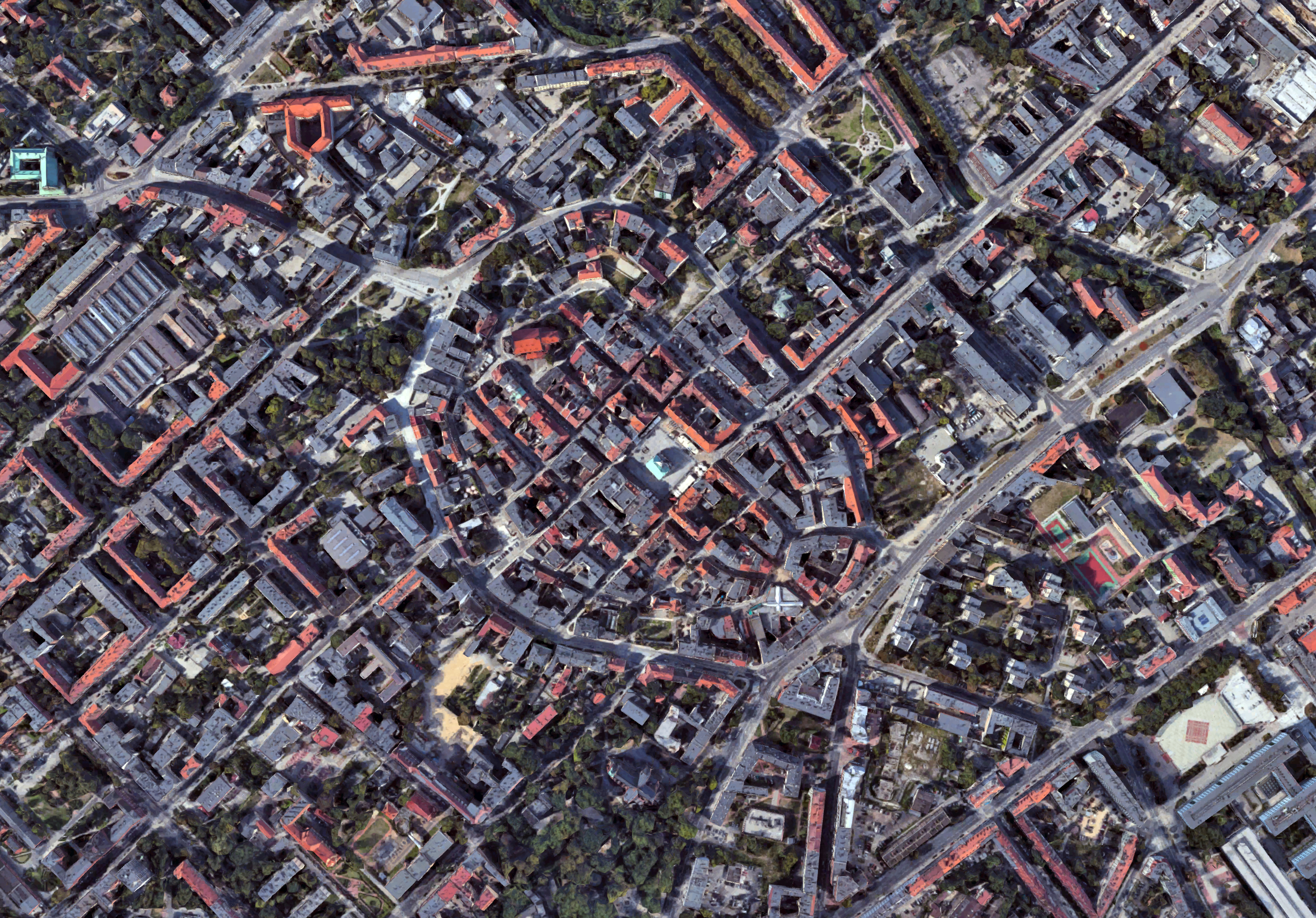
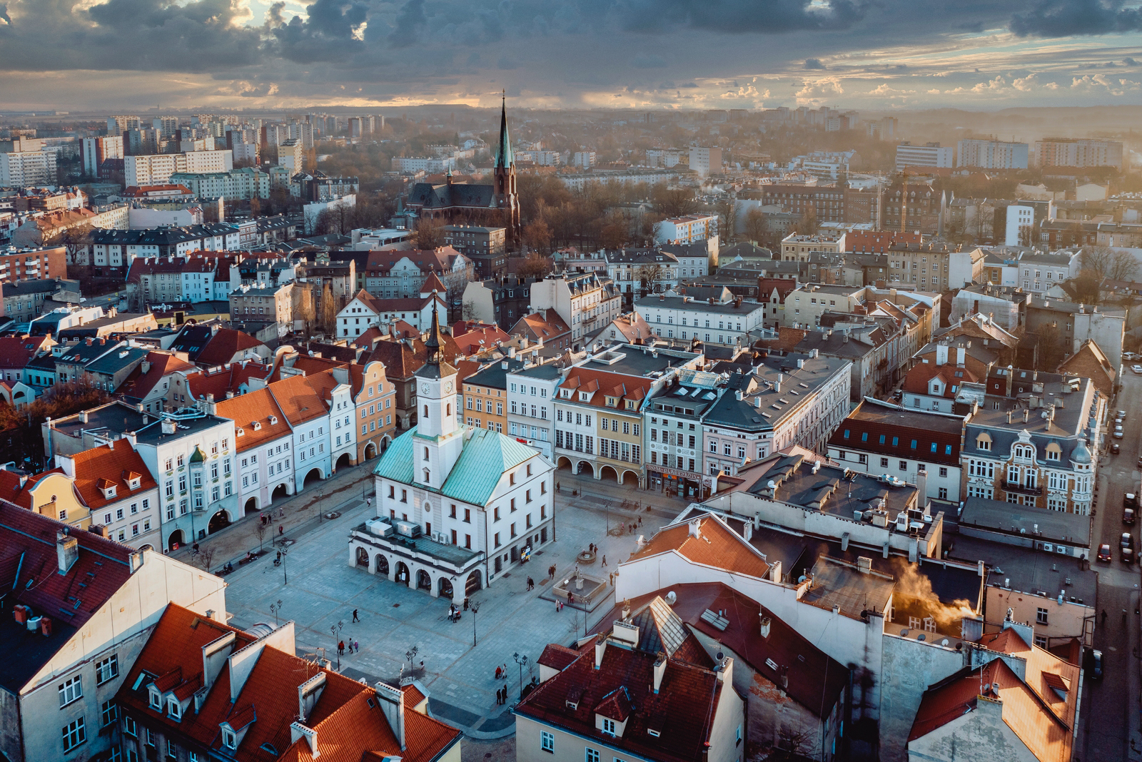
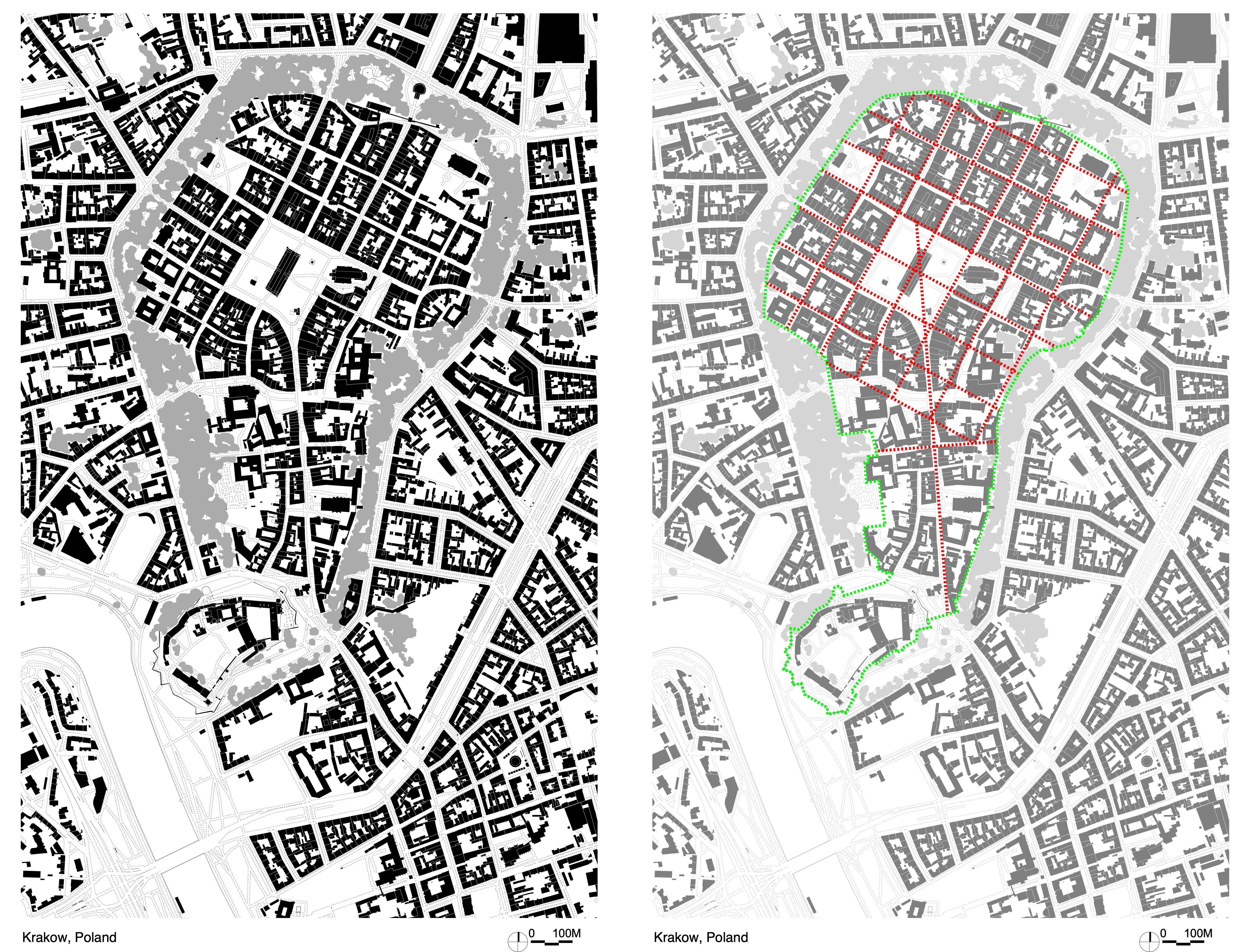
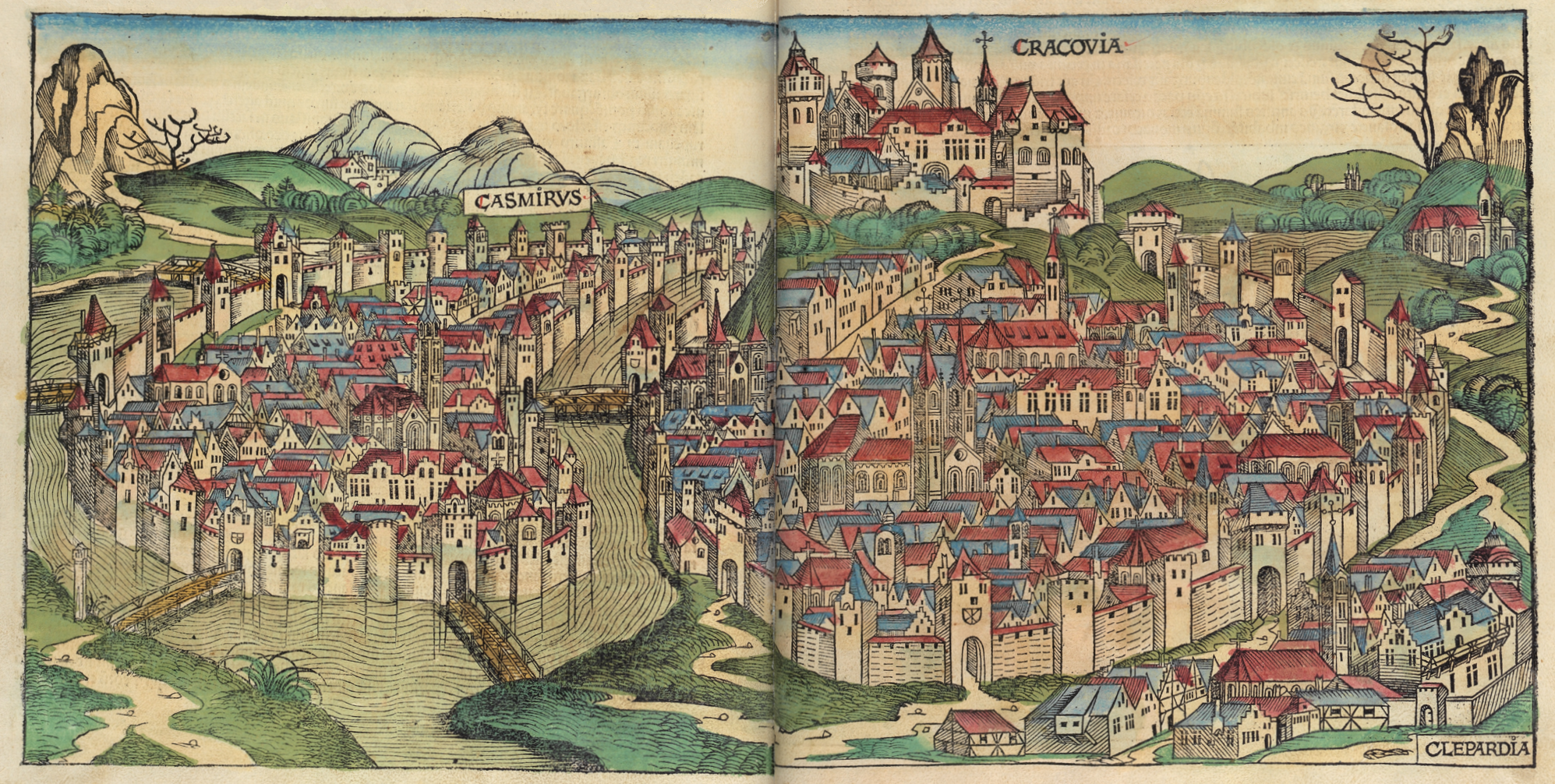
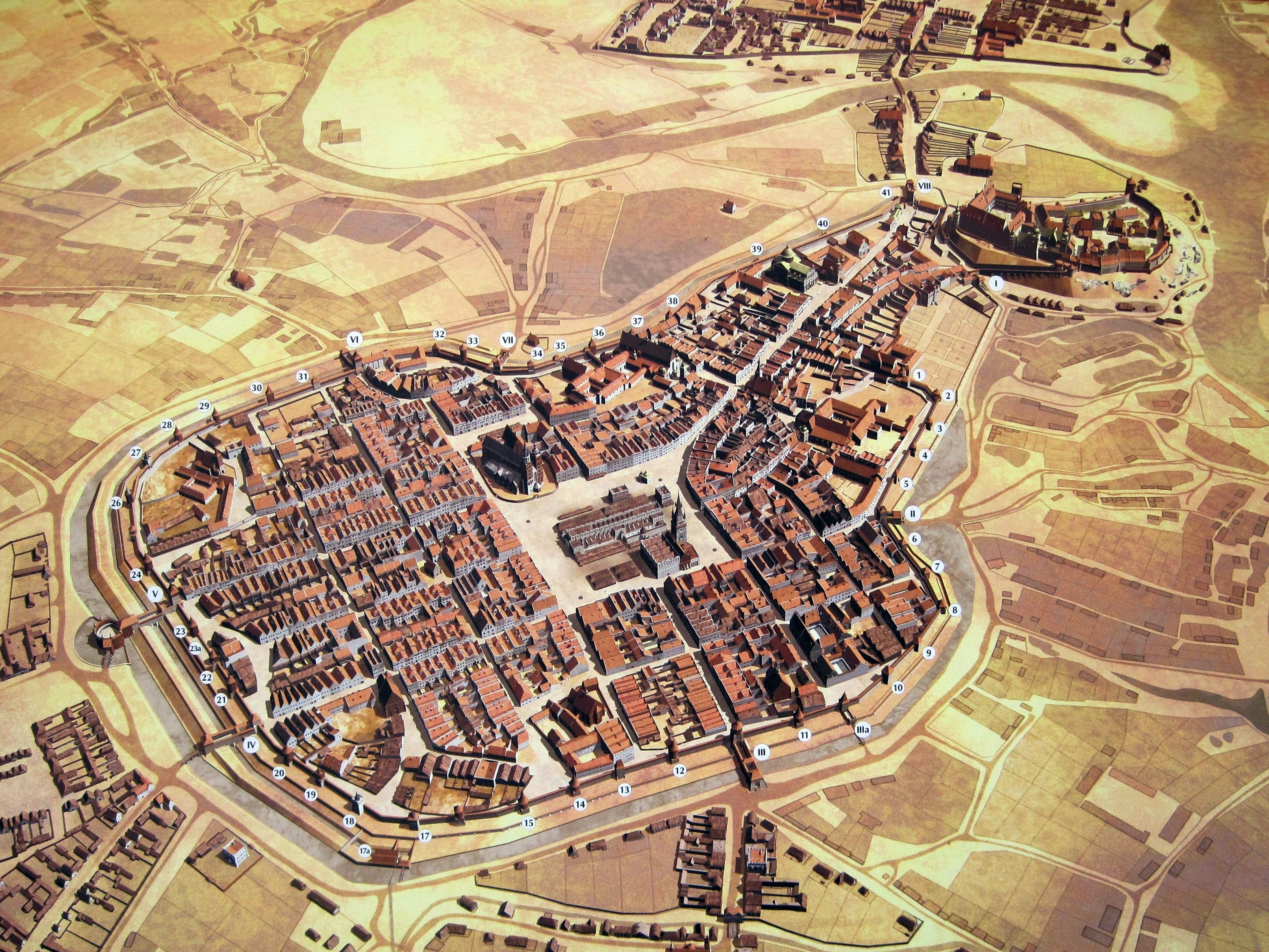
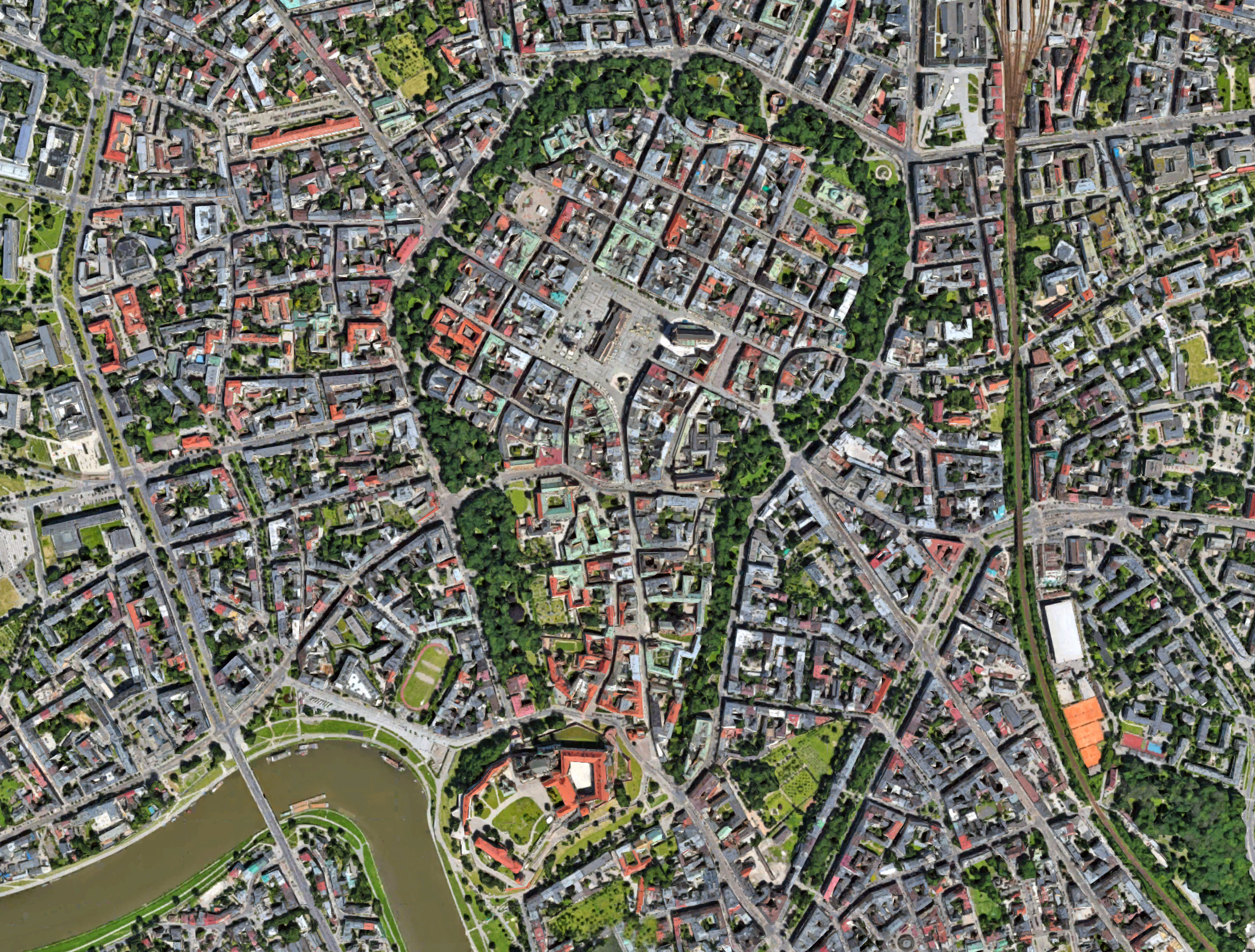
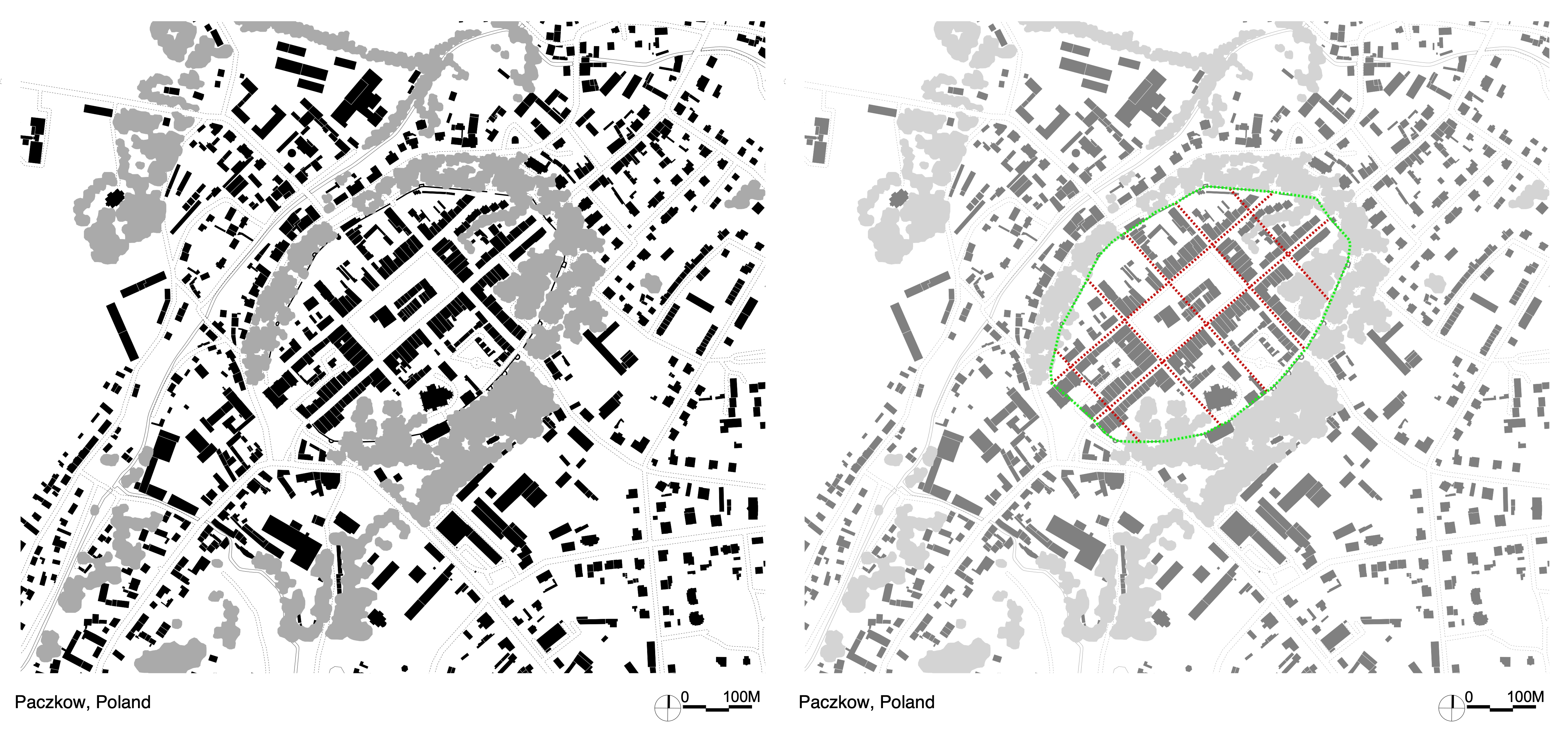
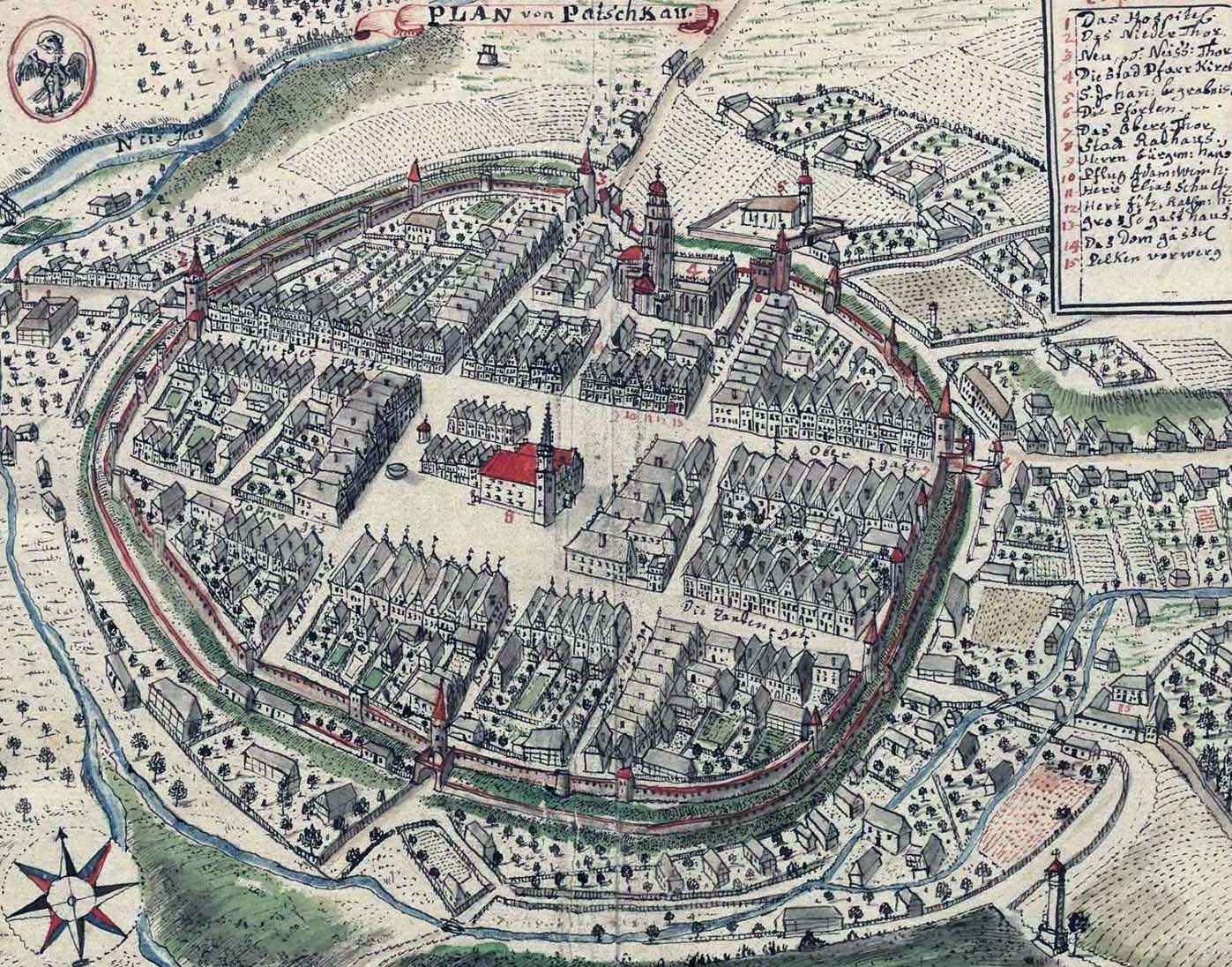
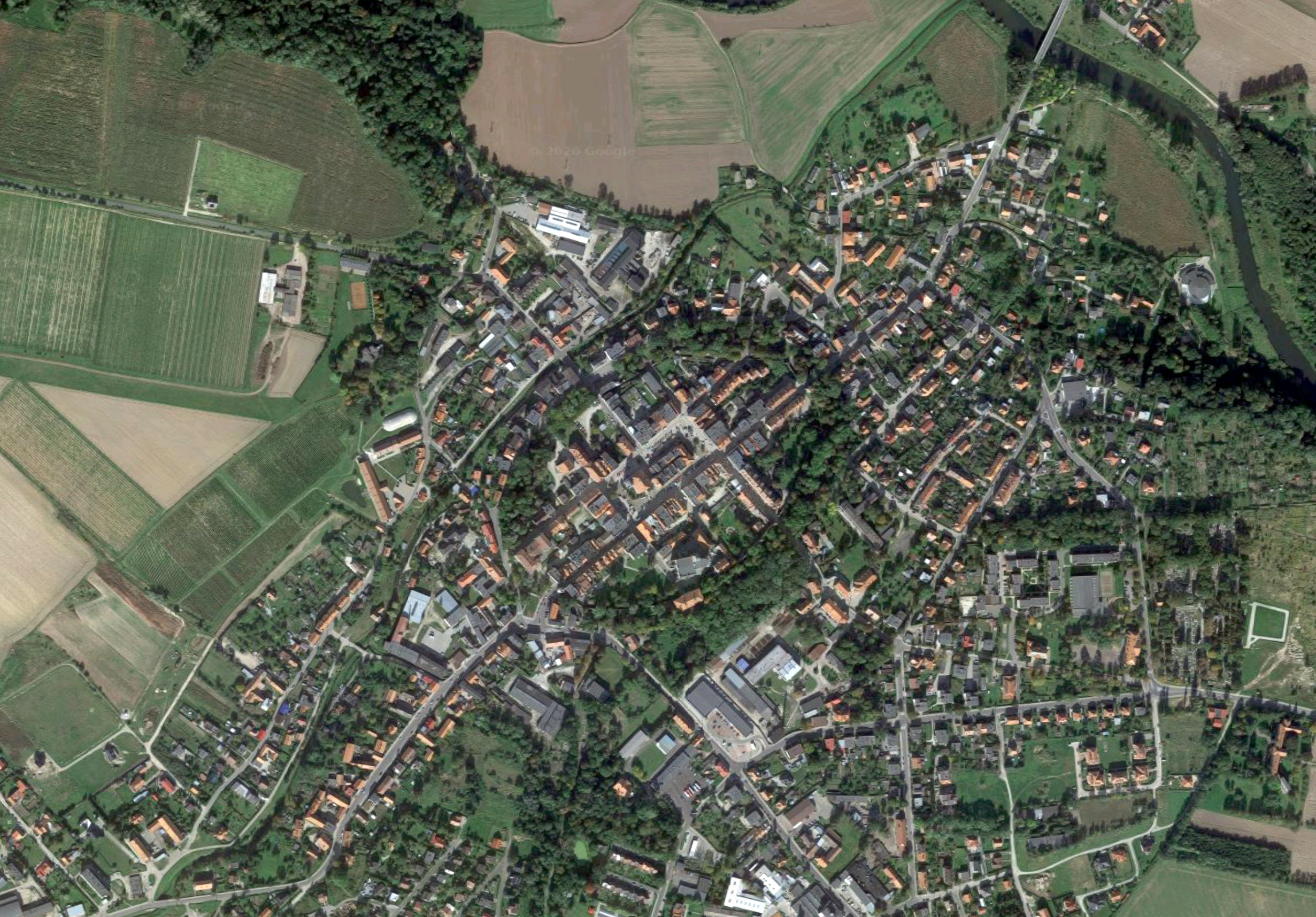
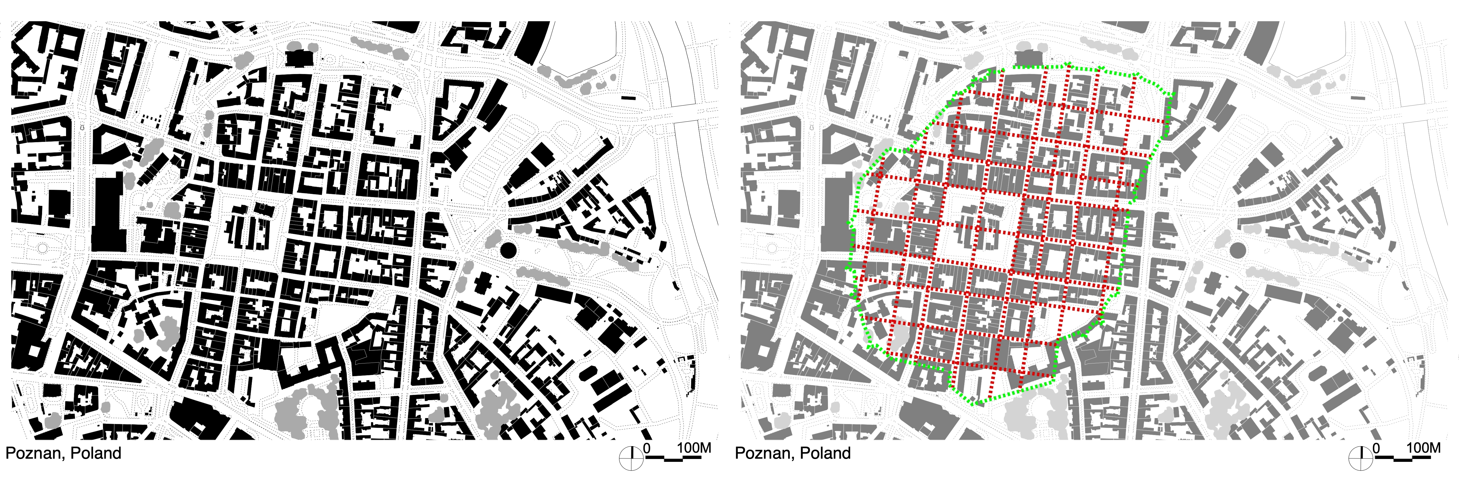
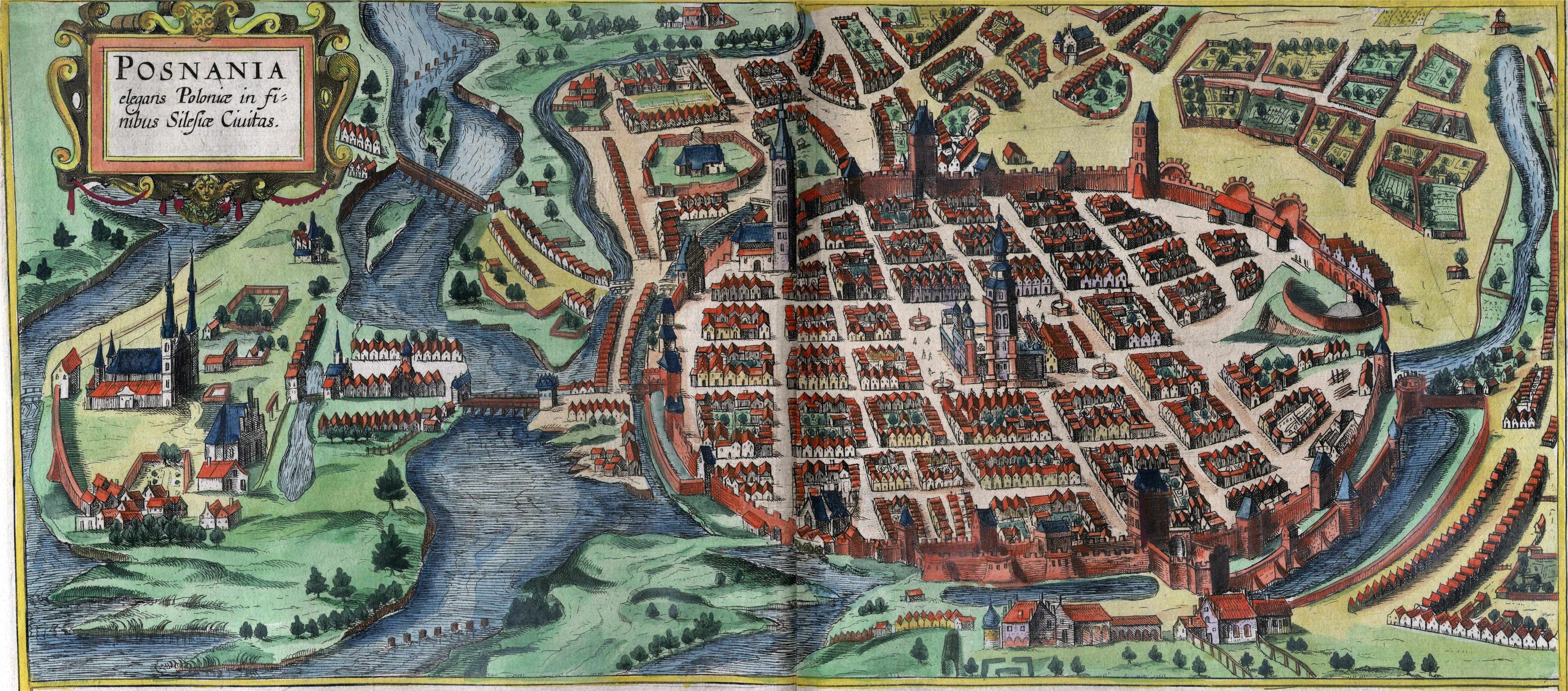
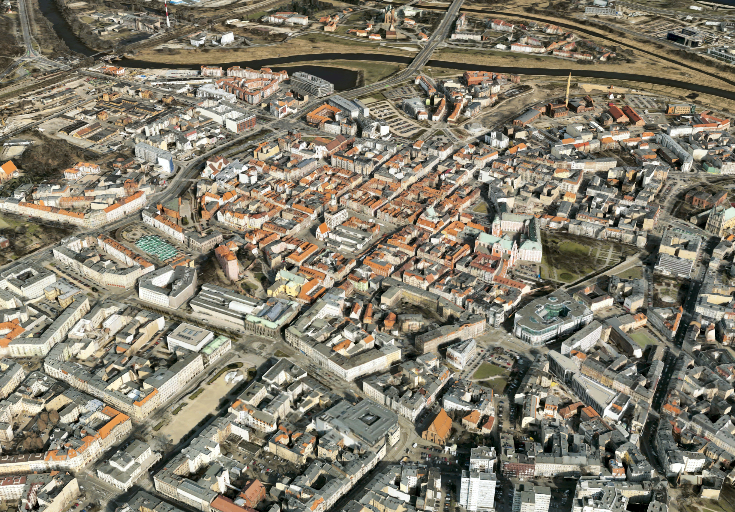
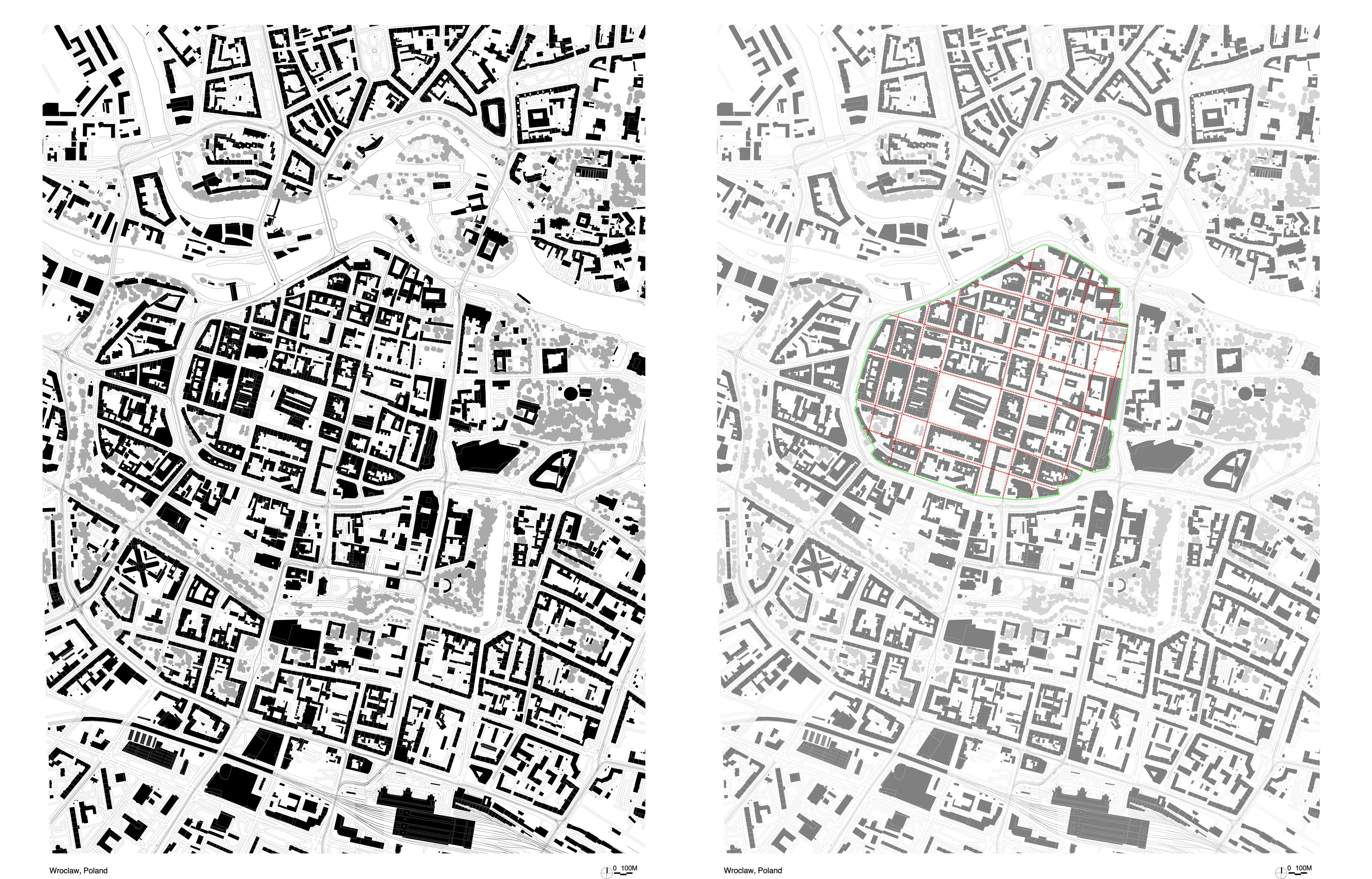
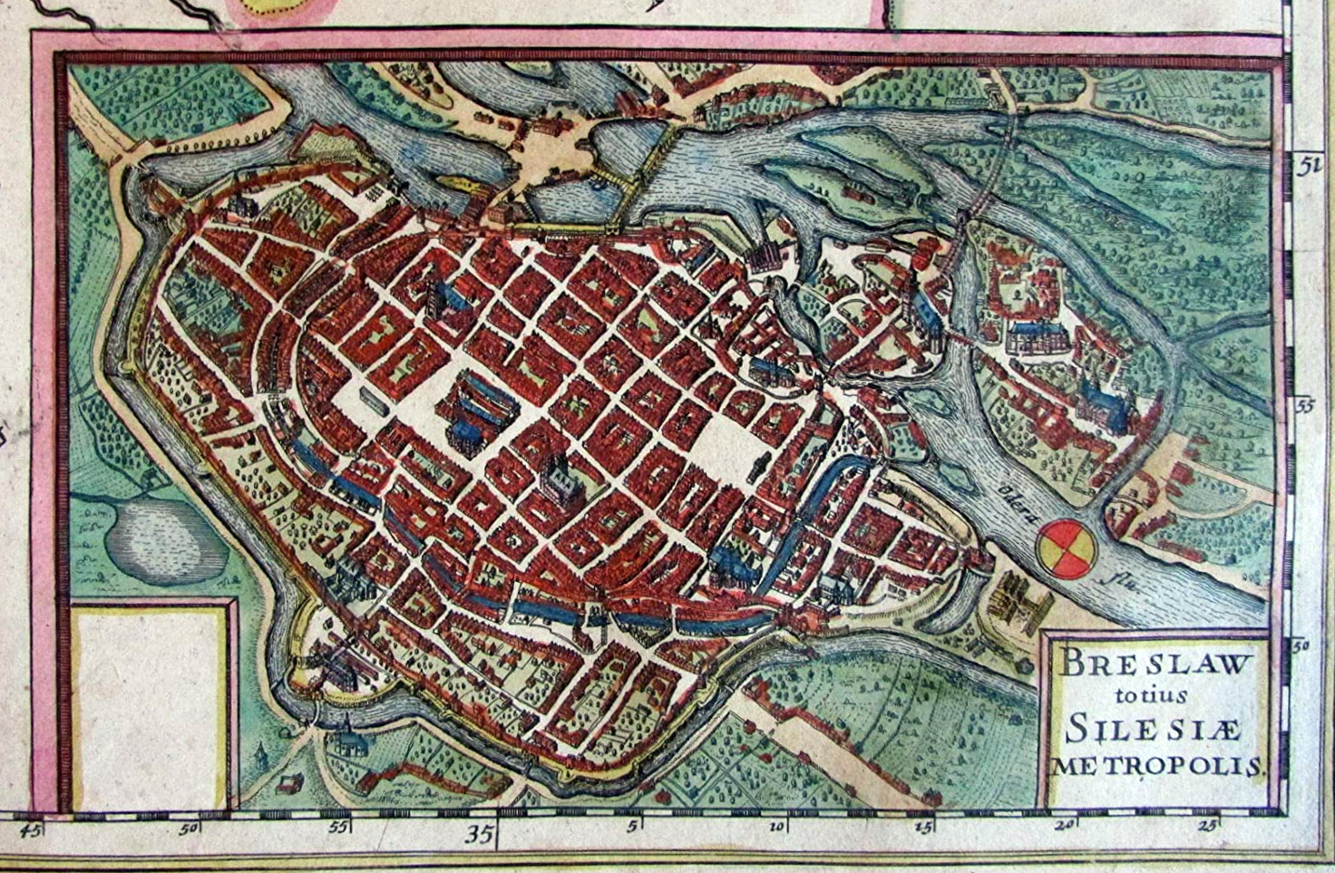
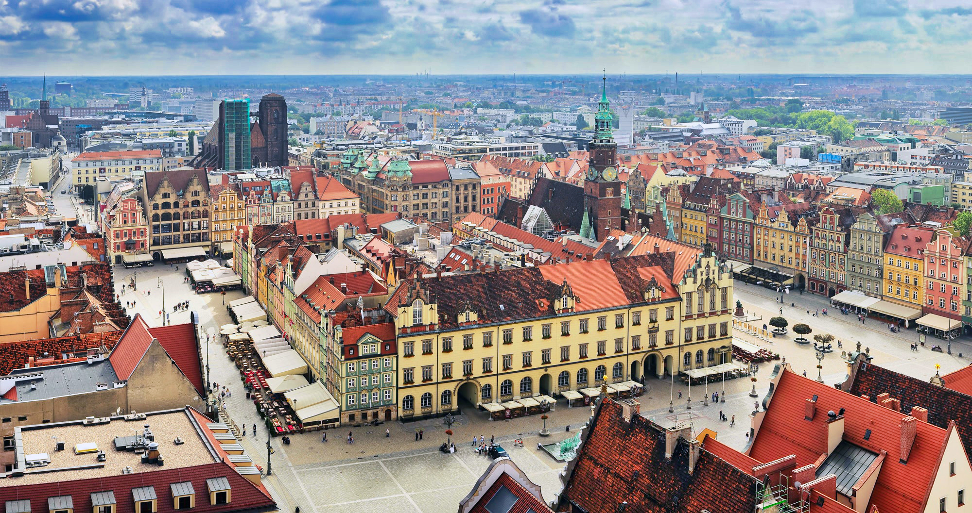
• Polish Medieval New Towns
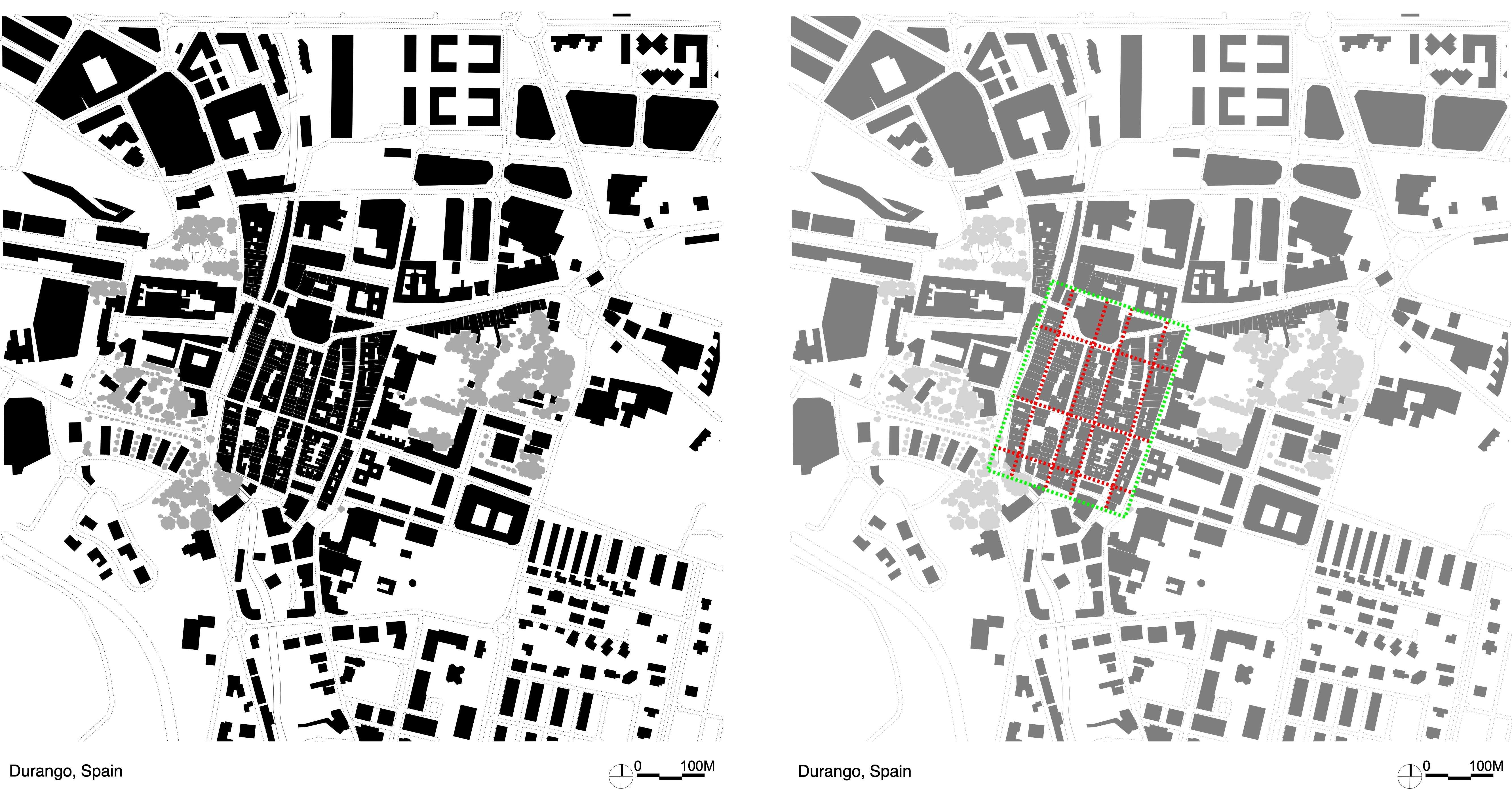
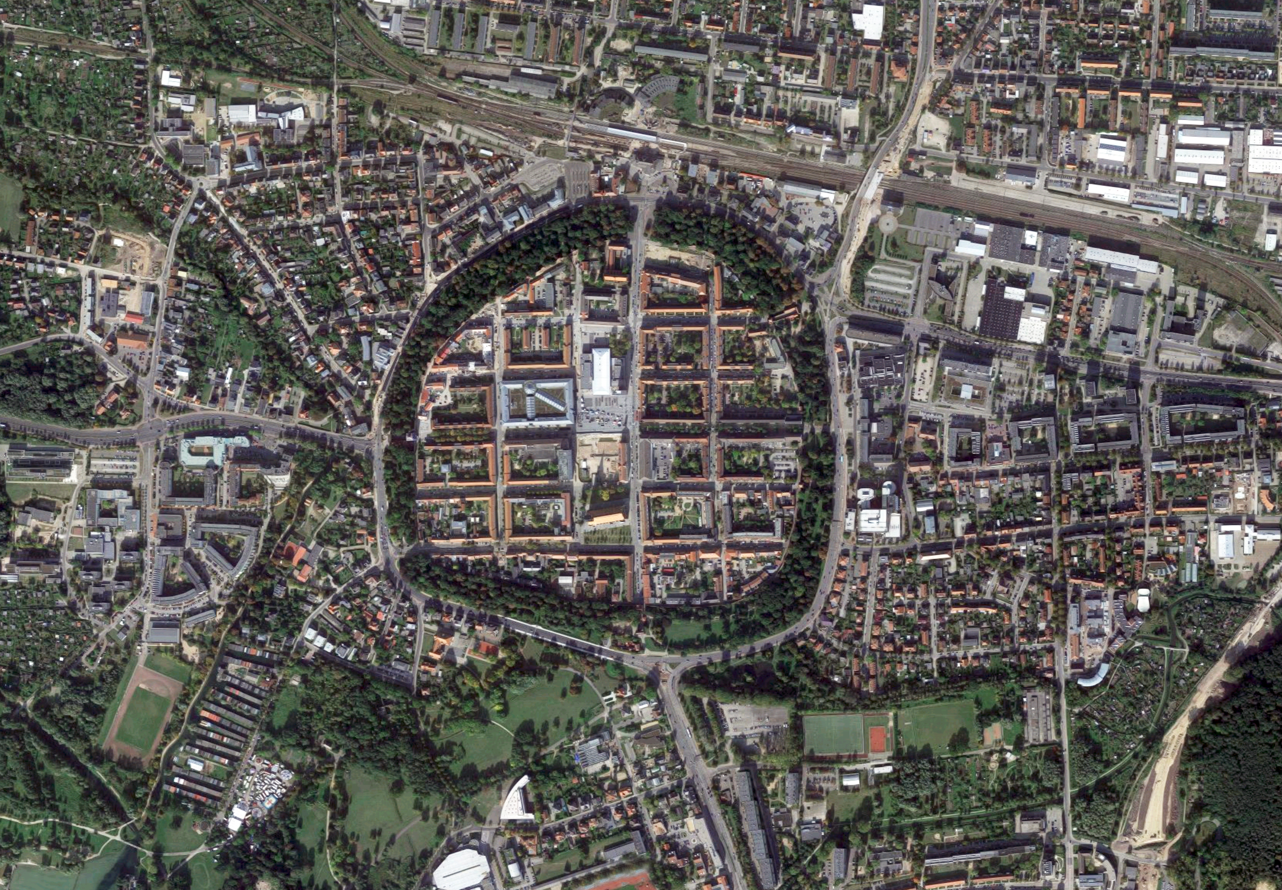
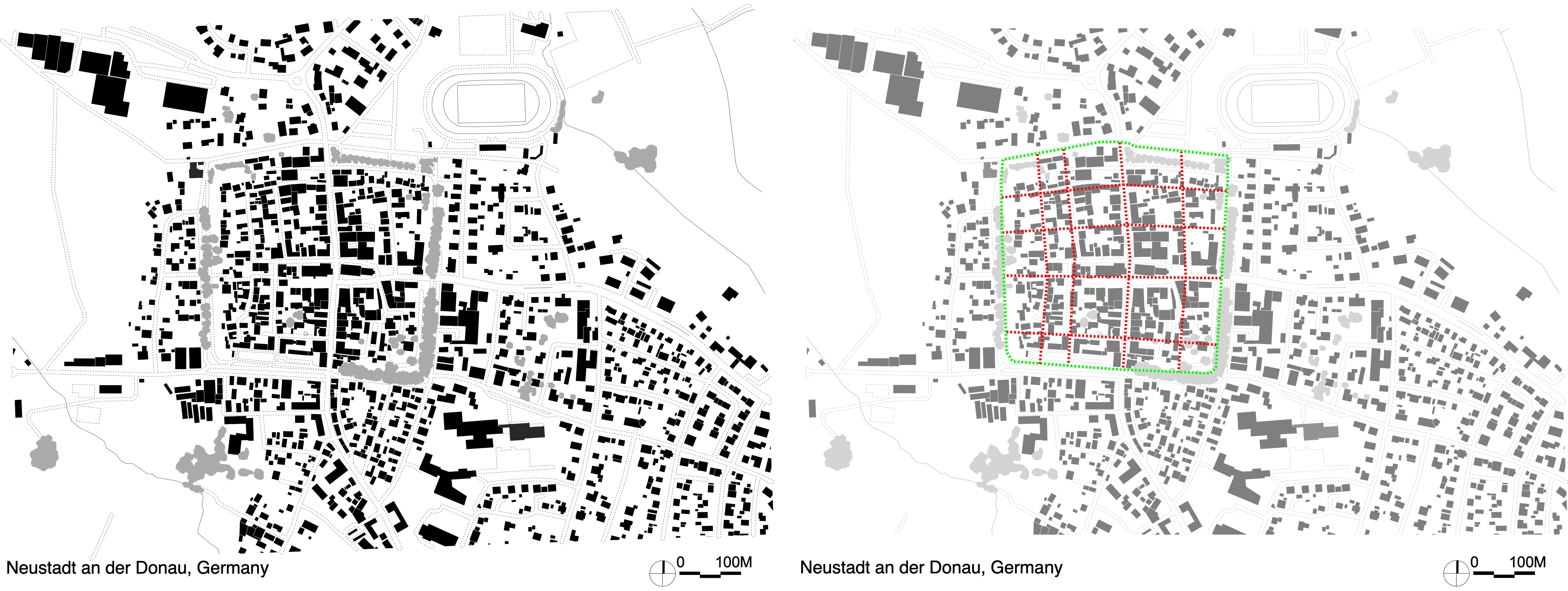
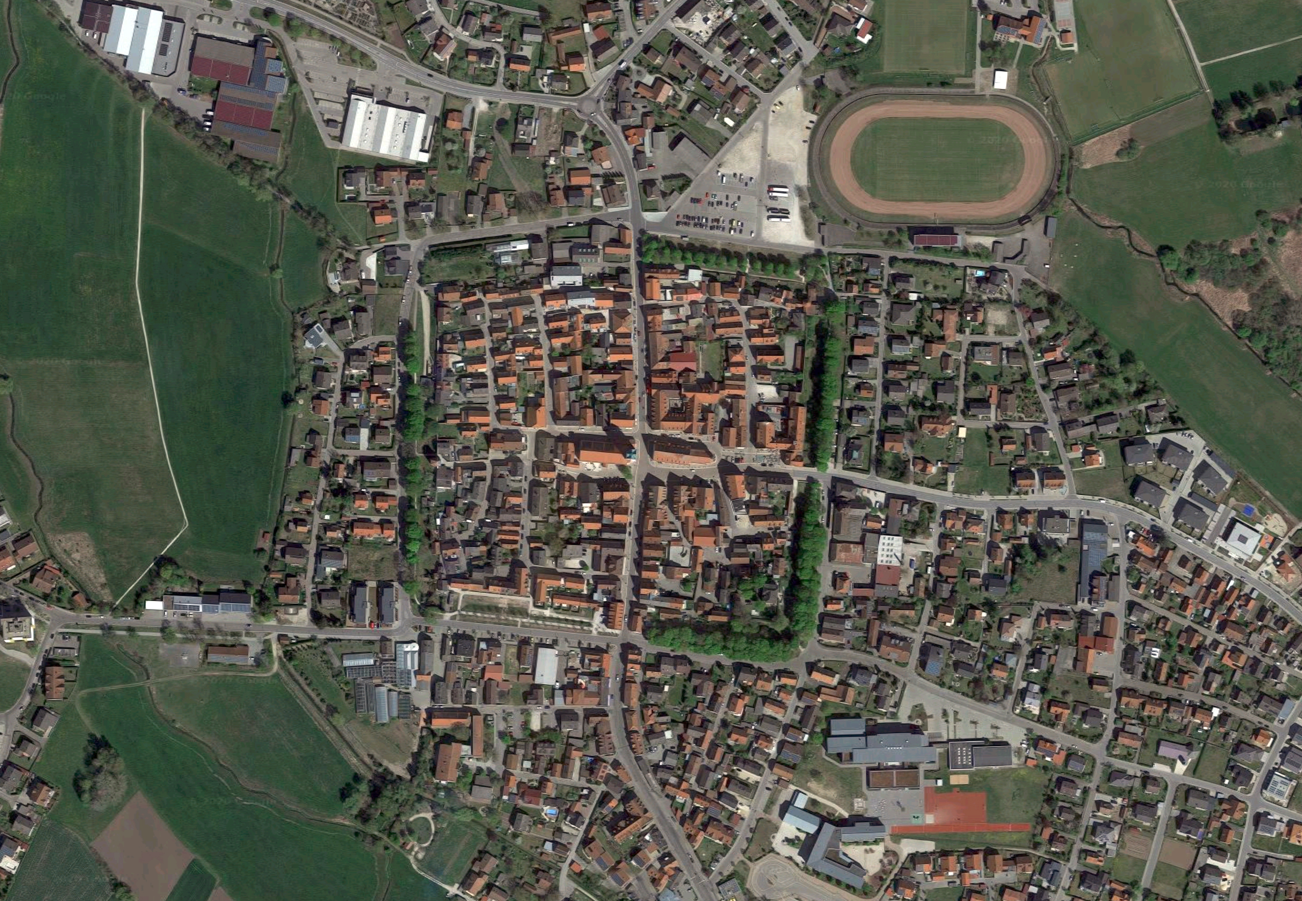
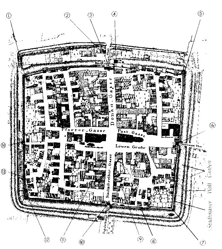
• German Medieval New Towns
Neustadt an der Donau, Germany
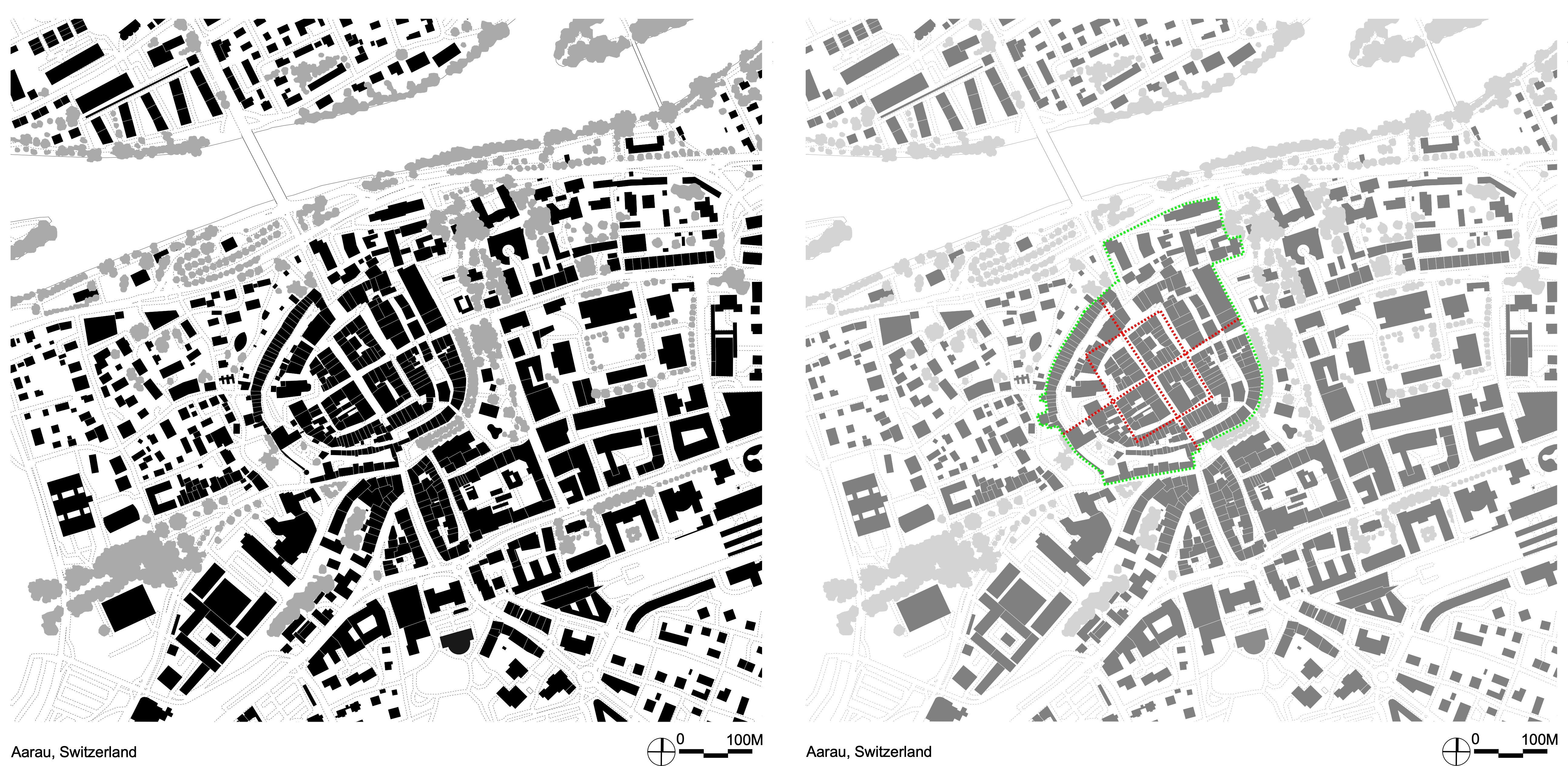
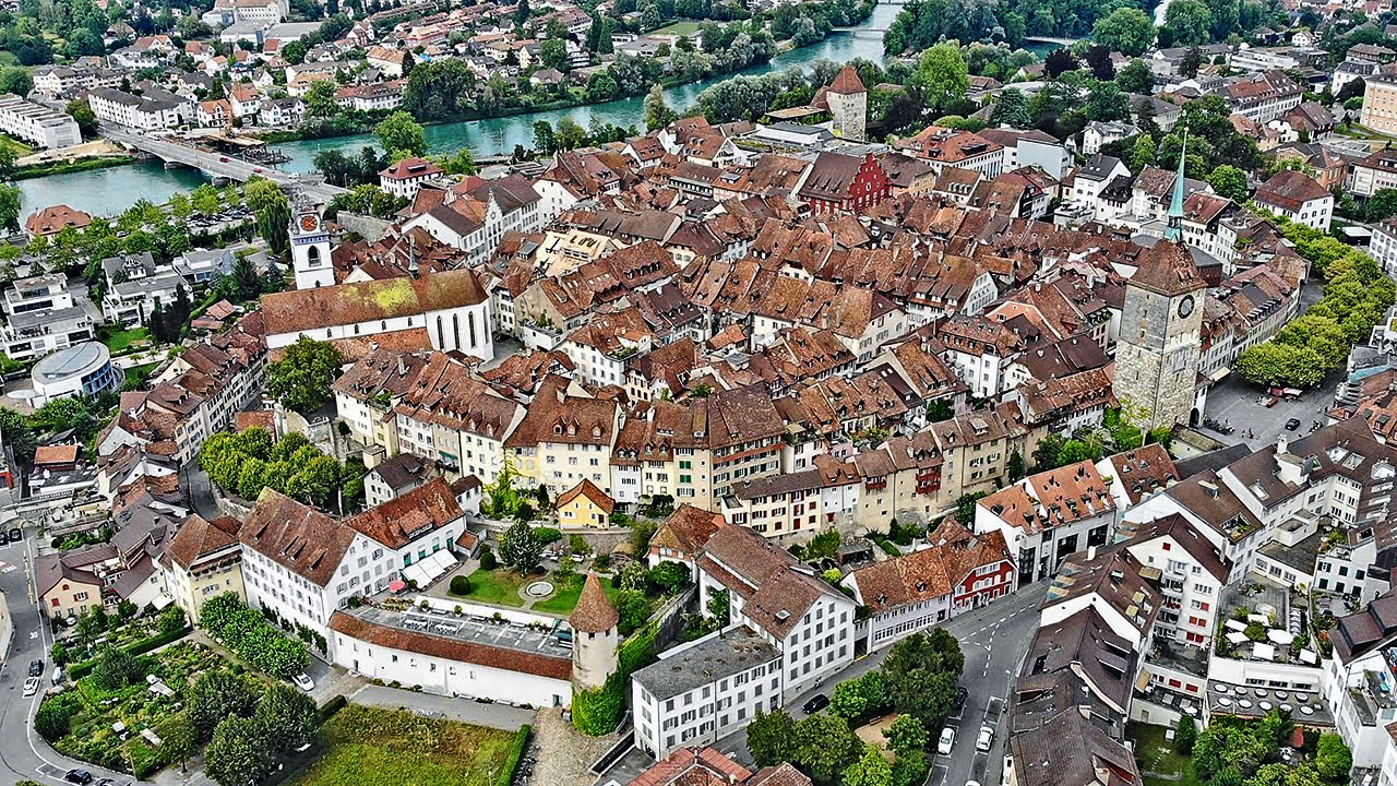
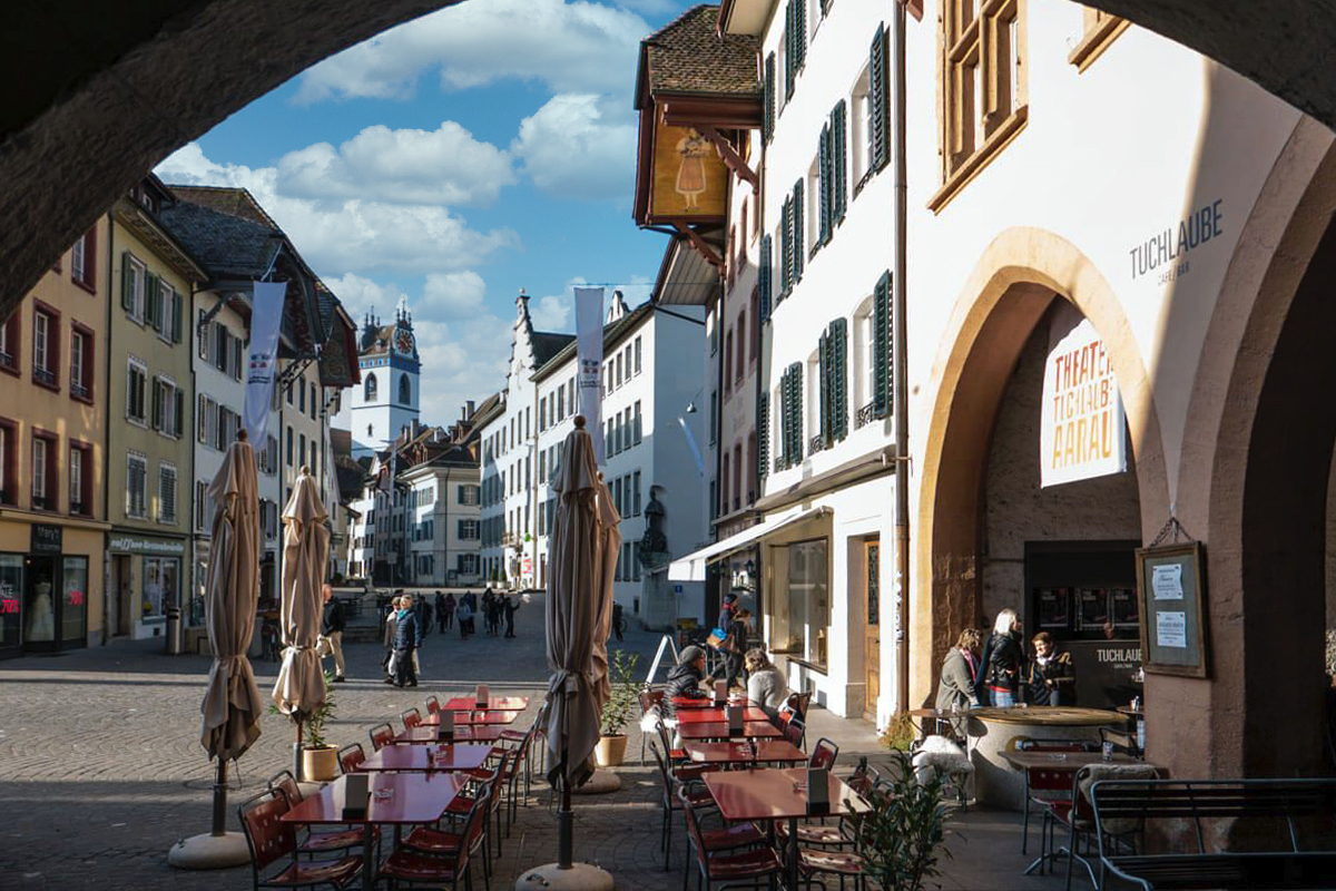
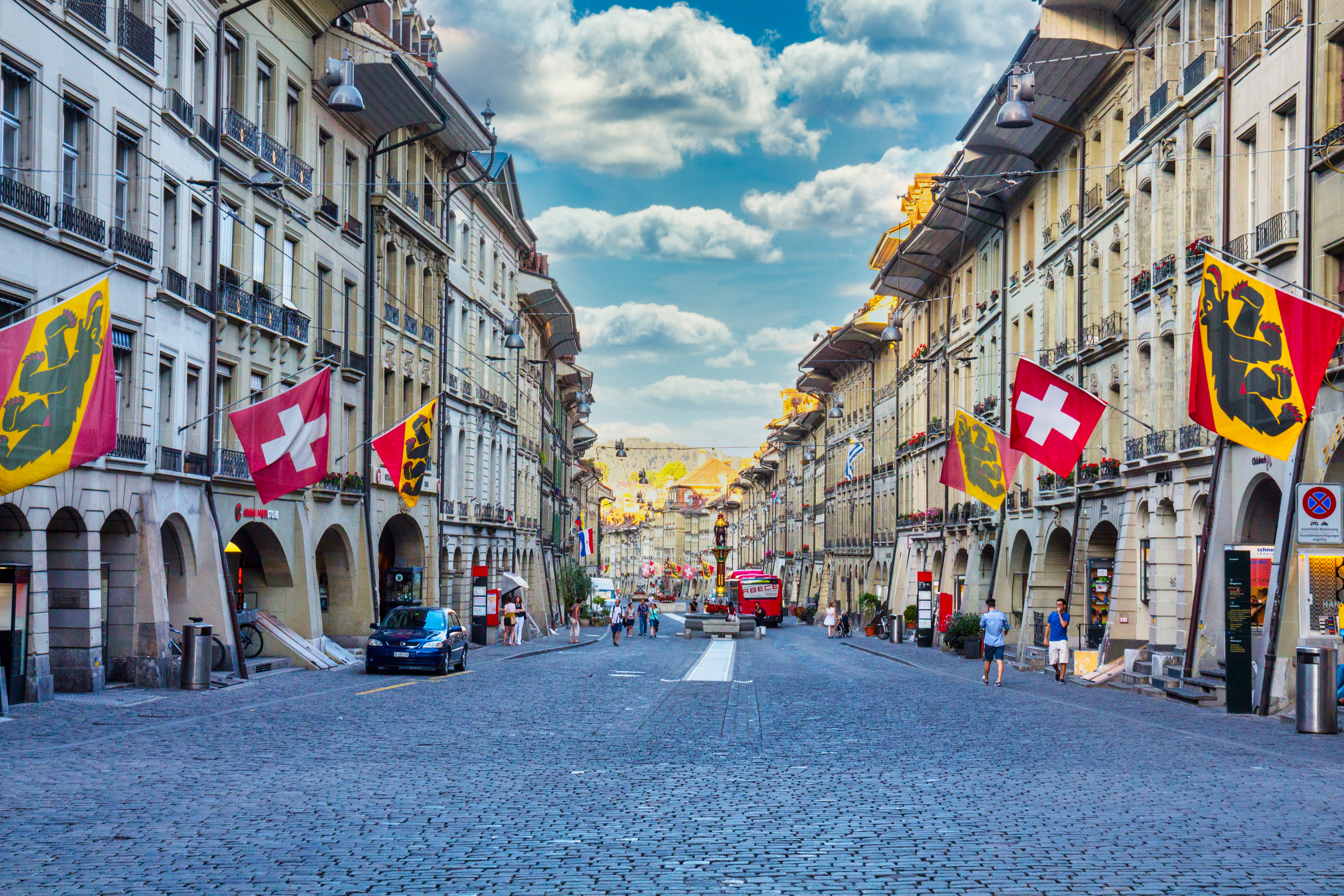
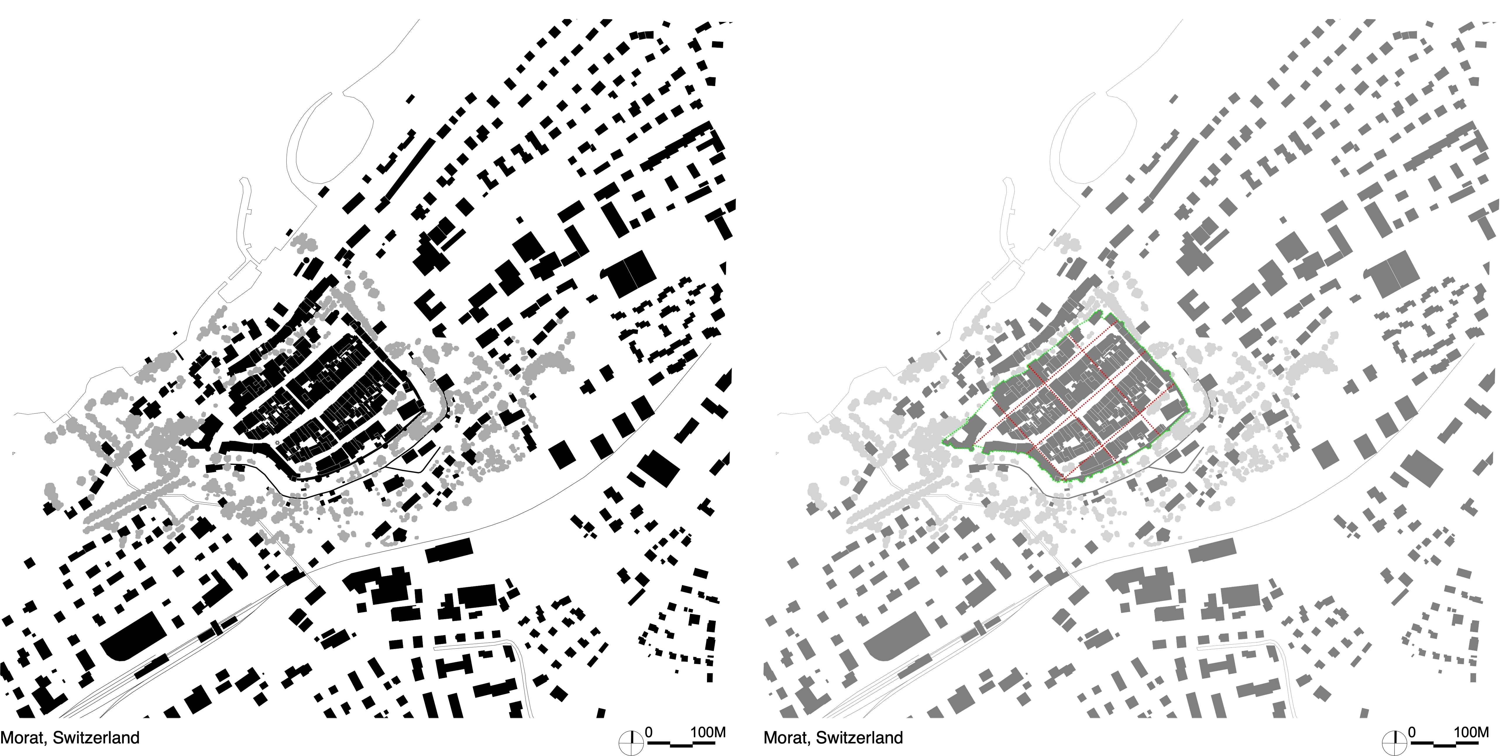
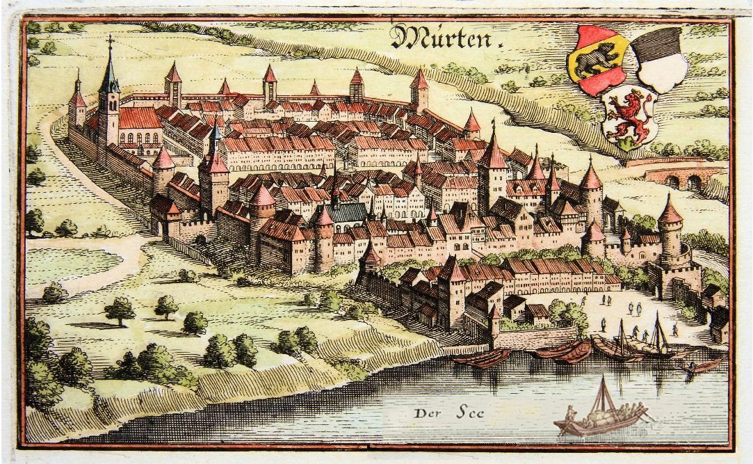
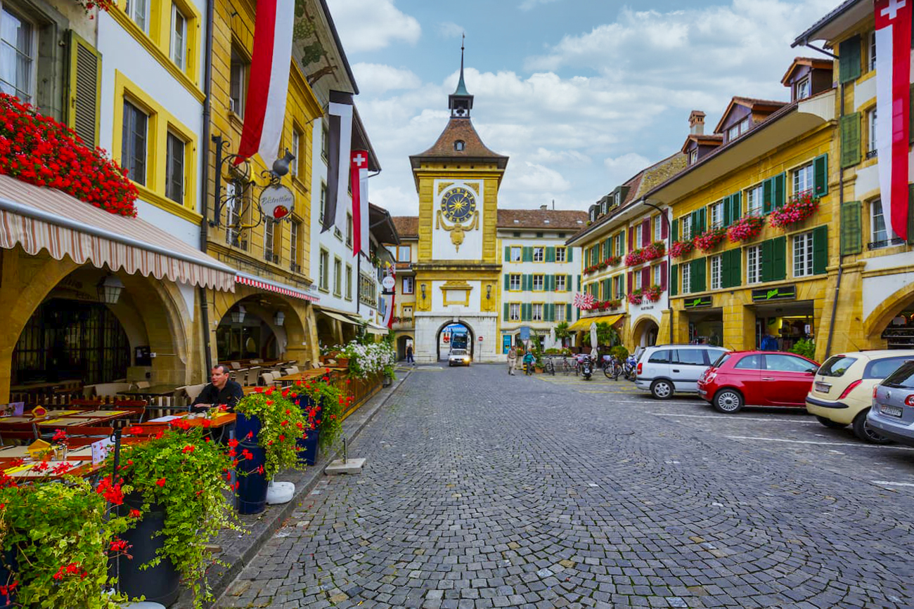
• Swiss Medieval New Towns
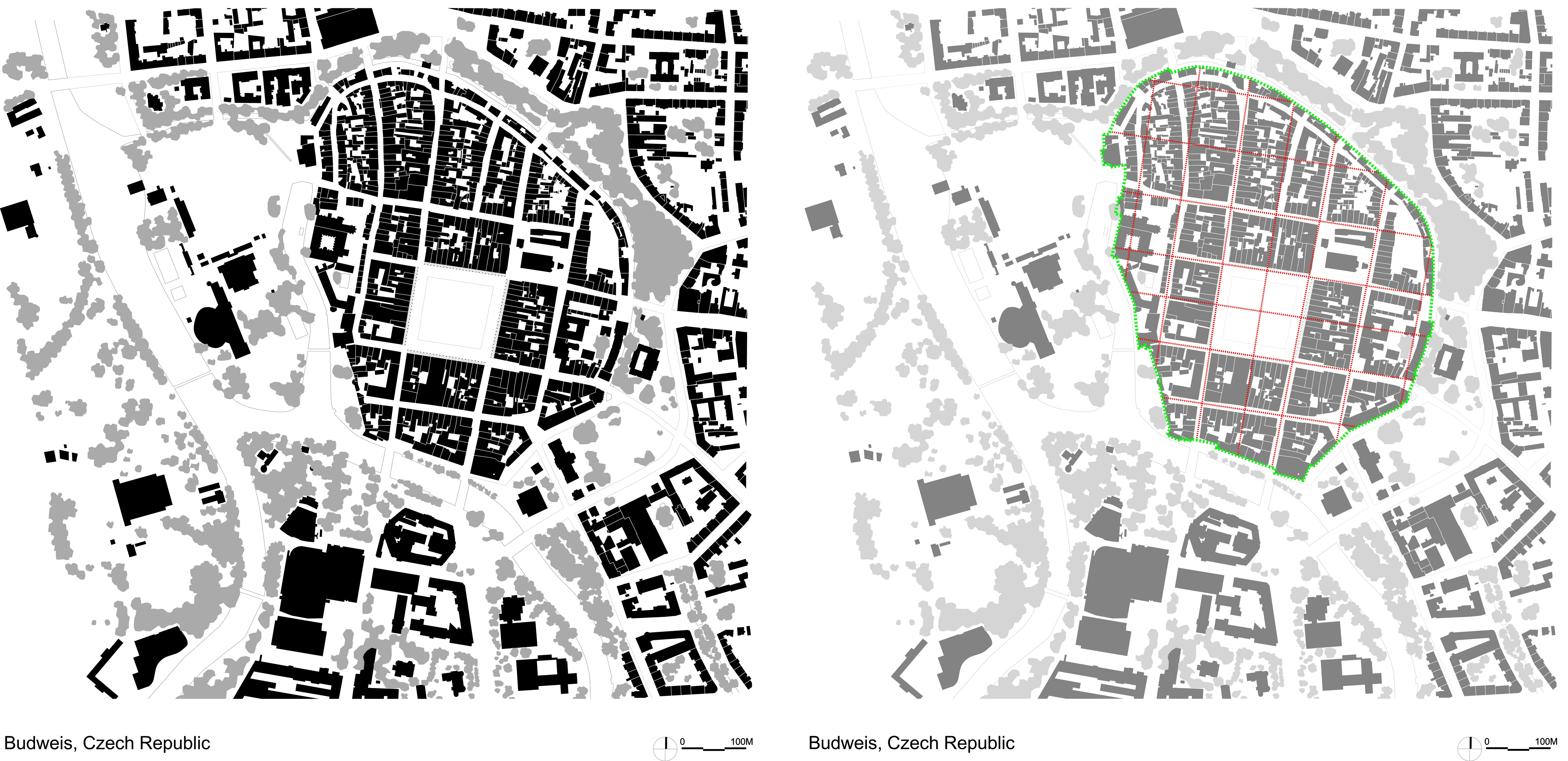
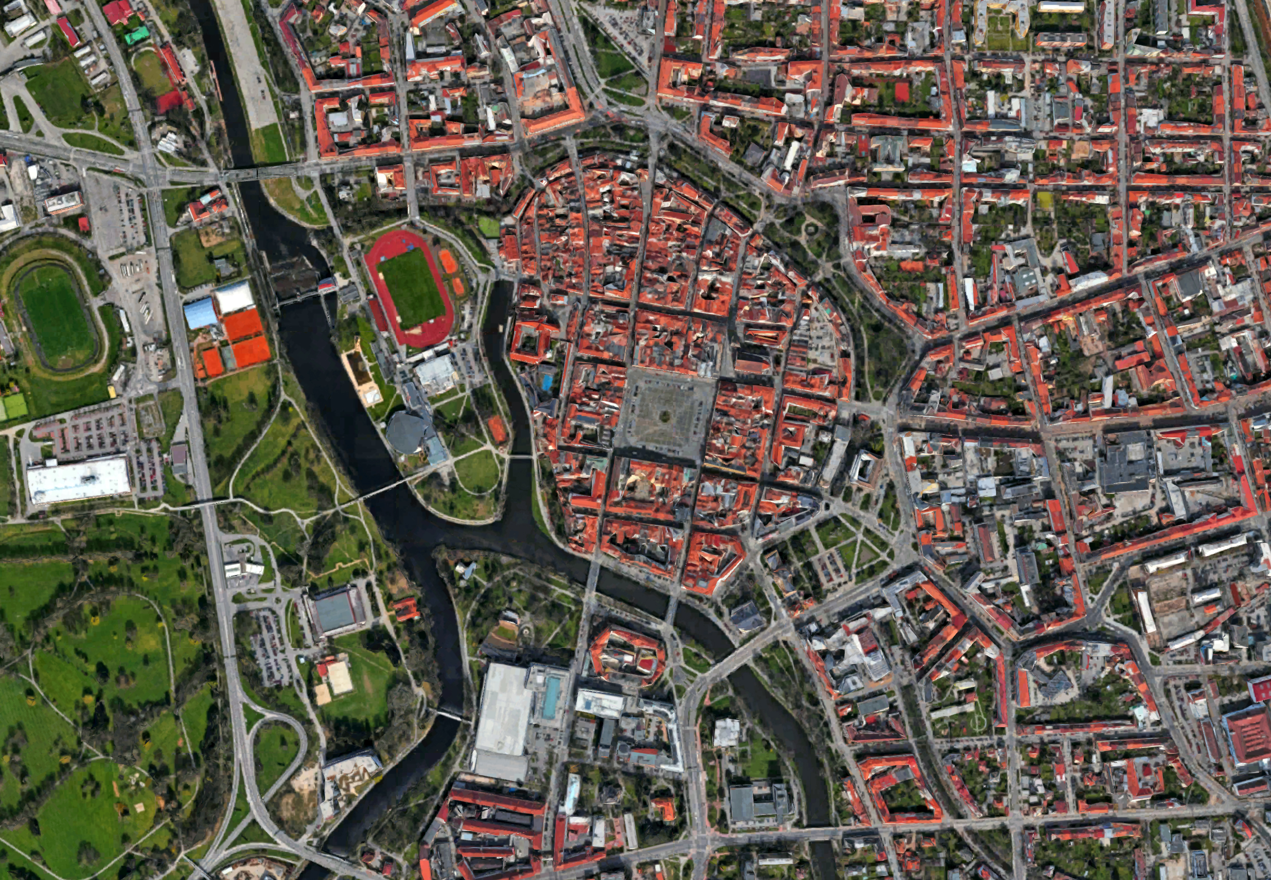
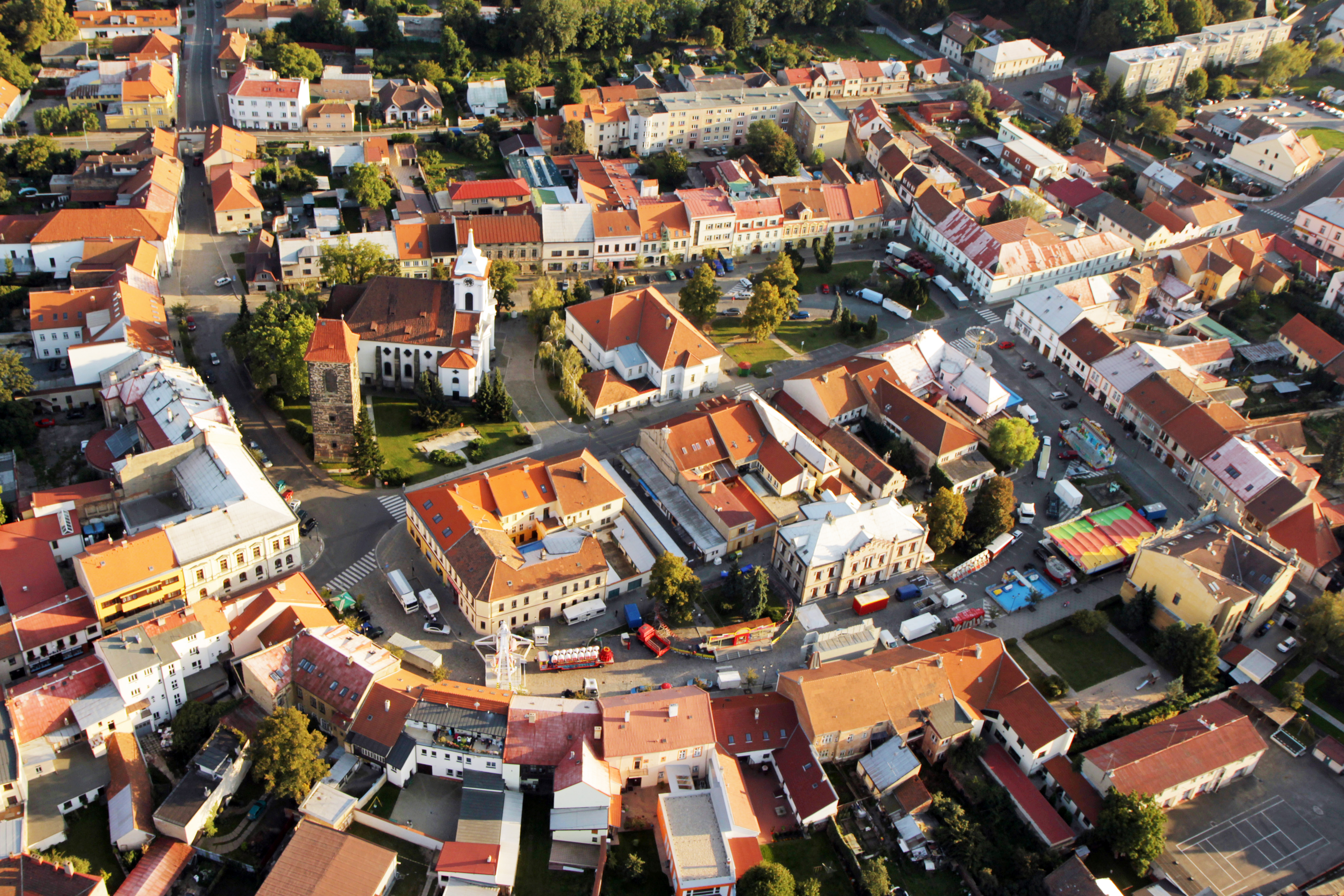
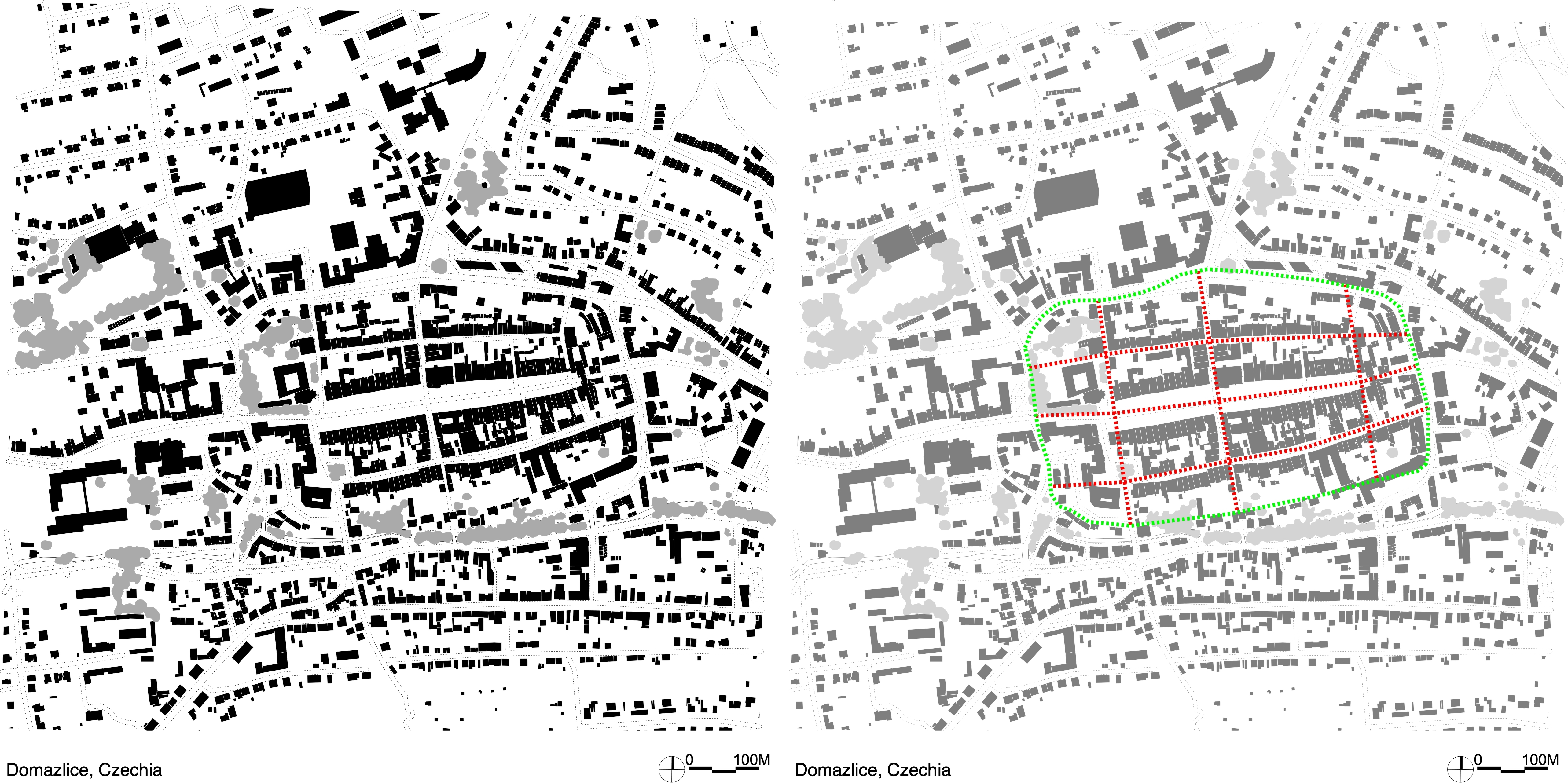
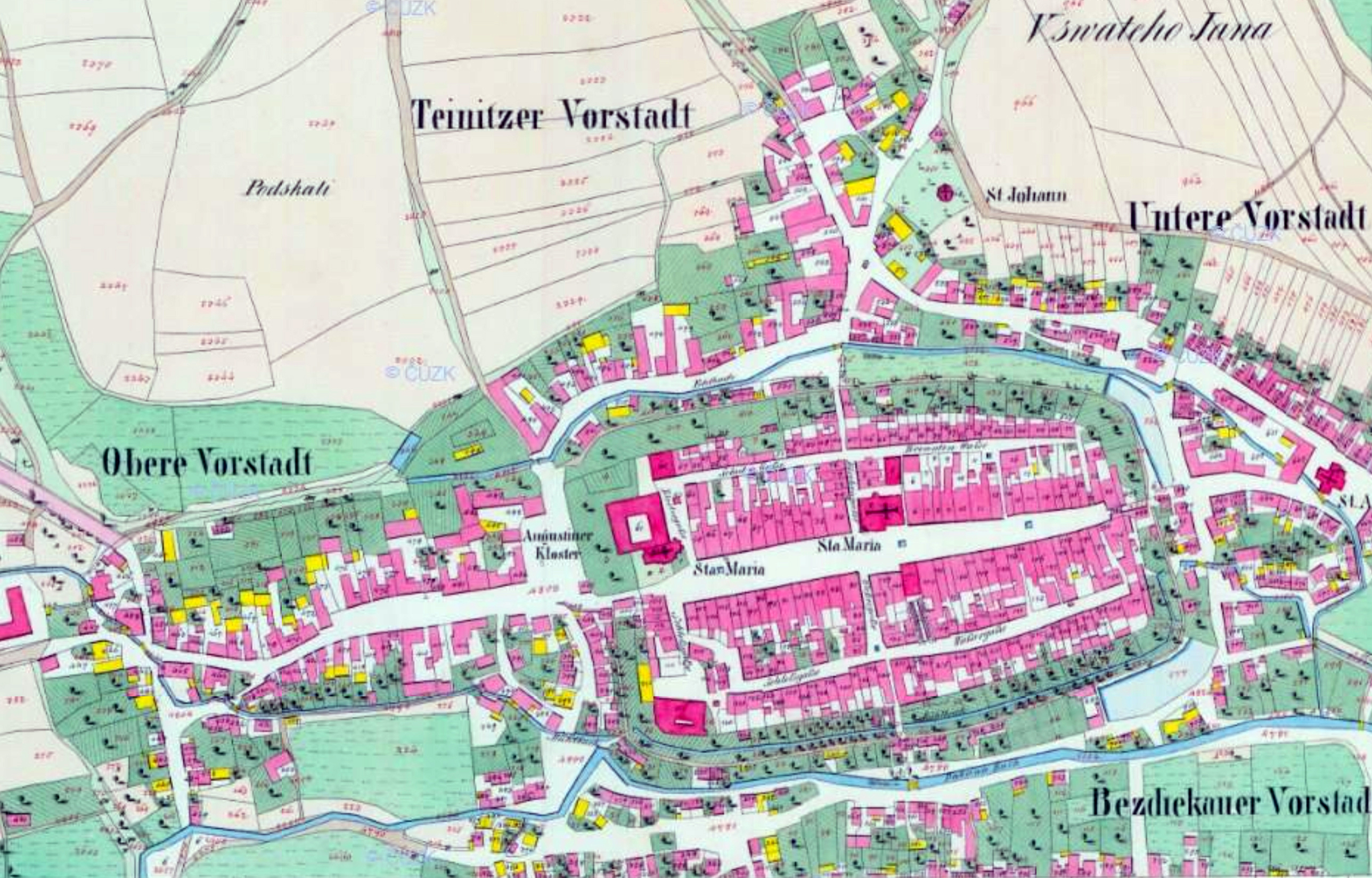
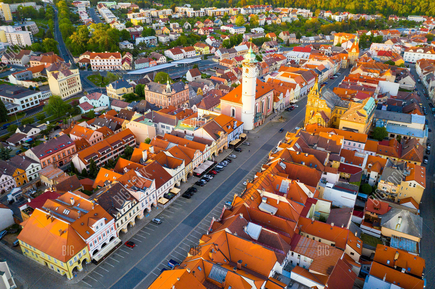
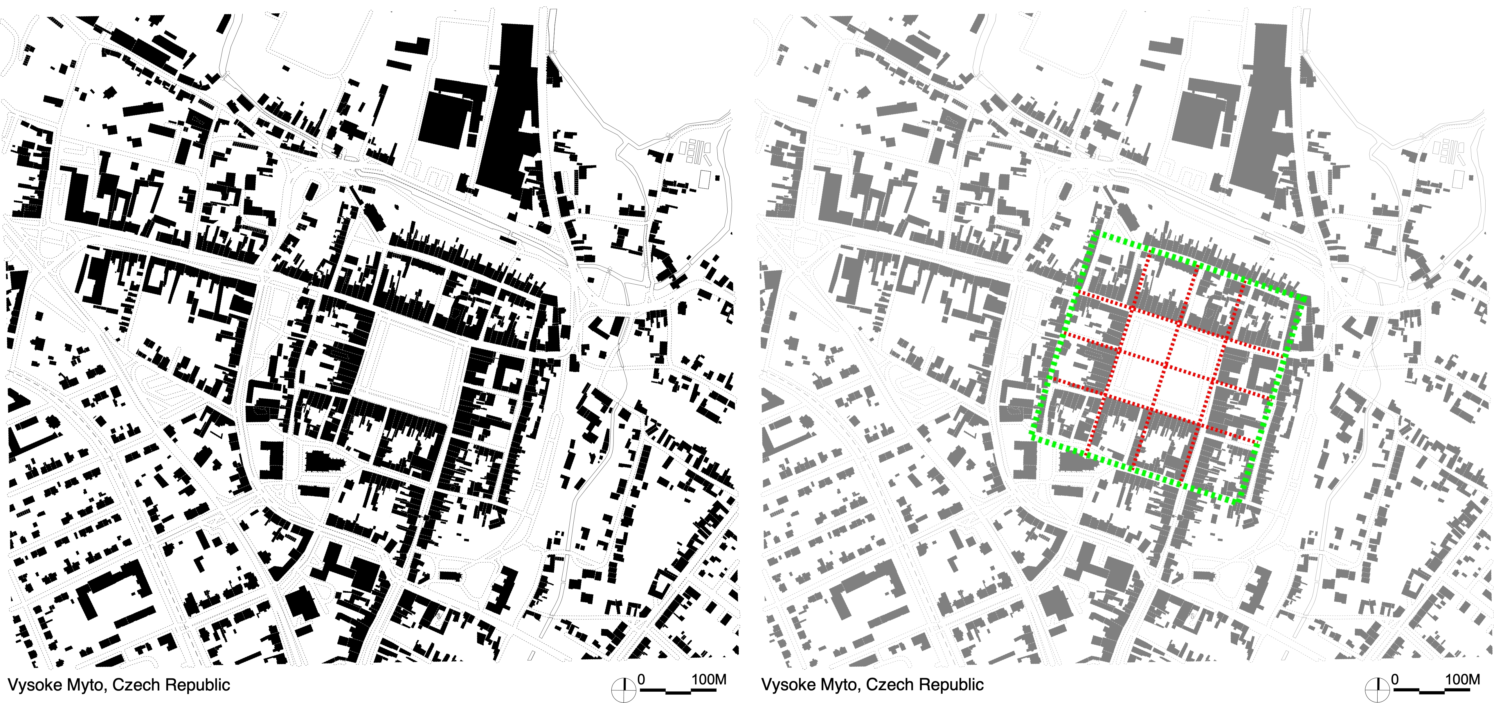
• Czech Republic Medieval New Towns
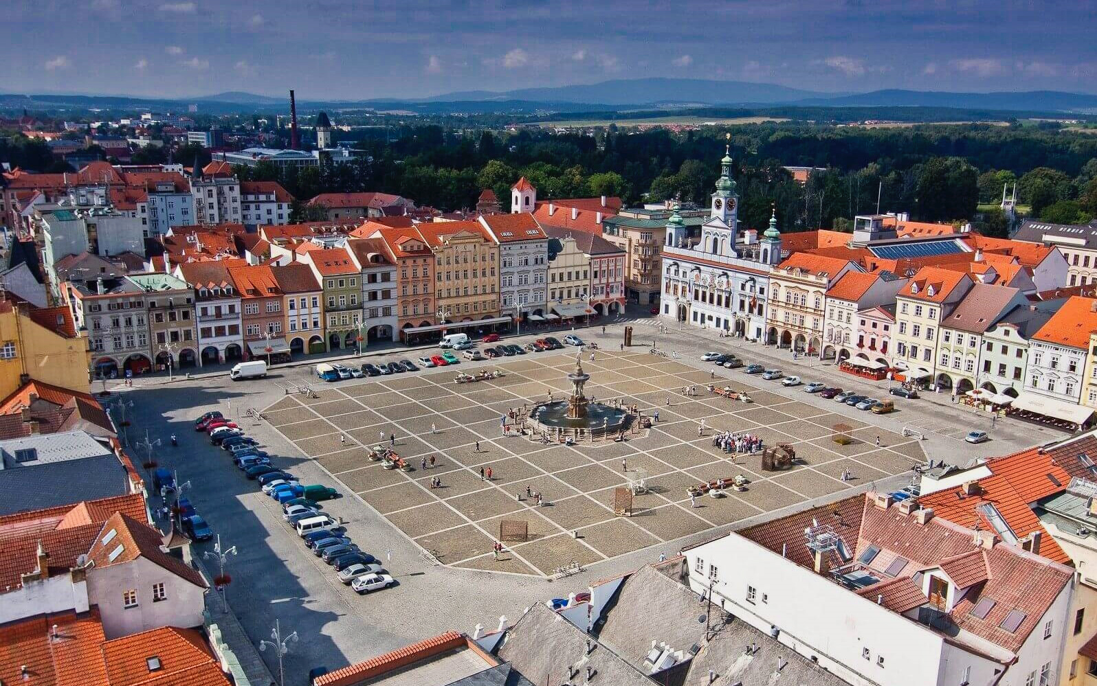
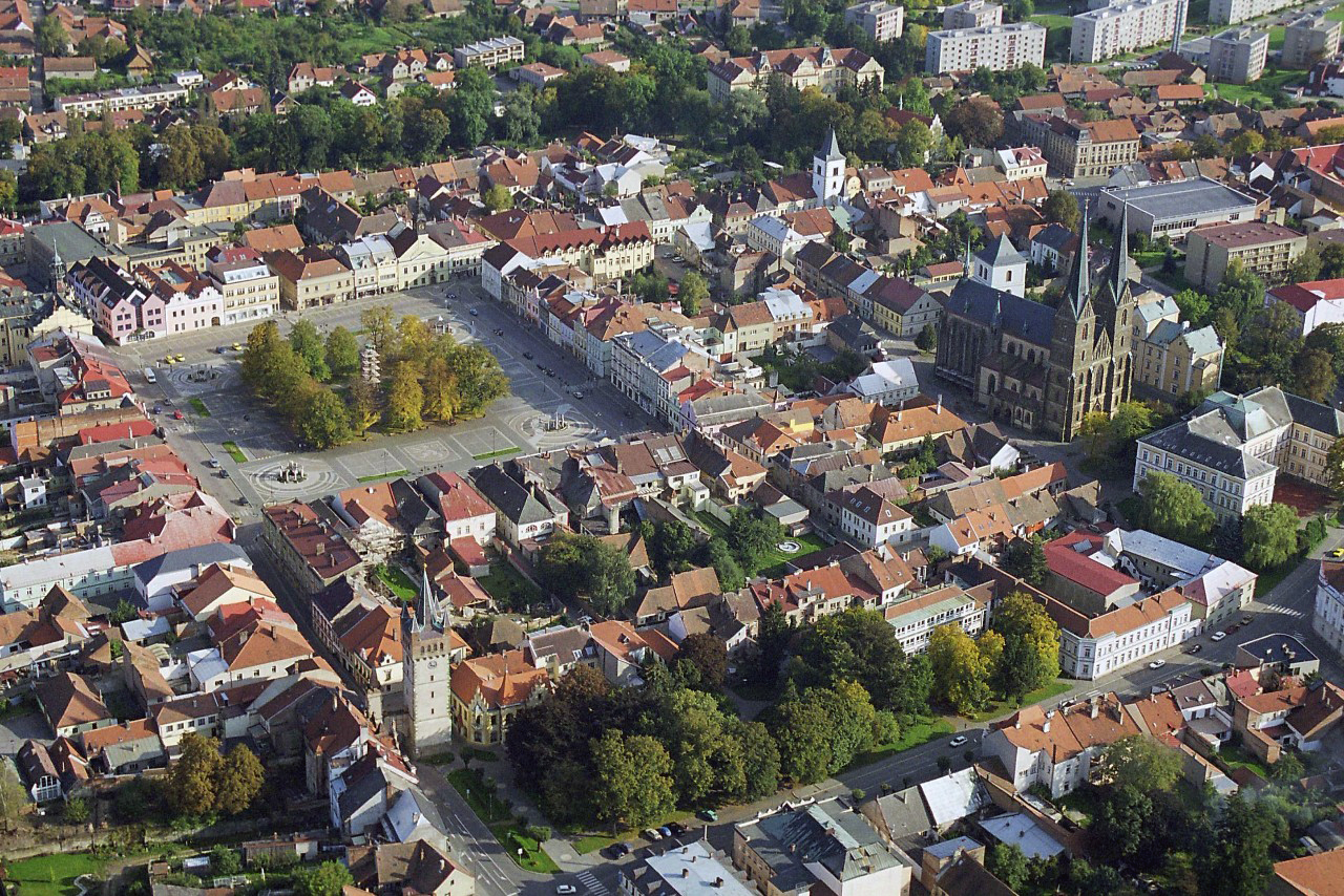
České Budějovice, (Budweis) Czech Republic
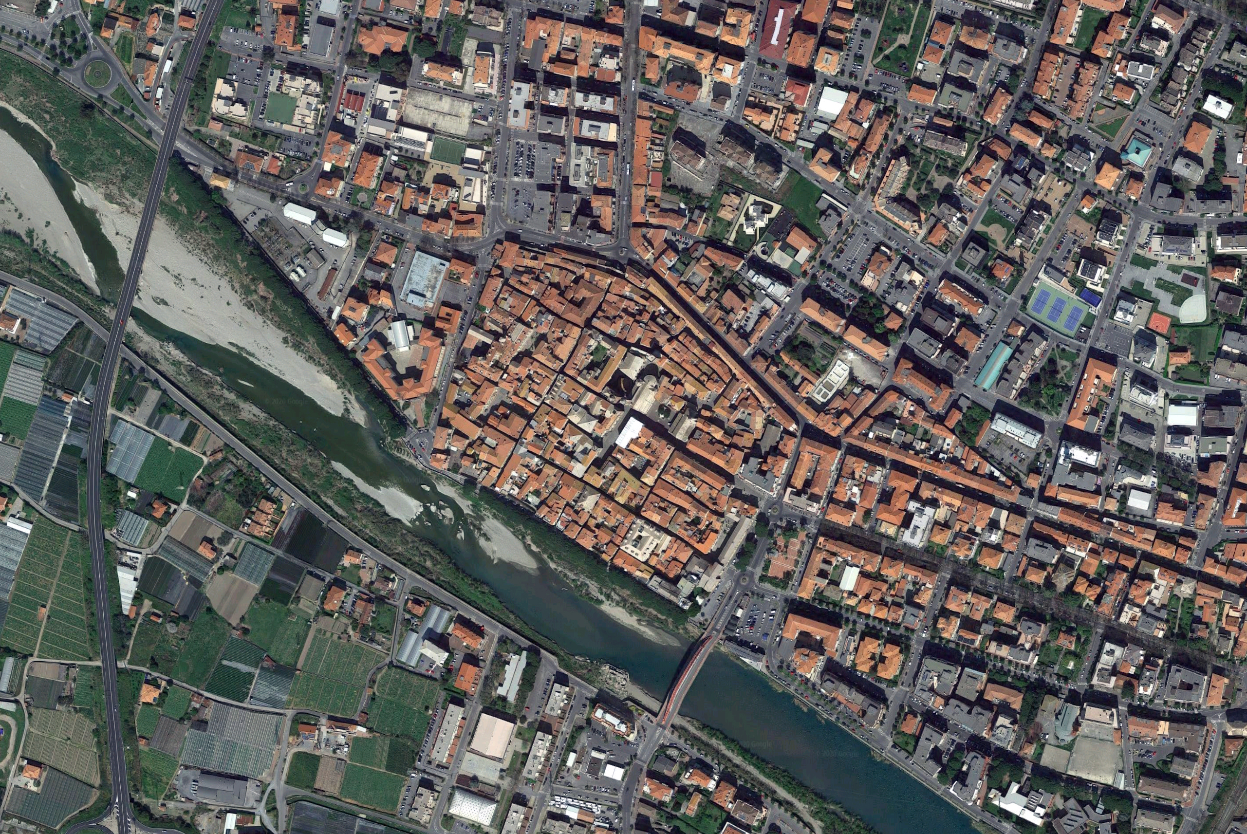
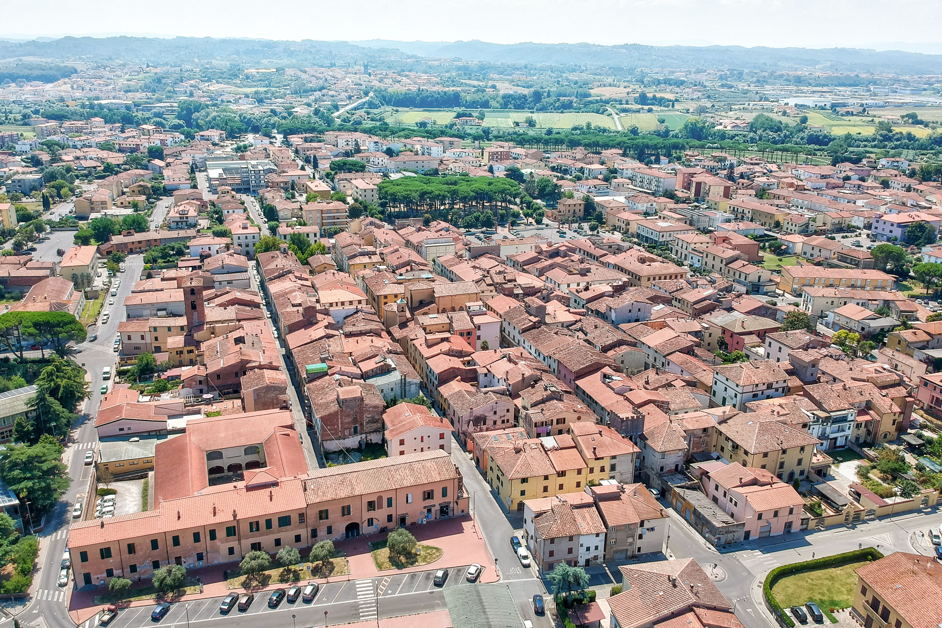
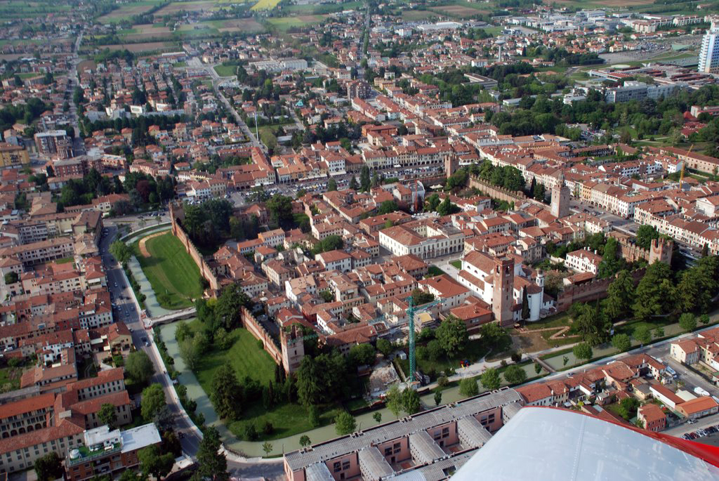
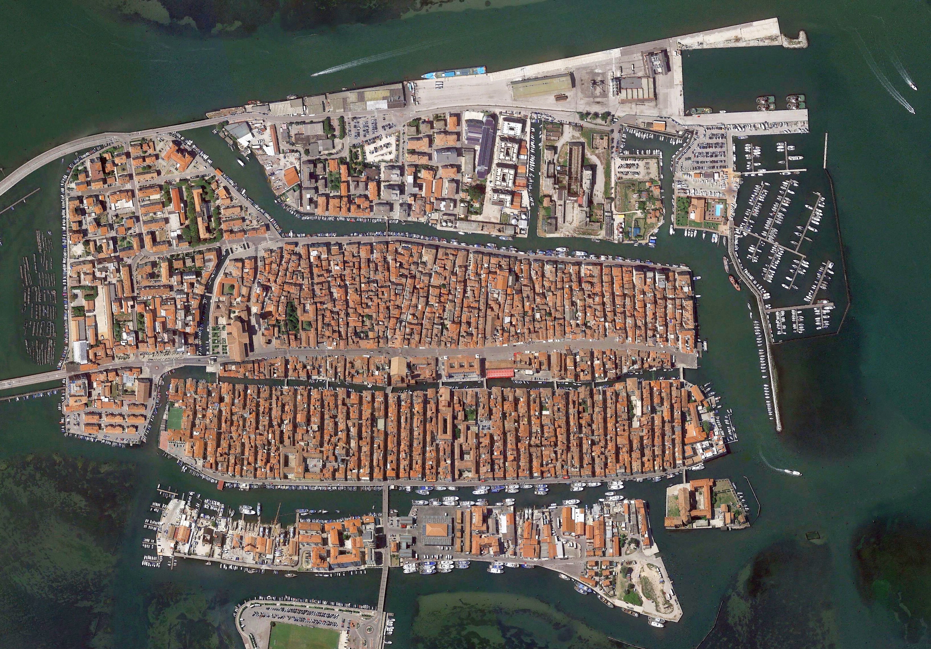
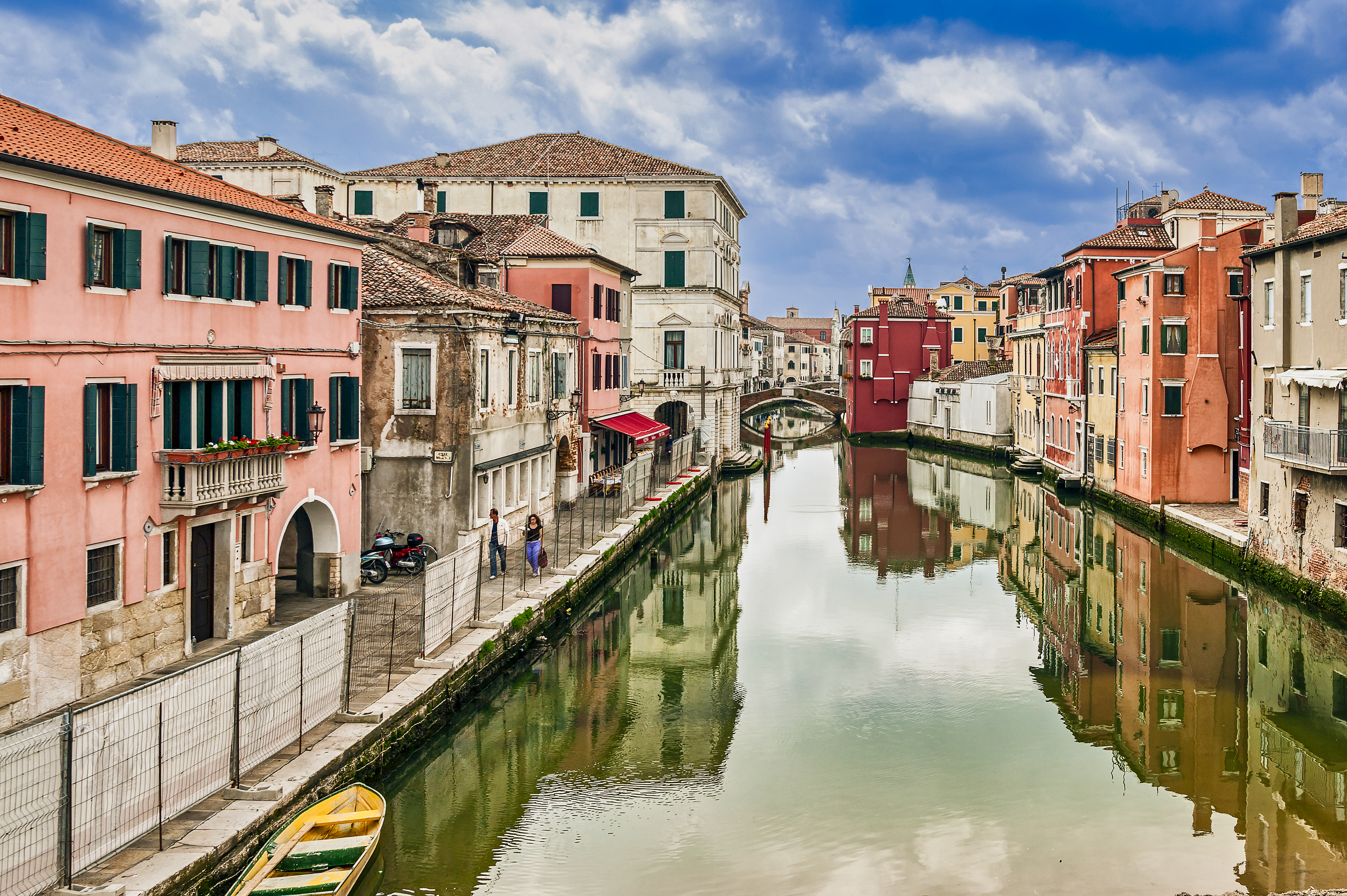
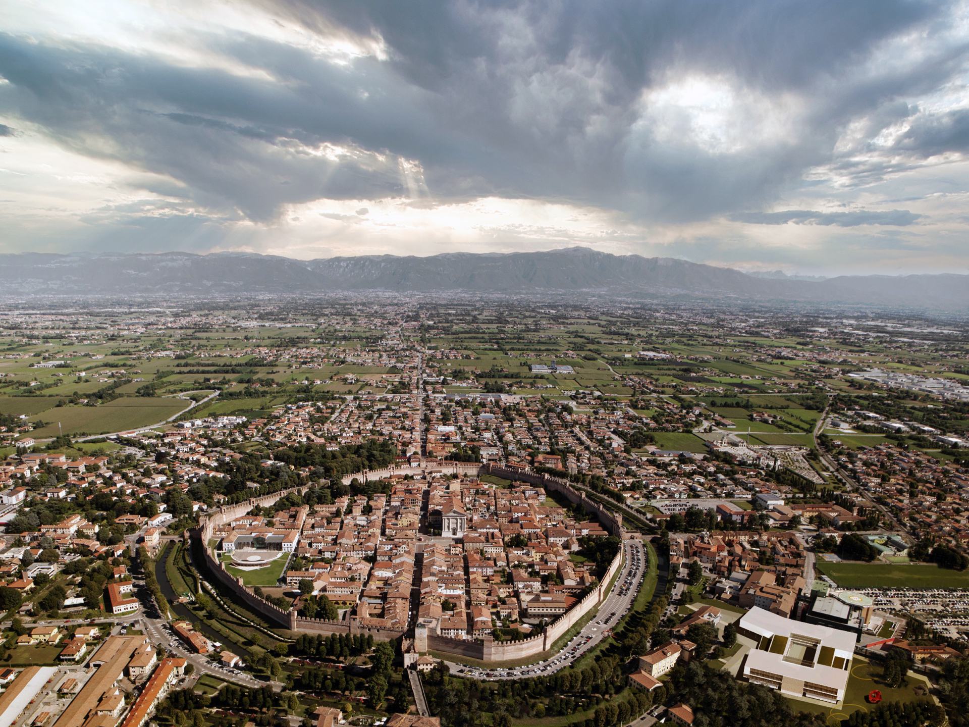
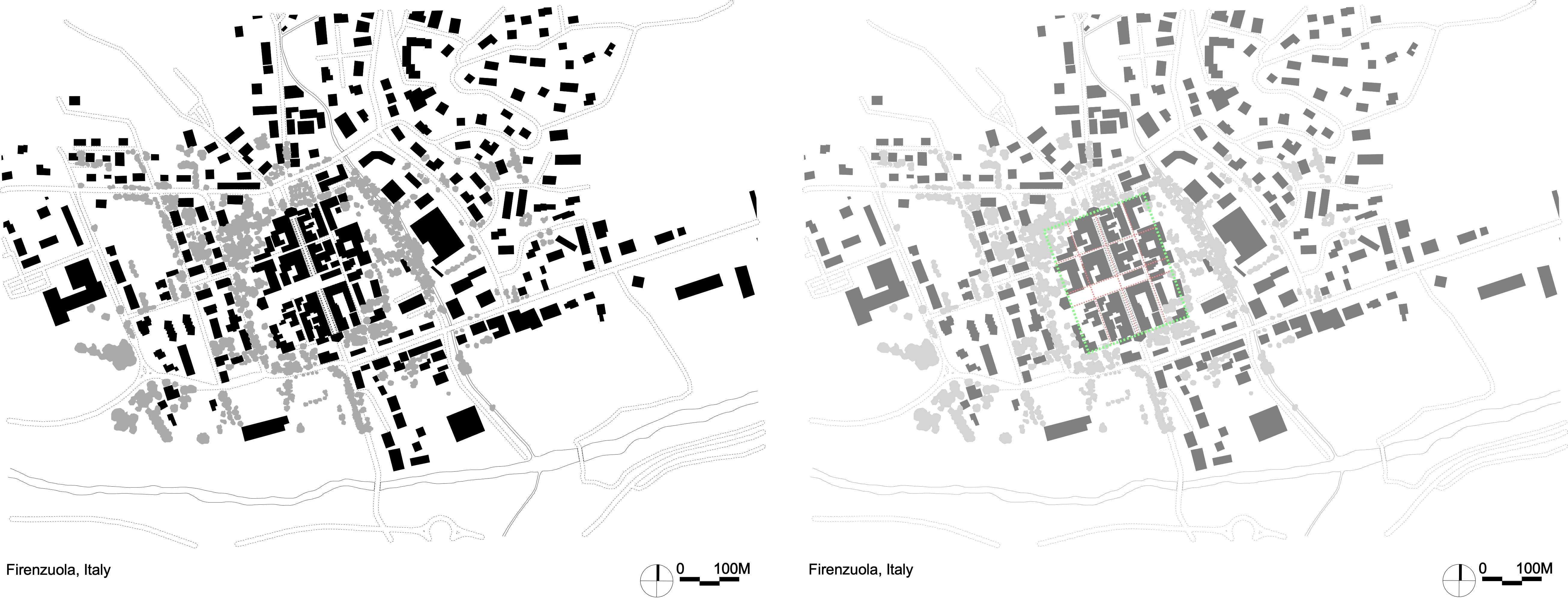
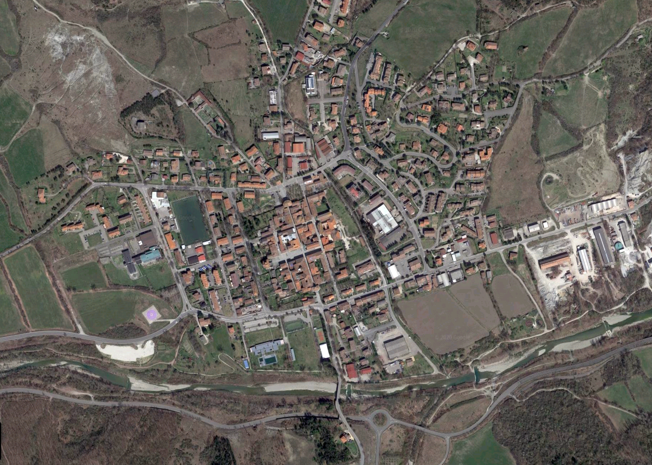
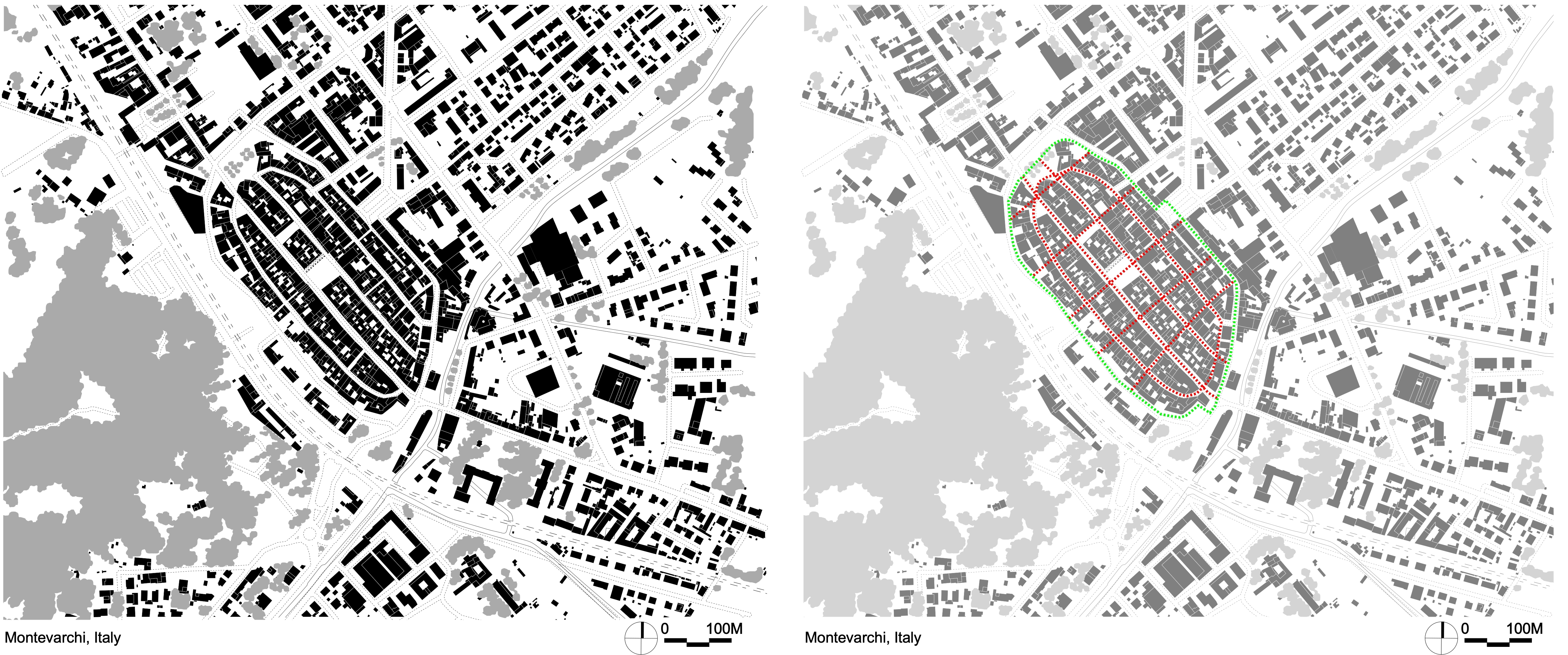
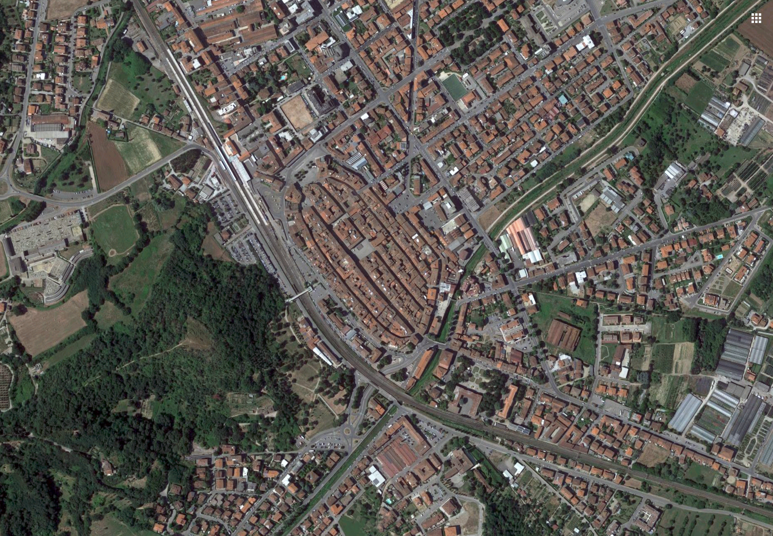
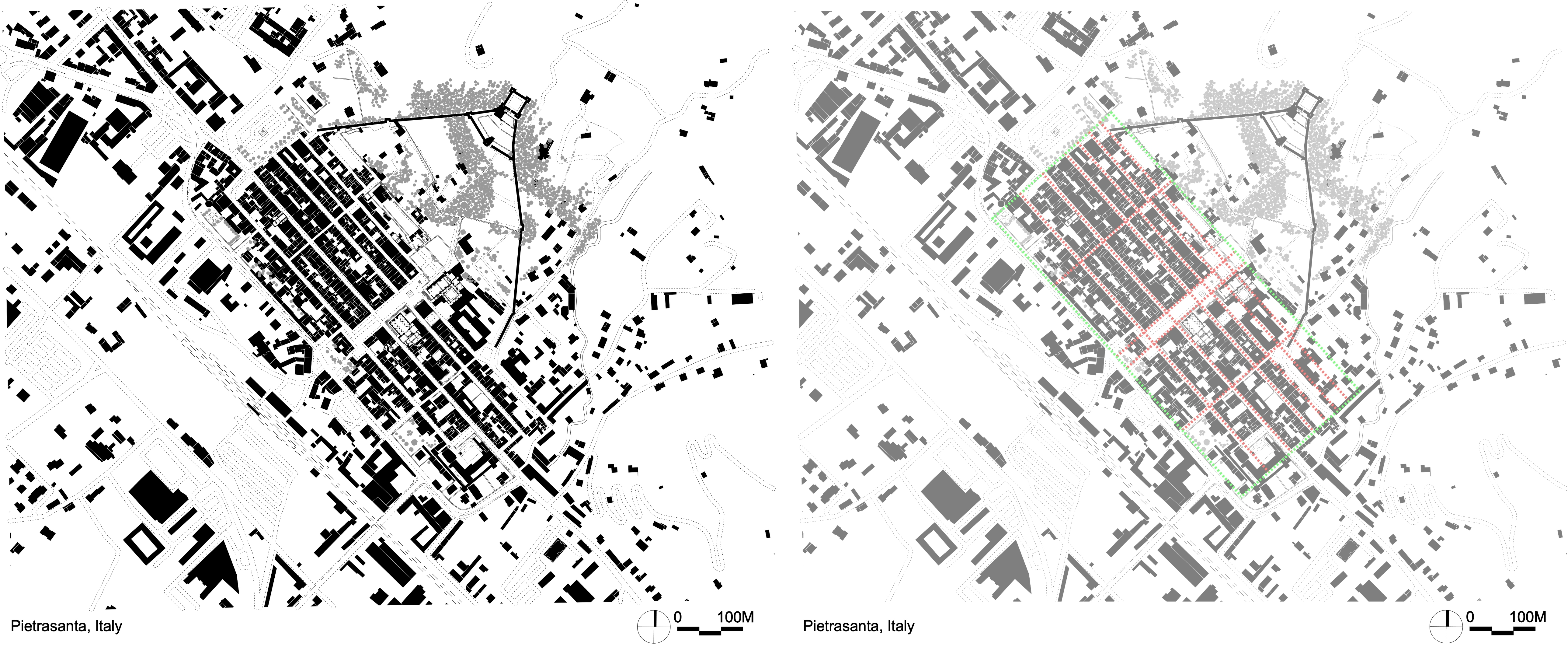
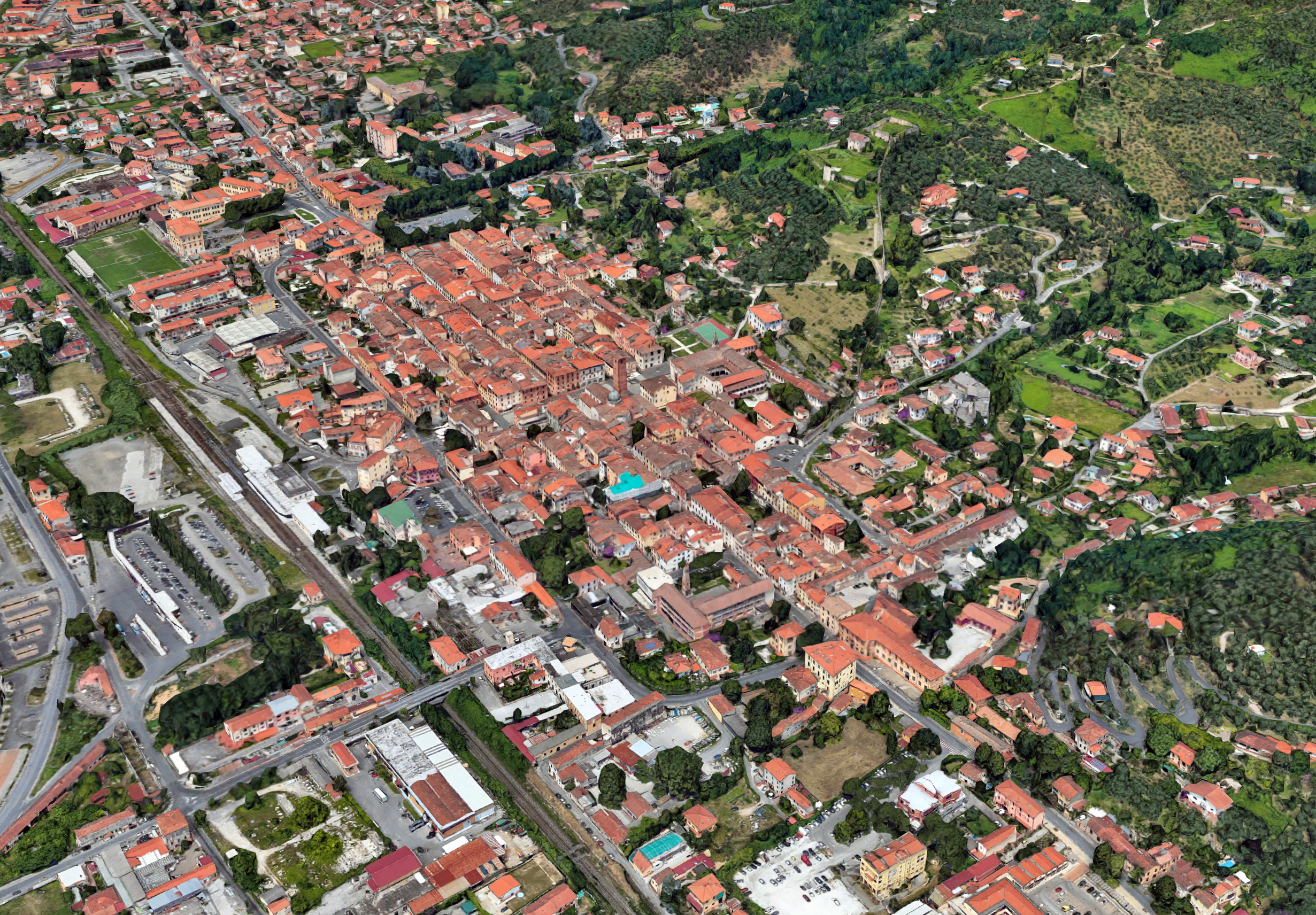
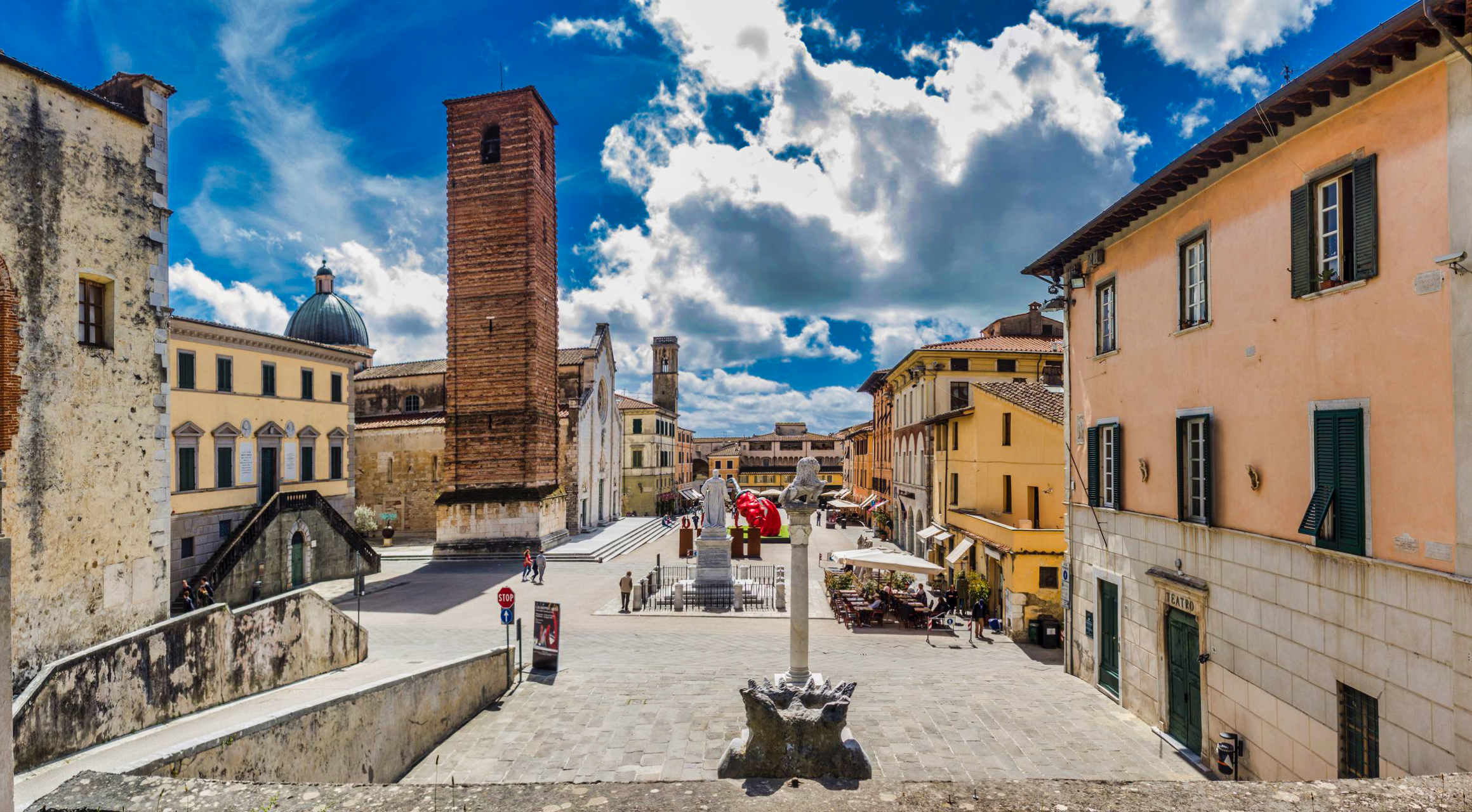
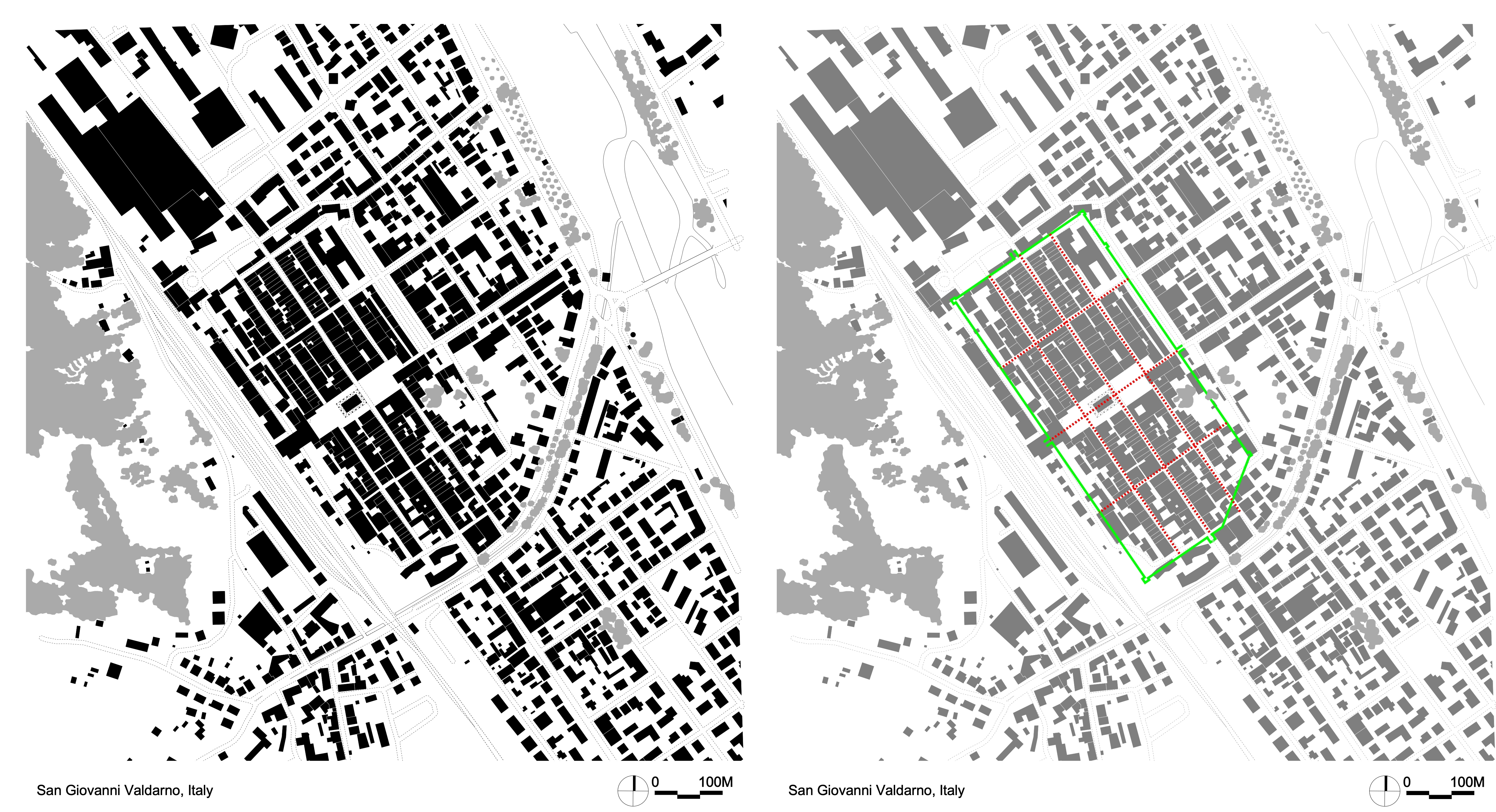
• Italian Medieval New Towns

• Methodologies for Designing Medieval New Towns.
In my research I’ve come across a few texts in English, which cover the topic of medieval new towns. These are,
- Beresford, M.W., “New towns of the Middle Ages : town plantation in England, Wales, and Gascony”
- Friedman, David, “Florentine new towns : urban design in the late Middle Ages”
- Bentley, James, “Fort towns of France : the bastides of the Dordogne & Aquitaine”
- Boerefijn, W.N.A., “The Foundation, Planning and Building of New Towns in the 13th and 14th Centuries in Europe: an Architectural-Historical Research into Urban Form and its Creation”
Although all four books have their merits, I personally believe Boerefijn’s PhD thesis covers the overall general topic of medieval new towns in Europe more in depth than the other manuscripts. Luckily “The Foundation, Planning and Building of New Towns in the 13th and 14th Centuries in Europe: an Architectural-Historical Research into Urban Form and its Creation” can be accessed in total via the University of Amsterdam web page.
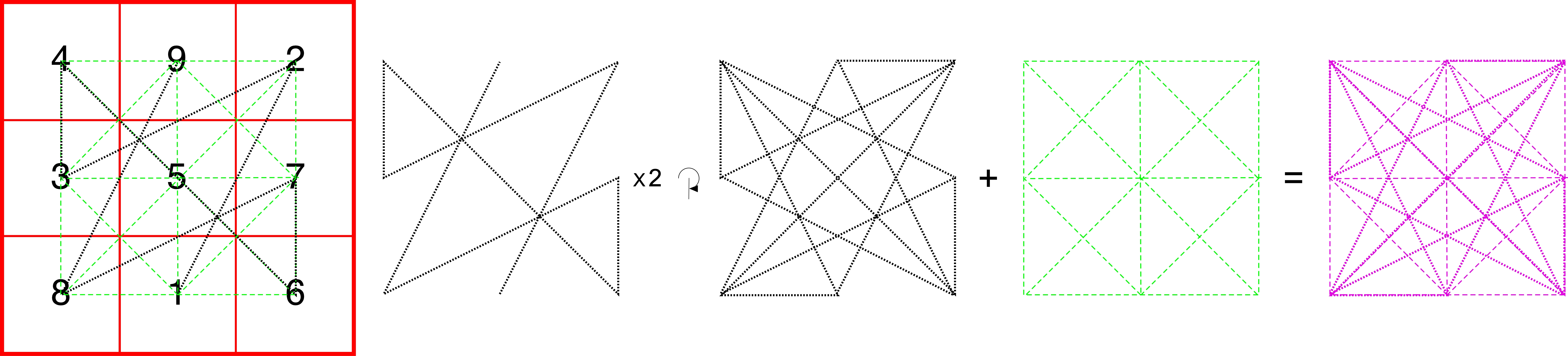
It’s a common belief that all of the medieval new towns tended to follow a formula in their design process. In Boerefijn’s thesis he discusses possible methodologies for designing medieval new towns, but basically negates the possibility of an all-encompassing mathematical formula in designing the towns.
He states,
“In most of the plans of newly founded towns of the period, one can recognize an inclination towards regularity and orthogonality. It is obvious that there must have been a very basic idea of geometrical order behind this, involving straight lines, right angles, equality of distances and often even symmetry. Some scholars believe that plans which are more or less regular have been laid out by use of very simple geometry, by setting out straight boundaries at regular distances that were determined as rational, mostly rounded, numbers of the then current units of measurement. This is called ‘arithmetic design’ or ‘simple geometric design’. Scholars have tried to reconstruct specific cases of this method of design on the basis of measurements taken from specific town plans (either in reality or in more or less accurate plans on paper).
This has led to various reconstructions, not all of which appear to be very reliable, however, as the accuracy of the measurements that have been taken varies greatly and the probability varies with the deviation that is accepted between measured dimensions and hypothetical original dimensions. Other scholars, however, believe that urban plans were designed by the use of more or less complex geometrical methods. From contemporary sources it is known that geometry was regarded as a crucial means for architectural design. Not much is clear, however, on how geometry was precisely used in the design process of buildings, and almost nothing is known of whether and how it played a role in urban planning. Since the mid-20th century, a number of hypothetical design methods have been reconstructed, proposing complex geometric figures underlying the designs of the plans of specific towns. After close examination it appears, however, that many of these are quite implausible. In some cases, the dimensions of the geometrical hypotheses clearly do not correspond well with the actual dimensions of the plans; while in other cases the supposed process of design is highly unlikely because it is anachronistically complicated or because it contradicts the inherent logic of the process. …
… Many scholars who have proposed hypothetical reconstructions of geometrical methods of urban design silently pass over the crucial question of why such methods would have been used. From philosophical writings of the 11th to 13th centuries it is known that great importance was attached to geometry and arithmetic as a means of understanding the Divine creation and to create beauty and order in harmony with the universe. It seems likely that many of the scholars who have proposed hypotheses for geometric design methods for town plans in the period under consideration tacitly believed that this inspired the use of these methods. In fact, this also seems to have been the reason for the geometric design method of the terre nuove: it was to bring the towns into auspicious harmony with the order of the Divinely created universe.
The fact that the geometric figures bear likeness to circular or polygonal cosmic symbols and depictions of the Heavenly Jerusalem may also be interpreted as an indication of this meaning. An additional motive may have been that the designer aimed for personal reward and fame or the advancement of his profession, as geometry was such a highly valued art. (Unfortunately, it is impossible to discern what the relative importance of the different possible motives was and to what degree people – planners, settlers and the public – were conscious of them.
… Moreover, one should also keep in mind that there are also newly created urban structures that were laid out with rather irregular non-geometric plans. Nonetheless, many scholars appear to have favored the idea of complex geometric design over other possible methods, such as dimensioning by arithmetically determined distances and proportions.”
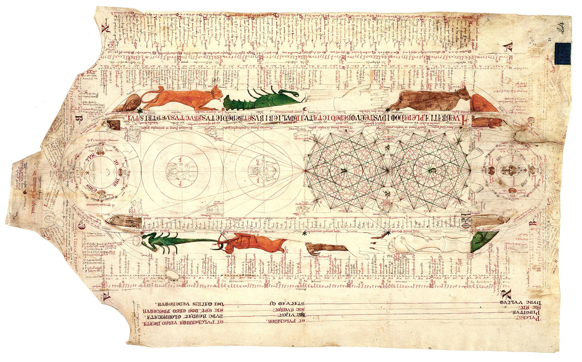
In chapter 6: The use of geometry in the design of new town plans in the high-period of town foundation, W.N.A Boerefijn goes in-depth analyzing all the different hypothesis on how medieval new towns were laid out. Without repeating his thesis here, I highly recommend you at least read this chapter. I will mention that he discusses the geometric diagram shown center right in the Opicinus de Canistris.
With that, I’ll end this much too long tome. Please feel free to contact me if you want further information on medieval new towns. I’ve traveled to a number of the towns I’ve shown here, and highly recommend you try a few. These are not typically on the tourist route, which I actually quite enjoy.
Thanks for taking the time to read this entry.
C.G.
